List of airports in Iran

Map of Iran
This is a list of airports in Iran, grouped by type and sorted by location.
As of 2013, Iran had 319 airports which made Iran the 22nd country in the world with most airports. [1]
Iran, officially the Islamic Republic of Iran, is a country in Central Eurasia and/or Western Asia. It is bordered on the north by Armenia, Azerbaijan, the Caspian Sea and Turkmenistan, on the east by Afghanistan and Pakistan, on the south by the Gulf of Oman and the Persian Gulf, on the west by Iraq and on the northwest by Turkey. The country's largest and capital city is Tehran.
Airports

AIRPORTS IN IRAN
Airport names shown in bold have scheduled passenger service on commercial airlines.
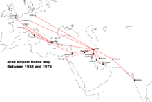
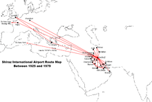
Old Airports Route Map in Iran
 Arak
Arak Bandar-e-Lengeh
 Bandar-e-Anzali
 Bushehr
 Ghasr-e-Shirin
 Isfahan
 Kerman
 Mashhad
 Masjed Soleyman is First Airport in Iran and Middle East
 North Airports
 Orumiyeh
 Sanandaj
 Shiraz
 Zahedan
See also
- List of airlines of Iran
- Busiest airports in Islamic Republic of Iran
- List of airports by ICAO code: O#OI - Iran
- List of Iranian Air Force bases
- Transport in Iran
- Wikipedia: WikiProject Aviation/Airline destination lists: Asia#Iran
References
- "ICAO Location Indicators by State" (PDF). International Civil Aviation Organization. 17 September 2010.
- "IATA Airline and Airport Code Search". International Air Transport Association.
- "UN Location Codes: Iran (includes IATA codes)". UN/LOCODE 2012-1. UNECE. 14 September 2012.
- "Airports in Iran". World Aero Data.
- "Airports in Iran". The Airport Guide.
- "Airports in Iran". Great Circle Mapper.
Footnotes
- ↑ "COUNTRY COMPARISON :: AIRPORTS". The World Factbook. CIA. 2014-11-27. Retrieved 2014-11-27.
- ↑ ICAO: OISA/Abadeh Airport/Abadeh, Fars Province, Iran
- ↑ Route map: Tehran to YES. Iran Aseman Airlines. Retrieved 16 July 2009.
- ↑ Yasouj Airport (YES/OISY) - Yasouj, Iran. Handbook of Business Aviation. Retrieved 16 July 2009.
External links
| Wikimedia Commons has media related to Airports in Iran. |
This article is issued from Wikipedia - version of the 11/30/2016. The text is available under the Creative Commons Attribution/Share Alike but additional terms may apply for the media files.
