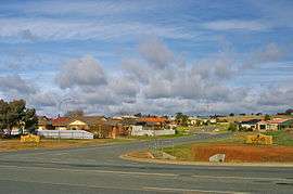
Lloyd, New South Wales
| Lloyd Wagga Wagga, New South Wales | |||||||||||||
|---|---|---|---|---|---|---|---|---|---|---|---|---|---|
 Suburb of Lloyd | |||||||||||||
| Coordinates | 35°8′42.46″S 147°21′7.48″E / 35.1451278°S 147.3520778°ECoordinates: 35°8′42.46″S 147°21′7.48″E / 35.1451278°S 147.3520778°E | ||||||||||||
| Postcode(s) | 2650 | ||||||||||||
| LGA(s) | City of Wagga Wagga | ||||||||||||
| County | Wynyard | ||||||||||||
| Parish | South Wagga Wagga | ||||||||||||
| State electorate(s) | Wagga Wagga | ||||||||||||
| Federal Division(s) | Riverina | ||||||||||||
| |||||||||||||
Lloyd is Wagga Wagga, New South Wales, Australia's newest suburb. It is located to the south-west of the city, to the west of Jubilee Park and Holbrook (Mangoplah) Road, and to the south of Red Hill Road. Development of the suburb commenced in the late 1990s and to date there are only residential dwellings present within its confines.
References
This article is issued from Wikipedia - version of the 10/8/2011. The text is available under the Creative Commons Attribution/Share Alike but additional terms may apply for the media files.