Maine State Route 136
| ||||
|---|---|---|---|---|
| Route information | ||||
| Maintained by MaineDOT | ||||
| Length: | 19.17 mi[1] (30.85 km) | |||
| Major junctions | ||||
| South end: |
| |||
|
| ||||
| North end: |
| |||
| Location | ||||
| Counties: | Cumberland, Androscoggin | |||
| Highway system | ||||
| ||||

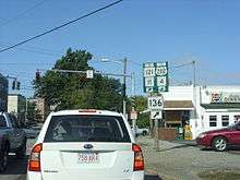
Maine State Route 136 in Auburn
State Route 136 is a numbered state highway in Maine, United States. It begins with Route 125 at the junction of U.S. 1 in Freeport, and travels to Auburn. Although it is only approximately 19.17 miles (30.85 km) long, it connects three major Maine commerce areas (Lewiston, Auburn, and Freeport as well as points south.) Many people who do not want to take the Maine Turnpike from Lewiston or Auburn to Portland or other points south of Freeport use Route 136.
References
This article is issued from Wikipedia - version of the 6/2/2015. The text is available under the Creative Commons Attribution/Share Alike but additional terms may apply for the media files.