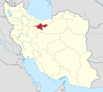
Malard
For the administrative subdivisions, see Malard County and Malard Rural District. For the village in Markazi Province, see Malard, Markazi. For the duck, see Mallard.
"Melard" redirects here. For the village in Mazandaran Province, see Melard, Mazandaran.
| Malard ملارد | |
|---|---|
| city | |
 Malard | |
| Coordinates: 35°39′57″N 50°58′36″E / 35.66583°N 50.97667°ECoordinates: 35°39′57″N 50°58′36″E / 35.66583°N 50.97667°E | |
| Country |
|
| Province | Tehran |
| County | Malard |
| Bakhsh | Central |
| Population (2006) | |
| • Total | 228,673 |
| Time zone | IRST (UTC+3:30) |
| • Summer (DST) | IRDT (UTC+4:30) |
Malard (Persian: ملارد, also Romanized as Malārd and Melārd; also known as Malār)[1] is a city in and the capital of Malard County, Tehran Province, Iran. At the 2006 census, its population was 228,673, in 61,302 families.[2]
Climate
Köppen-Geiger climate classification system classifies its climate as cold semi-arid (BSk).[3]
| Climate data for Malard | |||||||||||||
|---|---|---|---|---|---|---|---|---|---|---|---|---|---|
| Month | Jan | Feb | Mar | Apr | May | Jun | Jul | Aug | Sep | Oct | Nov | Dec | Year |
| Average high °C (°F) | 6.2 (43.2) |
8.9 (48) |
13.8 (56.8) |
20.3 (68.5) |
28 (82) |
32.4 (90.3) |
34.7 (94.5) |
35.1 (95.2) |
30.2 (86.4) |
24.6 (76.3) |
16 (61) |
10 (50) |
21.68 (71.02) |
| Daily mean °C (°F) | 1.2 (34.2) |
3.6 (38.5) |
8 (46) |
13.8 (56.8) |
20.7 (69.3) |
24.6 (76.3) |
27 (81) |
27.6 (81.7) |
22.6 (72.7) |
17.8 (64) |
10.2 (50.4) |
4.9 (40.8) |
15.17 (59.31) |
| Average low °C (°F) | −3.8 (25.2) |
−1.7 (28.9) |
2.3 (36.1) |
7.3 (45.1) |
13.4 (56.1) |
16.9 (62.4) |
19.4 (66.9) |
20.2 (68.4) |
15.1 (59.2) |
11.1 (52) |
4.4 (39.9) |
−0.2 (31.6) |
8.7 (47.65) |
| Average precipitation mm (inches) | 43 (1.69) |
35 (1.38) |
39 (1.54) |
33 (1.3) |
17 (0.67) |
5 (0.2) |
2 (0.08) |
2 (0.08) |
4 (0.16) |
15 (0.59) |
26 (1.02) |
32 (1.26) |
253 (9.97) |
| Source: Climate-Data.org, altitude: 1191m[3] | |||||||||||||
Transportation
See also: Malard and Suburbs Bus Organization
The city is served by buses from the municipal-run Malard and Suburbs Bus Organization, connecting the city to Shahriar, Karaj, Qods, and Tehran. Template:See also Malard and Suburbs taxi Organization
References
- ↑ Malard can be found at GEOnet Names Server, at this link, by opening the Advanced Search box, entering "-3073679" in the "Unique Feature Id" form, and clicking on "Search Database".
- ↑ "Census of the Islamic Republic of Iran, 1385 (2006)". Islamic Republic of Iran. Archived from the original (Excel) on 2011-11-11.
- 1 2 "Climate: Malard - Climate graph, Temperature graph, Climate table". Climate-Data.org. Retrieved 9 September 2013.
This article is issued from Wikipedia - version of the 6/26/2016. The text is available under the Creative Commons Attribution/Share Alike but additional terms may apply for the media files.
