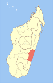
Mananjary, Fianarantsoa

Building in Mananjary


An inoperative bridge on Canal des Pangalanes in Mananjary in 2013, which was damaged by a typhoon. Underneath the bridge, a makeshift bamboo bridge was built, which is removed for passing ships upon payment of a fee.
Mananjary [mananˈdzarʲ] is a city located in Vatovavy-Fitovinany. The city had an estimated population of 28,498 inhabitants in 2005.[1]
It contains a town of the same name, situated on the southern part of the east coast, where the Mananjary River flows into the Indian Ocean.[2] There's a small port and an airport Mananjary Airport.
The Canal des Pangalanes divides the town into two sections. Local industry focuses on vanilla, coffee, and pepper production.[3]
It is the seat of the Roman Catholic Diocese of Mananjary. The small Antambahoaka tribe holds a ceremonial mass circumcision rite every seven years in the village, called "Sambatra."[4]
Education
French international schools:
- École primaire française de Mananjary[5]
References
| Wikimedia Commons has media related to Mananjary. |
- ↑ 2005 population estimates for cities in Madagascar
- ↑ www.britannica.com
- ↑ Madagascar & Comoros, pp. 230-31 (Lonely Planet, 2008)
- ↑ Bradt, Hilary. Madagascar: The Bradt Travel Guide, p. 298 (2007)
- ↑ "École primaire française de Mananjary." AEFE. Retrieved on May 7, 2015.
Coordinates: 21°13′52″S 48°20′31″E / 21.23111°S 48.34194°E
This article is issued from Wikipedia - version of the 10/28/2016. The text is available under the Creative Commons Attribution/Share Alike but additional terms may apply for the media files.