Mojkowo, Kętrzyn County
For the village in Elbląg County, see Mojkowo.
| Mojkowo | |
|---|---|
| Village | |
 Mojkowo | |
| Coordinates: 54°2′35″N 21°10′54″E / 54.04306°N 21.18167°E | |
| Country |
|
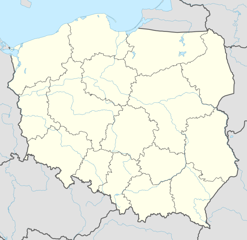
| Voivodeship | Warmian-Masurian |
| County | Kętrzyn |
| Gmina | Reszel |
| Population | 33 |
Mojkowo [mɔi̯ˈkɔvɔ] is a village in the administrative district of Gmina Reszel, within Kętrzyn County, Warmian-Masurian Voivodeship, in northern Poland.[1] It lies approximately 3 kilometres (2 mi) south-east of Reszel, 14 km (9 mi) west of Kętrzyn, and 54 km (34 mi) north-east of the regional capital Olsztyn.
Before 1945 the area was part of Germany (East Prussia).
The village has a population of 33.
References
Coordinates: 54°2′35″N 21°10′54″E / 54.04306°N 21.18167°E
This article is issued from Wikipedia - version of the 1/7/2015. The text is available under the Creative Commons Attribution/Share Alike but additional terms may apply for the media files.