Monette, Arkansas
| Monette, Arkansas | |
|---|---|
| City | |
|
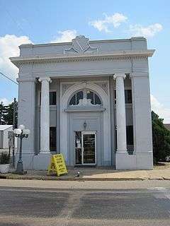
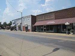
Downtown Monette, July 2011 | |
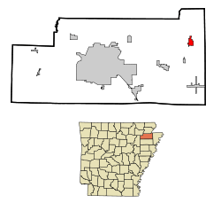
 Location in Craighead County and the state of Arkansas | |
| Coordinates: 35°53′27″N 90°20′39″W / 35.89083°N 90.34417°WCoordinates: 35°53′27″N 90°20′39″W / 35.89083°N 90.34417°W | |
| Country | United States |
| State | Arkansas |
| County | Craighead |
| Area | |
| • Total | 6.31 sq mi (16.33 km2) |
| • Land | 6.29 sq mi (16.30 km2) |
| • Water | 0.01 sq mi (0.03 km2) |
| Elevation | 236 ft (72 m) |
| Population (2010) | |
| • Total | 1,501 |
| • Density | 239/sq mi (92.1/km2) |
| Time zone | Central (CST) (UTC-6) |
| • Summer (DST) | CDT (UTC-5) |
| ZIP code | 72447 |
| Area code(s) | 870 |
| FIPS code | 05-46400 |
| GNIS feature ID | 0077680 |
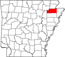
Monette is a city in Craighead County, Arkansas, United States. The population was 1,501 at the 2010 census.[1] It is included in the Jonesboro, Arkansas Metropolitan Statistical Area.
Geography
Monette is located in eastern Craighead County at 35°53′27″N 90°20′39″W / 35.89083°N 90.34417°W (35.890969, -90.344247).[2]
According to the United States Census Bureau, the city has a total area of 6.3 square miles (16.3 km2), of which 0.012 square miles (0.03 km2), or 0.19%, is water.[1]
List of highways
Demographics
| Historical population | |||
|---|---|---|---|
| Census | Pop. | %± | |
| 1910 | 559 | — | |
| 1920 | 1,066 | 90.7% | |
| 1930 | 1,111 | 4.2% | |
| 1940 | 1,074 | −3.3% | |
| 1950 | 1,114 | 3.7% | |
| 1960 | 981 | −11.9% | |
| 1970 | 1,076 | 9.7% | |
| 1980 | 1,165 | 8.3% | |
| 1990 | 1,115 | −4.3% | |
| 2000 | 1,179 | 5.7% | |
| 2010 | 1,501 | 27.3% | |
| Est. 2015 | 1,527 | [3] | 1.7% |

As of the census[5] of 2009, there were 1,247 people,529 households, and 321 families residing in the city. The population density was 721.8 people per square mile (279.3/km²). There were 572 housing units at an average density of 348.3/sq mi (134.8/km²). The racial makeup of the city was 96.61% White, 0.08% Black or African American, 0.08% Native American, 1.44% from other races, and 1.78% from two or more races. 2.63% of the population were Hispanic or Latino of any race.
There were 525 households out of which 23.8% had children under the age of 18 living with them, 47.2% were married couples living together, 10.7% had a female householder with no husband present, and 39.6% were non-families. 37.9% of all households were made up of individuals and 24.4% had someone living alone who was 65 years of age or older. The average household size was 2.12 and the average family size was 2.78.
In the city the population was spread out with 19.7% under the age of 18, 7.3% from 18 to 24, 23.6% from 25 to 44, 23.7% from 45 to 64, and 25.8% who were 65 years of age or older. The median age was 44 years. For every 100 females there were 76.5 males. For every 100 females age 18 and over, there were 73.4 males.
The median income for a household in the city was $27,500, and the median income for a family was $33,796. Males had a median income of $28,375 versus $20,109 for females. The per capita income for the city was $16,517. About 13.3% of families and 16.4% of the population were below the poverty line, including 20.8% of those under age 18 and 25.7% of those age 65 or over.
Education
Public education
Monette is the headquarters for the Buffalo Island Central School District, which provides public education to more than 850 elementary and secondary school students in Craighead and Mississippi counties. Students graduate from the Monette-based Buffalo Island Central High School. The school's mascot and athletic emblem is the Mustangs.
Public libraries
Kohn Memorial Library is the city's public library and one of seven branch libraries of the Crowley Ridge Regional library system.
Notable person
- Dave Wallace, Republican member of the Arkansas House of Representatives from Mississippi County; former Monette resident
References
| Wikimedia Commons has media related to Monette, Arkansas. |
- 1 2 "Geographic Identifiers: 2010 Demographic Profile Data (G001): Monette city, Arkansas". U.S. Census Bureau, American Factfinder. Retrieved June 18, 2014.
- ↑ "US Gazetteer files: 2010, 2000, and 1990". United States Census Bureau. 2011-02-12. Retrieved 2011-04-23.
- ↑ "Annual Estimates of the Resident Population for Incorporated Places: April 1, 2010 to July 1, 2015". Retrieved July 2, 2016.
- ↑ "Census of Population and Housing". Census.gov. Retrieved June 4, 2015.
- ↑ "American FactFinder". United States Census Bureau. Retrieved 2008-01-31.

