Mount Simeon District
| Mount Simeon District منطقة جبل سمعان | |
|---|---|
| District | |
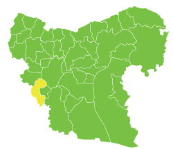
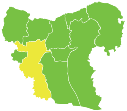 Location of Mount Simeon District within Aleppo Governorate | |
| Coordinates (Aleppo): 36°13′N 37°10′E / 36.22°N 37.17°ECoordinates: 36°13′N 37°10′E / 36.22°N 37.17°E | |
| Country |
|
| Governorate | Aleppo |
| Seat | Aleppo |
| Subdistricts | 7 nawāḥī |
| Area | |
| • Total | 2,757.27 km2 (1,064.59 sq mi) |
| Population (2004)[1] | 2,413,878 |
| Geocode | SY0200 |
Mount Simeon District (Arabic: منطقة جبل سمعان, translit. manṭiqat Jabal Sem‘ān), also known as Jabal Sem`an, is a district of Aleppo Governorate in northern Syria. Administrative centre is the city of Aleppo.
The administrative center of Huraytan Nahiyah shown above is the city of Haritan.
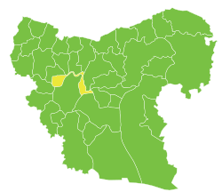
The administrative center of Darat Izza Nahiyah shown above is the city of Darat Izza.
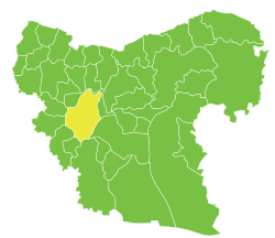
Jabal Sem‘ān Nahiyah's administrative center, which is administrative center of the Mount Simeon District, is Aleppo.
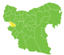
The administrative center of Az-Zirbeh Nahiyah shown above is the city of al-Zirbah.
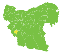
The administrative center of Hadher Nahiyah shown above is the city of Hadher.
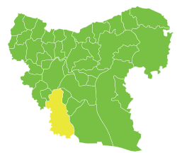
The administrative center of Tell ad-Daman Nahiyah shown above is the city of Tell ad-Daman.
Until December 2008, the sub-district of Atāreb was part of Mount Simeon District before being incorporated as a separate district.[2] At the 2004 census, the remaining sub-districts had a total population of 2,413,878.[1]
Sub-districts
The district of Mount Simeon is divided into seven sub-districts or nawāḥī (population as of 2004[1]):
| Code | Name | Area | Population | Seat |
|---|---|---|---|---|
| SY020000 | Mount Simeon Nahiya | 663.95 km² | 2,181,061 | Aleppo |
| SY020002 | Tell ad-Daman Nahiya | 1,146.95 km² | 47,501 | Tell ad-Daman |
| SY020003 | Haritan Nahiya | 232.76 km² | 67,745 | Haritan |
| SY020004 | Darat Izza Nahiya | 227.49 km² | 39,540 | Darat Izza |
| SY020005 | al-Zirbah Nahiya | 354.79 km² | 55,391 | al-Zirbah |
| Zammar Nahiya | Zammar | |||
| SY020006 | Hadher Nahiya | 131.33 km² | 20,834 | Hadher |
Zammar Nahiya was separated from al-Zirbah Nahiya in 2009.[3]
See also
References
- 1 2 3 "General Census of Population and Housing 2004" (PDF) (in Arabic). Syrian Central Bureau of Statistics. Retrieved 15 October 2015. Also available in English: "2004 Census Data". UN OCHA. Retrieved 15 October 2015.
- ↑ "إحداث منطقتي دير حافر والأتارب سيساهم في النهضة التنموية بالمحافظة". Al-Jamahir (in Arabic). Aleppo. 25 February 2009. Retrieved 24 January 2016.
- ↑ "احداث منطقتي دير حافر والاتارب تعزيزاً لمسيرة التنمية". Al-Jamahir (in Arabic). Aleppo. 25 February 2009. Retrieved 25 January 2016.
Capital: Aleppo | ||||||||
|  | |||||||
|
| ||||||||
| ||||||||
| ||||||||
| ||||||||
| ||||||||
This article is issued from Wikipedia - version of the 10/21/2016. The text is available under the Creative Commons Attribution/Share Alike but additional terms may apply for the media files.