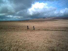
Mynydd y Betws
| Mynydd y Betws | |
|---|---|
 Upper slopes of Mynydd y Betws | |
| Highest point | |
| Elevation | 373 m (1,224 ft) |
| Prominence | 205 m (673 ft) |
| Listing | Marilyn, council top |
| Geography | |
| Location | Swansea / Carmarthenshire, Wales |
| OS grid | SN664094 |
Mynydd y Betws is a mountain or large hill located on the border between Swansea and Carmarthenshire in South Wales, between Ammanford and Clydach. It is an area of upland with large stretches of tussocky grassland. The medieval castle of Penlle'r Castell is located near the highest point and the Mynydd y Betws Wind Farm is prominent with fifteen 110 m (361 ft) wind turbines.
Geography
At 373 m (1,224 ft), Mynydd y Betws is the highest mountain in the City and County of Swansea, and the highest land between the River Loughor and the Upper Clydach River. A small road between Ammanford and Clydach passes very close to the summit, on which are located the historic ruins of Penlle'r Castell.[1] Little remains of this fort which was built to prevent armed marauders coming from the north and attacking Swansea. It was destroyed in 1252, not long after it was built.[2]
Wind farm
Mynydd y Betws is the site of a wind turbine farm. It was granted planning permission in 2009 and started producing electricity in 2013.[3] The original developers of the site were the renewable energy generating company Eco2, but in 2010, they sold the site to the Irish state-owned electricity utility ESB.[4] The mast of each turbine is 70 m (230 ft) tall and the blades are 40 m (131 ft) long.[5] With fifteen turbines, the wind farm has an installed capacity of 34.5 MW and is said to generate enough electricity to power 23,800 households, one third of the domestic usage in Carmarthenshire. The Mynydd y Betws Wind Farm community benefit fund provides grants for projects in neighbouring areas of Carmarthenshire, Swansea and Neath Port Talbot.[3]
References
- ↑ Philip's (1994). Atlas of the World. Reed International. pp. 16–17. ISBN 0-540-05831-9.
- ↑ Royal Commission on the Ancient and Historical Monuments of Wales (2000). An Inventory of the Ancient Monuments in Glamorgan: Volume III - Part 1b: Medieval Secular Monuments the Later Castles from 1217 to the present. Royal Commission on the Ancient and Historical Monuments of Wales. p. 273. ISBN 978-1-871184-22-8.
- 1 2 "Mynydd y Bettws Wind Farm". Cambrian Renewable Energy. Retrieved 8 April 2016.
- ↑ "Eco2 sells Mynydd y Betws wind farm". Insider Media Ltd. 4 June 2010. Retrieved 1 April 2016.
- ↑ "Mynydd y Betws Wind Farm". Eco2. Retrieved 8 April 2016.
External links
- www.geograph.co.uk : photos of Mynydd y Betws and surrounding area
- geograph: SN6510 images
- geograph: SN6610 images
- geograph: SN6710 images
Coordinates: 51°46′02″N 3°56′15″W / 51.76729°N 3.93750°W
