National Highway 4 (Djibouti)
Map of Djibouti national highway
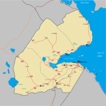
National Highway 4 is the shortest national highway of Djibouti. The highway begins at 11°31′4″N 42°53′5″E / 11.51778°N 42.88472°E, at a junction with National Highway 1 and connects it with Arta city at 11°31′30″N 42°50′36″E / 11.52500°N 42.84333°E.
This article is issued from Wikipedia - version of the 5/15/2016. The text is available under the Creative Commons Attribution/Share Alike but additional terms may apply for the media files.
