New Hampshire Route 63
| ||||
|---|---|---|---|---|
|
Map of Cheshire County in southwestern New Hampshire with NH 63 highlighted in red | ||||
| Route information | ||||
| Maintained by NHDOT | ||||
| Length: | 21.514 mi[1] (34.623 km) | |||
| Major junctions | ||||
| South end: |
| |||
|
| ||||
| North end: |
| |||
| Location | ||||
| Counties: | Cheshire | |||
| Highway system | ||||
| ||||

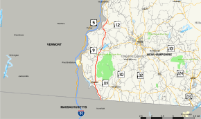
New Hampshire Route 63 is a 21.514-mile-long (34.623 km) north–south state highway in Cheshire County in southwestern New Hampshire. It runs from Winchester to Westmoreland.
The northern terminus of NH 63 is in Westmoreland at New Hampshire Route 12. The southern terminus is in Winchester at the Massachusetts state line, where the road continues as Massachusetts Route 63 in the town of Northfield. In Winchester, the road is named Northfield Road. In Hinsdale and Chesterfield, the road travels along the western edge of Pisgah State Park.
Major intersections
The entire route is in Cheshire County. [1][2]
| Location[1][2] | mi[1][2] | km | Destinations | Notes | |
|---|---|---|---|---|---|
| Winchester | 0.000 | 0.000 | Continuation from Massachusetts | ||
| Hinsdale | 4.706 | 7.574 | Southern end of concurrency with NH 119 | ||
| 4.987 | 8.026 | Northern end of concurrency with NH 119 | |||
| Chesterfield | 13.279 | 21.370 | |||
| Westmoreland | 21.514 | 34.623 | Northern terminus | ||
1.000 mi = 1.609 km; 1.000 km = 0.621 mi
| |||||
References
- 1 2 3 4 Bureau of Planning & Community Assistance (February 20, 2015). "NH Public Roads". Concord, New Hampshire: New Hampshire Department of Transportation. Retrieved April 7, 2015.
- 1 2 3 Bureau of Planning & Community Assistance (April 3, 2015). "Nodal Reference 2015, State of New Hampshire". New Hampshire Department of Transportation. Retrieved April 7, 2015.
External links
This article is issued from Wikipedia - version of the 5/11/2015. The text is available under the Creative Commons Attribution/Share Alike but additional terms may apply for the media files.
