Nob Hill, San Francisco
| Nob Hill | |
|---|---|
| Neighborhood | |
|
California Street on Nob Hill | |
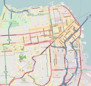
 Nob Hill Location within Central San Francisco | |
| Coordinates: 37°47′36″N 122°24′52″W / 37.79323°N 122.41448°W | |
| Country |
|
| State |
|
| City-county | San Francisco |
| Government | |
| • Supervisor | Aaron Peskin |
| • Assemblymember | David Chiu (D)[1] |
| • State senator | Scott Wiener (D)[1] |
| • U. S. rep. | Nancy Pelosi (D)[2] |
| Area[3] | |
| • Total | 0.313 sq mi (0.81 km2) |
| Population [3] | |
| • Total | 20,388 |
| • Density | 65,000/sq mi (25,000/km2) |
| Time zone | Pacific (UTC−8) |
| • Summer (DST) | PDT (UTC−7) |
| ZIP codes | 94108, 94109, 94133 |
| Area codes | 415/628 |
Nob Hill is a neighborhood in San Francisco, California, centered on the intersection of California Street and Powell Street. It is one of San Francisco's 44 hills, and one of its original "Seven Hills." Prior to the 1850s, Nob Hill was called California Hill (after California Street, which climbs its steep eastern face). It was renamed after the Central Pacific Railroad's Big Four – called the Nobs – built mansions there.[4]
Location
The actual peak of Nob Hill lies slightly to the northwest, approximately at the intersection of Jones and Sacramento Streets. South of Nob Hill is Lower Nob Hill neighborhood, the shopping district of Union Square, the Tenderloin neighborhood, and Market Street. To the east is San Francisco's Chinatown and a little farther, the city's financial district. Northeast of Nob Hill is North Beach and Telegraph Hill. North of Nob Hill is Russian Hill, and eventually, the tourist-centered areas of the waterfront such as Pier 39 and Fisherman's Wharf.
History
The area was settled in the rapid urbanization happening in the city in the late 19th century. Because of the views and its central position, it became an exclusive enclave of the rich and famous on the west coast who built large mansions in the neighborhood. This included prominent tycoons such as Leland Stanford, founder of Stanford University and other members of The Big Four. For this reason, its early citizens were known as nabobs, which was shortened to nob, giving the area its eventual name.
The neighborhood was destroyed in the 1906 earthquake and fire, except for the granite walls surrounding the Stanford, Crocker, Huntington and Hopkins mansions. Those walls remain and black scars caused by smoke from the intense fires that burned after the quake can still be seen.
Also gutted by the fires was the newly completed Fairmont Hotel at Mason and California Streets, as well as the mansion of tycoon James Flood. Both structures had stone exteriors that survived the fires, and both buildings were subsequently cleaned and refurbished. The Fairmont Hotel remains in operation to this day and the Flood Mansion is the headquarters of the exclusive Pacific-Union Club.
While the neighborhood was able to maintain its affluence following the quake, every mansion owner moved or rebuilt elsewhere. Some rebuilt mansions further west in San Francisco, for example, in Pacific Heights and Cow Hollow. In place of where the mansions had been located, swank hotels were erected. Hotels built over the ruins of the former mansions include the Mark Hopkins, Huntington and Stanford Court.
Attractions and characteristics
Nob Hill is an affluent district, home to many of the city's upper-class families as well as a large young urban professional population, and a growing Chinese immigrant population from Chinatown to the east. Nob is disparaging British slang abbreviation of "noble/nobility" referring to the monied, often titled upper-classes. The location is also derisively referred to as Snob Hill. The intersection of California and Powell streets is the location of two of its four well-known and most expensive hotels: the Fairmont Hotel, the Mark Hopkins Hotel, the Stanford Court. The Mark Hopkins Hotel and the Huntington Hotel are located one block away at Mason & California. The hotels were named for three of The Big Four, four entrepreneurs of the construction of the Central Pacific Railroad: Leland Stanford, Mark Hopkins & Collis P. Huntington. The fourth, Charles Crocker has a garage named after him in the neighborhood. The Fairmont is also named for a San Francisco tycoon, James G. Fair.
Opposite the Fairmont Hotel and Pacific Union Club is Grace Cathedral, one of the city's largest houses of worship. The state Masonic Temple is also located across from the church.
In the Lower Nob Hill area, the Academy of Art University owns and operates several buildings for housing and educational opportunities.[5]
On its southwest slope, Nob Hill begins to blend with the Tenderloin neighborhood in a region known as the "Tendernob".
Parks
Though Nob Hill is a very densely built neighborhood, there are parks at which residents and visitors can relax and enjoy the outdoors. The most prominent park in the neighborhood is Huntington Park, which takes up an entire block, bounded by Sacramento Street to the north, Taylor Street to the west, California Street to the south, and Cushman Street to the east. Huntington Park was formerly the site of the mansion of Central Pacific Railroad baron Collis P. Huntington; the mansion was destroyed by the 1906 earthquake and fire, however, and Mr. Huntington's widow donated the property to the city to establish a park in 1915.[6] Huntington Park has a playground for children, landscaping, and several fountains. Washington & Hyde Mini Park is situated on a single lot between two apartment buildings on the north side of Washington Street, between Hyde Street and Leavenworth Street. Washington & Hyde Mini Park has a playground for children, landscaping, and public restrooms.[7]
Images
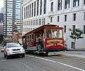
 MUNI electric trolleybus coming uphill
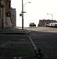
 Looking down Nob Hill, San Francisco bay and Fisherman's Wharf in distant background.
 By the Cable Car Museum
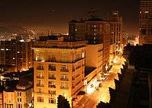
 Looking south on Nob Hill, from intersection at Mason and Sacramento Streets.

- Nob Hill Theatre
- A condominium complex across the street from Huntington Park
See also
References
- 1 2 "Statewide Database". UC Regents. Retrieved December 8, 2014.
- ↑ "California's 12th Congressional District - Representatives & District Map". Civic Impulse, LLC.
- 1 2 "Nob Hill neighborhood". City-Data. Retrieved December 10, 2014.
- ↑ Solnit, Rebecca (2003). River of Shadows: Eadweard Muybridge and the Technological Wild West. New York: Viking. p. 157.
- ↑ "Academy of Art University Campus Map" (PDF). academyart.edu. Academy of Art University. Retrieved 23 November 2016.
- ↑ "Huntington Park". Nob Hill Association.
- ↑ "Washington Hyde Mini Park". ParkScan. Archived from the original on July 21, 2011.
External links
| Wikivoyage has a travel guide for San Francisco/Nob Hill-Russian Hill. |
Coordinates: 37°47′36″N 122°24′52″W / 37.793230°N 122.414480°W

.svg.png)