Oxapampa Province
| Oxapampa | |
|---|---|
| Province | |
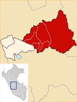
 Location of Oxapampa in the Pasco Region | |
| Country | Peru |
| Region | Pasco |
| Founded | November 27, 1944 |
| Capital | Oxapampa |
| Government | |
| • Mayor | Juan Hermitaño Rios |
| Area | |
| • Total | 18,673.79 km2 (7,209.99 sq mi) |
| Population | |
| • Total | 78,108 |
| • Density | 4.2/km2 (11/sq mi) |
| UBIGEO | 1903 |
| Website |
www |
The Oxapampa Province (Spanish: Provincia de Oxapampa) is the largest of three provinces that make up the Pasco Region in Peru.[1] The capital of the Oxapampa province is the city of Oxapampa.
Political division
The Oxapampa Province is divided into eight districts (Spanish: distritos, singular: distrito), each of which is headed by a mayor (alcalde):
Districts

Flag of Oxapampa
Places of interest
- El Sira Communal Reserve
- San Matías–San Carlos Protection Forest
- Yanachaga–Chemillén National Park
- Yanesha Communal Reserve]]
References
- ↑ (Spanish) Official web site of the Oxapampa Province
External links
- (Spanish) Official web site of the Oxapampa Province
- (Spanish) Pozuzo Information
Coordinates: 12°34′03″S 75°24′14″W / 12.56750°S 75.40389°W
This article is issued from Wikipedia - version of the 9/14/2013. The text is available under the Creative Commons Attribution/Share Alike but additional terms may apply for the media files.
