Perevalsk Raion
| Perevalskyi Raion Перевальський район | |||
|---|---|---|---|
| Raion | |||
| |||
 | |||
| Coordinates: 48°23′29″N 38°40′27″E / 48.39139°N 38.67417°ECoordinates: 48°23′29″N 38°40′27″E / 48.39139°N 38.67417°E | |||
| Country |
| ||
| Region | Luhansk Oblast | ||
| Established | 1965 | ||
| Admin. center | Perevalsk | ||
| Subdivisions |
List
| ||
| Government | |||
| • Governor | Igor Butenko | ||
| Area | |||
| • Total | 806.8 km2 (311.5 sq mi) | ||
| Population (2013) | |||
| • Total |
| ||
| Time zone | EET (UTC+2) | ||
| • Summer (DST) | EEST (UTC+3) | ||
| Postal index | 94300—94344 | ||
| Area code | +380 6441 | ||
| Website | http://prv.loga.gov.ua | ||
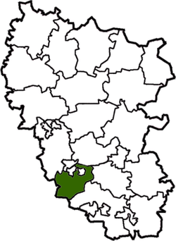
Perevalsk Raion (Ukrainian: Перевальський район) is a raion (district) in the eastern Ukrainian province of Luhansk. The administrative center of the raion is the city of Perevalsk. Population: 71,686 (2013 est.)[1].
Since 2014, the raion has been controlled by forces of the Luhansk People's Republic.[2] On 7 October 2014, to facilitate the governance of Luhansk Oblast, the Verkhovna Rada on 7 October 2014 made some changes in the administrative divisions, so that the localities in the government-controlled areas were grouped into districts. In particular, the urban-type settlement of Chornukhyne was transferred from Perevalsk Raion to Popasna Raion.[3] The list below contains LNR-controlled areas as well.
References
- ↑ "Чисельність наявного населення України (Actual population of Ukraine)" (in Ukrainian). State Statistics Service of Ukraine. Retrieved 21 January 2015.
- ↑ "Численность населения по состоянию на 1 октября 2015 года по Луганской Народной Республике" (PDF) (in Russian). Luhansk People's Republic. Retrieved 21 December 2015.
- ↑ "Рада изменила границы районов Луганской области" (in Russian). Lenta.ru. 7 October 2014. Retrieved 28 November 2015.
This article is issued from Wikipedia - version of the 12/25/2015. The text is available under the Creative Commons Attribution/Share Alike but additional terms may apply for the media files.

