Portobuffolé
| Portobuffolé | ||
|---|---|---|
| Comune | ||
| Comune di Portobuffolé | ||
|
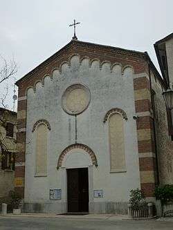
The Cathedral | ||
| ||
 Portobuffolé Location of Portobuffolé in Italy | ||
| Coordinates: 45°51′N 12°32′E / 45.850°N 12.533°E | ||
| Country | Italy | |
| Region | Veneto | |
| Province / Metropolitan city | Treviso (TV) | |
| Frazioni | Settimo, Ronche and Faé[1] | |
| Government | ||
| • Mayor | Andrea Sebastiano Susana | |
| Area | ||
| • Total | 5.0 km2 (1.9 sq mi) | |
| Elevation | 10 m (30 ft) | |
| Population (31 December 2010)[2] | ||
| • Total | 804 | |
| • Density | 160/km2 (420/sq mi) | |
| Demonym(s) | Portobuffolesi or Portuensi | |
| Time zone | CET (UTC+1) | |
| • Summer (DST) | CEST (UTC+2) | |
| Postal code | 31040 | |
| Dialing code | 0422 | |
| Website | Official website | |
Portobuffolé[3] (Italian pronunciation: [ˌpɔrtobuffoˈle]) or Portobuffolè[4] ([ˌpɔrtobuffoˈlɛ])[note 1] is a comune (municipality) in the province of Treviso in the Italian region Veneto, located about 50 kilometres (31 mi) northeast of Venice and about 30 kilometres (19 mi) northeast of Treviso on both the shores of the Livenza river.
Portobuffolé borders the following municipalities: Brugnera, Gaiarine, Mansuè, Prata di Pordenone. Sights include the Duomo (Cathedral), a synagogue re-consecrated in 1559. During the Middle Ages town, of Roman origins, was under the da Carrara, the patriarchs of Aquileia, the bishops of Ceneda, the comune of Treviso (1166) and then again under the bishops of Ceneda (1242). After a period of da Camino suzerainty (1307–36), it became part of the Republic of Venice since 1339.
Notes
References
- ↑ Statute of the commune of Portobuffolé - art.2
- ↑ All demographics and other statistics: Italian statistical institute Istat.
- ↑ DOP Online
- ↑ ISTAT (Italian National Institute of Statistics) List of statistical codes and official names of territorial units
- ↑ La tabele dai nons. "Cjarte dal Friûl Vignesie Julie". Societât filologjiche furlane / Casa editrice Tabacco. Udine: 2005. ISBN 9788883150821 (Friulian)

