Luckhoff
| Luckhoff | |
|---|---|
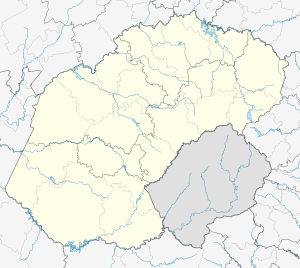  Luckhoff  Luckhoff  Luckhoff
| |
| Coordinates: 29°45′S 24°47′E / 29.750°S 24.783°ECoordinates: 29°45′S 24°47′E / 29.750°S 24.783°E | |
| Country | South Africa |
| Province | Free State |
| District | Xhariep |
| Municipality | Letsemeng |
| Established | 1892 |
| Area[1] | |
| • Total | 30.92 km2 (11.94 sq mi) |
| Population (2011)[1] | |
| • Total | 3,699 |
| • Density | 120/km2 (310/sq mi) |
| Racial makeup (2011)[1] | |
| • Black African | 46.1% |
| • Coloured | 49.1% |
| • Indian/Asian | 0.7% |
| • White | 3.9% |
| • Other | 0.2% |
| First languages (2011)[1] | |
| • Afrikaans | 77.2% |
| • Sotho | 11.3% |
| • Xhosa | 7.6% |
| • English | 1.2% |
| • Other | 2.7% |
| Postal code (street) | 9982 |
| PO box | 9982 |
| Area code | 053 |
Lückhoff is a small merino sheep farming town in the Free State province of South Africa. It was established on the farm Koffiekuil in 1892 and named after a Dutch Reformed Church minister Reverend HJ Luckhoff.
Nowadays the bulk of the sheep found in this district are dorper sheep and not merino. A small number of farmers also stock an indigenous sheep breed known as the damara.
The town is located 82 km north-west of Philippolis and 56 km west of Fauresmith. It was established in 1892 on the farm Koffiekuil. Probably named after Heinrich Jacob Luckhoff (1842-1943), Minister of the Dutch Reformed Church in Fauresmith at that time.[2]
References
- 1 2 3 4 "Main Place Luckhoff". Census 2011.
- ↑ "Dictionary of Southern African Place Names (Public Domain)". Human Science Research Council. p. 285.
 |
Koffiefontein | | ||
| Orania |  |
Fauresmith | ||
| ||||
 | ||||
| Vanderkloof Dam | Philippolis |


Municipalities and communities of Xhariep District Municipality, Free State | ||
|---|---|---|
District seat: Trompsburg | ||
| Kopanong | .svg.png) | |
| Letsemeng | ||
| Mohokare | ||
| Naledi | ||
This article is issued from Wikipedia - version of the 8/18/2016. The text is available under the Creative Commons Attribution/Share Alike but additional terms may apply for the media files.