Saint George Parish, New Brunswick
| Saint George St. George | |
|---|---|
| Parish | |
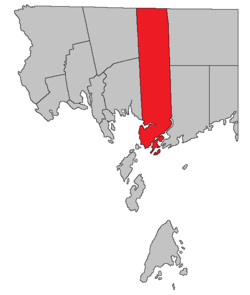 Location within Charlotte County. | |
| Country |
|
| Province |
|
| County | Charlotte County |
| Established | 1786 |
| Area[1] | |
| • Land | 499.76 km2 (192.96 sq mi) |
| Population (2011)[1] | |
| • Total | 2,472 |
| • Density | 4.9/km2 (13/sq mi) |
| • Pop 2006-2011 |
|
| • Dwellings | 1,196 |
| Time zone | AST (UTC-4) |
| • Summer (DST) | ADT (UTC-3) |
Saint George is a Canadian parish in Charlotte County, New Brunswick.[2]
History
Saint George Parish created in 1786: named for the English patron saint.
Delineation
Saint George Parish is defined in the Territorial Division Act[3] as being bounded:
- West by Saint Patrick Parish, Dumbarton Parish and Passamaquoddy Bay; north by the County line; east by the rear line of lot number three, granted to William Payne and its prolongation northerly to the County line, and southerly to Letang River; south by the Bay of Fundy, the channel to and through Letete Passage, and the channel to and through Letang Harbour and River, including Bliss Island.
Communities
Parish population total does not include incorporated municipalities (in bold):
|
Bodies of water and islands
This is a list of rivers, lakes, streams, creeks, marshes and islands that are at least partially in this parish
|
|
|
Demographics
Population
| Canada census – Saint George Parish, New Brunswick community profile | |||
|---|---|---|---|
| 2011 | 2006 | 2001 | |
| Population: | 2,472 (-0.2% from 2006) | 2,476 (+5.4% from 2001) | 2,350 (-0.3% from 1996) |
| Land area: | 499.76 km2 (192.96 sq mi) | 499.51 km2 (192.86 sq mi) | 499.51 km2 (192.86 sq mi) |
| Population density: | 4.9/km2 (13/sq mi) | 5.0/km2 (13/sq mi) | 4.7/km2 (12/sq mi) |
| Median age: | 45.1 (M: 45.1, F: 45.1) | 43.3 (M: 42.5, F: 44.1) | 39.5 (M: 38.3, F: 40.7) |
| Total private dwellings: | 1,196 | 1,262 | 989 |
| Median household income: | $50,205 | $41,632 | $35,996 |
| References: 2011[1] 2006[4] 2001[5] | |||
| Historical census data - Saint George Parish, New Brunswick<[6] | ||||||||||||||||||||||||||
|---|---|---|---|---|---|---|---|---|---|---|---|---|---|---|---|---|---|---|---|---|---|---|---|---|---|---|
|
|
| ||||||||||||||||||||||||
Language
| Canada Census mother tongue - Saint George Parish, New Brunswick[6] | ||||||||||||||||||
|---|---|---|---|---|---|---|---|---|---|---|---|---|---|---|---|---|---|---|
| Census | Total | English |
French |
English & French |
Other | |||||||||||||
| Year | Responses | Count | Trend | Pop % | Count | Trend | Pop % | Count | Trend | Pop % | Count | Trend | Pop % | |||||
| 2011 |
2,470 |
2,390 | |
96.76% | 30 | |
1.21% | 10 | |
0.40% | 40 | |
1.62% | |||||
| 2006 |
2,465 |
2,395 | |
97.16% | 35 | |
1.42% | 0 | |
0.00% | 35 | |
1.42% | |||||
| 2001 |
2,340 |
2,320 | |
99.15% | 10 | |
0.43% | 0 | |
0.00% | 10 | |
0.43% | |||||
| 1996 |
2,350 |
2,295 | n/a | 97.66% | 15 | n/a | 0.64% | 0 | n/a | 0.00% | 40 | n/a | 1.70% | |||||
Access routes
Highways and numbered routes that run through the parish, including external routes that start or finish at the parish limits:[7]
|
|
|
See also
References
- 1 2 3 2011 Statistics Canada Census Profile: Saint George Parish, New Brunswick
- ↑ New Brunswick Provincial Archives - Saint George Parish
- ↑ "Territorial Division Act (R.S.N.B. 1973, c. T-3)". Government of New Brunswick website. Retrieved 26 August 2016.
- ↑ "2006 Community Profiles". Canada 2006 Census. Statistics Canada. March 30, 2011. Retrieved 2014-03-17.
- ↑ "2001 Community Profiles". Canada 2001 Census. Statistics Canada. February 17, 2012. Retrieved 2014-03-17.
- 1 2 Statistics Canada: 1996, 2001, 2006, 2011 census
- ↑ Atlantic Canada Back Road Atlas ISBN 978-1-55368-618-7 Pages 4, 12
 |
New Maryland Parish | Gladstone Parish | Blissville Parish | |
| Dumbarton Parish | |
Clarendon Parish | ||
| ||||
| | ||||
| Saint Patrick Parish | Bay of Fundy West Isles Parish |
Pennfield Parish |
| Subdivisions | |
|---|---|
| Cities | |
| Counties | |
| |
Coordinates: 45°13′19″N 66°51′10″W / 45.221952°N 66.852837°W
This article is issued from Wikipedia - version of the 8/26/2016. The text is available under the Creative Commons Attribution/Share Alike but additional terms may apply for the media files.
