Savoy, Arkansas
| Savoy, Arkansas | |
|---|---|
| Unincorporated community | |
|
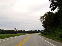
Entering Savoy on Highway 16 | |
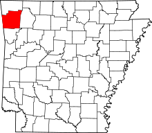
 Savoy, Arkansas Savoy's position in Arkansas | |
| Coordinates: 36°6′20″N 94°19′58″W / 36.10556°N 94.33278°WCoordinates: 36°6′20″N 94°19′58″W / 36.10556°N 94.33278°W | |
| Country |
|
| State |
|
| County | Washington |
| Township | Litteral |
| Elevation[1] | 317 m (1,040 ft) |
| Time zone | Central (CST) (UTC-6) |
| • Summer (DST) | CDT (UTC-5) |
| ZIP code | 72704 |
| Area code(s) | 479 |
| GNIS feature ID | 78300 |
| U.S. Geological Survey Geographic Names Information System: Savoy, Arkansas | |
Savoy (formerly Ladds Mill) is an unincorporated community in Litteral Township, Washington County, Arkansas, United States.[2] It is located on County Route 845 east of Lake Wedington.[3]
Savoy is home to the Illinois River Bridge at Phillips Ford, a bridge crossing the Illinois River that is listed on the National Register of Historic Places.
The Shiloh Museum of Ozark History contains some information about the Savoy baseball team of 1917.[4]
References
- ↑ "Savoy, Arkansas". Histopolis. Retrieved 4 September 2011.
- ↑ U.S. Geological Survey Geographic Names Information System: Savoy, Arkansas United States Geological Survey. Retrieved 4 September 2011.
- ↑ Arkansas Atlas and Gazetteer (Map) (Second ed.). DeLorme. § 22.
- ↑ "Shiloh Museum of Ozark History: Savoy baseball team, 1917". Retrieved 2009-12-15.
This article is issued from Wikipedia - version of the 2/11/2014. The text is available under the Creative Commons Attribution/Share Alike but additional terms may apply for the media files.

