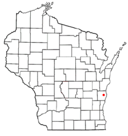
Sheboygan Falls, Wisconsin

| Sheboygan Falls, Wisconsin | |
|---|---|
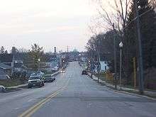
 Downtown Sheboygan Falls | |
| Coordinates: 43°44′N 87°49′W / 43.733°N 87.817°WCoordinates: 43°44′N 87°49′W / 43.733°N 87.817°W | |
| Former Name | Town of Rochester |
| Country | United States |
| State | Wisconsin |
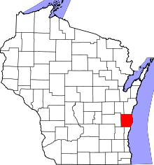
| Counties | Sheboygan |
| Surrounding Towns | Sheboygan, Kohler, Plymouth, Howards Grove, Oostburg |
| Settled | 1835 |
| Incorporated | 1913 |
| Government | |
| • Type | Mayor-Council |
| • Mayor | Randy Meyer[1] |
| Area[2] | |
| • Total | 14.01 km2 (5.41 sq mi) |
| • Land | 13.68 km2 (5.28 sq mi) |
| • Water | 0.34 km2 (0.13 sq mi) |
| Elevation | 200 m (659 ft) |
| Population (2010)[3] | |
| • Total | 7,775 |
| • Estimate (2012[4]) | 7,769 |
| • Density | 568.5/km2 (1,472.5/sq mi) |
| Time zone | Central (UTC-6) |
| • Summer (DST) | Central (UTC-5) |
| ZIP Code | 53085 |
| Area code(s) | 920 |
| Website | www.cityofsheboyganfalls.com |


Sheboygan Falls is a city in Sheboygan County, Wisconsin, United States. With a population of 7,775 at the 2010 census the city is the 3rd largest city in Sheboygan County, Wisconsin. The city is part of the Sheboygan, Wisconsin Metropolitan Statistical Area. Sheboygan Falls took its name from the nearby falls on the Sheboygan River. The city was also called Rochester for a brief time; the name was changed due to a town in Racine County already holding the same name.[5]
Geography
Sheboygan Falls is located at 43°44′N 87°49′W / 43.733°N 87.817°W (43.730, -87.821),[6] along the Sheboygan River between its confluences with the Mullet and Onion Rivers. Rapids and a dam, which once supplied hydroelectric energy, prohibit most water transportation through the city.
According to the United States Census Bureau, the city has a total area of 5.41 square miles (14.01 km2), of which, 5.28 square miles (13.68 km2) is land and 0.13 square miles (0.34 km2) is water.[2]
Demographics
| Historical population | |||
|---|---|---|---|
| Census | Pop. | %± | |
| 1870 | 1,174 | — | |
| 1880 | 1,148 | −2.2% | |
| 1890 | 1,118 | −2.6% | |
| 1900 | 1,301 | 16.4% | |
| 1910 | 1,630 | 25.3% | |
| 1920 | 2,002 | 22.8% | |
| 1930 | 2,934 | 46.6% | |
| 1940 | 3,395 | 15.7% | |
| 1950 | 3,599 | 6.0% | |
| 1960 | 4,061 | 12.8% | |
| 1970 | 4,771 | 17.5% | |
| 1980 | 5,253 | 10.1% | |
| 1990 | 5,823 | 10.9% | |
| 2000 | 6,772 | 16.3% | |
| 2010 | 7,775 | 14.8% | |
| Est. 2015 | 7,840 | [7] | 0.8% |
2000 census
As of the census[9] of 2000, there were 6,772 people, 2,745 households, and 1,869 families residing in the city. The population density was 1,658.3 people per square mile (640.9/km²). There were 2,826 housing units at an average density of 692.0 per square mile (267.4/km²). The racial makeup of the city was 98.05% White, 0.34% Black or African American, 0.31% Native American, 0.30% Asian, 0.30% from other races, and 0.71% from two or more races. 0.86% of the population were Hispanic or Latino of any race.
There were 2,745 households out of which 31.7% had children under the age of 18 living with them, 58.4% were married couples living together, 7.1% had a female householder with no husband present, and 31.9% were non-families. 26.7% of all households were made up of individuals and 9.5% had someone living alone who was 65 years of age or older. The average household size was 2.39 and the average family size was 2.91.
In the city the population was spread out with 23.9% under the age of 18, 7.4% from 18 to 24, 30.1% from 25 to 44, 22.7% from 45 to 64, and 15.9% who were 65 years of age or older. The median age was 39 years. For every 100 females there were 91.9 males. For every 100 females age 18 and over, there were 91.1 males.
The median income for a household in the city was $47,205, and the median income for a family was $55,668. Males had a median income of $40,006 versus $25,293 for females. The per capita income for the city was $22,456. About 2.6% of families and 2.7% of the population were below the poverty line, including 3.3% of those under age 18 and 4.6% of those age 65 or over.
2010 census
As of the census[3] of 2010, there were 7,775 people, 3,480 households, and 2,152 families residing in the city. The population density was 1,472.5 inhabitants per square mile (568.5/km2). There were 3,681 housing units at an average density of 697.2 per square mile (269.2/km2). The racial makeup of the city was 96.1% White, 0.6% African American, 0.3% Native American, 0.9% Asian, 0.8% from other races, and 1.4% from two or more races. Hispanic or Latino of any race were 2.5% of the population.
There were 3,480 households of which 27.2% had children under the age of 18 living with them, 50.2% were married couples living together, 8.6% had a female householder with no husband present, 3.1% had a male householder with no wife present, and 38.2% were non-families. 33.0% of all households were made up of individuals and 14.9% had someone living alone who was 65 years of age or older. The average household size was 2.22 and the average family size was 2.82.
The median age in the city was 42.6 years. 22.3% of residents were under the age of 18; 6% were between the ages of 18 and 24; 25.1% were from 25 to 44; 28.9% were from 45 to 64; and 17.7% were 65 years of age or older. The gender makeup of the city was 48.0% male and 52.0% female.
Infrastructure
The city provides water and sewer services. Wastewater is treated at the Sheboygan Regional Wastewater Treatment Facility in Sheboygan. The city has a municipal utility company providing electric service, with Wisconsin Public Service providing natural gas. Cable services are provided by Charter, with the city maintaining a government access channel on channel 992.
Education
- Sheboygan Falls High School
- Middle schools
- Elementary schools
Transportation
Roads
Four-lane Highway 23, which lies just north of the city, is a primary east-west route into the city. Highway 28, another east-west route into the city, forms part of the south edge of the city. Interstate 43, located less than five miles east of Sheboygan Falls, is the primary north-south transportation route into the area. Highway 32 another north-south route into the city, goes through downtown Sheboygan Falls.
Rail
A single-track railroad branch line between Plymouth and Sheboygan runs through the city. Built by the Chicago & North Western (C&NW) Railroad, the track originally paralleled the electric interurban Wisconsin Power & Light line which terminated at Elkhart Lake.[10] In later years it was primarily a freight line for the Chicago and North Western Transportation Company, and Union Pacific after UP acquired the C&NW in 1995. In 2006, citing low demand and degraded infrastructure, Union Pacific announced plans to abandon the line west of the Kohler Company factory in Kohler, thus terminating all service to Sheboygan Falls. In 2009, the Wisconsin Department of Transportation purchased the Plymouth-Sheboygan Falls portion of the line from Union Pacific, with the intent of repairing the long dormant line to allow the Wisconsin & Southern Railroad to provide restored service to Sheboygan Falls.[11]
The track through downtown Sheboygan Falls has been of interest to railfans because of a number of interesting features, including an iron trestle over the Sheboygan River, a small section of street running where the line runs at grade along city streets, and antiquated "wig-wag" signals at several crossings. Many of these features have been threatened because of the Union Pacific's abandonment of the line; the trestle has been barricaded and parts of the tracks leading to it have been removed,[12] and plans to restore the line for the resumption of service will require crossing signals to be upgraded. Wig wag signals have already been removed.
Airport
Sheboygan Falls is served by the Sheboygan County Memorial Airport, which is located several miles from the city.
Government
Administration
The mayor is Randy Meyer.
Emergency services
The Sheboygan Falls Police Department maintains a full-time police presence in the city, with an executive staff of four, ten officers, and an administrative staff. The city has a volunteer fire department. Orange Cross Ambulance Station 3 is quartered with the volunteer fire department at the Municipal Building.
Economy
Major employers
- Bemis Manufacturing Company is the world's largest toilet seat manufacturer and a leading manufacturer of engineered plastics.
- PolyVinyl Co. is headquartered in Sheboygan Falls. The company manufactures custom extrusions and color guard railing systems.
- School District of Sheboygan Falls
- Pine Haven Christian Home
- The Bull at Pinehurst Farms id=495
- Blattner's Piggly Wiggly
Business parks
There are two business parks in Sheboygan Falls: Sheboygan Falls Industrial Park, which is privately owned and fully developed, is located about 1 mile from State Highway 23. Vision Business Park has 70 city-owned acres available for development. The park is located less than one mile from State Highway 23, on County Highways C and TT.
Recreation
- Ducktona 500 - Antique car show and 3,000 plastic ducks race down the Sheboygan River for cash prizes.
- Golf
- Camping
Civic organizations
- Sheboygan Falls Kiwanis Club
- Sheboygan Falls Lions Club
- Boys & Girls Clubs of Sheboygan County
- Sheboygan Falls American Legion Post 149
- Workbound, Inc.
Notable people
- Herman E. Boldt, Wisconsin State Senator
- George H. Brickner, U.S. Representative
- Emery Crosby, Wisconsin State Assemblyman
- Marsena E. Cutts, politician
- Brian Donlevy, Irish-born actor
- George S. Graves, Wisconsin State Assemblyman
- David Giddings, businessman, engineer, territorial legislator
- Martin O. Galaway, Wisconsin State Assemblyman
- Harold F. Huibregtse, Wisconsin State Senator
- Rick Majerus, college basketball coach
- Louis H. Prange, Wisconsin State Senator
- Hiram N. Smith, Wisconsin State Assemblyman
- George W. Spratt, Wisconsin State Assemblyman
- John E. Thomas, Wisconsin State Senator
- Alfred Verhulst, U.S. Air Force general
- Charles H. Weisse, U.S. Representative
- Weldon Wyckoff, MLB player[13]
References
- ↑ Sheboygan Falls Common Council Members
- 1 2 "US Gazetteer files 2010". United States Census Bureau. Retrieved 2012-11-18.
- 1 2 "American FactFinder". United States Census Bureau. Retrieved 2012-11-18.
- ↑ "Population Estimates". United States Census Bureau. Retrieved 2013-06-24.
- ↑ Chicago and North Western Railway Company (1908). A History of the Origin of the Place Names Connected with the Chicago & North Western and Chicago, St. Paul, Minneapolis & Omaha Railways. p. 124.
- ↑ "US Gazetteer files: 2010, 2000, and 1990". United States Census Bureau. 2011-02-12. Retrieved 2011-04-23.
- ↑ "Annual Estimates of the Resident Population for Incorporated Places: April 1, 2010 to July 1, 2015". Retrieved July 2, 2016.
- ↑ "Census of Population and Housing". Census.gov. Retrieved June 4, 2015.
- ↑ "American FactFinder". United States Census Bureau. Retrieved 2008-01-31.
- ↑ Central Electric Railfans' Association, Badger Traction, 1969, p. 91.
- ↑ "State: Rail line connecting Falls, Plymouth to go back in service", Sheboygan Press, May 23, 2009.
- ↑ Family Wants Barricades on Railroad Trestle, WTMJ-4 TV (Milwaukee), May 21, 2009
- ↑ Weldon Wyckoff at SABR Baseball Biography Project
External links
- City of Sheboygan Falls
- Sheboygan Falls Chamber-Main Street
- Sheboygan Falls Memorial Library
- Sanborn fire insurance maps: 1884 1887
