Snowy Monaro Regional Council
| Snowy Monaro Regional Council New South Wales | |||||||||||||
|---|---|---|---|---|---|---|---|---|---|---|---|---|---|
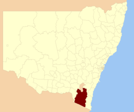
 location in New South Wales | |||||||||||||
| Population | 20,707 (2016)[1] | ||||||||||||
| • Density | 1.36572/km2 (3.53719/sq mi) | ||||||||||||
| Established | 12 May 2016 | ||||||||||||
| Area | 15,162 km2 (5,854.1 sq mi)[1] | ||||||||||||
| Administrator | Dean Lynch | ||||||||||||
| Region | |||||||||||||
| State electorate(s) | Monaro | ||||||||||||
| Federal Division(s) | Eden-Monaro | ||||||||||||
|
| |||||||||||||
| |||||||||||||
The Snowy Monaro Regional Council is a local government area located in the Snowy Mountains and Monaro regions of New South Wales, Australia. The council was formed on 12 May 2016 through a merger of the Bombala, Cooma-Monaro and Snowy River shires.[1]
The council comprises an area of 15,162 square kilometres (5,854 sq mi) and occupies the higher slopes of the eastern side of the Great Dividing Range between the Australian Capital Territory to the north and the state boundary with Victoria to the south. At the time of its establishment the council had an estimated population of 20,707.[1]
The Administrator of the Snowy Monaro Regional Council is Dean Lynch, until the elections for councillors to take place on 9 September 2017.[1]
Towns and localities
The following towns and localities are located within Snowy Monaro Regional Council:
- Adaminaby
- Ando
- Anglers Reach
- Berridale
- Bibbenluke
- Blue Cow
- Bombala
- Bredbo
- Bungarby
- Cathcart
- Cooma
- Countegany
- Craige
- Creewah
- Dalgety
- Delegate
- Guthega
- Jerangle
- Jindabyne
- Kiandra
- Michelago
- Mila
- Nimmitabel
- Numeralla
- Peak View
- Perisher
- Rock Flat
- Rockton
- Shannons Flat
- Smiggin Holes
- Thredbo
- Yaouk
Demographics
The population for the predecessor councils was estimated in 2013 as:[2]
- 2,401 in Bombala Shire
- 10,073 in Cooma-Monaro Shire and
- 8,087 in Snowy River Shire.
Council
Once elected, the Snowy Monaro Regional Council will comprise eleven Councillors elected proportionally in a single ward. All Councillors are expected to be elected for a fixed four-year term of office with effect from 9 September 2017.[1]
See also
References
- 1 2 3 4 5 6 "Snowy Monaro Regional Council". Stronger Councils. Government of New South Wales. 12 May 2016. Retrieved 13 May 2016.
- ↑ "3218.0 Regional Population Growth, Australia. Table 1. Estimated Resident Population, Local Government Areas, New South Wales". 3 April 2014. Retrieved 11 September 2014.
External links
- "Local Government Area Boundary: Snowy Monaro Regional Council" (PDF) (Map). Land and Property Information. Government of New South Wales. 19 April 2016.