South Carolina Highway 410
| ||||
|---|---|---|---|---|
 | ||||
| Route information | ||||
| Maintained by SCDOT | ||||
| Length: | 18 mi (29 km) | |||
| Existed: | 1949 – present | |||
| Major junctions | ||||
| South end: |
| |||
|
| ||||
| North end: |
| |||
| Location | ||||
| Counties: | Horry | |||
| Highway system | ||||
| ||||

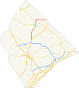
South Carolina Highway 410 is a state highway in Horry County going from the North Carolina state line to the community of Baxter Forks at U.S. Highway 701 which is just north of SC Hwy 22.
Route description
From the beginning, SC 410 starts at the North Carolina state line, near the community of Baxter Forks and Tabor City which was NC 410 and ends at U.S. Route 701 (US 701) near Homewood.
History
Major intersections
The entire highway is in Horry County.
| Location | mi | km | Destinations | Notes | |||
|---|---|---|---|---|---|---|---|
| Homewood | 0 | 0.0 | Southern terminus | ||||
| Green Sea | |||||||
| 18 | 29 | ||||||
| 1.000 mi = 1.609 km; 1.000 km = 0.621 mi | |||||||
References
External links
 Media related to South Carolina Highway 410 at Wikimedia Commons
This article is issued from Wikipedia - version of the 4/28/2016. The text is available under the Creative Commons Attribution/Share Alike but additional terms may apply for the media files.
