Stano, Kansas
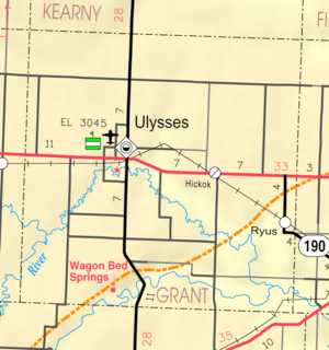
Map of Grant County from KDOT (map legend)
Stano is a rural unincorporated community in Grant County, Kansas, United States. It lies on the border of Sherman and Sullivan Townships[1] at the intersection of the Cimarron Valley Railroad with Road C, 8 miles (13 km) west-southwest of the county seat of Ulysses.[2]
References
- ↑ Census Bureau map, combined with county map
- ↑ Official county map
External links
Municipalities and communities of Grant County, Kansas, United States | ||
|---|---|---|
| City | 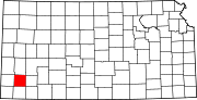 | |
| Unincorporated communities | ||
| Townships | ||
Coordinates: 37°31′14″N 101°29′24″W / 37.52056°N 101.49000°W
This article is issued from Wikipedia - version of the 4/5/2014. The text is available under the Creative Commons Attribution/Share Alike but additional terms may apply for the media files.