Texas State Highway 158
| |||||||
|---|---|---|---|---|---|---|---|
 | |||||||
| Route information | |||||||
| Maintained by TxDOT | |||||||
| Length: | 170.20 mi[1] (273.91 km) | ||||||
| Existed: | by 1931[1] – present | ||||||
| Major junctions | |||||||
| West end: |
| ||||||
|
| |||||||
| East end: |
| ||||||
| Highway system | |||||||
| |||||||

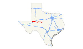
State Highway 158 or SH 158 is a state highway running from near Goldsmith, Texas eastward to Ballinger, Texas.
Route description
SH 158 begins at an intersection with State Highway 302/Farm to Market Road 181 northwest of Odessa in unincorporated Ector County. The highway runs in an northeast–southwest direction until Philips Plant Road, turning into a more east–west direction. SH 158 enters the town of Goldsmith, intersecting with Farm to Market Road 866. The highway resumes its rural route and has an interchange with U.S. Route 385 north of Odessa. SH 158 turns into a southeast–northwest direction near the Ector–Midland county line. The highway shares a short overlap with State Highway 191 in west Midland. The overlap ends at an interchange with Loop 250, with SH 158 following Loop 250 until Interstate 20. The highway leaves Interstate 20 in southeast Midland, running southeast–northwest through rural Midland County. SH 158 runs through Glasscock County and Garden City before entering Sterling County. SH 158 shares an overlap with U. S. Route 87, with the two highways running through Sterling City together. SH 158 leaves US 87 at the eastern edge of Sterling City, running in a north–south direction before resuming an east–west direction. The highway runs through Coke County, serving the towns of Robert Lee and Bronte and later enters Runnels County. SH 158 ends at an intersection with U.S. Route 67/U.S. Route 83 in the town of Ballinger.
History
SH 158 was designated by 1931 on a route starting at Robert Lee travelling through Bronte then turning northeast, terminating at Abilene. The route was slowly built, being completed in 1939. In the 1939 general redescription, an additional non-connected section was added, beginning 20 miles west of Robert Lee in Sterling City and travelling west through Garden City and Midland, terminating just west of Goldsmith.
In 1948, the section from Bronte to Abilene was transferred to U.S. Route 277, and was instead rerouted southeast to Ballinger, replacing State Highway 109 from Bronte to Ballinger.[2] The two disconnected portions were finally connected in 1969 when Farm to Market Road 387, completed in 1959, was re-designated.[3]
Junction list
| County | Location | mi | km | Destinations | Notes |
|---|---|---|---|---|---|
| Ector | | South end of FM 181 overlap | |||
| | North end of FM 181 overlap | ||||
| Goldsmith | |||||
| | |||||
| | Interchange | ||||
| Gardendale | |||||
| Midland | | ||||
| | Interchange | ||||
| Midland | West end of SH 191 overlap; west end of freeway | ||||
| East end of SH 191 overlap; west end of Loop 250 overlap | |||||
| Thomason Drive, Tradewinds Boulevard | |||||
| Frontage Road | Westbound exit and eastbound entrance | ||||
| Industrial Avenue | Westbound exit and eastbound entrance | ||||
| Interstate 20 Frontage Road | Eastbound exit and westbound entrance | ||||
| East end of Loop 250 overlap; west end of I-20/SH 349 overlap; I-20 exit 131 | |||||
| Midkiff Road | I-20 exit 134 | ||||
| Garfield Street | I-20 exit 135 | ||||
| East end of SH 349 overlap; I-20 exit 136 | |||||
| Lamesa Road | I-20 exit 137 | ||||
| East end of I-20 overlap; I-20 exit 138 | |||||
| | |||||
| | West end of FM 1379 overlap | ||||
| | East end of FM 1379 overlap | ||||
| Glasscock | | ||||
| Garden City | |||||
| Sterling | | Interchange; west end of US 87/SH 163 overlap | |||
| Sterling City | East end of SH 163 overlap | ||||
| East end of US 87 overlap | |||||
| Coke | | ||||
| | West end of RM 2034 overlap | ||||
| | East end of RM 2034 overlap | ||||
| Robert Lee | |||||
| Bronte | West end of US 277 overlap | ||||
| East end of US 277 overlap | |||||
| Runnels | | ||||
| | |||||
| | |||||
| Ballinger | |||||
1.000 mi = 1.609 km; 1.000 km = 0.621 mi
| |||||
References
- 1 2 Transportation Planning and Programming Division (n.d.). "State Highway No. 158". Highway Designation Files. Texas Department of Transportation. Retrieved 2010-06-15.
- ↑ Transportation Planning and Programming Division (n.d.). "State Highway No. 109". Highway Designation Files. Texas Department of Transportation. Retrieved April 8, 2016.
- ↑ Transportation Planning and Programming Division (n.d.). "Farm to Market Road No. 387". Highway Designation Files. Texas Department of Transportation. Retrieved April 8, 2016.