Torhouse
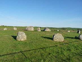 Torhousekie stone circle | |
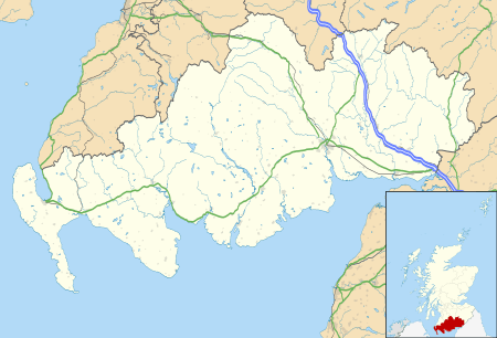 .svg.png) Shown within Dumfries and Galloway | |
| Alternate name | Torhousekie |
|---|---|
| Location | Galloway |
| Coordinates | 54°52′39″N 4°31′22″W / 54.877472°N 4.522639°W |
| Type | Stone circle |
| History | |
| Periods | Neolithic / Bronze Age |
| Site notes | |
| Ownership | Historic Scotland |
| Public access | Yes |
The Standing Stones of Torhouse (also Torhousekie) are a stone circle of nineteen granite boulders on the land of Torhouse, three miles west of Wigtown, Scotland.
Description
The stone circle consists of nineteen granite boulders set on a slightly raised platform.[1] The stones have a height ranging from about 0.6 metres to 1.5 metres and are arranged in a circle with a diameter of about 22 metres.[1] The larger stones, over 1 metre high, are on the southeast side.[2]
Three upright boulders stand in a line near the centre of the circle.[3] The direction of the line of the three central stones is northeast to southwest.[1]
Two stones stand 40 metres to the south-southeast of the stone circle, one large and the other small, and there is a stone row of three stones 130 metres to the east.[2] There are also surviving remains of several burial cairns, and history records others long removed to build field dykes.[2]
The stone circle has not yet been archaeologically excavated. It probably dates to the Neolithic period or the Bronze Age.[1][2] The Torhouse Stones are in the care of Historic Scotland.[2]
In folklore
Local tradition maintains that the three large stones in the middle of the circle contained the tomb of Galdus, a mythical Scottish king.[4] A similar story is told about one of the tombs at Cairnholy, also in Galloway.[5]
In the dyke on the south side of the road is a stone with a deep cavity which according to tradition, "the knowing never pass without depositing therein some pebble or gift to pass in peace".[6]
Gallery
 Central setting of three stones
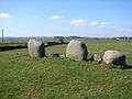 Torhousekie Stone Row, 130 metres east of the stone circle
References
- 1 2 3 4 "Torhouse Stone Circle". Historic Scotland Scheduled Monuments. Retrieved 14 August 2015.
- 1 2 3 4 5 "Torhouse Stone Circle". Historic Scotland. Retrieved 14 August 2015.
- ↑ RCAHMS. "Torhousekie (62843)". Canmore. Retrieved 14 August 2015.
- ↑ MacLeod, I. F. (1986). Discovering Galloway. John Donald. p. 213.
- ↑ Cairn Holy Chambered Cairns, Historic Scotland, accessed 14 August 2015
- ↑ Carroll, David (2013). Dumfries & Galloway Curiosities. The History Press. ISBN 075248950X.
External links
 |
Wikimedia Commons has media related to Torhousekie. |
Coordinates: 54°52′38.90″N 4°31′21.50″W / 54.8774722°N 4.5226389°W