Torneträsk
| Torneträsk Duortnosjávri | |
|---|---|
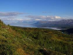 Torneträsk seen from the north | |
| Location | Kiruna Municipality, Norrbotten County |
| Coordinates | 68°22′N 019°06′E / 68.367°N 19.100°ECoordinates: 68°22′N 019°06′E / 68.367°N 19.100°E |
| Primary inflows |
• nameless flow from a little glacier south of lake Válfojávri (Nordland, Norway) → river Válfojohka → lake Gamajávri → river Kamajåkka → lake Abiskojaure → river Abiskojåkka • river Njuoreatnu • river Rágeseatnu • lake Koojärvi → river Stalojåkka • river Nakerijoki • river Sarvájohka • river Bessešjohka |
| Primary outflows | Torne River |
| Basin countries | Sweden |
| Max. length | 70 km (43 mi) |
| Max. width | 11 km (6.8 mi) |
| Surface area | 332 km2 (128 sq mi) |
| Average depth | 51 m (167 ft) |
| Max. depth | 168 m (551 ft) |
| Water volume | 17.1 km3 (13,900,000 acre·ft) |
| Surface elevation | 341 m (1,119 ft) |
| References | [1] |
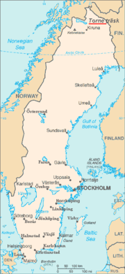
Torneträsk or Torne träsk (Saami: Duortnosjávri, Finnish/Meänkieli: Tornio or Torniojärvi) is a lake in Kiruna Municipality, Lapland, Norrbotten County in Sweden, in the Scandinavian mountain range. Träsk is the local word for lake (in Standard Swedish it means "swamp"). It is the sixth largest lake in Sweden, with a total area of 330 square kilometres (130 sq mi) and a length of 70 kilometres (43 mi). The lake drains to the south-east through Torne älv. South-west of the lake lie the Abisko National Park and the UNESCO World Heritage Site Laponian area.
Torneträsk originated from the remnant of a glacier, which has given the lake its depth of 168 metres (551 ft), making it the second deepest lake in Sweden. It is usually ice-covered from December through June, with variations dependent on temperature variations.
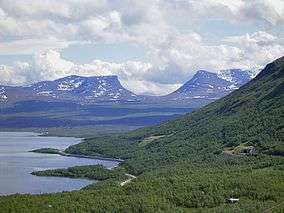 The lake and Lapporten in the background
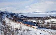 IORE train and Torneträsk lake
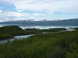 Abiskojåkka river and Torneträsk lake at Abisko
- View of Torneträsk lake, frozen, from STF Abisko Turiststation (Jan 2013)
- Frozen Torneträsk lake, with people walking and taking pictures in its surface (Jan 2013)
References
- ↑ "Sjöar och vattendrag" (in Swedish). Vattenmyndigheten Bottenviken. Retrieved 2008-09-13.
External links
![]() Media related to Torneträsk at Wikimedia Commons
Media related to Torneträsk at Wikimedia Commons
