Torteval, Guernsey
| Torteval Tortévas | |
|---|---|
| Parish | |
.gif) Location of Torteval in Guernsey | |
| Crown Dependency | Guernsey, Channel Islands |
| Government | |
| • Electoral district | West |
| Area | |
| • Total | 3.1 km2 (1.2 sq mi) |
| Population | |
| • Total | 973 (2,001) |
| Time zone | GMT |
| • Summer (DST) | UTC+01 (UTC) |
Torteval (Guernésiais: Tortévas) is the smallest of the ten parishes of Guernsey, one of the Western Parishes. Its name comes from the Guernésiais words for "twisting valley". The parish is split in two by the parish of St. Pierre du Bois, with the part in the east known as Torteval. The detached peninsula to the west is named Pleinmont-Torteval. It includes the westernmost point in Guernsey, and a nature reserve. The reserve, designed for birds in the 1970s, was to be redeveloped for the Diamond Jubilee of Queen Elizabeth II in 2012.[1]
In Guernésiais, people from Torteval were nicknamed "ânes à pid dé ch'fa", or "donkeys with horse's hooves".
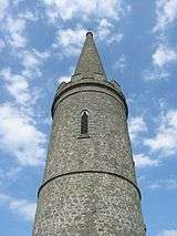
In the centre of the parish is a church designed by John Wilson and built in 1818, with the oldest bell in the Channel Islands, dating from 1432. The church is built on the site of an earlier church, consecrated on 4 November 1140, that had fallen into disrepair.[2]:68 The current church has the tallest steeple in Guernsey, which is intended to be used as a sea mark. It was proposed in 1849 to install a light on the steeple, but after inspection by Trinity House it was found unsuitable.[3]:30
The postal code for street addresses in this parish begins with GY8.
The parish produces a regular magazine called Les Tortévalais.
Features
|
The features of the parish include:
|
The parish of Torteval hosts:
 Torteval Church |
Politics
Torteval comprises part of the West administrative division with Forest, St. Saviour's and St. Pierre-du-Bois
In the Guernsey general election, 2016 there was a 3,188 or 74% turnout to elect five Deputies. Those elected (in order of votes received) being Al Brouard, Andrea Dudley-Owen, Emilie Yerby, David De Lisle and Shane Langlois.
See also
References
- 1 2 BBC Guernsey (2011). "Torteval nature reserve to be renewed for jubilee". Bbc.co.uk. BBC News. Retrieved 19 June 2012.
- ↑ Berry, William. The history of Guernsey from the remotest period of antiquity to the year 1814.
- ↑ Dafter, Ray (2003). Guernsey Sentinel. Matfield Books. ISBN 0-9540595-1-4.
- ↑ "The Pleinmont Fairy Ring". BBC.
- ↑ "Torteval Parish Memorial, Guernsey". Great War CI.
- ↑ "Fort Pezeries". Visit Guernsey.
- 1 2 Dillon, Paddy. Channel Island Walks. Cicerone Press Limited, 1999. ISBN 9781852842888.
- ↑ "Pleinmont Observation Tower". Visit Guernsey.
- ↑ "NAVAL RANGE-FINDING TOWER (MP3)". Festung Guernsey.
- ↑ "Batterie Dollman". Festung Guernsey.
- ↑ "PROTECTED BUILDINGS". Environment - Guernsey government.
- ↑ "Guernsey Abreuvoirs". La Société Guernesiaise.
- ↑ "In pictures: Scarecrows take over Torteval". BBC.
Coordinates: 49°25′47″N 2°38′46″W / 49.42972°N 2.64611°W
