U.S. Route 31E
| |
|---|---|
| Route information | |
| Length: | 190.9 mi[1][2][3] (307.2 km) |
| Major junctions | |
| South end: |
|
|
| |
| North end: |
|
| Location | |
| States: | Tennessee, Kentucky |
| Counties: |
TN: Davidson, Sumner KY: Allen, Barren, Hart, LaRue, Nelson, Spencer, Bullitt, Jefferson |
| Highway system | |

U.S. Route 31E (US 31E) is the easternmost of two parallel routes for U.S. Highway 31 from Nashville, Tennessee, to Louisville, Kentucky. (At one time, it split with U.S. Highway 31W at Sellersburg, Indiana, north of Louisville.)
Route description
Tennessee
US 31E begins as the Ellington Parkway at the corner of Main Street and US 31, US 31W, US 41 and US 431 (Spring Street) just east of Interstate 24 (I-24). The freeway's interchanges in the middle of the route mainly includes locally maintained streets such as Cleveland Street, East Trinity Lane, Hart Lane, and Broadmoor Drive.[4]
Ellington Parkway ends at an interchange with SR 155 (Briley Parkway), about 0.56 miles (900 m) east of the Briley's I-65 junction. A ramp directing Ellington Parkway's northbound traffic to I-65 north is provided at the Briley/Ellington junction. Access to Ellington Parkway southbound is also provided by a ramp from I-65 south via exit 90A. The road is named for former Tennessee governor Buford Ellington, who served two non-consecutive terms from 1959 to 1963, the other from 1967 to 1971. Ellington encouraged lots of road building throughout the state during his second term as governor.
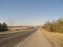
After Nashville, the highway passes through Hendersonville and Gallatin, Tennessee.It never intersects Interstate 40.
Kentucky
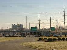
U.S. Route 31E in Kentucky is the easternmost of two parallel routes for U.S. Highway 31 in Kentucky, in between each is Interstate 65 in Kentucky. At the north end is Louisville, Kentucky, starting at the George Rogers Clark Memorial Bridge. Going south, it goes through the towns of Mount Washington, Bardstown, New Haven, Hodgenville, Glasgow, and Scottsville before arriving at the Tennessee border. In the 19th century the same route was a stagecoach path between Louisville and Nashville, Tennessee, and before that a postal route at least by 1820.[5] Originally part of the Jackson Highway, the Works Progress Administration measured the total distance on 31E in Kentucky as 147.8 miles (237.9 km).[6]
Its only interchanges with interstates are in Jefferson County; both of which are beltways: Interstate 264 (Watterson Expressway) and the I-265/Gene Snyder Expressway. However, it has intersections with the state freeways of Martha Layne Collins Blue Grass Parkway (in Nelson County) and with the Louie B. Nunn Cumberland Parkway in Barren County.
There are various historical sites along 31E in Kentucky. Among them are Cave Hill Cemetery and Farmington Historic Plantation in Louisville, My Old Kentucky Home State Park in Bardstown, and Abraham Lincoln Birthplace National Historic Site just south of Hodgenville. Also, five historic monuments to the Civil War are along the path: three in Louisville, one in Bardstown, and one in Glasgow.[7]
31E has been known as a dangerous road, with many risky spots. A historic one was at Coxs Creek in Nelson County, where a post office had to be relocated so traffic could see each other.[8] Other dangerous spots in Nelson County where emergency personnel consider notorious are Gobel Lake Curve, Hibbs Lane, and High Grove.[9]
When the rerouting of 31E in Nelson and Spencer Counties was being planned, a survey of historic sites that could have been affected by the new route was studied, especially if the sites could one day become listed on the National Register of Historic Places.[10]
History
The American Association of State Highway Officials (AASHO) adopted a resolution against split routes in 1934. In order to eliminate the split in US-31 between Nashville, Tennessee, and Louisville, Kentucky, AASHO commissioned U.S. Route 37, replacing US 31E from the Louisville area south to Glasgow, Kentucky, where it then followed Kentucky Route 63 and several routes in Tennessee to Chattanooga. The rest of US 31E from Glasgow to Nashville was assigned U.S. Route 143. This proposed route was extended southwest to Centerville in 1938 and Jackson in 1944 via State Route 100 and State Route 20. US 31W would have become the main route of US 31.
Kentucky and Tennessee refused to accept the renumbering and never changed signage for the routes. In 1952, AASHO re-recognized the split, officially restoring the US 31E and US 31W designations.
Major intersections
| State | County | Location | mi | km | Destinations | Notes | ||
|---|---|---|---|---|---|---|---|---|
| Tennessee | Davidson | Nashville | south end of SR 6 overlap; south end of freeway | |||||
| Main Street | southbound exit and northbound entrance | |||||||
| southbound exit and northbound entrance | ||||||||
| Cleveland Street | ||||||||
| Douglas Avenue | ||||||||
| Trinity Lane | ||||||||
| Hart Lane / Ben Allen Road | ||||||||
| Broadmoor Drive | ||||||||
| south end of SR 155 overlap; US 31E south follows exit 15B | ||||||||
| north end of SR 155 overlap; north end of freeway; US 31E north follows exit 14 | ||||||||
| Sumner | Hendersonville | SR 386 exit 3 | ||||||
| SR 386 exit 9; no access from US 31E south to SR 386 north | ||||||||
| Gallatin | interchange | |||||||
| south end of SR 174 overlap | ||||||||
| north end of SR 174 overlap | ||||||||
| Airport Road to Steam Plant Road - Bledsoe Creek State Park, Airport | ||||||||
| Bransford | south end of US 231 overlap | |||||||
| Westmoreland | ||||||||
| | 0.000 | 0.000 | Tennessee–Kentucky state line End concurrency with unsigned | |||||
| Kentucky | Allen | | ||||||
| | ||||||||
| Scottsville | ||||||||
| north end of US 231 overlap | ||||||||
| | ||||||||
| | ||||||||
| Cedar Springs | ||||||||
| Barren | | |||||||
| Lucas | south end of KY 1318 overlap | |||||||
| north end of KY 1318 overlap | ||||||||
| Haywood | ||||||||
| Glasgow | ||||||||
| Cumberland Parkway exit 11; south end of US 68 Truck / KY 90 Truck overlap | ||||||||
| north end of US 68 Truck / KY 90 Truck overlap; south end of KY 90 overlap | ||||||||
| north end of KY 90 overlap | ||||||||
| Griderville | ||||||||
| Hart | Bear Wallow | |||||||
| Wigwam Village | ||||||||
| Uno | ||||||||
| Hardyville | ||||||||
| | ||||||||
| Canmer | ||||||||
| Linwood | ||||||||
| south end of KY 569 overlap | ||||||||
| north end of KY 569 overlap | ||||||||
| Jonesville | ||||||||
| LaRue | Magnolia | |||||||
| | south end of KY 61 overlap | |||||||
| Hodgenville | north end of KY 61 overlap | |||||||
| south end of KY 84 overlap | ||||||||
| south end of KY 210 overlap; traffic circle around city park | ||||||||
| south end of KY 210 overlap | ||||||||
| Ovesen Heights | ||||||||
| | ||||||||
| White City | south end of KY 470 overlap | |||||||
| north end of KY 84 overlap | ||||||||
| north end of KY 470 overlap | ||||||||
| Nelson | New Haven | south end of KY 52 overlap | ||||||
| north end of KY 52 overlap | ||||||||
| Culvertown | ||||||||
| | south end of KY 46 overlap | |||||||
| Balltown | north end of KY 46 overlap | |||||||
| | ||||||||
| Bardstown | south end of US 62 overlap | |||||||
| north end of US 62 overlap; south end of US 150 overlap; traffic circle around Old Courthouse Building | ||||||||
| Coxs Creek | ||||||||
| | ||||||||
| | ||||||||
| Highgrove | ||||||||
| Spencer |
No major junctions | |||||||
| Bullitt | | |||||||
| Mount Washington | ||||||||
| | ||||||||
| Jefferson | Louisville | |||||||
| I-265 exit 17 | ||||||||
| Bardstown Road (KY 2251 north) - Buechel Business District | ||||||||
| Progress Boulevard | interchange | |||||||
| West Buechel | Hikes Lane (KY 2052 south) | |||||||
| Bardstown Road (KY 2251 south) - Buechel Business District | ||||||||
| Louisville | I-264 exit 16 | |||||||
| north end of US 150 overlap | ||||||||
| south end of US 60 overlap; no direct access from US 42 west / US 60 west to US 31E south | ||||||||
| north end of US 60 overlap | ||||||||
| 1.000 mi = 1.609 km; 1.000 km = 0.621 mi | ||||||||
Special routes
Glasgow business route
| |
|---|---|
| Location: | Glasgow, Barren County, KY |
| Length: | 3.24 mi (5.214 km) |
U.S. Route 31E Business starts near the Southgate Shopping Center 0.379 mile north of the Exit 11 interchange of the Louie B. Nunn Cumberland Parkway, and intersects Kentucky Routes 249 and 63 before reaching the Barren County Courthouse at the Public Square. It then joins US 68 Business for only 0.123 miles before right-turning onto North Race Street. US 31E Business then follows North Race Street, passes the T.J. Samson Hospital, and ends at an intersection with the regular US 31E alignment on the north side of town about one mile south of the Veterans Outer Loop.
Major intersections
The entire route is in Glasgow, Barren County.
| mi[11] | km | Destinations | Notes | ||
|---|---|---|---|---|---|
| 0.000 | 0.000 | Western terminus | |||
| 1.001 | 1.611 | Northern terminus of KY 249 | |||
| 1.269 | 2.042 | Western terminus of KY 63 | |||
| 1.406 | 2.263 | Begin concurrency with KY 80/KY 90/US-Bus 68 | |||
| 1.516 | 2.440 | End concurrency with KY 80/KY 90/US-Bus 68 | |||
| 2.118 | 3.409 | To | Old KY 90; previously KY 90 Alternate | ||
| 3.240 | 5.214 | Eastern terminus | |||
1.000 mi = 1.609 km; 1.000 km = 0.621 mi
| |||||
U.S. Route 31E Truck
| |
|---|---|
| Location: | Bardstown, Nelson County |
U.S. Route 31E Truck (US 31E Truck) is the truck route of US 31E in the Nelson County seat of Bardstown.
The truck route consists of the following designations:
- Bluegrass Parkway between exits 21 and 25.
- U.S. Route 150 between the Bluegrass Parkway and KY 245, and
- Kentucky Route 245 bypass from US 150 east of downtown to US 31E/150 north of downtown.
U.S. Route 31EX
| |
|---|---|
| Location: | Mount Washington, Bullitt County |
| Length: | 2.487 mi[11] (4.002 km) |
U.S. Route 31EX (US 31EX) is the business route of US 31E in the Bullitt County town of Mount Washington. The only major intersection it has besides the main alignment is with KY 44 in the town's business district. The route is 2.487 miles (4.002 km) long.[11]
See also
References
- ↑ Commonwealth of Kentucky. "Official DMI Route Log". Retrieved 5 July 2016.
- ↑ Tennessee Department of Transportation (2000). Nashville City Map (Northeast) (PDF) (Map). Nashville: Tennessee Department of Transportation.
- ↑ Tennessee Department of Transportation (2000). Sumner County General Highway Map (PDF) (Map). Nashville: Tennessee Department of Transportation.
- ↑ DeLorme (2004). Tennessee Atlas & Gazetteer (Map). Yarmouth, ME: DeLorme.
- ↑ Kleber p.16
- ↑ Simon pp.288,289
- ↑ Joseph E. Brent (January 8, 1997). "National Register of Historic Places Multiple Property Submission: Civil War Monuments in Kentucky, 1865-1935" (pdf). National Park Service.
- ↑ Rennick p.70
- ↑ "US 31E Nelson-Spencer Counties" (PDF). Kentucky Transportation Cabinet. Fall 2004. Retrieved 2009-01-10.
- ↑ "US 31E Nelson-Spencer Counties" (PDF). Kentucky Transportation Cabinet. Winter 2002. Retrieved 2009-01-10.
- 1 2 3 Commonwealth of Kentucky. "Official DMI Route Log". Retrieved 2015-07-28.
- Kleber, ed. (1992). The Kentucky Encyclopedia. University Press of Kentucky. ISBN 0-8131-1772-0.
- Rennick, Robert M. (1988). Kentucky Place Names. University Press of Kentucky. ISBN 0-8131-0179-4.
- Simon, F. Kevin (1996). The WPA Guide to Kentucky: A Guide to the Bluegrass State. University Press of Kentucky. ISBN 0-8131-0865-9.
External links
-
 Media related to U.S. Route 31E at Wikimedia Commons