Verendrye Site
|
Verendrye Site | |
|
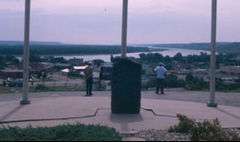
Monument at the site | |
  | |
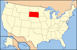
| Location | Fort Pierre, South Dakota |
|---|---|
| Coordinates | 44°21′20″N 100°22′43″W / 44.35556°N 100.37861°WCoordinates: 44°21′20″N 100°22′43″W / 44.35556°N 100.37861°W |
| NRHP Reference # | 74001899[1] |
| Significant dates | |
| Added to NRHP | August 7, 1974[2] |
| Designated NHL | July 17, 1991[1] |
Verendrye Site is an archaeological site in Stanley County, South Dakota, United States, in the city of Fort Pierre. It was declared a National Historic Landmark in 1991.[1][3]
At the time of the designation in 1991, it was stated:
Here, in late March 1743, the Verendryes, the first Europeans to explore the northern plains region of the present United States, secreted a lead plate beneath a pile of stones. Sixty-one years before Lewis and Clark first arrived in this area, these French explorers, in search of a Northwest Passage to the Pacific, lay the basis for French sovereignty on the Upper Missouri, seeking to define the bounds of French Louisiana to include the entire Mississippi River drainage.[1]
References
- 1 2 3 4 "Verendrye Site". National Historic Landmark summary listing. National Park Service. Retrieved 2008-06-22.
- ↑ National Park Service (2008-04-15). "National Register Information System". National Register of Historic Places. National Park Service.
- ↑ Charleton, James H. (Dec 1990). "La Verendrye Site" (PDF). National Register of Historic Places Inventory-Nomination. National Park Service.
External links
- Verendrye Site - National Park Service
This article is issued from Wikipedia - version of the 10/26/2016. The text is available under the Creative Commons Attribution/Share Alike but additional terms may apply for the media files.


