Vrhpolje, Hrpelje-Kozina
| Vrhpolje | |
|---|---|
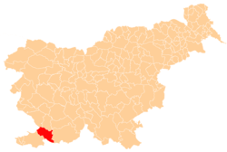
 Vrhpolje Location in Slovenia | |
| Coordinates: 45°37′38.44″N 13°55′47.99″E / 45.6273444°N 13.9299972°ECoordinates: 45°37′38.44″N 13°55′47.99″E / 45.6273444°N 13.9299972°E | |
| Country |
|
| Traditional region | Littoral |
| Statistical region | Coastal–Karst |
| Municipality | Hrpelje-Kozina |
| Area | |
| • Total | 6.51 km2 (2.51 sq mi) |
| Elevation | 497.3 m (1,631.6 ft) |
| Population (2002) | |
| • Total | 79 |
| [1] | |
Vrhpolje (pronounced [ʋəɾxˈpoːljɛ]; Italian: Verpolie) is a village in the Municipality of Hrpelje-Kozina in the Littoral region of Slovenia close to the border with Italy.[2]
The local church, built on a hill above the settlement, is dedicated to Saint Thomas and belongs to the Parish of Draga.[3]
References
External links
This article is issued from Wikipedia - version of the 8/2/2016. The text is available under the Creative Commons Attribution/Share Alike but additional terms may apply for the media files.
