Vysoké Mýto
| Vysoké Mýto | |||
| Town | |||
 | |||
|
|||
| Country | Czech Republic | ||
|---|---|---|---|
| Region | Pardubice | ||
| District | Ústí nad Orlicí | ||
| River | Loučná | ||
| Elevation | 284 m (932 ft) | ||
| Coordinates | CZ 49°57′N 16°10′E / 49.950°N 16.167°ECoordinates: CZ 49°57′N 16°10′E / 49.950°N 16.167°E | ||
| Area | 42.07 km2 (16 sq mi) | ||
| Population | 12,436 (2014) | ||
| Density | 296/km2 (767/sq mi) | ||
| Founded | 1262 | ||
| Mayor | Ing. Miloslav Soušek | ||
| Timezone | CET (UTC+1) | ||
| - summer (DST) | CEST (UTC+2) | ||
| Postal code | 565 41 – 566 01 | ||
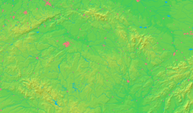
  Location in the Czech Republic | |||
| Wikimedia Commons: Vysoké Mýto | |||
| Website: www.vysoke-myto.cz | |||
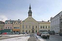
Vysoké Mýto (Czech pronunciation: [ˈvɪsokɛː ˈmiːto]; German: Hohenmaut, also Hohenmauth) is a town in the Pardubice Region, Czech Republic. Founded in 1262 by the Bohemian king, Přemysl Otakar II, it is situated near its original location, called Vraclav. Vysoké Mýto is a centre of tourism, due to its architectural monuments and the nature that surrounds it. Industrial companies in the city include an Iveco bus factory (brand name Karosa). There is also a football club, SK Vysoké Mýto. The town square is exceptionally beautiful and it is one of the largest examples of its type in Bohemia.
History
1262 – foundation of the city by the Bohemian king, Přemysl Otakar II
Until 1918, the town was part of the Austrian monarchy (Austria side after the compromise of 1867), head of the HOHENMAUTH district, one of the 94 Bezirkshauptmannschaften in Bohemia.[1]
Notable people
- Bedřich Bridel (1619–1680), writer, poet and missionary
- Dismas Hataš (1724-1777), violinist andcomposer
- Hermenegild Jireček (1827–1909), jurisconsult
- Josef Jireček (1825–1888), scholar
- Karel Škorpil (1859–1944), and Hermann Škorpil (1858–1923), fathers of Bulgarian archaeology and Varna museum of archaeology (1888)
- Alois Vojtěch Šembera (1807–1882), linguist, historian of literature, writer, journalist, and Czech nationalist
International relations
Twin towns – Sister cities
Vysoké Mýto is twinned with:
See also
External links
- Official website (in Czech)
- Museum in Vysoké Mýto
- View of Vysoké Mýto in the 18th century (large image)
References
- ↑ Die postalischen Abstempelungen auf den österreichischen Postwertzeichen-Ausgaben 1867, 1883 und 1890, Wilhelm KLEIN, 1967
| Wikimedia Commons has media related to Vysoké Mýto. |

