Wells State Park (Michigan)
| Wells State Park | |
|---|---|
|
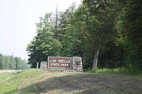
Sign | |
 Location within the state of Michigan | |
| Location | Cedarville Township, Menominee County, Michigan, USA |
| Nearest city | Menominee, Michigan |
| Coordinates | 45°24′06″N 87°22′19″W / 45.40167°N 87.37194°WCoordinates: 45°24′06″N 87°22′19″W / 45.40167°N 87.37194°W |
| Area | 678 acres (2.74 km²) |
| Established | 1925 |
| Governing body | Michigan Department of Natural Resources |
| http://www.michigandnr.com/parksandtrails/details.aspx?id=432&type=SPRK | |
Wells State Park (also known as J.W. Wells State Park) is a state park in the U.S. state of Michigan. The 678-acre (2.74 km2) park is located in Menominee County on the shore of Lake Michigan's Green Bay, just south of Cedar River. It is on M-35, roughly midway between Menominee and Escanaba.
The park was established in 1925 through a donation by the children of John Walter Wells, a pioneer lumberman in the area and the mayor of Menominee for three terms beginning in 1893. Many of the park's buildings, landscaping and water and sewage systems were built by the Civilian Conservation Corps in the 1930s and 1940s.
Facilities and activities
- Swimming: The park features a three-mile (5 km) shoreline with a sandy beach for swimming.
- Hiking: Hiking is available on the Wells-Cedar River Trail, which runs along the shore, with side trails looping through other parts of the park.
- Cross-country skiing: The park's seven miles of ski trails are not groomed.
- Fishing
- Picnicking
- Picnic Area
- Picnic Shelter
- Playground
- Camping: There is a modern campground with 150 sites and five rustic cabins available for rent from mid-March to mid-December. The modern Bay Stone Lodge sleeps twelve and includes an equipped kitchen, two full bathrooms, screened porch and a stone fireplace in the great room.
External links
- Wells State Park Michigan Department of Natural Resources
- Bay Stone Lodge Michigan DNR
- Wells State Park Protected Planet (World Database on Protected Areas)
This article is issued from Wikipedia - version of the 11/18/2016. The text is available under the Creative Commons Attribution/Share Alike but additional terms may apply for the media files.
