Zawada, Prudnik County
For other places with the same name, see Zawada.
| Zawada Zowade | |
|---|---|
| Village | |
 | |
 Zawada Zowade | |
| Coordinates: 50°23′58″N 17°49′2″E / 50.39944°N 17.81722°E | |
| Country |
|
| Voivodeship | Opole |
| County | Prudnik |
| Gmina | Głogówek |
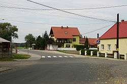
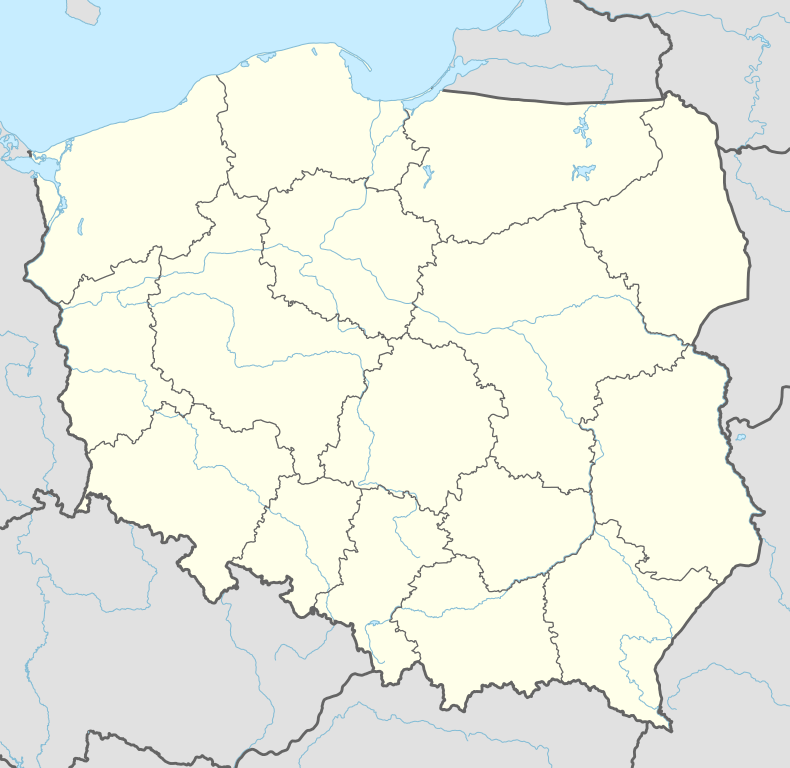
Zawada [zaˈvada], German Zowade, is a village in the administrative district of Gmina Głogówek, within Prudnik County, Opole Voivodeship, in south-western Poland, close to the Czech border.[1] It lies approximately 8 kilometres (5 mi) north-west of Głogówek, 20 km (12 mi) north-east of Prudnik, and 31 km (19 mi) south of the regional capital Opole.
Before 1945 the area was part of Germany (see Territorial changes of Poland after World War II).
References
| Wikimedia Commons has media related to Zawada. |
| Town and seat |  | |
|---|---|---|
| Villages | ||
Coordinates: 50°23′58″N 17°49′2″E / 50.39944°N 17.81722°E
This article is issued from Wikipedia - version of the 5/20/2016. The text is available under the Creative Commons Attribution/Share Alike but additional terms may apply for the media files.