Azaz District
| Azaz District منطقة أعزاز | |
|---|---|
| District | |
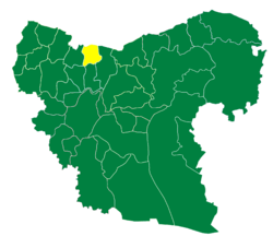
 Location of Azaz District within Aleppo Governorate | |
| Coordinates (Azaz): 36°21′N 37°02′E / 36.35°N 37.03°ECoordinates: 36°21′N 37°02′E / 36.35°N 37.03°E | |
| Country |
|
| Governorate | Aleppo |
| Seat | Azaz |
| Subdistricts | 6 nawāḥī |
| Area | |
| • Total | 1,259.96 km2 (486.47 sq mi) |
| Population (2004)[1] | 251,769 |
| Geocode | SY0204 |
Azaz District (Arabic: منطقة أعزاز, translit. manṭiqat A'zāz) is a district of Aleppo Governorate in northern Syria. Administrative centre is the city of Azaz. At the 2004 census, the district had a population of 251,769.[1]
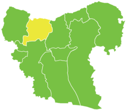
The administrative center of Nahiya Azaz shown above is the city of Azaz.
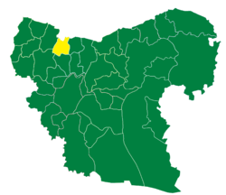
The administrative center of Nahiya Tell Rifaat shown above is the city of Tell Rifaat.
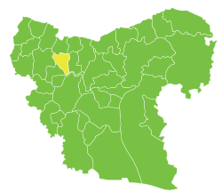
The administrative center of Nahiya Nubl shown above is the city of Nubl.

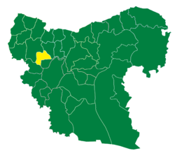
The administrative center of Nahiya Mare' shown above is the city of Mare'.
The administrative center of Nahiya Sawran shown above is the city of Sawran.
The administrative center of Nahiya Akhtarin shown above is the city of Akhtarin.
The district lies between Afrin District to the west, Mount Simeon District to the south and al-Bab District to the east. To the north is the Kilis Province of Turkey.
Subdistricts
| PCode | Name | Area | Population | Villages | Seat |
|---|---|---|---|---|---|
| SY020400 | Nahiya Azaz | 180.12 km² | 47,570 | 20 | Azaz |
| SY020401 | Nahiya Akhtarin | 341.78 km² | 39,385 | 43 | Akhtarin |
| SY020402 | Nahiya Tell Rifaat | 204.52 km² | 43,781 | 13 | Tell Rifaat |
| SY020403 | Nahiya Mare' | 191.42 km² | 39,306 | 18 | Mare' |
| SY020404 | Nahiya Nubl | 174.79 km² | 51,948 | 12 | Nubl |
| SY020405 | Nahiya Sawran | 167.32 km² | 30,032 | 18 | Sawran |
References
- 1 2 "General Census of Population and Housing 2004" (PDF) (in Arabic). Syrian Central Bureau of Statistics. Archived from the original (PDF) on 8 December 2015. Retrieved 15 October 2015. Also available in English: "2004 Census Data". UN OCHA. Retrieved 15 October 2015.
Capital: Aleppo | ||||||||
|  | |||||||
|
| ||||||||
| ||||||||
| ||||||||
| ||||||||
| ||||||||
This article is issued from Wikipedia - version of the 10/23/2016. The text is available under the Creative Commons Attribution/Share Alike but additional terms may apply for the media files.
