Christmas Creek, Queensland
| Christmas Creek Queensland | |||||||||||||
|---|---|---|---|---|---|---|---|---|---|---|---|---|---|
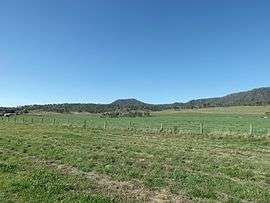 Fields along Christmas Creek Road, 2014 | |||||||||||||
 Christmas Creek | |||||||||||||
| Coordinates | 28°10′45″S 152°59′25″E / 28.17917°S 152.99028°ECoordinates: 28°10′45″S 152°59′25″E / 28.17917°S 152.99028°E | ||||||||||||
| Postcode(s) | 4285 | ||||||||||||
| LGA(s) | Scenic Rim Region | ||||||||||||
| State electorate(s) | Beaudesert | ||||||||||||
| Federal Division(s) | Wright | ||||||||||||
| |||||||||||||
Christmas Creek is a locality in the Scenic Rim Region of South East Queensland, Australia.[1] The eastern border of the locality is marked by the high point of the JinBroken Range while the west is similar defined by another ridgeline. Christmas Creek, a tributary of the Logan River flows in north/south direction roughly parallel to the only main road in the area called Christmas Creek Road.
History

Like many places in South East Queensland the first industry to developed was timber-getting. Agriculture soon became the area's main industry.
The Beaudesert Shire Tramway had a station at Christmas Creek. The station was once known as Lillybank and for several years was the line's terminus.[2]
Heritage listings
Christmas Creek has the following heritage sites:
- 1441 Christmas Creek Road: Catholic Church and Cemetery [3]
References
- ↑ "Christmas Creek (entry 45128)". Queensland Place Names. Queensland Government. Retrieved 3 September 2014.
- ↑ "Christmas Creek Tramway Monument". Monument Australia. Retrieved 2 September 2014.
- ↑ "Local Heritage Register" (PDF). Scenic Rim Regional Council. Retrieved 9 February 2015.
External links
![]() Media related to Christmas Creek, Queensland at Wikimedia Commons
Media related to Christmas Creek, Queensland at Wikimedia Commons
