Hillview, Queensland
| Hillview Queensland | |||||||||||||
|---|---|---|---|---|---|---|---|---|---|---|---|---|---|
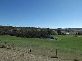 Farms along Hillview Connection Road, 2014 | |||||||||||||
 Hillview | |||||||||||||
| Coordinates | 28°12′59″S 153°0′23″E / 28.21639°S 153.00639°ECoordinates: 28°12′59″S 153°0′23″E / 28.21639°S 153.00639°E | ||||||||||||
| Postcode(s) | 4285 | ||||||||||||
| LGA(s) | Scenic Rim Region | ||||||||||||
| State electorate(s) | Beaudesert | ||||||||||||
| Federal Division(s) | Wright | ||||||||||||
| |||||||||||||
Hillview is a small town and locality in the Scenic Rim Region of South East Queensland, Australia.[1][2] Hillview occupies a section of Christmas Creek valley where it is joined by Widgee Creek. Hillview's eastern boundary is marked by the high point of Jinbroken Range.
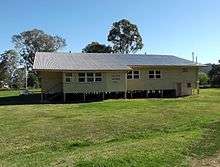
Hillview Memorial Hall, 2014
The town was once a stop on the Beaudesert Shire Tramway.[3]
Hillview State School was established in 1887.[4]
References
- ↑ "Hillview (entry 15910)". Queensland Place Names. Queensland Government. Retrieved 2 September 2014.
- ↑ "Hillview (entry 45145)". Queensland Place Names. Queensland Government. Retrieved 2 September 2014.
- ↑ "Beaudesert". Centre for the Government of Queensland. University of Queensland. Retrieved 2 September 2014.
- ↑ "School Profile". Education Queensland. Retrieved 2 September 2014.
External links
![]() Media related to Hillview, Queensland at Wikimedia Commons
Media related to Hillview, Queensland at Wikimedia Commons
This article is issued from Wikipedia - version of the 7/19/2016. The text is available under the Creative Commons Attribution/Share Alike but additional terms may apply for the media files.