D208 road (Croatia)
| |
|---|---|
| Route information | |
| Length: | 6.9 km (4.3 mi) |
| Major junctions | |
| From: |
|
| To: |
|
| Location | |
| Counties: | Međimurje |
| Major cities: | Čakovec |
| Highway system | |
| State roads in Croatia | |

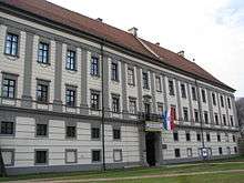
Čakovec, near the eastern terminus of the D208 road
D208 is a state road in Međimurje region of Croatia connecting Trnovec and nearby Trnovec border crossing to Slovenia to D3 state road in Nedelišće near Čakovec,[maps 1] and the road also serves as a connecting road to the A4 motorway as it terminates near Čakovec interchange via the D3.[1] The road is 6.9 km (4.3 mi) long.[2]
The road, as well as all other state roads in Croatia, is managed and maintained by Hrvatske ceste, state owned company.[3]
Traffic volume
Traffic is regularly counted and reported by Hrvatske ceste, operator of the road.[4]
| D208 traffic volume | ||||
| Road | Counting site | AADT | ASDT | Notes |
| |
1202 Trnovec | 948 | 1,009 | Between border crossing and Ž2009 junction. |
Road junctions and populated areas
| D208 junctions/populated areas | |
| Type | Slip roads/Notes |
| |
Trnovec border crossing to Slovenia.[5] The western terminus of the road. |
| |
Trnovec |
| |
Ž2009 to Macinec, Gornji Mihaljevec and D227 state road. |
| |
Gornji Hrašćan Ž2019 to Črečan. |
| |
Nedelišće The eastern terminus of the road. |
Maps
- ↑ Overview map of the D208 (Map). OpenStreetMap. Retrieved September 11, 2013.
Sources
- 1 2 "Regulation on motorway markings, chainage, interchange/exit/rest area numbers and names". Narodne novine (in Croatian). April 24, 2003.
- ↑ Ministry of Sea, Transport and Infrastructure (Croatia) (May 10, 2013). "Odluka o razvrstavanju javnih cesta" [Decision on categorization of public roads]. Narodne novine (in Croatian) (066/2013).
- ↑ "Public Roads Act". Narodne novine (in Croatian). December 14, 2004.
- ↑ "Traffic counting on the roadways of Croatia in 2013 - digest" (PDF). Hrvatske ceste. May 2014. Retrieved 2014-08-23.
- ↑ "Map of border crossings and customs office areas" (PDF). Customs Administration of the Republic of Croatia (in Croatian). March 6, 2008.
This article is issued from Wikipedia - version of the 8/23/2014. The text is available under the Creative Commons Attribution/Share Alike but additional terms may apply for the media files.
