D24 road (Croatia)
| |
|---|---|
| Route information | |
| Length: | 72.4 km (45.0 mi) |
| Major junctions | |
| From: |
|
|
| |
| To: |
|
| Location | |
| Counties: | Krapina-Zagorje, Varaždin |
| Major cities: | Zabok, Zlatar Bistrica, Novi Marof, Varaždinske Toplice, Ludbreg |
| Highway system | |
| State roads in Croatia | |

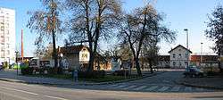
Zabok, at the western terminus of the D24 road
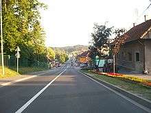
Novi Marof, on the D24 road route

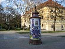
Varaždinske Toplice, on the D24 road route
Ludbreg, at the eastern terminus of the D24 road
D24 is a state road in the northwestern Croatia connecting Zabok on the D1 state road, near the A2 motorway Zabok interchange, Novi Marof on the D3 state road, the A4 motorway Novi Marof interchange and Ludbreg on the D2 state road, near the A4 motorway Ludbreg interchange.[1][maps 1] The road is 72.4 km (45.0 mi) long.[2]
The road, as well as all other state roads in Croatia, is managed and maintained by Hrvatske ceste, state owned company.[3]
Traffic volume
Traffic is regularly counted and reported by Hrvatske ceste, operator of the road.[4]
| D24 traffic volume | ||||
| Road | Counting site | AADT | ASDT | Notes |
| |
1111 Bedekovčina | 7,966 | 9,396 | Between the Ž2197 and Ž2166 junctions. |
| |
1238 Poznanovec | 6,456 | 6,713 | Between the Ž2201 and Ž2168 junctions. |
| |
1230 Konjščina | 3,980 | 4,130 | Adjacent to the Ž2170 junction. |
| |
1226 Krapina Selo | 2,479 | 2,430 | Between the Ž2204 and Ž2171 junctions. |
| |
1222 Novi Marof - west | 2,909 | 3,519 | Adjacent to the L25134 junction. |
| |
1237 Ljubešćica | 2,594 | 2,796 | Adjacent to the Ž2136 junction. |
| |
1309 Leskovec Toplički | 1,240 | 1,401 | Adjacent to the Ž2111 junction. |
Road junctions and populated areas
| D24 junctions/populated areas | |
| Type | Slip roads/Notes |
| |
Hum Zabočki The western terminus of the road. |
| |
Ž2197 to Oroslavje (D307). |
| |
Dubrava Zabočka |
| |
Špičkovina |
| |
Bedekovčina Ž2165 to Grabe and Veliki Komor Ž2166 to Mirkovec (D1). Ž2198 to Lepa Ves and Donja Stubica (D307). |
| |
Lug Poznanovečki |
| |
Poznanovec Ž2168 to Mali Bukovec and Mače (D29). Ž2201 to Dubovec and Banšćica (D307). Ž2242 to Veliki Bukovec. |
| |
Lovrečan |
| |
Zlatar Bistrica |
| |
Veleškovec |
| |
Lipovec |
| |
Konjščina Ž2170 to Donja Batina and Gornja Batina. Ž2204 to Sušobreg, Poljanica Bistrička and Marija Bistrica. Ž2205 to the Ž2221 county road. |
| |
Jelovec |
| |
Galovec |
| |
Krapina Selo |
| |
Ž2171 to Hrašćina and Breznički Hum (D3). |
| |
Budinšćina Ž2131 to Zajezda. Ž2169 to Gornja Batina and Zlatar (D29). |
| |
Podrute Ž2107 to Bela. |
| |
Ž2133 to Kamena Gorica. |
| |
Jelenščak Ž2134 to Donje Makojišće and D3 road. |
| |
Topličica |
| |
Madžarevo |
| |
Ž2135 to Grana and D22 road. |
| |
Novi Marof |
| |
The D22 and D24 are concurrent to the west. |
| |
Možđenec Ž2136 to Ključ. |
| |
Ljubeščica |
| |
Kapela Kalnička |
| |
Ž2109 to Oštrice and Presečno (D3). |
| |
Varaždinske Toplice Ž2250 to Turčin (D3). |
| |
Tuhovec Ž2054 to Grešćevina, Jalžabet and Šemovec (D2). |
| |
Jalšovec Svibovečki Ž2110 to Drenovec. |
| |
Ž2111 to Gornja Poljana and Grešćevina. |
| |
Leskovec Toplički |
| |
Slanje Ž2074 to Križovljan (D2). |
| |
Ž2262 to Ludbreg (D2) |
| |
Poljanec The eastern terminus of the road. |
Maps
- ↑ Overview map of the D24 (Map). OpenStreetMap. Retrieved July 21, 2014.
Sources
- 1 2 3 4 5 "Regulation on motorway markings, chainage, interchange/exit/rest area numbers and names". Narodne novine (in Croatian). April 24, 2003.
- ↑ Ministry of Sea, Transport and Infrastructure (Croatia) (June 4, 2013). "Decision on categorization of public roads" (in Croatian). Narodne novine. Retrieved July 21, 2014.
- ↑ "Public Roads Act". Narodne novine (in Croatian). December 14, 2004.
- ↑ "Traffic counting on the roadways of Croatia in 2013 - digest" (PDF). Hrvatske ceste. May 2014. Retrieved 2014-07-20.
This article is issued from Wikipedia - version of the 11/20/2016. The text is available under the Creative Commons Attribution/Share Alike but additional terms may apply for the media files.
