D29 road (Croatia)
| |
|---|---|
| Route information | |
| Length: | 49.8 km (30.9 mi) |
| Major junctions | |
| From: |
|
|
| |
| To: |
|
| Location | |
| Counties: | Krapina-Zagorje, City of Zagreb |
| Major cities: | Zlatar, Marija Bistrica |
| Highway system | |
| State roads in Croatia | |

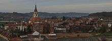
Marija Bistrica, on the D29 road route
D29 is a state road in the northwestern Croatia connecting Novi Golubovec and the D35 state road to Soblinec on the D3 state road[maps 1] near the A4 motorway Popovec interchange.[1] The road is 49.8 km (30.9 mi) long.[2]
The road, as well as all other state roads in Croatia, is managed and maintained by Hrvatske ceste, state owned company.[3]
Traffic volume
Traffic is regularly counted and reported by Hrvatske ceste, operator of the road.[4]
| D29 traffic volume | ||||
| Road | Counting site | AADT | ASDT | Notes |
| |
1232 Mače - east | 3,147 | 3,217 | Between the Ž2168 and Ž2128 junctions. |
| |
1231 Zlatar Bistrica | 3,163 | 3,501 | Between the D24 and Ž2202 junctions. |
| |
2004 Kašina | 2,198 | 2,331 | Adjacent to the Ž1001 junction. |
Road junctions and populated areas
Maps
- ↑ Overview map of the D29 (Map). OpenStreetMap. Retrieved July 22, 2014.
Sources
- 1 2 "Regulation on motorway markings, chainage, interchange/exit/rest area numbers and names". Narodne novine (in Croatian). April 24, 2003.
- ↑ Ministry of Sea, Transport and Infrastructure (Croatia) (June 4, 2013). "Decision on categorization of public roads" (in Croatian). Narodne novine. Retrieved July 22, 2014.
- ↑ "Public Roads Act". Narodne novine (in Croatian). December 14, 2004.
- ↑ "Traffic counting on the roadways of Croatia in 2013 - digest" (PDF). Hrvatske ceste. May 2014. Retrieved 2014-07-22.
This article is issued from Wikipedia - version of the 8/12/2014. The text is available under the Creative Commons Attribution/Share Alike but additional terms may apply for the media files.