Fillols
| Fillols | |
|---|---|
|
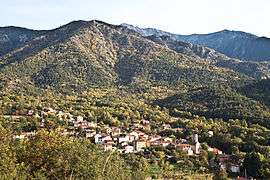
A general view of Fillols | |
 Fillols | |
|
Location within Occitanie region 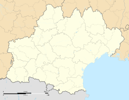 Fillols | |
| Coordinates: 42°33′43″N 2°24′37″E / 42.5619°N 2.4103°ECoordinates: 42°33′43″N 2°24′37″E / 42.5619°N 2.4103°E | |
| Country | France |
| Region | Occitanie |
| Department | Pyrénées-Orientales |
| Arrondissement | Prades |
| Canton | Prades |
| Area1 | 8.40 km2 (3.24 sq mi) |
| Population (1999)2 | 141 |
| • Density | 17/km2 (43/sq mi) |
| Time zone | CET (UTC+1) |
| • Summer (DST) | CEST (UTC+2) |
| INSEE/Postal code | 66078 / 66820 |
| Elevation |
576–2,360 m (1,890–7,743 ft) (avg. 650 m or 2,130 ft) |
|
1 French Land Register data, which excludes lakes, ponds, glaciers > 1 km² (0.386 sq mi or 247 acres) and river estuaries. 2 Population without double counting: residents of multiple communes (e.g., students and military personnel) only counted once. | |
Fillols is a commune in the Pyrénées-Orientales department in southern France.
Geography
Fillols is located in the canton of Prades and in the arrondissement of Prades.
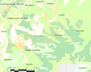
Map of Fillols and its surrounding communes
Population
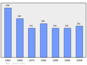
Population 1962-2008
See also
References
| Wikimedia Commons has media related to Fillols (Pyrénées-Orientales). |
This article is issued from Wikipedia - version of the 7/20/2016. The text is available under the Creative Commons Attribution/Share Alike but additional terms may apply for the media files.