Mississippi Highway 21
| ||||
|---|---|---|---|---|
| Route information | ||||
| Maintained by MDOT | ||||
| Length: | 73.272 mi[1] (117.920 km) | |||
| Major junctions | ||||
| South end: |
| |||
| North end: |
| |||
| Location | ||||
| Counties: | Scott, Leake, Newton, Neshoba, Kemper, Noxubee | |||
| Highway system | ||||
| ||||

Mississippi Highway 21 (MS 21) is a state highway in Mississippi. It runs from north to south for 73.5 miles (118.3 km) and serves six counties: Scott, Leake, Newton, Neshoba, Kemper, and Noxubee.
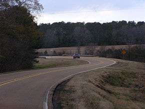
Mississippi Highway 21 southbound in northeast Neshoba County.
Locales on Route
From North to South
Major intersections
| County | Location | mi | km | Destinations | Notes |
|---|---|---|---|---|---|
| Scott | Forest | ||||
| | Damascus Road - Golden Memorial State Park | to MS 492 west | |||
| Sebastopol | |||||
| Neshoba | | ||||
| Fairview | |||||
| Philadelphia | south end of MS 15 overlap | ||||
| south end of MS 16 overlap | |||||
| Cooper Williams Drive - Williamsville | |||||
| north end of MS 15 overlap; south end of MS 19 overlap | |||||
| north end of MS 16 / MS 19 overlap | |||||
| Pecan Avenue - Louisville, Kosciusko | former MS 15 north / MS 19 north | ||||
| | |||||
| Kemper | Preston | ||||
| Noxubee | | south end of MS 39 overlap | |||
| Shuqualak | north end of MS 39 overlap | ||||
| 1.000 mi = 1.609 km; 1.000 km = 0.621 mi | |||||
References
- ↑ "Mississippi Public Roads Selected Statistics" (PDF). Mississippi Department of Transportation. 2008. Retrieved 2010-06-03.
This article is issued from Wikipedia - version of the 6/8/2014. The text is available under the Creative Commons Attribution/Share Alike but additional terms may apply for the media files.
