Montreal Metro
 | |||
|
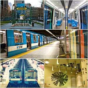
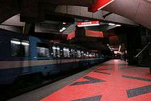
Top Left: Hector Guimard's Paris Métro entrance at Square-Victoria-OACI Top Right: Interior of the new MPM-10 ("Azur") trains.[1] Centre:MR-73 train at Montmorency station. Bottom Left: Two MR-73 trains at Plamondon station. Bottom Right: Ceramic mural at Crémazie station. | |||
| Overview | |||
|---|---|---|---|
| Native name | Métro de Montréal | ||
| Locale | Montreal, Quebec, Canada | ||
| Transit type | Rapid transit | ||
| Number of lines | 4 | ||
| Number of stations | 68 | ||
| Daily ridership |
1,245,700 (avg. weekday, Q1 2014)[2] | ||
| Annual ridership | 356,096,000 (2013)[3] | ||
| Operation | |||
| Began operation | October 14, 1966 | ||
| Operator(s) | Société de transport de Montréal | ||
| Number of vehicles | 759 | ||
| Technical | |||
| System length | 69.2 km (43.0 mi)[4][5] | ||
| Track gauge |
1,435 mm (4 ft 8 1⁄2 in) standard gauge with running pads for the rubber tired wheels outside of the steel rails | ||
| Electrification | "Third rail", 750 V DC on the guide bars at either side of the track | ||
| Average speed | 40 km/h (25 mph) | ||
| Top speed | 72 km/h (45 mph) | ||
| |||
The Montreal Metro (French: Métro de Montréal) is a rubber-tired, underground metro system, and the main form of public transport, in the city of Montreal, Quebec, Canada.
The Metro, operated by the Société de transport de Montréal (STM), was inaugurated on October 14, 1966, during the tenure of Mayor Jean Drapeau. The metro has expanded since the 1960s from 26 stations on three separate lines to 68 stations on four lines totalling 69.2 kilometres (43.0 mi) in length,[4][5] serving the north, east and centre of the Island of Montreal with connections to Longueuil, via the Yellow Line, and Laval, via the Orange line.
The Montreal Metro is Canada's busiest metro system, and North America's third busiest by daily ridership behind those of New York City and Mexico City, delivering an average of 1,245,700 daily unlinked passenger trips per weekday (as of Q1 2014).[2] In 2013, 356.1 million trips on the Metro were completed (transfers counted as separate trips).[3] According to the STM the Metro system had transported over 7 billion passengers as of 2010. Montreal has built one of North America's largest urban rapid transit schemes, serving the fourth-largest number of passengers overall (after New York City, Mexico City, and Toronto) and attracting the second-highest ridership per capita behind New York City.[6]
The Montreal Metro was inspired by the Paris Metro, which is clearly seen in the Metro's station design and rolling stock.[7]
History

Urban transit began in Montreal in 1861 when a line of horse-drawn cars started to operate on Craig (now St-Antoine) and Notre-Dame streets. Eventually, as the then Canadian metropolis grew, a comprehensive network of streetcar lines provided service almost everywhere. But urban congestion started to take its toll on streetcar punctuality, so the idea of an underground system was soon considered.[8]
Fifty years of projects
In 1902, as European and American cities were inaugurating their first subway systems, the federal government created the Montreal Subway Company to promote the idea in Canada.
Starting in 1910, many proposals were tabled but the Montreal Metro would prove to be an elusive goal. First, the Montreal Street Railway Company, the Montreal Central Terminal Company and the Montreal Underground and Elevated Railway Company undertook fruitless negotiations with the city.[8] Then a year later, the Comptoir Financier Franco-Canadien and the Montreal Tunnel Company proposed tunnels under the city centre and the Saint-Lawrence River to link the emerging South Shore neighbourhoods but faced the opposition of railway companies.[9] The Montreal Tramways Company (MTC) was the first to receive the approval of the provincial government in 1913 and four years to start construction.[10] The reluctance of elected city officials to advance funds foiled this first attempt.
The issue of a metro remained present in the newspapers but World War I and the following recession hitting Montreal prevented any execution. The gradual return of the financial health during the 1920s brought the MTC project back and attracted support from the Premier of Quebec.[8] The Great Depression, indebting Montreal again and atrophying its streetcars attendance, overcame this new attempt and the next devised by Mayor Camillien Houde in 1939 as a way to provide work for the jobless masses.[11]
-

1910 project under Park Avenue
-
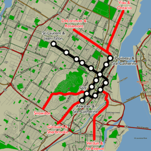
1944 project
-
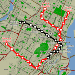
1953 project
World War II and the war effort in Montreal resurrected trams crowding. In 1944, the MTC proposed a two-line network, one line running underneath Saint Catherine Street, the other under Saint Denis and Notre-Dame and Saint Jacques Streets.[12] In 1953 the newly formed public Montreal Transportation Commission replaced streetcars by buses and proposed a single metro line reusing the 1944 plans and extending it all the way to Boulevard Crémazie, right by the D'Youville maintenance shops.[13] By this point, construction was already well underway on Canada's first metro line in Toronto under Yonge Street, which would be opened in 1954. Still, Montreal councillors remained cautious and no work was initiated. For some of them, including Jean Drapeau during its first municipal term, public transit was a thing of the past.[11]
In 1959, a private company, the Société d'expansion métropolitaine, offered to build a rubber-tired metro but the Transportation Commission wanted its own network and rejected the offer.[14] This was the last missed opportunity, for the re-election of Jean Drapeau as mayor and the arrival of his right hand man, Lucien Saulnier, changed everything. In the early 1960s, the western world experienced an economic boom and Quebec underwent its Quiet Revolution. From August 1, 1960, many municipal services were addressing the project and on November 3, 1961, the Montreal City Council voted appropriations amounting to $132 million ($1.06 billion in 2016) to construct and equip a initial network of 16 kilometres in length.[13]
Building the Metro
The 1961 plan reused several previous studies and planned three lines carved into the rock under the city centre to the most populated areas of the city.
The first two lines
The main line, or number 1 (Green Line) was to pass between the two most important arteries, Sainte-Catherine and Sherbrooke streets, more or less under the De Maisonneuve Boulevard. It would extend between the English-speaking west at Atwater station and French-speaking east at Frontenac. Line 2 (Orange Line) would pass north of the city, from Crémazie station and descend under residential neighbourhoods to the south and the business district at Place-d'Armes station.
Construction of the first two lines began May 23, 1962 under the supervision of the Director of Public Works, Lucien L'Allier, the "father of the subway". On June 11, 1963 the construction costs for tunnels being lower than expected, Line 2 was extended by two stations at each end and the new terminus became the Henri-Bourassa and Bonaventure stations. The project, which employed more than 5,000 workers at its height, and cost the lives of 12 of them, ended on October 14, 1966. The service was opened gradually between October 1966 and April 1967 as the stations were completed.
Cancellation of Line 3
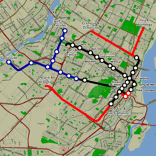
A third line was planned. It was to use Canadian National Railway (CN) tracks passing under the Mount Royal to reach the northwest suburb of Cartierville from the city centre. Unlike the previous two lines, trains were to be partly running above ground. Negotiations with the CN and municipalities were stalling as Montreal was chosen in November 1962 to hold the 1967 Universal Exposition (Expo 67). Having to make a choice, the city decided that a number 4 line linking Montreal to the South Shore suburbs following a plan similar to those of the early century was more necessary.[15]
Line 3 was never built and the number was never used again. The railway, already used for a commuter train to the North Shore at Deux-Montagnes, was completely renovated in the early 1990s and effectively replaced the planned third line. The next line would thus be numbered 5 (blue line).
Expo 67
The Montreal municipal administration asked municipalities of the South Shore of the Saint Lawrence River which one would be interested by the Metro and Longueuil got the link. Line 4 (Yellow Line) therefore pass under the river, from Berri-de-Montigny station, junction of lines 1 and 2, to Longueuil. A stop was added in between to access the site of Expo 67, built on two islands of the Hochelaga Archipelago in the river. Saint Helen's Island, on which the station of the same name was build, was massively enlarged and consolidated with several nearby islands (including Ronde Island) using backfill excavated during the construction of the metro. Notre Dame Island, adjacent, was created from scratch with the same material. Line 4 was completed on April 1, 1967, in time for the opening of the World's Fair.[15]
The first Metro network was completed with the public opening of the yellow line on 28 April 1967. The cities of Montreal, Longueuil and Westmount had assumed the entire cost of construction and equipment of $213.7 million ($1.6 billion in 2016). Montreal became the seventh city in North America to operate a subway. The 1960s being very optimistic years, Metro planning did not escape the general exuberance of the time, and a 1967 study ″Horizon 2000″[16] imagined a network of 160 kilometers of tunnels for the year 2000.[17]
Extensions and unbuilt lines

In 1970, the Montreal Urban Community (MUC) was created. This group was made of municipalities that occupy the Island of Montreal and the city of Montreal was the biggest participant. MUC's mission was to provide standardized services at a regional level, one of them being transportation. The MUC Transportation Commission was thus created at the same time to serve as prime contractor for the metro extensions. It merged all island transport companies and became the Société de transport de la communauté urbaine de Montréal (STCUM) in 1985 and then the Société de transport de Montréal (STM) in 2002.
Montreal Olympics
The success of the Metro increased the pressure to extend the network to other populated areas, including the suburbs on the Island of Montreal. After getting in May 1970 the 1976 Summer Olympics, a loan of $430 million ($2.7 billion in 2016) was approved by the MUC on February 12, 1971 to fund the extensions of Lines 1 and 2 and the construction of a transverse line: Line 5. The Government of Quebec agreed to bear 60% of the costs.
The work on the extensions started October 14, 1971 with Line 1 (green) towards the east to reach the site where the Olympic Stadium was to be built and Autoroute 25 (Honoré-Beaugrand station) that could serve as a transfer point for visitors arriving from outside. The extensions were an opportunity to make improvements to the network, such as new trains, larger stations and even semi-automatic control. The first extension was completed in June 1976 just before the Olympics. Line 1 was later extended to the southwest to reach the suburbs of Verdun and LaSalle with the Angrignon as the terminus station, named after the zoo. This station opened in September 1978.
In the process, further extensions were planned and in 1975 spending was expected to reach reached $1.6 billion ($7.3 billion in 2016). Faced with these soaring costs, the Government of Quebec declared a moratorium May 19, 1976 to the all-out expansion desired by Mayor Drapeau. Tenders were frozen, including those of Line 2 after Snowdon and those of Line 5 whose works were yet already underway. A struggle then ensued between the MUC and the Government of Quebec as any extension could not be done without the agreement of both parties. The Montreal Transportation Office may have tried to put the government in front of a fait accompli by awarding large contracts to build the tunnel between Namur station and Bois-Franc just before the moratorium entry into force.[18]
Moratorium on Metro expansion
In 1977, the newly elected government partially lifted the moratorium on the extension of Line 2 and the construction of Line 5. The orange line was gradually extended westward to Place-Saint-Henri (1980) and Snowdon (1981). As the stations were completed, the service was extended. In December 1979 Quebec presented its "integrated transport plan" in which Line 2 was to be tunnelled to Du College and Line 5 from Snowdon to Anjou. The plan proposed no other underground lines as the government preferred the option of converting existing railway lines to overground Metro ones. The mayors of the MUC, initially reluctant, accepted this plan when Quebec promised in February 1981 to finance future extensions fully. The moratorium was then modestly lifted on Line 2 that reached Du College (1984) and finally Côte-Vertu (1986). This line took the shape of an "U" linking the north of the island to the city centre and serving two very populous axes.
The various moratoriums and technical difficulties encountered during the construction of the fourth line stretched its realization over fourteen years. This Line 5 (blue), which runs through the centre of the island of Montreal, crossed the east branch of Line 2 (Jean-Talon station) in 1986 and its west branch (Snowdon metro) in 1988. Because it was not crowded, STCUM at first operated the line weekdays only from 5:30 am to 7:30 pm and was circulating three-car trains. Students from the University of Montreal, the main source of customers, obtained extension of the closing time to 11:10 pm and then 0:15 am in 2002.[19]
Recession and unfinished projects

In the late 1980s, the original network length had nearly quadrupled in twenty years and exceeded that of Toronto, but the plans did not stop there. In its 1983-1984 scenario, the MUC planned a new underground Line 7 (Pie-IX to Montreal-Nord) and several surface lines numbered 6 (Du Collège to Repentigny), 8 (Radisson to Pointe-aux-Trembles), 10 (Vendôme to Lachine) and 11 (Angrignon to LaSalle). In 1985 however, a new government in Quebec rejected the project, replacing the metro lines by commuter train lines in its own 1988 transport plan. Yet the provincial elections of 1989 approaching, the Line 7 project reappeared and the extensions of Line 5 to Anjou (Pie-IX, Viau, Lacordaire, Langelier and Galeries d'Anjou) and Line 2 northward (Deguire/Poirier, Bois-Franc and Salaberry) were announced.
At the beginning of the 1990s, there was a significant deficit in public finances across Canada, especially in Quebec, and an economic recession. The metro ridership decreased and the Government of Quebec removed subsidies for the operation of urban public transport.[20] Faced with this situation, the extensions projects were put on hold and the MUC prioritized the renovation of its infrastructures.
Creation of AMT, and improvements
In 1996, the Government of Quebec created a supra-municipal agency, the Agence métropolitaine de transport (AMT), whose mandate is to coordinate the development of transport throughout the Greater Montreal area. The AMT is responsible, among others, for the development of the metro and suburban trains.
Laval extension
Announced in 1998 by the STCUM,[21][22] the project to extend Line 2 (orange) past the Henri-Bourassa terminus to the city of Laval, passing under the Rivière des Prairies, was launched March 18, 2002.[13] The extension was decided and funded by the Government of Quebec. The AMT received the mandate of its implementation but the ownership and operation of the line stayed with the Société de transport de Montréal (STCUM successor). The work completed, opening to the public happened April 28, 2007. This extension added 5.2 km to the network and three stations in Laval (Cartier, De la Concorde and Montmorency). As of 2009, ridership increased by 60,000 a day with the new stations, making a success of this extension.[23]
Major renovations
Since 2004, most of the STM investment has been directed to rolling stock and infrastructure renovation programs.[24] New trains are being delivered and should, by 2018, replace the older ones (MR-63). Tunnels are being repaired and several stations, including Berri-UQAM, have been several years in rehabilitation. Many electrical[25] and ventilation structures[26][27] on the surface are in 2016 completely rebuilt to modern standards.
Anjou extension project
In December 2011, the AMT proposed its "Vision 2020" plan expanding the Line 5 (blue) towards the borough of Anjou and Line 2 (orange) towards Bois-Franc train station.[28] On September 20, 2013 the Société de transport de Montréal (STM) and provincial government announced the extension of the Line 5 east as far as Anjou with five new stations. After the Parti Québécois lost the 2014 provincial election, the future of the Blue Line extension came into question. The successor Liberal government had expressed interest in extending mass-transit to the Airport and implementing a Light Rail line on the new Champlain Bridge under construction. The project could cost up to $3 billion based on a February 2016 reassessment.[29] Because of funding for infrastructure promised by the federal government in 2015, the Blue Line project remains a priority, according to Quebec and the STM.[30]
Network
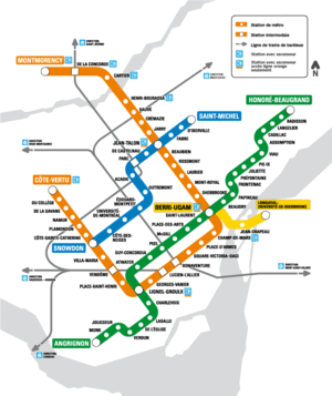
The Montreal Metro consists of four lines,[31] which are usually identified by their colour or terminus station. The terminus station in the direction of travel is used to differentiate between directions.
Lines and operation
The Yellow Line is the shortest line, with three stations, built for Expo 67. Metro lines that leave the Île de Montréal are the Orange Line, which continues to Laval, and the Yellow Line, which continues to Longueuil.
Metro service starts at 05:24 am and 05:30 am and stops at 01:00 on weekdays and Sunday, and 01:30 on Saturday. However, the Blue Line service stops earlier, at 00:15 due to lower passenger volumes. During rush hour, there are two to five minutes between trains on the Orange and Green Lines. The frequency, however, decreases to 12 minutes during late nights.
| Line # | Colour | From | To | Year First Opened | Year Last Extended | Length | Stations | Trains Frequency | |
|---|---|---|---|---|---|---|---|---|---|
| Rush Hour | Off-Peak | ||||||||
| 1 | Green | Angrignon | Honoré-Beaugrand | 1966 | 1978 | 22.1 km | 27 | 3–5 minutes | 4–11 minutes |
| 2 | Orange | Côte-Vertu | Montmorency | 1966 | 2007 | 30.0 km | 31 | 3–4 minutes | 4–8 minutes |
| 4 | Yellow | Berri-UQAM | Longueuil–Université-de-Sherbrooke | 1967 | 1967 | 4.25 km | 3 | 4–5 minutes | 5–10 minutes |
| 5 | Blue | Snowdon | Saint-Michel | 1986 | 1988 | 9.7 km | 12 | 4–5 minutes | 5–10 minutes |
Fares
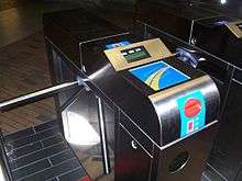
The Société de transport de Montréal (STM) operates Metro and bus services in Montreal, and thus transfers between the two are free inside a 120 minutes time range after the first validation.[32]
Fares are only partially integrated with the Agence métropolitaine de transport (AMT) commuter rail system, which links the Metro to the outer suburbs via five interchange stations (Bonaventure, Lucien-L'Allier, Vendôme, De la Concorde and Parc). The AMT sells tickets allowing the use of both its trains and the Metro (TRAM titles)[33] while the STM tickets do not permit the boarding of trains.
Fare payment is via a barrier system accepting magnetic tickets and RFID like contacless cards. A rechargeable contactless smart card called "OPUS" unveiled on April 21, 2008 provides seamless integration with other transit networks of neighboring cities by being capable of holding multiple transport tickets: tickets, books or subscriptions, a subscription for Montreal only and commuter train tickets.[34] Moreover, unlike the magnetic stripe cards, which had been sold alongside the new OPUS cards up until May 2009, the contactless cards are not at risk of becoming demagnetized and rendered useless and do not require patrons to slide them through a reader.
Since 2015, customers have been able to purchase an OPUS card reader to recharge their personal card online from a computer.[35] In 2016, the STM is developing a smart phone application featuring NFC technology, which could replace the OPUS card.[36]
MétroVision
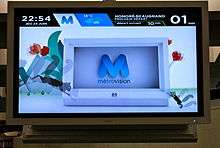
Metro stations are equipped with the MétroVision information screens displaying advertising, news headlines from RDI and MétéoMédia weather informations, as well as STM-specific informations regarding service changes, service delays and information pertaining to using the system. Since the end of 2014 the STM has installed screens in all of the 68 metro stations. Berri-UQAM station was the first station to have these screens installed.[37]
Ridership
Montreal Metro ridership has more than doubled since it opened: the number of passengers increasing from 136 millions in 1967 to 357 millions in 2014. Montreal has one of North America's busiest public transportation systems with, after New York, the largest number of users compared to its population. However, this growth was not continuous: in the late 1960s and early 1990s, ridership has declined in some periods. From 1996 to 2015 the number of passengers grew. Today, portions of the busiest lines, such as Line 1 between Berri-UQAM and McGill stations or Line 2 eastern branch are expericencing overcrowding during peak hours. It is not uncommon, in these sections, that travellers must let several trains pass before boarding.[38] The conditions between these stations worsen in summer because of the lack of air conditioning and heat generated by the trains.
In 2014, the five most popular stations (in millions of inbound travellers) were: Berri-UQAM (12.8), McGill (11.1), Bonaventure (8.1), Guy-Concordia (8.1) and Côte-Vertu (7.6);[39] the first four are located in downtown. The least busy station is Georges-Vanier with 773,078 entries in 2011.[40]
Funding

The network operations funding (maintenance, equipment purchase and salaries) is provided by the STM. However, tickets and subscriptions covering only 40% of the actual operations costs, the shortfall must be offset by the urban agglomeration of Montreal (28%), the Montreal Metropolitan Community (5%) and the Government of Quebec (23%).[41]
The STM does not keep separate accounts for Metro and buses services. The following figures therefore include both activities. In 2016, direct operating revenue planned by the STM totalled $667 million. To compensate for the reduced rates, the city will pay $513 million plus $351 million from Quebec. For a budget of $1.53 billion, salaries account for 57% of expenditures, followed in importance by financial expenses (22%) resulting from a 2.85 billion debt. For the Metro only, wages represented 75% of the $292 million operating costs, before electricity costs (9%).[41]
Heavy investments (network extensions) are entirely funded by the provincial government. Renovations and service improvements are subsidized up to 100% by the Government of Canada, the province and the urban agglomeration. For example, 74% of the trains replacement cost is paid for by Quebec and 33% of the bill for the ventilation structures upgrading is paid for by the federal government. Small investments to maintain the network in working order remain entirely the responsibility of the STM.[42]
Security

Montreal metro facilities are patrolled daily by 155 STM inspectors and 115 agents of the Montreal Police Service (SPVM) assigned to the subway.[43] They are in contact with the command centre of the metro which has 2,000 cameras distributed on the network, coupled with a computerized visual recognition system.[44]
On station platforms, emergency points are available with a telephone connected to the command centre, an emergency power supply cut-off switch and a fire extinguisher.[45] The power supply system is segmented into short sections that can be independently powered, so that following an incident a single train can be stopped while the others reach the nearest station.
In tunnels, a raised path at trains level facilitates evacuation and allows people movement without walking on the tracks. Every 15 meters, directions are indicated by illuminated yellow signs. Every 150 meters, emergency stations with telephones, power switches and fire hoses can be found. At the ventilation shafts locations in the old tunnels or every 750 meters in recent tunnels sections (Laval), emergency exits reach the surface.
On the surface, blue fire hydrants in the streets are dry risers connected to the Metro fire control system. If a fire breaks out in tunnels, firefighters connect the red fire hydrant with the blue terminals to power the subway system. This decoupling prevents accidental flooding.[46]
Station design
The design of the Metro was heavily influenced by Montreal's winter conditions. Unlike other cities' metros, nearly all station entrances in Montreal are set back from the sidewalk and completely enclosed; usually in small, separate buildings or within building facades. They are equipped with swivelling "butterfly" doors meant to mitigate the wind caused by train movements that can make doors difficult to open.[47] The entire system runs underground and some stations are directly connected to buildings, making the Metro an integral part of Montreal's Underground City.
The network had 68 stations, four of which have connections between Metro lines, and five connect to the commuter train network. They are mostly named after streets adjacent to them.[48]
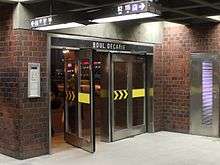
The average distance between stations is 950 metres, with a minimum in the city centre between Peel and McGill stations (296 metres) and a maximum between Berri-UQAM and Jean-Drapeau stations (2,362 metres).[48] Average station depth is 15 metres. The deepest station of the network, Charlevoix, has its Honoré-Beaugrand bound platform located 29.6 metres underground. The shallowest stations are Angrignon and Longueuil-Université-de-Sherbrooke terminus, 4.3 metres below surface.
Platforms, 152.4 metres (500 feet) long and at least 3.8 metres wide, are positioned on either sides of the tracks except in the Lionel-Groulx, Snowdon and Jean-Talon stations, where they are superimposed to facilitate transfers between lines in certain directions. Charlevoix and De l'Eglise stations are designed with bunk platforms for engineering reasons, the basement rock in their area (shales) being too brittle for a station with more footprint. The terminus stations of future extensions could be equipped with central platforms[49] to accommodate a turning loop.
Architectural design and public art

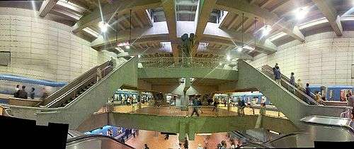
Montreal's metro is renowned for its architecture and public art. Under the direction of Drapeau, a competition among Canadian architects was held to decide the design of each station, ensuring that every station was built in a different style by a different architect. Several stations, such as Berri-UQAM, are important examples of modernist architecture, and various system-wide design choices were informed by the International Style.
Along with the Stockholm Metro, Montreal pioneered the installation of public art in the metro among capitalist countries, a practice that beforehand was mostly found in socialist and communist nations (the Moscow Metro being a case in point). More than fifty stations are decorated with over one hundred works of public art, such as sculpture, stained glass, and murals by noted Quebec artists, including members of the famous art movement, the Automatistes.
Some of the most important works in the Metro include the stained-glass window at Champ-de-Mars station, the masterpiece of major Quebec artist Marcelle Ferron; and the Guimard entrance at Square-Victoria-OACI station, like the famous metro entrances designed for the Paris Métro, on permanent loan[50] since 1966 by the RATP to commemorate its cooperation in constructing the metro. Installed in 1967 (the 100th anniversary of Hector Guimard's birth), this is the only authentic Guimard entrance in use outside Paris.a
Accessibility
The Montreal Metro had been a rather late adopter of accessibility compared to many subway systems (including those older than the Metro), much to the dismay of accessibility advocates in Montreal.[51] The first accessible stations on the system were the three stations in Laval, Cartier, De la Concorde and Montmorency which opened in 2007 as part of the Orange Line extension. Four existing stations - Lionel-Groulx, Berri-UQAM, Henri-Bourassa, and Cote-Vertu had been made accessible during the course of 2009 to 2010.[52] Bonaventure is equipped with elevators between the platforms and ticket hall; however, elevators connecting the latter to the street level have not yet been installed.
To date, there are nine accessible stations on the system, all of which along the Orange Line (though some are interchange stations): Côte-Vertu, Lionel-Groulx, Champ-de-Mars, Berri-UQAM (orange line only), Henri-Bourassa, Cartier, De la Concorde, Montmorency, Jean-Talon (orange line only), and most recently, Snowdon. As of July 2016, elevator installation works are underway at Rosemont, Place-d'Armes, and Honoré-Beaugrand, have been announced for Du Collège, Viau, and Mont-Royal.
One much-discussed issue is the lack of elevators at Vendôme, the station serving the new McGill University Health Centre mega-hospital. It was decided that retrofitting the existing entrance building for elevators would be prohibitively expensive; as a result, in December 2015, the Quebec government announced funding for the construction of a second entrance building for the station, which will include a direct underground connection to the hospital and will be wheelchair-accessible.[53] In the meantime, the STM has set up a bus line, 77 CUSM/Station Lionel-Groulx, connecting the wheelchair-accessible Lionel-Groulx station with the hospital.
Rolling stock
The Montreal Metro's 759-car fleet runs entirely underground and uses exclusively rubber tires instead of steel wheels. The Metro runs entirely underground because the cars are not weatherproof and the electrical system would be severely affected by rain and melting snow.
Conception of the first generation of rolling stock in Montreal went beyond just adopting the MP 59 metro car from Paris.
North American cities building modern metro systems (Washington, D.C., San Francisco, Atlanta, Montreal) in the 1960s and 1970s were in search of modern rolling stock that not only best fit their needs, but also encompassing a change in industrial design that focused on the aesthetics and performance of public transit vehicles.
Unlike the metro cars of most other systems, Montreal's cars do not have air conditioning.[54] The claim, stated by the STM, is that the metro is built entirely underground and air conditioning would heat the tunnels potentially creating a larger problem. The Montreal trains are among the oldest North American metro trains in service - the Canadian Vickers MR-63 dates back to the system's opening in 1966 and the Bombardier Transportation MR-73 to 1976 - but extended longevity is expected of rolling stock operated under fully sheltered conditions. The lack of air conditioning can make trips uncomfortable for passengers.[55] Passengers cannot move between cars once on board with the current train stock, which can be an inconvenience if the car becomes overcrowded or when looking for a seat. The trains are 2.5 m (8.20 ft) wide, narrower than the trains used by most other North American metro systems. This narrow width limits the train capacity, but allows the use of single tunnels (for both tracks) in construction of the metro lines.[56] In response to overcrowding on the orange line, a redesign of the MR-73 cars removed some seats to provide more standing room. The new Bombardier MPM-10 (AZUR) trains will allow passengers to move between cars once on board.
Design

Montreal's metro trains are made of LAHT (low-alloy high-tensile) steel, painted blue with a thick white stripe running lengthwise. Trains are assembled in three-, six- or nine-car lengths. Each three-car segment element consists of two motor cab cars encompassing a trailer car. Each car is 2.5 m (8 ft 2 3⁄8 in) wide and has four wide bi-parting leaf doors on each side for rapid passenger entry and egress. The small cross section of the cars allows easier tunnel construction under existing underground utilities. The total capacity of each car is 160 passengers, 39 to 40 of which are seated. Design specifications called for station dwell times of typically 8 to 15 seconds.
Each car has two sets of bogies (trucks), each with four sets of support tires, guide tires and backup conventional steel wheels. The motor cars each have four direct-current traction motors coupled to reduction gears and differentials. Montreal's metro trains use electromagnetic brakes, which create retarding forces against the side rails of the track. The electromagnetic brakes are generated by the train's kinetic energy until it has slowed down to about 10 km/h (6.2 mph). The train then uses composite brake blocks made of yellow birch injected with peanut oil to bring it to a complete stop. Two sets are applied against the treads of the steel wheels for friction braking. Hard braking produces a characteristic burnt popcorn scent. Wooden brake shoes perform well, but if subjected to numerous high-speed applications they develop a carbon film that diminishes brake performance.
Rubber tires on the Montreal Metro transmit minimal vibration and help the cars climb uphill more easily and negotiate turns at high speeds. However, the advantages of rubber tires are offset by noise levels generated by traction motors, which are noisier than the typical North American metro car. Trains can climb grades of up to 6.5%and economize the most energy when following a humped-station profile (track profiles that descend to accelerate after leaving a station and climb before entering the station). Steel-wheel train technology has undergone significant advances and can better round tight curves, and climb and descend similar grades and slopes but despite these advances, steel-wheel trains still cannot operate at high speeds (45 mph or 72 km/h) on the same steep or tightly curved track profiles as a train equipped with rubber tires.
Train operation
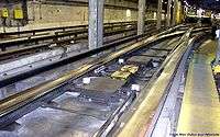
All lines but the Yellow Line are equipped with automatic train control. Generally, the train operator does the closing of doors and starts the DA (Départ automatique, automatic departure), and then the train drives itself. The train operator can also drive the train manually at his or her discretion. Signalling is effected through coded pulses sent through the rails. Coded speed orders and station stop positions transmitted through track beacons are captured by beacon readers mounted under the driver cabs. The information sent to the train's electronic modules conveys speed information, and it is up to the train automatic control system computer to conform to the imposed speed. Additionally, the train computer can receive energy-saving instructions from track beacons, providing the train with four different economical coasting modes, plus one mode for maximum performance. In case of manual control, track speed is displayed on the cab speedometer indicating the maximum permissible speed. The wayside signals consist of point (switch/turnout) position indicators in proximity to switches and inter-station signalling placed at each station stop. Trains often reach their maximum speed of 70–72 km/h (43.5–44.7 mph) in 16 to 26 seconds depending on grade and load.
Trains are programmed to stop at certain station positions with a precise odometer (accurate to plus or minus five centimetres). They receive their braking program and station stop positions orders (one-third, two-thirds, or end of station) from track beacons prior to entering the station, with additional beacons in the station for ensuring stop precision. The last beacon is positioned at precisely 12 turns of wheels from the end of the platform, which help improve the overall precision of the system.
Trains draw current from two sets of 750-volt direct current guide bar/third rails on either side of each motor car. Nine-car trains draw large currents of up to 6,000 amperes , requiring that all models of rolling stock have calibrated traction motor control systems to prevent power surges, arcing and breaker tripping. Both models have electrical braking (using motors) to assist primary friction braking, reducing the need to replace the brake pads.
The trains are equipped with double coverage broadband radio systems, provided by Thales Group.[57]
Models
The Montreal Metro uses three models of metro cars:
- Canadian Vickers MR-63
- Bombardier Transportation MR-73
- Bombardier-Alstom MPM-10
The oldest MR-63s have been in service since 1966. They were produced by the Canadian Vickers and mostly circulate on the Green line and are currently in the process of being retired.
The MR-73 have been in use since 1976 (and have been refurbished between 2005-2008). They were constructed by Bombardier. Those trains run on the Blue and Orange lines. They will soon be migrating to the Green line as newer Azur trains are being deployed on the Orange Line.
The brand new MPM-10 "Azur" model, which entered service in 2016. The STM is planning to replace the old MR-63 model with the Azur trains, and will result in the retirement of the MR-63 trains after over 50 years of service. The new model will have fully connected train wagons that allow passengers to move from one end of the train to the other.[58]
Maintenance facilities
Rolling stock maintenance is effected in three facilities, in two locations.
Plateau d'Youville
The Plateau d'Youville facility in the north end of the city is located at the intersection of Crémazie and Saint-Laurent Boulevards.
It provides heavy maintenance of buses, metro cars, light maintenance of MR-73 metro cars and is the main base for the track maintenance workshops (where track sections are pre-assembled prior to installation).
Beaugrand Garage
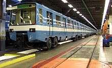
The Beaugrand Garage is located east of Line 1 terminus Honoré-Beaugrand. It is entirely underground, and its main access point is through the Honoré-Beaugrand station.
It has seven tracks to accommodate light maintenance on MR-63 metro cars and two test tracks.[59]
Centre d'attachement Duvernay
Duvernay is a garage and base for maintenance of way equipment. It accesses the network through the Line 1/Line 2 interchange southeast of Lionel-Groulx. The access building is located at the corner of Duvernay and Vinet streets in Sainte-Cunégonde.
Centre d'attachement Viau
Viau is a garage and base for maintenance of way equipment. It accesses the network immediately west of the Viau station (Line 1). The access building is within the Viau station building; in fact, facilities are visible from trains going west of the station.
Snowdon
The interchange track between Lines 2 and 5 south/west of Snowdon station is used for the storage of maintenance of way equipment. There are no surface facilities.
The tail tracks west of Snowdon station extend about 790 metres west of the station, reaching the border of the city of Hampstead. The end of the track is marked by an emergency exit on the corner of Queen Mary and Dufferin Roads.
Garages
Idle trains are stored in four garages: Angrignon (west of Angrignon Line 1 terminus), Beaugrand (east of Honoré-Beaugrand Line 1 terminus), Saint-Charles (north of Henri-Bourassa terminus) and Montmorency. The latter has been built perpendicular to its station to allow an easier potential expansion of the Line 2 deeper in Laval territory.
Future projects
City of Montreal
On June 12, 2008 the City of Montreal released its overall transportation plan for the immediate future. In addition to service improvements in bus and rail, the following projects were given priority status in the overall transportation scheme:
- The Blue Line will be extended in two phases: from Saint-Michel up to Pie-IX Boulevard. The second phase will extend past Pie-IX to the boroughs of Saint-Leonard and Anjou, committing to the line's original design. It would consist of four new stations: Viau, Lacordaire, Langelier and Anjou. This extension is planned to be completed in 2021.[60]
- The Orange Line could also be extended northwest from the Côte-Vertu station, up to the Bois-Franc commuter rail station in Saint-Laurent. The extension would include two stations: Poirier and Bois-Franc (an intermodal station with the Bois-Franc Station of the Deux-Montagnes commuter rail line). This extension is planned to be completed in 2022.[61] See also City of Laval below.
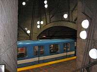
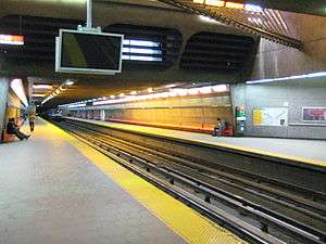
- A new extension of the Yellow Line from Berri-UQAM is being studied in the long term that would go to McGill station to ease congestion on that part of the Green Line.[62]
- A 2006 study rejected the possibility and cost of an extension from Lionel-Groulx to the City of Brossard on the south shore of Montreal as an alternative to the proposed light rail project in the Champlain bridge corridor.
City of Longueuil
- In 2001, the Réseau de transport de Longueuil (RTL) has considered an extension of the Yellow Line with four new stations beyond Longueuil–Université-de-Sherbrooke, under the city of Longueuil to Collège Édouard-Montpetit but their priority was switched to the construction of the proposed light rail project in the Champlain bridge corridor. In 2008, Longueuil Mayor Claude Gladu brought the proposal back to life stating that an expansion to College Édouard-Montpetit was a priority for his city.[63]
- The first new station (Vieux-Longueuil) is to be located at the corner of Rue Saint-Charles and Rue Saint-Jean in the Old Longueuil neighbourhood. This area is generally considered to be the downtown area of Longueuil.[64]
- The second station (Gentilly) would be located at the corner of Chemin Chambly and Rue Gentilly. The station would be located near the campus of Collège Édouard-Montpetit.[64]
- The third station (Curé-Poirier/Roland-Therrien) is to be located at the corner of Boulevard Curé-Poirier and Boulevard Roland-Therrien, a major intersection of two commercial arteries.[64]
- The fourth station (Jacques-Cartier/De Mortagne) would be located at the intersection of Boulevard Jacques-Cartier and Boulevard Roland-Therrien. This station would serve as a regional hub with buses available to the cities of Boucherville, Varennes and Sainte-Julie. It would also be in proximity to Centre hospitalier Pierre-Boucher, Longueuil's second largest hospital.[64]
City of Laval
- On July 22, 2007, the mayor of Laval, Gilles Vaillancourt, with the ridership success of the current Laval extension, announced his wish to loop the Orange Line from Montmorency to Côte-Vertu stations with the addition of six (or possibly seven) new stations (three in Laval and another three in Montreal). He proposed that Transports Quebec, the provincial transport department, set aside $100 million annually to fund the project, which is expected to cost upwards of $1.5 billion.[65] See also City of Montreal (Orange Line) above.
- On May 26, 2011, the mayor of Laval, Gilles Vaillancourt, after the successful opening of highway 25 toll bridge in the eastern part of Laval, proposed that Laval, in the next decades, will develop the remaining territories with a transit oriented development (TOD) approach called "Évolucité". At the heart of the project is a plan of building five new metro stations: four on the west branch of the Orange Line and one more on the east branch. The next to last station on the west branch will act as a corresponding station between the east branch and the west branch of the Orange Line; the finished line should look like this:
Future Line 2, West Branch to East Branch
- 1- Carrefour (*) (Daniel-Johnson/Le Carrefour) or Terminus Le Carrefour (AMT)
- 2- St-Martin (*) (C) (St-Martin Ouest/Chomedey)
- 3- Notre-Dame (*) (Notre-Dame/Curé-Labelle)
- 4- Lévesque (*) (Lévesque/Curé-Labelle)
- 5- Gouin (*) (Gouin/Grenet)
- 6- Bois-Franc (*) (Grenet/T, Bois-Franc station) (Boulevard Henri-Bourassa/Marcel-Laurin)
- 7- Poirier (*) (Poirier/Grenet)
- 8- Côte-Vertu & Terminus Côte-Vertu
- 9- Du Collège
- 10- De La Savane
- 11- Namur
- 12- Plamondon
- 13- Côte-Sainte-Catherine
- 14- Snowdon (C)
- 15- Villa-Maria
- 16- Vendôme (T, Vendôme station)
- 17- Place-Saint-Henri
- 18- Lionel-Groulx (C)
- 19- Georges-Vanier
- 20- Lucien-L'Allier (T, Lucien-L'Allier station)
- 21- Bonaventure (T, Central Station)
- 22- Square-Victoria-OACI
- 23- Place-d'Armes
- 24- Champ-de-Mars
- 25- Berri-UQAM (C)
- 26- Sherbrooke
- 27- Mont-Royal
- 28- Laurier
- 29- Rosemont
- 30- Beaubien
- 31- Jean-Talon (C)
- 32- Jarry
- 33- Crémazie
- 34- Sauvé (T, Sauve station)
- 35- Henri-Bourassa
- 36- Cartier
- 37- De La Concorde (T, De La Concorde station)
- 38- Montmorency
- 39- De l'Agora (*) (Armand-Frappier et Du Souvenir)
- 40- St-Martin (*) (C) (St-Martin Ouest / Chomedey)
- (*) New Metro station
- (C) Transfer station with other metro line or branch of the same line.
- (T) Transfer station with train line.
West Island
- Montreal's West Island newspapers have discussed in 2006 and 2007 plans to extend the Blue Line from Snowdon into the Notre-Dame-de-Grâce area of Montreal, as depicted in its original design.
Pioneer in tunnel advertising
In the early years of the Montreal Metro's life, a unique mode of advertising was used. In some downtown tunnels, cartoons depicting an advertiser's product were mounted on the walls of the tunnel at the level of the cars' windows. A retail film processing outfit called Direct Film advertised on the north wall in the Westbound track of the Guy (now Guy-Concordia)-to-Atwater Station (Green Line) during 1967-1969. Strobe lights, aimed at the frames of the cartoon and triggered by the passing train, sequentially illuminated the images so that they appeared to the viewer (passenger) on the train as a movie.[66] Today known as "tunnel movies" or "tunnel advertising", they have been installed in many cities' metros around the world in recent years,[67] for example in the Southgate tube station in London, the MBTA Red Line in Boston, MARTA in Atlanta, the DC Metro, San Francisco's Montgomery Bay Area Rapid Transit station, and on the North South MRT Line on the Mass Rapid Transit of Singapore.[68]
See also
- List of rapid transit systems
- List of North American rapid transit systems by ridership
- Metro systems by annual passenger rides
- Société de transport de Montréal
- Agence métropolitaine de transport
- Transportation in Canada
- Rapid transit in Canada
- Rubber-tired metro
- List of bridges spanning the Saint Lawrence River and Saint Lawrence Seaway
- List of bridges spanning the Rivière des Prairies
- List of crossings of the Rivière des Prairies
- Table of Montreal Metro stations
- List of Montreal bus routes
- Montreal Expo Express — demo mini-rapid transit line during Expo '67
- Underground City, Montreal
Further reading
- The Montreal Métro, a source of pride (PDF document)
- P.Laprise, ed. (1983). The Montreal Metro. Montreal: Metropolitan Transit Bureau. ISBN 2-920295-20-9
- Bombardier Transportation. (1974). MR-73: Fiche technique.
- Programme triennial d'immobilisations 2006-2007-2008 (PDF document)
- Voitures de métro MR-73 rénovées (PDF document)
- Rénovation des voitures de métro MR-73 (PDF document)
- Le « dou-dou-dou » du métro - Le hacheur de courant (PDF document)
Notes and references
- ^a Although reproductions using original molds were given to Mexico City (Metro Bellas Artes on line 8), Chicago (Van Buren Station on the Metra network), Lisbon (Picoas station on the yellow line) and Moscow (Kievskaya station on the Arbatsko-Pokrovskaya).
- ↑ "Bombardier to lay off 145 workers in La Pocatière over Metro car production stall". CBC News. January 23, 2015. Retrieved 4 April 2015.
- 1 2 "Transit Ridership Report, First Quarter, 2014" (PDF). American Public Transportation Association. May 21, 2014. p. 32. Retrieved 2014-07-24.
- 1 2 "Transit Ridership Report, Fourth Quarter, 2013" (PDF). American Public Transportation Association. February 14, 2014. p. 31. Retrieved 2014-07-24.
- 1 2 Montreal Metro at urbanrail.net
- 1 2 Montreal Metro at metrobits.org
- ↑ Yonah Freemark September 18th, 2009 (2009-09-18). "Montréal and Québec Leaders Announce "Irreversible" Decision to Expand Métro « The Transport Politic". Thetransportpolitic.com. Retrieved 2011-03-10.
- ↑ http://www.virgin-vacations.com/11-top-underground-transit-systems-in-the-world.aspx
- 1 2 3 (Clairoux 2001, p. 11).
- ↑ "Le Metro de Montreal : les projets 1902-1953". www.genealogieplanete.com (in French). Retrieved 2016-10-24.
- ↑ "Company timeline". Société de transport de Montréal. Retrieved 2016-10-24.
- 1 2 Gilbert, Dale. "Montréal Metro". The Canadian Encyclopedia. Retrieved 2016-10-24.
- ↑ (Clairoux 2001, p. 13).
- 1 2 3 "Métro history". Société de transport de Montréal. Retrieved 2016-10-25.
- ↑ (Clairoux 2001, p. 21).
- 1 2 Bureau de transport métropolitain (1983). Le métro de Montréal (in French). Bibliothèque nationale du Québec: Bureau de transport métropolitain. ISBN 2-920295-19-5.
- ↑ "Le film Horizon 2000 dévoilé en 1967 !". archivesdemontreal.com (in French). Archives de Montréal. Retrieved 2016-10-26.
- ↑ "Le futur n'était-il pas magnifique?". emdx.org. Retrieved 2016-10-26.
- ↑ "Expansion du réseau". esteemfoundation.org (in French). Retrieved 2016-10-27.
- ↑ "Line 5 - Blue". www.metrodemontreal.com. Retrieved 2016-10-27.
- ↑ "Achalandage record pour le transport en commun". Le Devoir (in French). Retrieved 2016-10-27.
- ↑ "Notes pour l'allocution du ministre des transports du Québec, Monsieur Jacques Brassard, lors de l'annonce des investissements pour le prolongement du métro a Laval." (PDF). bv.transports.gouv.qc.ca (in French). 1998-10-08.
- ↑ "Prolongement du metro vers Laval". agencequebecpresse.photoshelter.com (in French). Retrieved 2016-10-27.
- ↑ "Métro à Laval : Un succès sur toute la ligne". radio-canada.ca (in French). Retrieved 2011-03-10.
- ↑ "Priorisation des Projets d'investissements 2011-2020 de 11,5 G$". Société de transport de Montréal (in French). Retrieved 2016-10-27.
- ↑ "Guizot rectifier station". Société de transport de Montréal. Retrieved 2016-10-27.
- ↑ "Saint-Timothée mechanical ventilation station". Société de transport de Montréal. Retrieved 2016-10-27.
- ↑ "Saint-Dominique mechanical ventilation station". Société de transport de Montréal. Retrieved 2016-10-27.
- ↑ "Railway Gazette: Montréal's 2020 vision". Railway Gazette International. Retrieved 2 January 2012.
- ↑ Lessard, Denis. "Prolongement de la ligne bleue du métro: deux fois plus cher que prévu". La Presse (in French). Retrieved 2016-10-27.
- ↑ "Ottawa investirait dans le prolongement du métro de Montréal". Métro (in French). Retrieved 2016-03-17.
- ↑ "Useful info > Networks > Métro [map]". Société de transport de Montréal (STM). Retrieved 2014-07-24.
- ↑ "1 trip". Société de transport de Montréal. Retrieved 2016-10-27.
- ↑ "AMT - TRAM fares". www.amt.qc.ca. Retrieved 2016-10-27.
- ↑ "OPUS cards and other fare media". Société de transport de Montréal. Retrieved 2016-10-27.
- ↑ "La carte OPUS pourra être rechargée en ligne". La Presse (in French). Retrieved 2016-10-27.
- ↑ "STM developing mobile payment system for Android phones". CBC News. Retrieved 2016-10-27.
- ↑ "More Screens Added to the Subway System: Another Initiative to Better Inform the Clientele". Société de transport de Montréal. Retrieved 2016-10-27.
- ↑ "Autobus, métro : " On est entassés comme des bêtes "". Radio-Canada.ca (in French). ICI.Radio-Canada.ca. Retrieved 2016-10-27.
- ↑ Rapport annuel STM 2014. myvirtualpaper.com.
- ↑ "Palmarès des stations de métro les plus et les moins fréquentées". Métro (in French). 2012-07-08. Retrieved 2016-10-28.
- 1 2 "Budget 2016" (PDF). stm.info (in French). 2015-11-17.
- ↑ "STM's 2016-2018 Three-Year Capital Expenditures Program: $2.8B to improve the customer experience". Société de transport de Montréal. Retrieved 2016-10-31.
- ↑ "Quelle station de métro connaît le plus de crimes et de délits ?". Radio-Canada.ca (in French). Retrieved 2016-10-30.
- ↑ "Visite du centre de surveillance de la STM". TVA Nouvelles (in French). Retrieved 2016-10-30.
- ↑ "Sécurité dans le métro". Société de transport de Montréal. Retrieved 2016-10-30.
- ↑ "Ville de Montréal - L'eau de Montréal - Saviez-vous que...". ville.montreal.qc.ca. Retrieved 2016-10-30.
- ↑ "L'effet piston" (PDF). stm.info (in French).
- 1 2 "Frequently Asked Questions - metrodemontreal.com". www.metrodemontreal.com. Retrieved 2016-10-29.
- ↑ Bisson, Bruno. "Métro de Montréal: une refonte majeure du réseau". La Presse (in French). Retrieved 2016-10-29.
- ↑ Interview Pierre Bourgeau by SRC oct 2006
- ↑ Sutherland, Anne (2010-12-15). "Métro elevator plans stall". Montrealgazette.com. Retrieved 2011-03-10.
- ↑ ""Les ascenseurs des stations Lionel-Groulx et Berri-UQAM maintenant en service." ''Métro'' (Montreal). 14 September 2009. Accessed 20 September 2009". Journalmetro.com. 2010-12-21. Retrieved 2011-03-10.
- ↑ Shaffer, Marie-Ève (December 18, 2015). "http://journalmetro.com/actualites/montreal/893247/un-deuxieme-edicule-construit-a-la-station-vendome/". Métro. Retrieved 24 July 2016. External link in
|title=(help) - ↑ ""Métro et autobus: chaud débat sur la climatisation" ''Rue Frontenac'' (Montreal). 31 August 2010. Accessed 9 October 2010". Ruefrontenac.com. 2009-01-27. Retrieved 2011-03-10.
- ↑ "Montreal's Car-Free Day Week: The Target Market, The Image, the Underground Heat". Montreal.about.com. 2010-09-21. Retrieved 2011-03-10.
- ↑ "Frequently Asked Questions". metrodemontreal.com. Retrieved 2011-03-10.
- ↑ "Thales Awarded Communications System Contract for Montreal Metro" (Press release). Thales. November 30, 2011. Retrieved 10 June 2015.
- ↑ http://www.stm.info/en/about/major_projects/azur-metro
- ↑ "Visite du garage Honoré-Beaugrand". Marc Dufour. Retrieved 2013-04-10.
- ↑ http://www.newswire.ca/en/story/1381803/prolongement-de-la-ligne-bleue-du-metro
- ↑ "Ville de Montréal - Plan de transport - Le métro". Ville.montreal.qc.ca. Retrieved 2011-03-10.
- ↑ "Deux nouvelles stations en vue". Radio-canada.ca. 2008-03-03. Retrieved 2011-03-10.
- ↑ Grenier, Jean-Claude (11/12/2008). "Le maire de Longueuil réitère l'importance de prolonger le métro vers Edouard-Montpetit" (in French). 24 Heures. Check date values in:
|date=(help); - 1 2 3 4 Lapointe, Diane (2009-04-04). "EXCLUSIF - Prolongement du métro : Longueuil veut que le projet aboutisse" (in French). Le Courrier du Sud. Retrieved 2009-04-06.
- ↑ CA (2007-07-22). "Courrier Laval — Actualités — Montréal a bien d'autres priorités". Courrierlaval.com. Retrieved 2011-03-10.
- ↑ NamesPro.ca. "NamesPro.ca | Register with Confidence". Sidetrack.ca. Retrieved 2011-03-10.
- ↑ "PingMag - The Tokyo-based magazine about "Design and Making Things" " Archive " Top 10 ad-tricks in Tokyo's train stations". Pingmag.jp. 2006-10-13. Retrieved 2011-03-10.
- ↑ "Moving Tunnel Ads Debut in D.C. | Business solutions from". AllBusiness.com. Retrieved 2011-03-10.
Bibliography
- Clairoux, Benoît (2001). Le Métro de Montréal 35 ans déjà (in French). Éditions Hurtubise HMH. ISBN 978-2-89428-526-8.
External links
| Wikimedia Commons has media related to Montreal metro. |
- Société de transport de Montréal (STM) (English)
- Montreal by Metro (English)
- History of Metro station names in Montréal (French)
- Montreal Metro Google Maps mashup (English) (French)
- Agence métropolitaine de transport — Information on extension to Laval (French)
- Marc Dufour's site — Behind the scenes information in French (French)
- Topology of lines, garages, shops, interchanges and switches & crossovers. (French)
- CBC Digital Archives - Going Underground: Toronto's Subway and Montreal's Metro
- CBC Television Archives Talking about how hard it can be to open doors in Metro Stations.
- Sounds of the Montreal Metro by yototo
- Voir un schéma détaillé d'un Bogie (French)
- Exterior and interior station photos, in black and white only.
- Metro Bits - Photo gallery featuring art and architecture of various stations in Montreal (English)
- Le prolongement de la ligne 4 du métro dans Longueuil (French)
