| [3] |
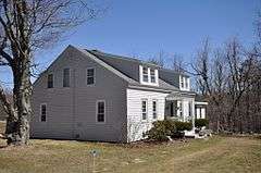
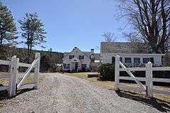
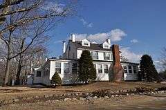
Name on the Register[4] |
Image |
Date listed[5] |
Location |
City or town |
Description |
|---|
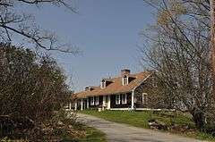
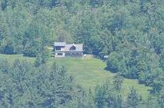
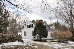
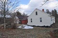
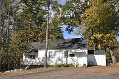
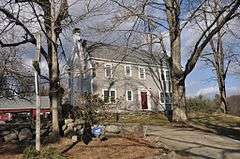
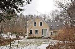
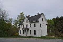
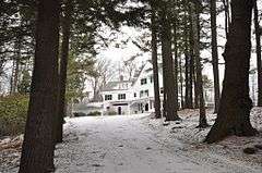
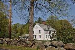
| 1 |
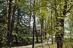
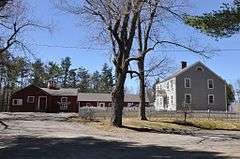
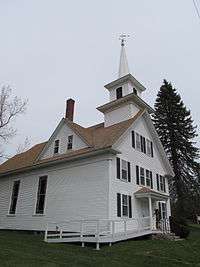
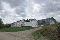
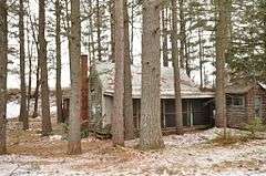
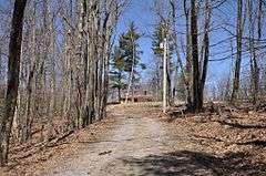
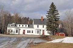
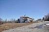
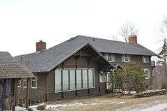
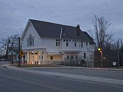
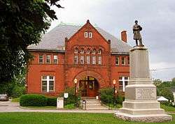
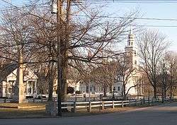
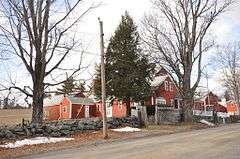
The Acre |
|
000000001988-01-14-0000January 14, 1988
(#86003257) |
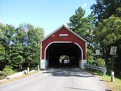
South of the lower part of the village of Harrisville at an S-curve in the road to Dublin
42°56′12″N 72°05′25″W / 42.936758°N 72.090154°W / 42.936758; -72.090154 (The Acre) |
Harrisville |
|
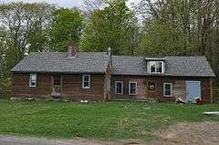
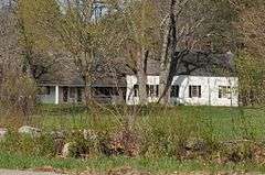
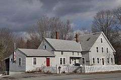
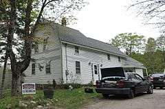
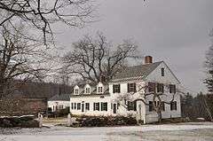
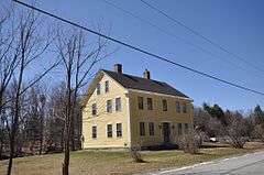
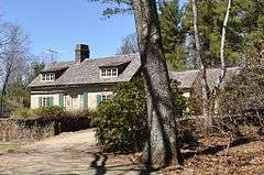
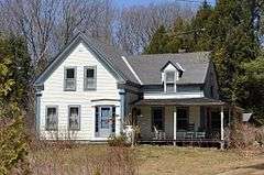
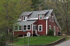
| 2 |
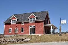
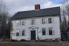
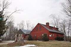
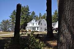
Adams Farm |
Upload image |
000000001988-01-14-0000January 14, 1988
(#86003246) |
Off MacVeagh Rd. near Fansnacloich
42°55′41″N 72°07′24″W / 42.928056°N 72.123333°W / 42.928056; -72.123333 (Adams Farm) |
Harrisville |
|
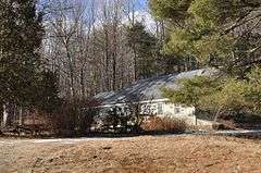
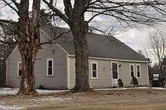
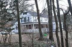
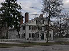
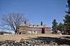
| 3 |
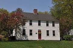
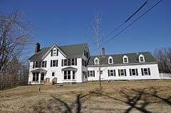
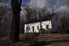
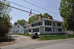
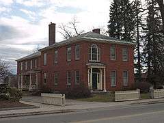
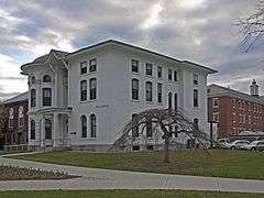
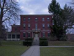
Dr. Daniel Adams House |
|
000000001989-06-08-0000June 8, 1989
(#89000449) |
324 Main St.
42°55′32″N 72°16′36″W / 42.925531°N 72.276642°W / 42.925531; -72.276642 (Dr. Daniel Adams House) |
Keene |
|
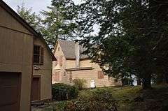
| 4 |
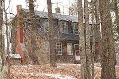
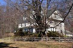
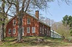
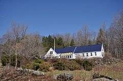
John Adams Homestead-Wellscroft |
|
000000001988-01-14-0000January 14, 1988
(#86003250) |
West of Sunset Hill Rd.
42°56′59″N 72°08′57″W / 42.9496°N 72.1491°W / 42.9496; -72.1491 (John Adams Homestead-Wellscroft) |
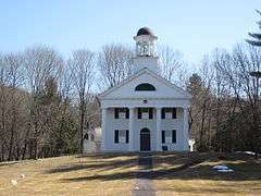
Harrisville |
|
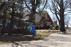
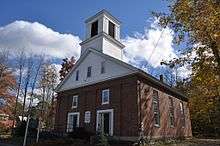
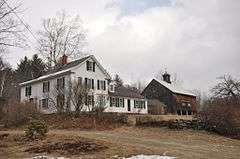
| 5 |
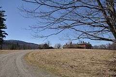
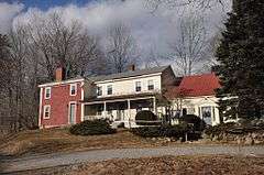
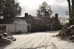
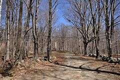
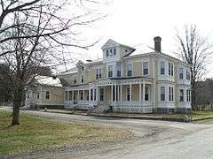
Aldworth Manor |
|
000000001988-01-14-0000January 14, 1988
(#86003244) |
On hill above IP-14 on the northern side of Chesham-Harrisville Rd.
42°57′01″N 72°06′55″W / 42.95014°N 72.115316°W / 42.95014; -72.115316 (Aldworth Manor) |
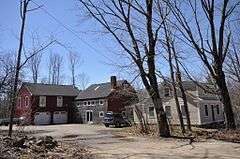
Harrisville |
|
| 6 |
Capt. Samuel Allison House |
|
000000001983-12-18-0000December 18, 1983
(#83004005) |
Keene Rd.
42°54′45″N 72°07′09″W / 42.9125°N 72.119167°W / 42.9125; -72.119167 (Capt. Samuel Allison House) |
Dublin |
|
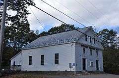
| 7 |
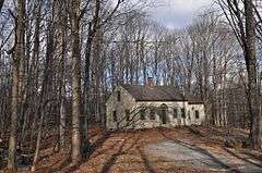
Amory Ballroom |
|
000000001985-05-02-0000May 2, 1985
(#85000921) |
Off Old Troy Rd.
42°53′35″N 72°05′45″W / 42.893°N 72.0959°W / 42.893; -72.0959 (Amory Ballroom) |
Dublin |
|
| 8 |
Amory House |
|
000000001983-12-15-0000December 15, 1983
(#83004006) |
Off Old Troy Rd.
42°53′37″N 72°06′01″W / 42.8937°N 72.1003°W / 42.8937; -72.1003 (Amory House) |
Dublin |
|
| 9 |
Amory-Appel Cottage |
|
000000001985-05-02-0000May 2, 1985
(#85000920) |
Off Old Troy Rd.
42°53′36″N 72°05′42″W / 42.893333°N 72.095°W / 42.893333; -72.095 (Amory-Appel Cottage) |
Dublin |
|
| 10 |
Appleton Farm |
|
000000001983-12-18-0000December 18, 1983
(#83004008) |
73 Hancock Rd.
42°54′26″N 72°01′24″W / 42.907222°N 72.023333°W / 42.907222; -72.023333 (Appleton Farm) |
Dublin |
Houses Del Rossi's Trattoria
|
| 11 |
Appleton-Hannaford House |
|
000000001983-12-15-0000December 15, 1983
(#83004007) |
253 Hancock Rd.
42°54′37″N 72°00′25″W / 42.910278°N 72.006944°W / 42.910278; -72.006944 (Appleton-Hannaford House) |
Dublin |
|
| 12 |
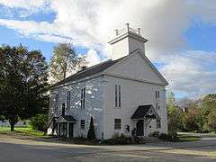
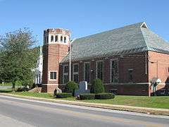
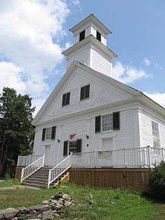
Asbury United Methodist Church |
|
000000001983-12-21-0000December 21, 1983
(#83004009) |
NH 63
42°53′17″N 72°28′14″W / 42.888056°N 72.470556°W / 42.888056; -72.470556 (Asbury United Methodist Church) |
Chesterfield |
|
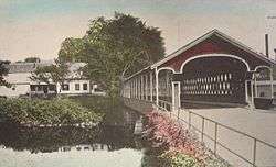
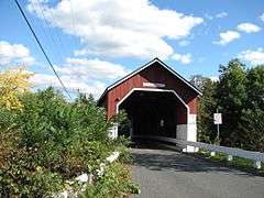
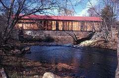
| 13 |
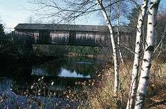
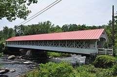
Ashuelot Covered Bridge |
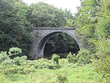
|
000000001981-02-20-0000February 20, 1981
(#81000069) |
NH 119 and Bolton Rd.
42°46′35″N 72°25′26″W / 42.776389°N 72.423889°W / 42.776389; -72.423889 (Ashuelot Covered Bridge) |
Ashuelot |
Over Ashuelot River
|
| 14 |
Ballou-Newbegin House |
|
000000001983-12-18-0000December 18, 1983
(#83004011) |
Old Marlborough Rd.
42°53′39″N 72°08′38″W / 42.894167°N 72.143889°W / 42.894167; -72.143889 (Ballou-Newbegin House) |
Dublin |
|
| 15 |
Timothy Bancroft House |
|
000000001988-01-14-0000January 14, 1988
(#86003241) |
Bancroft Rd.
42°57′57″N 72°05′55″W / 42.965797°N 72.098597°W / 42.965797; -72.098597 (Timothy Bancroft House) |
Harrisville |
|
| 16 |
Persia Beal House |
|
000000001988-01-14-0000January 14, 1988
(#86003243) |
Northern side of Chesham Rd., west of IP-13
42°56′41″N 72°06′15″W / 42.944612°N 72.104144°W / 42.944612; -72.104144 (Persia Beal House) |
Harrisville |
Now the Harrisville Inn
|
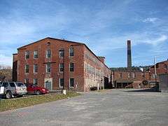
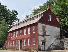
| 17 |
Beaver Mills |
|
000000001999-12-09-0000December 9, 1999
(#99001481) |
93-115 Railroad St.
42°55′56″N 72°16′27″W / 42.932222°N 72.274167°W / 42.932222; -72.274167 (Beaver Mills) |
Keene |
|
| 18 |
Beech Hill |
|
000000001983-12-15-0000December 15, 1983
(#83004012) |
Off New Harrisville Rd.
42°54′39″N 72°04′00″W / 42.910833°N 72.066667°W / 42.910833; -72.066667 (Beech Hill) |
Dublin |
|
| 19 |
Beech Hill Summer Home District |
|
000000001988-01-14-0000January 14, 1988
(#86003079) |
Roughly Venable, Appleton, and Old Harrisville Rds.
42°55′31″N 72°05′11″W / 42.925278°N 72.086389°W / 42.925278; -72.086389 (Beech Hill Summer Home District) |
Harrisville |
Six summer properties primarily along Old Harrisville Rd.
|
| 20 |
Elbridge G. Bemis House |
|
000000001988-01-14-0000January 14, 1988
(#86003247) |
Chesham Rd.
42°56′14″N 72°08′33″W / 42.937222°N 72.1425°W / 42.937222; -72.1425 (Elbridge G. Bemis House) |
Harrisville |
|
| 21 |
George Bemis House |
|
000000001988-01-14-0000January 14, 1988
(#86003248) |
Chesham Rd.
42°56′15″N 72°08′31″W / 42.9375°N 72.141944°W / 42.9375; -72.141944 (George Bemis House) |
Harrisville |
|
| 22 |
Brackett House |
|
000000001983-12-18-0000December 18, 1983
(#83004013) |
High Ridge Rd.
42°52′45″N 71°59′45″W / 42.879167°N 71.995833°W / 42.879167; -71.995833 (Brackett House) |
Dublin |
|
| 23 |
Stephen Rowe Bradley House |
|
000000002005-12-22-0000December 22, 2005
(#05001445) |
43 Westminster St.
43°04′46″N 72°25′49″W / 43.079444°N 72.430278°W / 43.079444; -72.430278 (Stephen Rowe Bradley House) |
Walpole |
|
| 24 |
Buckminster-Kingsbury Farm |
|
000000002011-12-30-0000December 30, 2011
(#11000964) |
80 Houghton Ledge Rd.
42°58′30″N 72°12′37″W / 42.974994°N 72.21025°W / 42.974994; -72.21025 (Buckminster-Kingsbury Farm) |
Roxbury |
|
| 25 |
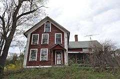
Burpee Farm |
|
000000001983-12-18-0000December 18, 1983
(#83004014) |
Burpee Rd.
42°52′19″N 72°04′15″W / 42.871944°N 72.070833°W / 42.871944; -72.070833 (Burpee Farm) |
Dublin |
Destroyed by fire in 2013[6]
|
| 26 |
Louis Cabot House |
|
000000001983-12-18-0000December 18, 1983
(#83004015) |
Windmill Hill Rd.
42°53′25″N 72°02′11″W / 42.890278°N 72.036389°W / 42.890278; -72.036389 (Louis Cabot House) |
Dublin |
|
| 27 |
T. H. Cabot Cottage |
Upload image |
000000001983-12-15-0000December 15, 1983
(#83004016) |
Snow Hill Rd.
42°53′53″N 72°04′07″W / 42.898056°N 72.068611°W / 42.898056; -72.068611 (T. H. Cabot Cottage) |
Dublin |
|
| 28 |
Carleton Bridge |
|
000000001975-06-10-0000June 10, 1975
(#75000121) |
On Carleton Rd. over South Branch Ashuelot River
42°51′14″N 72°16′28″W / 42.853889°N 72.274444°W / 42.853889; -72.274444 (Carleton Bridge) |
East Swanzey |
|
| 29 |
George Cheever Farm |
|
000000001988-01-14-0000January 14, 1988
(#86003238) |
Intersection of Nelson and Tolman Pond Rds.
42°57′20″N 72°06′29″W / 42.955417°N 72.107921°W / 42.955417; -72.107921 (George Cheever Farm) |
Harrisville |
|
| 30 |
Chesham Village District |
|
000000001986-12-29-0000December 29, 1986
(#86003102) |
Roughly bounded by Yellow Wings, Seaver, Chesham, and Marienfield Rds.
42°56′06″N 72°08′43″W / 42.935°N 72.145278°W / 42.935; -72.145278 (Chesham Village District) |
Harrisville |
|
| 31 |
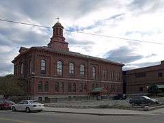
Cheshire County Courthouse |
|
000000001978-12-13-0000December 13, 1978
(#78000210) |
12 Court St.
42°56′03″N 72°16′48″W / 42.934167°N 72.28°W / 42.934167; -72.28 (Cheshire County Courthouse) |
Keene |
|
| 32 |
Clymer House |
|
000000001988-01-14-0000January 14, 1988
(#86003239) |
31 Clymer Rd.
42°57′40″N 72°06′14″W / 42.961134°N 72.103801°W / 42.961134; -72.103801 (Clymer House) |
Harrisville |
|
| 33 |
Colony House |
|
000000002005-09-09-0000September 9, 2005
(#05000969) |
104 West St.
42°55′59″N 72°16′56″W / 42.932928°N 72.282275°W / 42.932928; -72.282275 (Colony House) |
Keene |
|
| 34 |
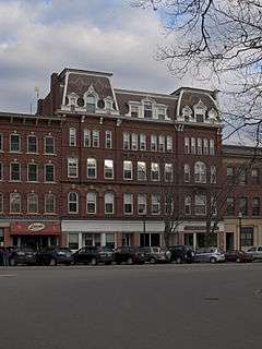
Colony's Block |
|
000000001983-03-24-0000March 24, 1983
(#83001134) |
4-7 Central Square
42°56′02″N 72°16′40″W / 42.934006°N 72.277872°W / 42.934006; -72.277872 (Colony's Block) |
Keene |
|
| 35 |
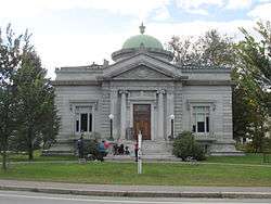
Conant Public Library |
|
000000001987-08-27-0000August 27, 1987
(#87001420) |
Main St.
42°46′19″N 72°23′03″W / 42.771944°N 72.384167°W / 42.771944; -72.384167 (Conant Public Library) |
Winchester |
|
| 36 |
Noah Cooke House |
|
000000001973-04-23-0000April 23, 1973
(#73000268) |
West of Keene on Daniels Hill Rd.
42°55′32″N 72°20′24″W / 42.925556°N 72.34°W / 42.925556; -72.34 (Noah Cooke House) |
Keene |
|
| 37 |
Coombs Covered Bridge |
|
000000001976-11-21-0000November 21, 1976
(#76000122) |
North of Winchester off NH 10
42°50′17″N 72°21′43″W / 42.838056°N 72.361944°W / 42.838056; -72.361944 (Coombs Covered Bridge) |
Winchester |
Over Ashuelot River
|
| 38 |
Corey Farm |
|
000000001983-12-15-0000December 15, 1983
(#83004017) |
Parsons Rd.
42°53′01″N 72°02′59″W / 42.883611°N 72.049722°W / 42.883611; -72.049722 (Corey Farm) |
Dublin |
|
| 39 |
Derby Shop-Goodnow Pail Factory-Holman & Merriman Machine Shop-L. A. Carpenter Machine Shop-Streeter Shop |
|
000000002007-12-11-0000December 11, 2007
(#07001260) |
63 Canal St.
42°47′17″N 72°28′30″W / 42.788056°N 72.475°W / 42.788056; -72.475 (Derby Shop-Goodnow Pail Factory-Holman & Merriman Machine Shop-L. A. Carpenter Machine Shop-Streeter Shop) |
Hinsdale |
|
| 40 |
Dinsmoor-Hale House |
|
000000001976-04-26-0000April 26, 1976
(#76000197) |
Main and Winchester Sts.
42°55′41″N 72°16′41″W / 42.927972°N 72.278175°W / 42.927972; -72.278175 (Dinsmoor-Hale House) |
Keene |
|
| 41 |
Drewsville Mansion |
|
000000001996-09-13-0000September 13, 1996
(#96000953) |
Old Cheshire Turnpike at the southern end of the Drewsville village common
43°07′36″N 72°23′34″W / 43.126667°N 72.392778°W / 43.126667; -72.392778 (Drewsville Mansion) |
Walpole |
|
| 42 |
Dublin Lake Historic District |
|
000000001983-12-18-0000December 18, 1983
(#83004018) |
Lake, E. Lake, W. Lake, and Old Harrisville Rds.
42°54′30″N 72°05′00″W / 42.908333°N 72.083333°W / 42.908333; -72.083333 (Dublin Lake Historic District) |
Dublin |
Properties surrounding the pond
|
| 43 |
Dublin Town Hall |
|
000000001980-06-25-0000June 25, 1980
(#80000275) |
NH 101
42°54′21″N 72°03′39″W / 42.905744°N 72.060744°W / 42.905744; -72.060744 (Dublin Town Hall) |
Dublin |
|
| 44 |
Dublin Village Historic District |
|
000000001983-12-15-0000December 15, 1983
(#83004019) |
Old Common and Harrisville Rds. and Main and Church Sts.
42°54′22″N 72°03′37″W / 42.906144°N 72.0603°W / 42.906144; -72.0603 (Dublin Village Historic District) |
Dublin |
|
| 45 |
East Jaffrey Historic District |
|
000000002002-06-14-0000June 14, 2002
(#02000642) |
Roughly along NH 124 through Jaffrey
42°49′40″N 72°03′17″W / 42.8279°N 72.0546°W / 42.8279; -72.0546 (East Jaffrey Historic District) |
Jaffrey |
|
| 46 |
Moses Eaton, Jr., House |
|
000000001988-01-14-0000January 14, 1988
(#86003106) |
NH 137
42°56′04″N 72°00′57″W / 42.934400°N 72.015900°W / 42.934400; -72.015900 (Moses Eaton, Jr., House) |
Harrisville |
|
| 47 |
Elliot Mansion |
|
000000001976-04-30-0000April 30, 1976
(#76000220) |
305 Main St.
42°55′33″N 72°16′41″W / 42.925833°N 72.278056°W / 42.925833; -72.278056 (Elliot Mansion) |
Keene |
|
| 48 |
Eveleth Farm |
|
000000001983-12-18-0000December 18, 1983
(#83004020) |
Burpee Rd.
42°52′20″N 72°04′24″W / 42.872222°N 72.073333°W / 42.872222; -72.073333 (Eveleth Farm) |
Dublin |
|
| 49 |
Far Horizons |
|
000000001983-12-15-0000December 15, 1983
(#83004023) |
Learned Rd.
42°52′48″N 72°04′23″W / 42.88°N 72.073056°W / 42.88; -72.073056 (Far Horizons) |
Dublin |
|
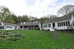
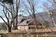
| 50 |
Corban C. Farwell Homestead |
|
000000001988-01-14-0000January 14, 1988
(#86003253) |
Northern side of Childs Bog Rd.
42°57′09″N 72°07′50″W / 42.952591°N 72.130494°W / 42.952591; -72.130494 (Corban C. Farwell Homestead) |
Harrisville |
|
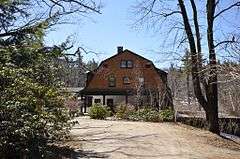
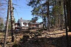
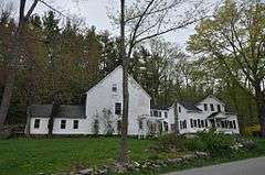
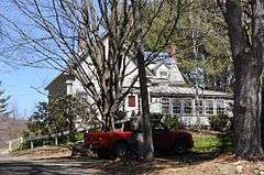
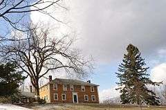
| 51 |
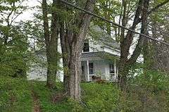
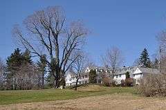
Fasnacloich |
Upload image |
000000001988-01-14-0000January 14, 1988
(#86003245) |
Four Hill Rd., north of the Dublin town line
42°55′27″N 72°06′30″W / 42.924167°N 72.108333°W / 42.924167; -72.108333 (Fasnacloich) |
Harrisville |
|
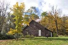
| 52 |
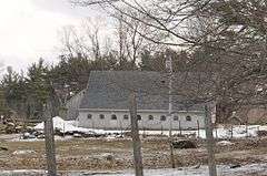
Fisk Barn |
|
000000001983-12-18-0000December 18, 1983
(#83004024) |
Gerry Rd.
42°53′38″N 72°01′42″W / 42.893889°N 72.028333°W / 42.893889; -72.028333 (Fisk Barn) |
Dublin |
|
| 53 |
Catherine Fiske Seminary For Young Ladies |
|
000000001976-05-03-0000May 3, 1976
(#76000196) |
251 Main St.
42°55′39″N 72°16′41″W / 42.927397°N 72.277967°W / 42.927397; -72.277967 (Catherine Fiske Seminary For Young Ladies) |
Keene |
|
| 54 |
Fitzwilliam Common Historic District |
|
000000001997-05-02-0000May 2, 1997
(#97000399) |
Junction of NH 119, Richmond Rd., and the Templeton Highway
42°46′45″N 72°08′47″W / 42.7792°N 72.1464°W / 42.7792; -72.1464 (Fitzwilliam Common Historic District) |
Fitzwilliam |
|
| 55 |
Foothill Farm |
|
000000001983-12-15-0000December 15, 1983
(#83004025) |
Old Troy Rd.
42°53′47″N 72°06′16″W / 42.896389°N 72.104444°W / 42.896389; -72.104444 (Foothill Farm) |
Dublin |
|
| 56 |
Frost Farm |
|
000000001983-12-15-0000December 15, 1983
(#83004026) |
Old Marlborough Rd.
42°53′54″N 72°06′37″W / 42.898469°N 72.110339°W / 42.898469; -72.110339 (Frost Farm) |
Dublin |
Now Fairwood Bible Institute
|
| 57 |
Frost Farm |
|
000000001983-12-18-0000December 18, 1983
(#83004027) |
Korpi Rd.
42°52′15″N 72°01′35″W / 42.870833°N 72.026389°W / 42.870833; -72.026389 (Frost Farm) |
Dublin |
|
| 58 |
Gilchrest |
|
000000001988-01-14-0000January 14, 1988
(#86003105) |
NH 137
42°55′44″N 72°00′57″W / 42.9289°N 72.0159°W / 42.9289; -72.0159 (Gilchrest) |
Harrisville |
|
| 59 |
Gilsum Stone Arch Bridge |
|
000000001989-08-31-0000August 31, 1989
(#89001207) |
Surry Rd. over the Ashuelot River, west of its junction with NH 10
43°02′20″N 72°16′14″W / 43.038889°N 72.270556°W / 43.038889; -72.270556 (Gilsum Stone Arch Bridge) |
Gilsum |
|
| 60 |
Glenchrest |
|
000000001988-01-14-0000January 14, 1988
(#86003104) |
NH 137
42°55′38″N 72°00′54″W / 42.9272°N 72.01505°W / 42.9272; -72.01505 (Glenchrest) |
Harrisville |
|
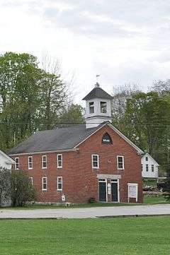
| 61 |
Golden Rod Grange No. 114 |
|
000000001994-03-17-0000March 17, 1994
(#94000169) |
Western side of NH 32, 0.1 mi (0.16 km) south of its junction with Eaton Rd.
42°52′20″N 72°16′57″W / 42.872222°N 72.2825°W / 42.872222; -72.2825 (Golden Rod Grange No. 114) |
Swanzey |
|
| 62 |
James Gowing Farm |
|
000000001983-12-18-0000December 18, 1983
(#83004028) |
Page Rd.
42°52′41″N 72°02′13″W / 42.878056°N 72.036944°W / 42.878056; -72.036944 (James Gowing Farm) |
Dublin |
Now the Dublin Christian Academy
|
| 63 |
Joseph Gowing Farm |
|
000000001983-12-15-0000December 15, 1983
(#83004029) |
Page Rd.
42°52′53″N 72°02′13″W / 42.881389°N 72.036944°W / 42.881389; -72.036944 (Joseph Gowing Farm) |
Dublin |
|
| 64 |
Grace United Methodist Church |
|
000000001985-03-07-0000March 7, 1985
(#85000476) |
34 Court St.
42°56′04″N 72°17′03″W / 42.934444°N 72.284167°W / 42.934444; -72.284167 (Grace United Methodist Church) |
Keene |
|
| 65 |
Isaac Greenwood House |
|
000000001983-12-18-0000December 18, 1983
(#83004034) |
Peterborough Rd.
42°54′26″N 72°02′34″W / 42.9072°N 72.0429°W / 42.9072; -72.0429 (Isaac Greenwood House) |
Dublin |
|
| 66 |
Moses Greenwood House |
|
000000001983-12-15-0000December 15, 1983
(#83004036) |
Pierce and Old County Rds.
42°54′16″N 72°02′33″W / 42.904444°N 72.0425°W / 42.904444; -72.0425 (Moses Greenwood House) |
Dublin |
|
| 67 |
Harrisville Historic District |
|
000000001971-09-17-0000September 17, 1971
(#71000072) |
Central Harrisville and its environs
42°56′52″N 72°05′49″W / 42.947778°N 72.096944°W / 42.947778; -72.096944 (Harrisville Historic District) |
Harrisville and vicinity |
National Historic Landmark; a picturesque mill town
|
| 68 |
Harrisville Rural District |
|
000000001987-02-18-0000February 18, 1987
(#86003078) |
Roughly along Venable, Old Harrisville, New Harrisville, and Bonds Corner Rds.
42°55′36″N 72°04′42″W / 42.926667°N 72.078333°W / 42.926667; -72.078333 (Harrisville Rural District) |
Harrisville |
|
| 69 |
High Tops School |
|
000000001984-12-13-0000December 13, 1984
(#84000519) |
Reynolds and River Rds.
42°57′45″N 72°29′16″W / 42.9625°N 72.487778°W / 42.9625; -72.487778 (High Tops School) |
Westmoreland |
|
| 70 |
Hutchinson House |
|
000000002015-02-02-0000February 2, 2015
(#14001240) |
400 Alstead Center Rd.
43°07′26″N 72°19′39″W / 43.123967°N 72.327611°W / 43.123967; -72.327611 (Hutchinson House) |
Alstead |
|
| 71 |
Ivanov-Rinov House |
|
000000001983-12-18-0000December 18, 1983
(#83004038) |
88 Pierce Rd.
42°53′58″N 72°02′34″W / 42.899444°N 72.042778°W / 42.899444; -72.042778 (Ivanov-Rinov House) |
Dublin |
|
| 72 |
Jaffrey Center Historic District |
|
000000001975-06-11-0000June 11, 1975
(#75000122) |
Northwest of Jaffrey on NH 124
42°49′38″N 72°03′13″W / 42.8272°N 72.0536°W / 42.8272; -72.0536 (Jaffrey Center Historic District) |
Jaffrey |
|
| 73 |
Jaffrey Mills |
|
000000001982-08-10-0000August 10, 1982
(#82004992) |
41 Main St.
42°48′54″N 72°01′25″W / 42.815°N 72.0236°W / 42.815; -72.0236 (Jaffrey Mills) |
Jaffrey |
Converted to residences
|
| 74 |
Jewett-Kemp-Marlens House |
|
000000001997-05-30-0000May 30, 1997
(#97000506) |
North Rd., 2 mi (3.2 km) north of its junction with NH 123
43°09′26″N 72°17′36″W / 43.157222°N 72.293333°W / 43.157222; -72.293333 (Jewett-Kemp-Marlens House) |
Alstead |
|
| 75 |
Jones Hall |
|
000000001984-06-07-0000June 7, 1984
(#84002722) |
Church St.
43°06′59″N 72°11′59″W / 43.116389°N 72.199722°W / 43.116389; -72.199722 (Jones Hall) |
Marlow |
|
| 76 |
Kendall Cottage |
|
000000001988-01-14-0000January 14, 1988
(#86003251) |
Northern side of Silver Lake Rd.
42°56′46″N 72°08′11″W / 42.94612°N 72.136502°W / 42.94612; -72.136502 (Kendall Cottage) |
Harrisville |
|
| 77 |
Knollwood |
|
000000001983-12-18-0000December 18, 1983
(#83004039) |
Windmill Hill Rd.
42°53′35″N 72°03′34″W / 42.893056°N 72.059444°W / 42.893056; -72.059444 (Knollwood) |
Dublin |
|
| 78 |
Lattice Cottage |
|
000000001983-12-15-0000December 15, 1983
(#83004040) |
Off Old Troy Rd.
42°53′31″N 72°05′38″W / 42.891944°N 72.093889°W / 42.891944; -72.093889 (Lattice Cottage) |
Dublin |
|
| 79 |
Lawrence Farm |
|
000000002000-06-09-0000June 9, 2000
(#00000650) |
9 Lawrence Rd.
42°50′39″N 72°11′11″W / 42.844167°N 72.186389°W / 42.844167; -72.186389 (Lawrence Farm) |
Troy |
|
| 80 |
Learned Homestead |
|
000000001983-12-15-0000December 15, 1983
(#83004043) |
Upper Jaffrey Rd.
42°53′41″N 72°03′37″W / 42.894722°N 72.060278°W / 42.894722; -72.060278 (Learned Homestead) |
Dublin |
|
| 81 |
Amos Learned Farm |
|
000000001983-12-15-0000December 15, 1983
(#83004041) |
NH 137
42°53′34″N 72°01′27″W / 42.892778°N 72.024167°W / 42.892778; -72.024167 (Amos Learned Farm) |
Dublin |
|
| 82 |
Benjamin Learned House |
|
000000001983-12-18-0000December 18, 1983
(#83004042) |
Upper Jaffrey Rd.
42°53′46″N 72°03′37″W / 42.896111°N 72.060278°W / 42.896111; -72.060278 (Benjamin Learned House) |
Dublin |
|
| 83 |
Markham House |
|
000000001983-12-18-0000December 18, 1983
(#83004044) |
Snow Hill Rd.
42°54′11″N 72°04′06″W / 42.903056°N 72.068333°W / 42.903056; -72.068333 (Markham House) |
Dublin |
|
| 84 |
Benjamin Marshall House |
|
000000001983-12-15-0000December 15, 1983
(#83004046) |
1541 Peterborough Rd.
42°54′05″N 72°01′28″W / 42.901389°N 72.024444°W / 42.901389; -72.024444 (Benjamin Marshall House) |
Dublin |
|
| 85 |
Micajah Martin Farm |
|
000000001983-12-18-0000December 18, 1983
(#83004047) |
Old Peterborough Rd.
42°53′44″N 72°00′44″W / 42.895556°N 72.012222°W / 42.895556; -72.012222 (Micajah Martin Farm) |
Dublin |
|
| 86 |
Mason House |
|
000000001983-12-15-0000December 15, 1983
(#83004049) |
Snow Hill Rd.
42°54′06″N 72°03′57″W / 42.901667°N 72.065833°W / 42.901667; -72.065833 (Mason House) |
Dublin |
|
| 87 |
Mason-Watkins House |
|
000000001982-03-11-0000March 11, 1982
(#82001670) |
RD # 2
42°59′12″N 72°20′18″W / 42.986667°N 72.338333°W / 42.986667; -72.338333 (Mason-Watkins House) |
Surry |
|
| 88 |
McKenna Cottage |
|
000000001983-12-18-0000December 18, 1983
(#83004051) |
Windmill Hill Rd.
42°53′37″N 72°02′58″W / 42.8937°N 72.0494°W / 42.8937; -72.0494 (McKenna Cottage) |
Dublin |
|
| 89 |
Moore Farm and Twitchell Mill Site |
|
000000001983-12-18-0000December 18, 1983
(#83004052) |
Off Page Rd.
42°51′58″N 72°02′04″W / 42.866111°N 72.034444°W / 42.866111; -72.034444 (Moore Farm and Twitchell Mill Site) |
Dublin |
|
| 90 |
Asa Morse Farm |
|
000000001983-12-15-0000December 15, 1983
(#83004054) |
NH 101
42°54′47″N 72°05′39″W / 42.913056°N 72.094167°W / 42.913056; -72.094167 (Asa Morse Farm) |
Dublin |
|
| 91 |
Capt. Thomas Morse Farm |
|
000000001983-12-15-0000December 15, 1983
(#83004055) |
Old Marlborough Rd.
42°54′01″N 72°06′22″W / 42.900278°N 72.106111°W / 42.900278; -72.106111 (Capt. Thomas Morse Farm) |
Dublin |
|
| 92 |
Eli Morse Farm |
|
000000001983-04-11-0000April 11, 1983
(#83001135) |
Lake Rd.
42°53′43″N 72°05′08″W / 42.895278°N 72.085556°W / 42.895278; -72.085556 (Eli Morse Farm) |
Dublin |
|
| 93 |
Eli Morse Sawmill Foundations |
Upload image |
000000001983-12-18-0000December 18, 1983
(#83004056) |
Off Old Marlborough Rd.
42°53′57″N 72°05′31″W / 42.899167°N 72.091944°W / 42.899167; -72.091944 (Eli Morse Sawmill Foundations) |
Dublin |
|
| 94 |
Mountain View Farm |
|
000000001983-12-18-0000December 18, 1983
(#83004057) |
Upper Jaffrey Rd.
42°53′20″N 72°04′03″W / 42.888889°N 72.0675°W / 42.888889; -72.0675 (Mountain View Farm) |
Dublin |
|
| 95 |
Needham House |
|
000000001988-01-14-0000January 14, 1988
(#86003254) |
Meadow Rd.
42°55′45″N 72°09′07″W / 42.929303°N 72.151843°W / 42.929303; -72.151843 (Needham House) |
Harrisville |
|
| 96 |
Nelson Schoolhouse |
|
000000001973-04-23-0000April 23, 1973
(#73000251) |
Old Sullivan Rd.
42°59′22″N 72°07′38″W / 42.989424°N 72.127268°W / 42.989424; -72.127268 (Nelson Schoolhouse) |
Nelson |
|
| 97 |
New Hampshire Conservatory of Music and the Arts |
|
000000001980-05-15-0000May 15, 1980
(#80000276) |
Central Sq.
42°46′24″N 72°22′59″W / 42.773333°N 72.383056°W / 42.773333; -72.383056 (New Hampshire Conservatory of Music and the Arts) |
Winchester |
|
| 98 |
Old Patch Place |
|
000000001980-08-15-0000August 15, 1980
(#80000277) |
West of Fitzwilliam on Rhododendron Rd.
42°47′02″N 72°11′28″W / 42.7839°N 72.1911°W / 42.7839; -72.1911 (Old Patch Place) |
Fitzwilliam |
|
| 99 |
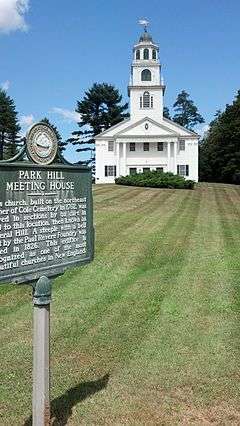
Park Hill Meetinghouse |
|
000000001980-09-08-0000September 8, 1980
(#80000278) |
Park Hill
42°58′31″N 72°27′24″W / 42.975278°N 72.456667°W / 42.975278; -72.456667 (Park Hill Meetinghouse) |
Westmoreland |
|
| 100 |
Parsons Studio and Casino |
|
000000001983-12-18-0000December 18, 1983
(#83004058) |
Parsons Rd.
42°53′07″N 72°03′07″W / 42.885278°N 72.051944°W / 42.885278; -72.051944 (Parsons Studio and Casino) |
Dublin |
|
| 101 |
Peck-Porter House |
|
000000002000-08-31-0000August 31, 2000
(#00001037) |
Main St., junction with Middle St.
43°04′41″N 72°25′37″W / 43.078056°N 72.426944°W / 43.078056; -72.426944 (Peck-Porter House) |
Walpole |
|
| 102 |
Ivory Perry Homestead |
|
000000001983-12-15-0000December 15, 1983
(#83004061) |
Corner Valley and Dooe Rds.
42°52′38″N 72°00′01″W / 42.877222°N 72.000278°W / 42.877222; -72.000278 (Ivory Perry Homestead) |
Dublin |
|
| 103 |
John Perry Homestead |
|
000000001983-12-18-0000December 18, 1983
(#83004063) |
135 Dooe Rd.
42°52′45″N 72°00′18″W / 42.879167°N 72.005°W / 42.879167; -72.005 (John Perry Homestead) |
Dublin |
|
| 104 |
Rufus Piper Homestead |
|
000000001983-12-15-0000December 15, 1983
(#83004065) |
Pierce Rd.
42°53′45″N 72°02′30″W / 42.8957°N 72.0418°W / 42.8957; -72.0418 (Rufus Piper Homestead) |
Dublin |
|
| 105 |
Solomon Piper Farm |
|
000000001983-12-18-0000December 18, 1983
(#83004067) |
227 Valley Rd.
42°52′22″N 72°00′05″W / 42.872778°N 72.001389°W / 42.872778; -72.001389 (Solomon Piper Farm) |
Dublin |
|
| 106 |
Point Comfort |
|
000000001988-01-14-0000January 14, 1988
(#86003256) |
S. Skatutakee Rd.
42°56′10″N 72°05′01″W / 42.936192°N 72.083631°W / 42.936192; -72.083631 (Point Comfort) |
Harrisville |
|
| 107 |
Pottersville District |
|
000000001986-12-29-0000December 29, 1986
(#86003096) |
Roughly intersection of Roxbury and Meadow Rds., and along Brown Rd. northeast of Chesham Rd.
42°55′44″N 72°08′41″W / 42.928889°N 72.144722°W / 42.928889; -72.144722 (Pottersville District) |
Harrisville |
Properties primarily along Chesham Rd. from Meadow Rd to Brown Rd., then along Brown Rd.
|
| 108 |
Pumpelly Studio |
|
000000001983-12-15-0000December 15, 1983
(#83004069) |
Snow Hill Rd.
42°53′56″N 72°04′13″W / 42.898889°N 72.070278°W / 42.898889; -72.070278 (Pumpelly Studio) |
Dublin |
|
| 109 |
Raubold House |
|
000000001988-01-14-0000January 14, 1988
(#86003242) |
Northern side of Chesham Rd. west of IP-9A
42°56′43″N 72°06′09″W / 42.945177°N 72.102599°W / 42.945177; -72.102599 (Raubold House) |
Harrisville |
|
| 110 |
Abijah Richardson, Sr. Homestead |
|
000000001983-12-18-0000December 18, 1983
(#83004070) |
359 Hancock Rd.
42°54′46″N 72°00′06″W / 42.912778°N 72.001667°W / 42.912778; -72.001667 (Abijah Richardson, Sr. Homestead) |
Dublin |
|
| 111 |
Deacon Abijah Richardson House |
|
000000001983-12-15-0000December 15, 1983
(#83004071) |
334 Hancock Rd.
42°54′42″N 72°00′04″W / 42.911667°N 72.001111°W / 42.911667; -72.001111 (Deacon Abijah Richardson House) |
Dublin |
|
| 112 |
John Richardson Homestead |
|
000000001983-12-18-0000December 18, 1983
(#83004072) |
Hancock Rd.
42°55′00″N 72°00′06″W / 42.916667°N 72.001667°W / 42.916667; -72.001667 (John Richardson Homestead) |
Dublin |
|
| 113 |
Luke Richardson House |
|
000000001983-12-15-0000December 15, 1983
(#83004073) |
204 Hancock Rd.
42°54′35″N 72°00′44″W / 42.909722°N 72.012222°W / 42.909722; -72.012222 (Luke Richardson House) |
Dublin |
|
| 114 |
Richmond Community Church |
|
000000001983-03-24-0000March 24, 1983
(#83001136) |
Fitzwilliam Rd.
42°45′16″N 72°16′17″W / 42.7544°N 72.2714°W / 42.7544; -72.2714 (Richmond Community Church) |
Richmond |
|
| 115 |
Richmond School House No. 6 |
|
000000001980-11-25-0000November 25, 1980
(#80000279) |
NH 119
42°45′19″N 72°16′27″W / 42.7553°N 72.2742°W / 42.7553; -72.2742 (Richmond School House No. 6) |
Richmond |
Now houses the local public library
|
| 116 |
Richmond Town Hall |
|
000000001979-12-19-0000December 19, 1979
(#79000273) |
NH 32
42°45′46″N 72°16′08″W / 42.7628°N 72.2689°W / 42.7628; -72.2689 (Richmond Town Hall) |
Richmond |
|
| 117 |
James Robbe, Jr., House |
|
000000001983-12-18-0000December 18, 1983
(#83004074) |
Old Peterborough Rd.
42°53′29″N 72°00′01″W / 42.891389°N 72.000278°W / 42.891389; -72.000278 (James Robbe, Jr., House) |
Dublin |
|
| 118 |
Sawyer Tavern |
|
000000001980-05-15-0000May 15, 1980
(#80000280) |
63 Arch St.
42°56′21″N 72°19′00″W / 42.939167°N 72.316667°W / 42.939167; -72.316667 (Sawyer Tavern) |
Keene |
|
| 119 |
Sawyers Crossing Covered Bridge |
|
000000001978-11-14-0000November 14, 1978
(#78000211) |
North of Swanzey off NH 32
42°53′10″N 72°17′12″W / 42.886111°N 72.286667°W / 42.886111; -72.286667 (Sawyers Crossing Covered Bridge) |
Swanzey |
Over Ashuelot River
|
| 120 |
Second Rindge Meetinghouse, Horsesheds and Cemetery |
|
000000001979-10-05-0000October 5, 1979
(#79003791) |
U.S. Route 202 and Rindge Common
42°44′59″N 72°00′37″W / 42.7497°N 72.0103°W / 42.7497; -72.0103 (Second Rindge Meetinghouse, Horsesheds and Cemetery) |
Rindge |
|
| 121 |
Shedd-Porter Memorial Library |
|
000000002010-12-27-0000December 27, 2010
(#10001086) |
3 Main St.
43°08′56″N 72°21′40″W / 43.1489°N 72.3611°W / 43.1489; -72.3611 (Shedd-Porter Memorial Library) |
Alstead |
|
| 122 |
Silver Lake District |
|
000000001986-12-29-0000December 29, 1986
(#86003100) |
Roughly along Old Nelson, Eastside, and Westside Rds.
42°57′03″N 72°08′09″W / 42.950894°N 72.135901°W / 42.950894; -72.135901 (Silver Lake District) |
Harrisville |
Around Silver Lake
|
| 123 |
Silver Lake Farm |
|
000000001988-01-14-0000January 14, 1988
(#86003252) |
Between Silver Lake and Seaver Rds. near the intersection with Old Nelson Rd.
42°56′52″N 72°07′56″W / 42.947753°N 72.132125°W / 42.947753; -72.132125 (Silver Lake Farm) |
Harrisville |
|
| 124 |
Slate Covered Bridge |
|
000000001978-11-14-0000November 14, 1978
(#78000212) |
Off NH 10
42°50′51″N 72°20′29″W / 42.8475°N 72.3414°W / 42.8475; -72.3414 (Slate Covered Bridge) |
Westport |
Over Ashuelot River
|
| 125 |
Smith-Mason Farm |
|
000000001988-01-14-0000January 14, 1988
(#86003255) |
Northwest of the intersection of Meadow and Old Roxbury Roads
42°55′55″N 72°09′22″W / 42.931919°N 72.156243°W / 42.931919; -72.156243 (Smith-Mason Farm) |
Harrisville |
|
| 126 |
Spur House |
|
000000001983-12-15-0000December 15, 1983
(#83004075) |
Off Old Common Rd.
42°54′32″N 72°04′05″W / 42.9089°N 72.0681°W / 42.9089; -72.0681 (Spur House) |
Dublin |
|
| 127 |
Stationmaster's House |
|
000000001988-01-14-0000January 14, 1988
(#86003108) |
Jaquith Rd.
42°56′03″N 72°02′13″W / 42.9342°N 72.0369°W / 42.9342; -72.0369 (Stationmaster's House) |
Harrisville |
|
| 128 |
Stone Arch Bridge |
|
000000002012-08-14-0000August 14, 2012
(#12000504) |
Mile 89.41 of the Cheshire Railroad over Branch River, between Route 101 and Swanzey Factory Road
42°54′51″N 72°15′11″W / 42.914085°N 72.253007°W / 42.914085; -72.253007 (Stone Arch Bridge) |
Keene |
|
| 129 |
Stone Farm |
|
000000001983-12-18-0000December 18, 1983
(#83004076) |
Old Marlborough Rd.
42°53′41″N 72°08′54″W / 42.894722°N 72.148333°W / 42.894722; -72.148333 (Stone Farm) |
Dublin |
|
| 130 |
Stone-Darracott House |
|
000000001983-12-15-0000December 15, 1983
(#83004077) |
Old Marlborough Rd.
42°53′34″N 72°08′54″W / 42.892778°N 72.148333°W / 42.892778; -72.148333 (Stone-Darracott House) |
Dublin |
|
| 131 |
Stonehenge |
|
000000001983-12-18-0000December 18, 1983
(#83004079) |
Windmill Hill Rd.
42°53′41″N 72°03′01″W / 42.894722°N 72.050278°W / 42.894722; -72.050278 (Stonehenge) |
Dublin |
|
| 132 |
Capt. Richard Strong House |
|
000000001983-12-18-0000December 18, 1983
(#83004080) |
1471 Peterborough Rd.
42°54′14″N 72°01′46″W / 42.903889°N 72.029444°W / 42.903889; -72.029444 (Capt. Richard Strong House) |
Dublin |
|
| 133 |
Richard Strong Cottage |
|
000000001983-12-15-0000December 15, 1983
(#83004081) |
35 Gowing Lane
42°54′12″N 72°01′37″W / 42.903333°N 72.026944°W / 42.903333; -72.026944 (Richard Strong Cottage) |
Dublin |
|
| 134 |
Henry Strongman House |
|
000000001983-12-15-0000December 15, 1983
(#83004082) |
1443 Peterborough Rd.
42°54′19″N 72°01′54″W / 42.905278°N 72.031667°W / 42.905278; -72.031667 (Henry Strongman House) |
Dublin |
|
| 135 |
William Strongman House |
|
000000001983-12-18-0000December 18, 1983
(#83004083) |
85 Old County Rd.
42°54′19″N 72°02′20″W / 42.905278°N 72.038889°W / 42.905278; -72.038889 (William Strongman House) |
Dublin |
|
| 136 |
Third Fitzwilliam Meetinghouse |
|
000000001977-08-26-0000August 26, 1977
(#77000162) |
Village Green
42°46′46″N 72°08′41″W / 42.7794°N 72.1447°W / 42.7794; -72.1447 (Third Fitzwilliam Meetinghouse) |
Fitzwilliam |
|
| 137 |
Todd Block |
|
000000001988-06-14-0000June 14, 1988
(#88000646) |
27-31 Main St.
42°47′12″N 72°29′33″W / 42.786667°N 72.4925°W / 42.786667; -72.4925 (Todd Block) |
Hinsdale |
|
| 138 |
Townsend Farm |
|
000000001983-12-15-0000December 15, 1983
(#83004084) |
E. Harrisville Rd.
42°55′04″N 72°02′20″W / 42.917778°N 72.038889°W / 42.917778; -72.038889 (Townsend Farm) |
Dublin |
|
| 139 |
Jabez Townsend House |
|
000000001988-01-14-0000January 14, 1988
(#86003107) |
E. Harrisville and Cherry Hill Rds.
42°55′48″N 72°02′15″W / 42.93°N 72.0375°W / 42.93; -72.0375 (Jabez Townsend House) |
Harrisville |
|
| 140 |
Troy Village Historic District |
|
000000002002-12-13-0000December 13, 2002
(#02001500) |
Encompassing the village center, mostly along NH 12
42°49′28″N 72°10′57″W / 42.824444°N 72.1825°W / 42.824444; -72.1825 (Troy Village Historic District) |
Troy |
|
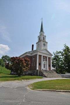
| 141 |
United Church of Christ in Keene |
|
000000001982-03-09-0000March 9, 1982
(#82001671) |
23 Central Sq.
42°56′04″N 72°16′43″W / 42.934444°N 72.278611°W / 42.934444; -72.278611 (United Church of Christ in Keene) |
Keene |
|
| 142 |
Veterans' Memorial Hall |
|
000000001986-09-04-0000September 4, 1986
(#86002160) |
NH 32
42°45′53″N 72°16′09″W / 42.7647°N 72.2692°W / 42.7647; -72.2692 (Veterans' Memorial Hall) |
Richmond |
|
| 143 |
Mary Anne Wales House |
|
000000001983-12-18-0000December 18, 1983
(#83004085) |
Snow Hill Rd.
42°54′14″N 72°04′01″W / 42.903889°N 72.066944°W / 42.903889; -72.066944 (Mary Anne Wales House) |
Dublin |
|
| 144 |
Walpole Academy |
|
000000001975-05-21-0000May 21, 1975
(#75000230) |
Main St.
43°04′44″N 72°25′32″W / 43.078889°N 72.425556°W / 43.078889; -72.425556 (Walpole Academy) |
Walpole |
|
| 145 |
Weldwood |
|
000000001983-12-15-0000December 15, 1983
(#83004086) |
Old Troy Rd.
42°53′17″N 72°06′25″W / 42.888056°N 72.106944°W / 42.888056; -72.106944 (Weldwood) |
Dublin |
|
| 146 |
West Swanzey Covered Bridge |
|
000000001980-02-29-0000February 29, 1980
(#80000281) |
Main St.
42°52′18″N 72°19′42″W / 42.871667°N 72.328333°W / 42.871667; -72.328333 (West Swanzey Covered Bridge) |
West Swanzey |
Over Ashuelot River
|
| 147 |
Wildwood Cottage |
|
000000001988-01-14-0000January 14, 1988
(#86003240) |
Bancroft Rd.
42°57′55″N 72°05′58″W / 42.965342°N 72.099423°W / 42.965342; -72.099423 (Wildwood Cottage) |
Harrisville |
|
| 148 |
Willard Homestead |
|
000000001988-01-14-0000January 14, 1988
(#86003249) |
Sunset Hill Ave.
42°56′42″N 72°08′57″W / 42.944863°N 72.149205°W / 42.944863; -72.149205 (Willard Homestead) |
Harrisville |
|
| 149 |
Winchester Town Hall |
|
000000001987-08-27-0000August 27, 1987
(#87001419) |
Main St.
42°46′22″N 72°23′02″W / 42.772778°N 72.383889°W / 42.772778; -72.383889 (Winchester Town Hall) |
Winchester |
|
| 150 |
Windmill Hill |
|
000000001983-12-18-0000December 18, 1983
(#83004087) |
Windmill Hill Rd.
42°53′14″N 72°02′09″W / 42.887222°N 72.035833°W / 42.887222; -72.035833 (Windmill Hill) |
Dublin |
|
| 151 |
Wood House |
|
000000001983-12-15-0000December 15, 1983
(#83004088) |
NH 101 and NH 137
42°54′00″N 72°01′25″W / 42.9°N 72.0236°W / 42.9; -72.0236 (Wood House) |
Dublin |
|
| 152 |
Wyman Tavern |
|
000000001972-04-03-0000April 3, 1972
(#72000106) |
339 Main St.
42°55′30″N 72°16′39″W / 42.924981°N 72.277522°W / 42.924981; -72.277522 (Wyman Tavern) |
Keene |
|


.jpg)
_(2).jpg)