Interstate 20 in Texas
| ||||
|---|---|---|---|---|
_map.svg.png) | ||||
| Route information | ||||
| Maintained by TxDOT | ||||
| Length: | 636.08 mi[1] (1,023.67 km) | |||
| Existed: | 1959 – present | |||
| Major junctions | ||||
| West end: |
 I-10 at Scroggins Draw I-10 at Scroggins Draw | |||
 I-30 near Fort Worth I-30 near Fort Worth I-35W in Fort Worth I-35W in Fort Worth I-35E in Dallas I-35E in Dallas I-45 in Hutchins I-45 in Hutchins    I-369 / US 59 near Marshall I-369 / US 59 near Marshall | ||||
| East end: |
 I-20 near Greenwood, LA I-20 near Greenwood, LA | |||
| Highway system | ||||
| ||||

Interstate 20 in Texas (abbreviated I-20 or IH-20) is a major east–west Interstate Highway in the Southern United States, running east from a junction with Interstate 10 east of Kent, Texas, through the Dallas-Fort Worth Metroplex to the border with Louisiana near Waskom, Texas. The original distance of Interstate 20 was 647 miles (1,041 km) from I-10 to the Louisiana border, reduced to the current distance of 636 miles (1,024 km) with the rerouting of I-20 in the 1980s and 1990s. I-20 is known as the Ronald Reagan Memorial Highway within the Dallas-Fort Worth Metroplex.
History
Interstate 20 in Texas was designated in 1959, and was to replace or run parallel to U.S. Route 80. Initial construction began from east to west and as bypass loops around larger cities. By 1967, the highway was complete from the Louisiana border to the western side of Fort Worth on a route to the south of US 80, with slower construction in the lesser populated areas of West Texas concurrent with US 80. In 1971, I-20 was rerouted across the southern side of the Dallas/Fort Worth Metroplex, with the old section through downtown Dallas and Fort Worth being redesignated as Interstate 30. In 1991, the entire concurrent designation of US 80 was removed from the I-10 interchange to Dallas.
Route description
West Texas
I-20 begins at a junction with I-10 in a desolate region of West Texas about 6 miles (10 km) east of the town of Kent. I-20 leaves the interchange with I-10 with a speed limit of 80 until Milemarker 89. Interstate 20 also generally heads to the east-northeast passing by the cities of Odessa and Midland while transitioning from the West Texas desert to the prairie. I-20 runs concurrently with the La Entrada al Pacífico corridor from its junction with US 385 in Odessa to its junction with FM 1788 near Midland International Airport. Near Sweetwater, I-20 begins to head east as it heads towards the city of Abilene. In Abilene, I-20 curves towards the north and transverses the northern part of the city while also forming the northern arc of the loop around the city. I-20 continues heading east from Abilene until the town of Eastland when I-20 takes a more northeasterly route towards Weatherford while transitioning from the West Texas prairie to the central plains of North Texas as the terrain grows hilly. In Weatherford, I-20 again heads back towards the east as it heads towards the Dallas-Fort Worth Metroplex.
Dallas-Fort Worth area

I-20 interchanges with I-30 west of Fort Worth with I-30 heading east and I-20 to the southeast. I-20 heads back towards the east when it interchanges with Interstate 820. I-20 forms the southern arc of the complete loop around the city of Fort Worth, and serves as the southernmost west–east freeway in the Dallas-Fort Worth Metroplex. Interchanging with I-35W south of downtown Fort Worth, I-20 heads east towards Dallas passing through Arlington, where it is also known as the Ronald Reagan Memorial Highway.[2] From Arlington, I-20 passes into Dallas County at Grand Prairie and heads east in to Dallas, interchanging with I-35E south of downtown and I-45 shortly after. I-20 intersects with I-635 (where it completes a three-quarter loop around the city) on Dallas' southeast side before heading east towards East Texas. The interstate varies from 4 to 10 lanes from its I-30 junction near Weatherford to its US-80 junction near Terrell.
East Texas
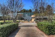
I-20 leaves the Dallas-Fort Worth Metroplex and heads generally to the east-southeast through East Texas. I-20 begins heading to the east as it passes to the north of the city of Tyler at Lindale, Texas. The intersection of I-20 at US 69 in Lindale is the highest traffic count intersection on I-20 east of Terrell to the Louisiana state line. From Lindale, I-20 continues east, going through Kilgore in the piney woods region of East Texas. I-20 leaves the state of Texas near Waskom and just west of Shreveport, Louisiana.
Auxiliary route
Interstate 20 has one auxiliary route in Texas.
- Interstate 820 is a 35.2-mile (56.6 km) loop around the city of Fort Worth. I-20 absorbed the southern section as part of its relocation to the south and I-30 being extended westward over the old alignment of I-20 through the center of town.[3]
Business routes
All of the business loops within Texas are maintained by the Texas Department of Transportation (TxDOT). Interstate 20 has fifteen business loops in the state, all located in western Texas. Along I-20, TxDOT identifies each business route as Business Interstate 20 followed by an alphabetic suffix. Along Texas Interstates, the alphabetic suffixes on business route names ascend eastward and northward. There are gaps in the alphabetic values to allow for future system expansion. The alphabetic naming suffixes are included as small letters on the bottom of route shields.
Texas State Loop 254 takes the place of a business route in Ranger, Texas, and follows the original route of U.S. Route 80.
I-20 business routes in Texas generally follow the path of the former US 80 through the central portions of towns now bypassed by the Interstate route.
Exit list
| County | Location | mi | km | Exit | Destinations | Notes | ||
|---|---|---|---|---|---|---|---|---|
| Reeves | | 0.00 | 0.00 | I-10 west – El Paso | National western terminus; access to I-10 east via I-10 exit 186 | |||
| | I-10 | Eastbound entrance only; I-10 exit 187 | ||||||
| | 3 | Stocks Road | ||||||
| | 7 | Johnson Road | ||||||
| | 13 | McAlpine Road | ||||||
| Toyah | 22 |  FM 2903 – Toyah FM 2903 – Toyah | ||||||
| | 29 | Shaw Road | ||||||
| | 33 |  FM 869 FM 869 | ||||||
| | 37 |  BL I-20 east – Pecos BL I-20 east – Pecos | ||||||
| Pecos | 39 |  SH 17 – Fort Davis, Balmorhea SH 17 – Fort Davis, Balmorhea | ||||||
| 40 | Country Club Drive | |||||||
| 42 |  US 285 – Fort Stockton, Carlsbad US 285 – Fort Stockton, Carlsbad | |||||||
| | 44 | Collie Road | ||||||
| Ward | | 49 |  FM 516 – Barstow FM 516 – Barstow | |||||
| | 52 | BL I-20 west – Barstow | Westbound exit and eastbound entrance | |||||
| | 58 | Frontage Road | ||||||
| Pyote | 66 |   SH 115 / FM 1927 – Pyote, Kermit SH 115 / FM 1927 – Pyote, Kermit | ||||||
| | 70 |  Spur 65 Spur 65 | ||||||
| Wickett | 73 |  FM 1219 – Wickett FM 1219 – Wickett | ||||||
| | 76 | BL I-20 east – Monahans | ||||||
| Thorntonville | 79 |  Loop 464 Loop 464 | ||||||
| Monahans | 80 |  SH 18 – Kermit, Fort Stockton SH 18 – Kermit, Fort Stockton | ||||||
| | 83 | BL I-20 west – Monahans | ||||||
| | 86 |  PR 41 – Monahans Sandhills State Park PR 41 – Monahans Sandhills State Park | ||||||
| Crane |
No major junctions | |||||||
| Ector | | 93 |  FM 1053 – Fort Stockton FM 1053 – Fort Stockton | |||||
| | 101 |  FM 1601 – Penwell FM 1601 – Penwell | ||||||
| | 104 |  FM 866 – Goldsmith FM 866 – Goldsmith | ||||||
| | 108 | Moss Avenue – Meteor Crater | ||||||
| | 112 |  BL I-20 east / FM 1936 – Odessa BL I-20 east / FM 1936 – Odessa | ||||||
| | 113 |   SH 302 / Loop 338 – Kermit SH 302 / Loop 338 – Kermit | ||||||
| Odessa | 115 |  FM 1882 (County Road West) FM 1882 (County Road West) | ||||||
| 116 |   US 385 – Andrews, Crane US 385 – Andrews, Crane | Access to Medical Center Hospital and Odessa Regional Medical Center | ||||||
| 118 |  FM 3503 / Grandview Avenue FM 3503 / Grandview Avenue | |||||||
| 120 | JBS Parkway | |||||||
| 121 | Loop 338 – Odessa | |||||||
| Midland | | 126 |   FM 1788 / SH 349 north – UT Permian Basin CEED FM 1788 / SH 349 north – UT Permian Basin CEED | Western end of SH 349 overlap | ||||
| Midland | 131 |   SH 158 west / Loop 250 – Midland SH 158 west / Loop 250 – Midland | Western end of SH 158 overlap | |||||
| 134 | Midkiff Road | |||||||
| 135 | Cotton Flat Road | |||||||
| 136 |  Bus. SH 349 / SH 349 south – Rankin, Lamesa Bus. SH 349 / SH 349 south – Rankin, Lamesa | Eastern end of SH 349 overlap | ||||||
| 137 | Old Lamesa Road | |||||||
| 138 |  SH 158 east / FM 715 – Garden City, San Angelo SH 158 east / FM 715 – Garden City, San Angelo | Eastern end of SH 158 overlap | ||||||
| | 140 |  FM 307 – Greenwood FM 307 – Greenwood | Eastbound exit and westbound entrance | |||||
| | 143 | Loop 250 | ||||||
| | 144 | BL I-20 west / Loop 250 – Midland | No westbound entrance | |||||
| Martin | | 151 |  FM 829 FM 829 | Westbound exit and entrance | ||||
| | 154 | BL I-20 east – Stanton | ||||||
| Stanton | 156 |  SH 137 – Lamesa SH 137 – Lamesa | Access to Martin County Hospital | |||||
| | 158 | BL I-20 west – Stanton | ||||||
| Howard | | 165 |  FM 818 FM 818 | |||||
| | 169 |  FM 2599 FM 2599 | ||||||
| | 171 | Moore Field Road | ||||||
| | 172 | Cauble Road | ||||||
| Big Spring | 174 | BL I-20 east – Big Spring | ||||||
| 176 |  SH 176 – Andrews SH 176 – Andrews | |||||||
| 177 |  US 87 – San Angelo, Lamesa US 87 – San Angelo, Lamesa | |||||||
| 178 |  SH 350 – Snyder SH 350 – Snyder | |||||||
| 179 | BL I-20 west – Big Spring | |||||||
| 181A |  FM 700 FM 700 | |||||||
| 181B | Refinery Road | |||||||
| | 182 | Midway Road | ||||||
| | 184 | Moss Lake Road – Sand Springs | ||||||
| | 186 | Salem Road – Sand Springs | ||||||
| Coahoma | 188 |  FM 820 – Coahoma FM 820 – Coahoma | ||||||
| | 189 | McGregor Road | ||||||
| | 190 | Snyder Field Road | ||||||
| | 192 |  FM 821 FM 821 | ||||||
| | 194A | East Howard Field Road | ||||||
| | 195 | Frontage Road | No eastbound entrance | |||||
| Mitchell | | 199 | Iatan Road | |||||
| | 200 | Conaway Road | ||||||
| | 206 |  BL I-20 east / FM 670 – Westbrook BL I-20 east / FM 670 – Westbrook | ||||||
| Westbrook | 207 | BL I-20 west – Westbrook | ||||||
| | 209 | Dorn Road | ||||||
| | 210 |  FM 2836 FM 2836 | ||||||
| | 212 |  FM 1229 FM 1229 | ||||||
| | 213 | BL I-20 east / Enderly Road – Colorado City | ||||||
| Colorado City | 215 |  FM 3525 TDCJ - 80 John Wallace Unit, Dick Ware Unit FM 3525 TDCJ - 80 John Wallace Unit, Dick Ware Unit | ||||||
| 216 |  SH 208 north / Bus. SH 208 – Snyder, Colorado City SH 208 north / Bus. SH 208 – Snyder, Colorado City | Western end of SH 208 overlap | ||||||
| 217 | SH 208 south – San Angelo | Eastern end of SH 208 overlap | ||||||
| | 219A | Country Club Road | Signed as exit 219 eastbound | |||||
| | 219B | BL I-20 west – Colorado City | Eastbound exit is via exit 219 | |||||
| | 220 |  FM 1899 FM 1899 | ||||||
| | 221 | Lasky Road | ||||||
| | 223 | Lucas Road | ||||||
| | 224 | BL I-20 east – Loraine | ||||||
| Loraine | 225 |  FM 644 south FM 644 south | ||||||
| | 226A | FM 644 north | Eastbound exit is via exit 225 | |||||
| | 226B | BL I-20 west / Wimberley Road | ||||||
| | 227 | Narrell Road | ||||||
| Nolan | | 230 |  FM 1230 FM 1230 | |||||
| | 235 |  BS I-20 east – Roscoe BS I-20 east – Roscoe | ||||||
| Roscoe | 236 |  FM 608 – Roscoe FM 608 – Roscoe | ||||||
| | 237 | Cemetery Road | ||||||
| | 238A |  US 84 west – Lubbock, Snyder US 84 west – Lubbock, Snyder | Western end of US 84 overlap; no eastbound exit | |||||
| | 238B | Blackland Road | ||||||
| | 238C | Frontage Road | Eastbound exit and entrance | |||||
| | 239 | May Road | No access across I-20 | |||||
| | 240 |  Loop 170 Loop 170 | ||||||
| Sweetwater | 241 | BL I-20 east – Sweetwater | ||||||
| 242 | Hopkins Road | |||||||
| 243 | Hillsdale Road, Robert Lee Street | |||||||
| 244 |  SH 70 south / Bus. SH 70 – Sweetwater, San Angelo SH 70 south / Bus. SH 70 – Sweetwater, San Angelo | Western end of SH 70 overlap | ||||||
| 245 | Arizona Avenue | Westbound exit only | ||||||
| | 246 | Alabama Avenue | ||||||
| Sweetwater | 247 | BL I-20 west / SH 70 north – Sweetwater, Roby | Eastern end of SH 70 overlap | |||||
| | 249 |  FM 1856 FM 1856 | ||||||
| | 251 | Eskota Road | ||||||
| | 255 | Adrian Road | ||||||
| | 256 | Stink Creek Road | ||||||
| | 258 | White Flat Road | ||||||
| | 259 | Sylvester Road | ||||||
| Taylor | | 261 | BL I-20 east – Trent | |||||
| Trent | 262 |  FM 1085 FM 1085 | ||||||
| | 263 | BL I-20 west – Trent | ||||||
| | 264 | Noodle Dome Road | ||||||
| | 266 | Derstine Road | ||||||
| | 267 | BL I-20 east – Merkel | ||||||
| Merkel | 269 |  FM 126 FM 126 | ||||||
| | 270 |  BL I-20 west / FM 1235 – Merkel BL I-20 west / FM 1235 – Merkel | ||||||
| | 272 | Wimberly Road | ||||||
| | 274 | Wells Lane | ||||||
| Tye | 277 |  BL I-20 east / FM 707 – Tye BL I-20 east / FM 707 – Tye | ||||||
| 278 | BL I-20 west – Tye | |||||||
| Abilene | 279 | BL I-20 east / US 84 east – Abilene | Eastern end of US 84 overlap; no westbound exit | |||||
| 280 | Fulwiler Road | |||||||
| 281 |  FM 3438 (Hayter Road) – Dyess AFB FM 3438 (Hayter Road) – Dyess AFB | |||||||
| 282 | Shirley Road / Ambler Avenue | |||||||
| 283 |   US 83 (Winters Freeway) / US 277 – San Angelo, Ballinger, Anson US 83 (Winters Freeway) / US 277 – San Angelo, Ballinger, Anson | Signed as exits 283A (south) and 283B (north) | ||||||
| 285 | Old Anson Road – Impact | |||||||
| 286A | Bus. US 83 – Abilene | Signed as exits 286A (south) and 286B (north) eastbound, access to Hendrick Medical Center and Abilene Regional Medical Center | ||||||
| 286C |  FM 600 FM 600 | |||||||
| 288 |  SH 351 – Albany, Abilene Christian University SH 351 – Albany, Abilene Christian University | |||||||
| 290 |   Loop 322 (Jake Roberts Freeway) to SH 36 – Cross Plains Loop 322 (Jake Roberts Freeway) to SH 36 – Cross Plains | |||||||
| 292A | BL I-20 west – Abilene | |||||||
| 292B | Elmdale Road | |||||||
| Callahan | | 294 | Buck Creek Road | |||||
| | 297 |  FM 603 FM 603 | ||||||
| Clyde | 299 |  FM 1707 (Hays Road) FM 1707 (Hays Road) | ||||||
| 300 |  FM 604 – Clyde FM 604 – Clyde | |||||||
| 301 | Cherry Lane | |||||||
| | 303 | Union Hill Road | ||||||
| Baird | 306 |  BL I-20 east / FM 2047 – Baird BL I-20 east / FM 2047 – Baird | ||||||
| 307 |  US 283 – Albany, Coleman US 283 – Albany, Coleman | |||||||
| | 308 | BL I-20 west – Baird | ||||||
| | 310 | Finley Road | ||||||
| | 313 |  FM 2228 FM 2228 | ||||||
| | 316 | Brushy Creek Road | ||||||
| Putnam | 319 |  FM 880 south – Putnam, Cross Plains FM 880 south – Putnam, Cross Plains | Western end of FM 880 overlap | |||||
| | 320 |  FM 880 north / FM 2945 east – Moran FM 880 north / FM 2945 east – Moran | Eastern end of FM 880 overlap | |||||
| | 322 | Cooper Creek Road | ||||||
| Eastland | | 324 | Scranton Road | |||||
| Cisco | 330 |  SH 206 – Cross Plains, Cisco, Coleman SH 206 – Cross Plains, Cisco, Coleman | ||||||
| 332 |  US 183 – Breckenridge, Cisco, Brownwood, Albany US 183 – Breckenridge, Cisco, Brownwood, Albany | |||||||
| | 337 |  Spur 490 Spur 490 | ||||||
| | 340 |  SH 6 – Gorman, Eastland, De Leon, Breckenridge SH 6 – Gorman, Eastland, De Leon, Breckenridge | ||||||
| Eastland | 343 |   SH 112 / FM 570 – Lake Leon SH 112 / FM 570 – Lake Leon | ||||||
| | 345 |  FM 3363 – Olden FM 3363 – Olden | Eastbound exit and westbound entrance | |||||
| | 347 | FM 3363 – Olden | Westbound exit and eastbound entrance | |||||
| Ranger | 349 |   Loop 254 / FM 2461 – Lake Leon, Ranger Loop 254 / FM 2461 – Lake Leon, Ranger | ||||||
| 351 | Desdemona Boulevard | Eastbound exit and westbound entrance | ||||||
| 352 | Blundell Street | Westbound exit and eastbound entrance | ||||||
| | 354 | Loop 254 west – Ranger | ||||||
| | 358 | Frontage Road | Westbound exit and eastbound entrance | |||||
| | 361 |  SH 16 – Strawn, De Leon SH 16 – Strawn, De Leon | ||||||
| | 363 | Tudor Road | ||||||
| Erath | | 367 |  SH 108 north – Mingus, Thurber SH 108 north – Mingus, Thurber | Western end of SH 108 overlap | ||||
| Palo Pinto | | 370 |  SH 108 south / FM 919 – Gordon, Stephenville SH 108 south / FM 919 – Gordon, Stephenville | Eastern end of SH 108 overlap | ||||
| | 373 |  SH 193 – Gordon SH 193 – Gordon | ||||||
| | 376 | Panama Road, Blue Flat Road | ||||||
| | 380 |  FM 4 – Palo Pinto, Lipan, Santo FM 4 – Palo Pinto, Lipan, Santo | ||||||
| | 386 |  US 281 – Stephenville, Mineral Wells US 281 – Stephenville, Mineral Wells | ||||||
| Parker | | 391 | Gilbert Pit Road | |||||
| | 394 |  FM 113 – Millsap FM 113 – Millsap | ||||||
| | 397 |  FM 1189 – Brock FM 1189 – Brock | ||||||
| | 402 |  Spur 312 east – Weatherford Spur 312 east – Weatherford | Eastbound exit and westbound entrance | |||||
| | 403 | Dennis Road | Westbound exit and eastbound entrance | |||||
| | 405 | Old Brock Road, Ric Williamson Memorial Highway | ||||||
| Weatherford | 406 | Old Dennis Road, South Bowie Drive | ||||||
| 407 |  FM 1884 (Bethel Road) / Tin Top Road FM 1884 (Bethel Road) / Tin Top Road | Westbound exit is via exit 408 | ||||||
| 408 |   SH 171 / FM 51 – Granbury, Cleburne SH 171 / FM 51 – Granbury, Cleburne | |||||||
| 409A | Holland Lake Road, Fossil Hill Road | Westbound exit and eastbound entrance | ||||||
| 409 |  FM 2552 north (Santa Fe Drive) / Clear Lake Road FM 2552 north (Santa Fe Drive) / Clear Lake Road | |||||||
| 410 | East Bankhead Drive | |||||||
| | 411 | Center Point Road | Westbound exit only | |||||
| Hudson Oaks | 413 | Lake Shore Drive | Eastbound exit and westbound entrance | |||||
| 414 |  US 180 – Weatherford, Mineral Wells US 180 – Weatherford, Mineral Wells | Westbound exit and eastbound entrance | ||||||
| | 415 |  FM 5 (Mikus Road) – Annetta FM 5 (Mikus Road) – Annetta | ||||||
| Willow Park | 418 | Ranch House Road – Willow Park | ||||||
| 420 |   FM 1187 / FM 3325 – Aledo FM 1187 / FM 3325 – Aledo | |||||||
| | 421 | I-30 east – Downtown Fort Worth | Eastbound exit and westbound entrance | |||||
| Tarrant | | 425 | Markum Ranch Road | |||||
| | 426 |  RM 2871 RM 2871 | ||||||
| Benbrook | 428 |  I-820 north (Jim Wright Freeway) I-820 north (Jim Wright Freeway) | I-820 exit 0 | |||||
| 429A |  US 377 (Benbrook Boulevard) – Granbury US 377 (Benbrook Boulevard) – Granbury | |||||||
| 429B | Winscott Road | |||||||
| Fort Worth | 431 | Bryant Irvin Road | ||||||
| 432 |  Chisholm Trail Parkway Chisholm Trail Parkway | |||||||
| 432 |  SH 183 west (Southwest Boulevard) SH 183 west (Southwest Boulevard) | Westbound exit and eastbound entrance | ||||||
| 433 | Hulen Street, South Drive – TCU | |||||||
| 434A | Granbury Road, South Drive | |||||||
| 434B | Trail Lake Drive, Westcreek Drive | |||||||
| 435 | McCart Avenue, Westcreek Drive | |||||||
| 436A |  FM 731 (Crowley Road) / James Avenue FM 731 (Crowley Road) / James Avenue | |||||||
| 436B | Hemphill Street | |||||||
| 437 | I-35W (South Freeway) – Denton, Waco | I-35W exit 45A-B | ||||||
| 438 | Oak Grove Road | |||||||
| 439 | CampUS Drive | |||||||
| Forest Hill | 440A | Wichita Street | ||||||
| 440B | Forest Hill Drive | |||||||
| 441 | Anglin Drive | |||||||
| Fort Worth | 442A |   Bus. US 287 (Mansfield Highway) Bus. US 287 (Mansfield Highway) | ||||||
| 442B | I-820 north (East Loop) / US 287 north – Downtown Fort Worth | Western end of US 287 overlap, I-820 exit 34A | ||||||
| Arlington | 443 | Bowman Springs Road | Westbound exit and eastbound entrance | |||||
| 444 | US 287 south / Little Road – Waxahachie | Eastern end of US 287 overlap | ||||||
| 445 | Green Oaks Boulevard, Little Road | |||||||
| 447 | Kelly–Elliott Road, Park Springs Road | |||||||
| 448 | Bowen Road | |||||||
| 449 |  FM 157 (Cooper Street) – UT Arlington FM 157 (Cooper Street) – UT Arlington | Signed as exits 449A (south) and 449B (north) eastbound | ||||||
| 450 | Matlock Road | Access to Medical Center of Arlington | ||||||
| 451 | Collins Street, New York Avenue | |||||||
| 453 |  SH 360 (Frontage Roads, Watson Road) – D/FW Airport SH 360 (Frontage Roads, Watson Road) – D/FW Airport | Signed as exits 453A (north) and 453B (south) | ||||||
| Grand Prairie | 454 | Great Southwest Parkway | ||||||
| Dallas | 455A |  Pres. George Bush Tpk. north Pres. George Bush Tpk. north | ||||||
| 455B |  SH 161 / Lake Ridge Parkway SH 161 / Lake Ridge Parkway | |||||||
| 456 | Carrier Parkway | |||||||
| 457 |  FM 1382 (Belt Line Road) – Grand Prairie, Cedar Hill FM 1382 (Belt Line Road) – Grand Prairie, Cedar Hill | |||||||
| Dallas | 458 | Mountain Creek Parkway | ||||||
| 460 |  Spur 408 north (Patriot Parkway) Spur 408 north (Patriot Parkway) | |||||||
| Duncanville | 461 | Cedar Ridge Drive | ||||||
| 462 | Duncanville Road, North Main Street | |||||||
| 463 | Cockrell Hill Road, Camp Wisdom Road | |||||||
| Dallas | 464 |  US 67 (Marvin D. Love Freeway) – Dallas, Cleburne US 67 (Marvin D. Love Freeway) – Dallas, Cleburne | Signed as exits 464A (north) and 464B (south) | |||||
| 465 | Wheatland Road, Hampton Road | Access to Charlton Methodist Hospital | ||||||
| 466 | South Polk Street | |||||||
| 467 | I-35E (South R.L. Thornton Freeway) – Dallas, Waco | Signed as exits 467A (north) and 467B (south); I-35E exits 418A-B | ||||||
| Lancaster | 468 | Houston School Road | ||||||
| Dallas | 470 |  SH 342 (Lancaster Road) SH 342 (Lancaster Road) | ||||||
| 472 | Bonnie View Road | |||||||
| 473A | J. J. Lemmon Road | Eastbound exit and westbound entrance | ||||||
| 473 | I-45 (Julius Schepps Freeway) – Dallas, Houston | Signed as exits 473B (south) and 473C (north); I-45 exits 276A-B | ||||||
| 474 |  SH 310 (South Central Expressway) SH 310 (South Central Expressway) | Westbound exit and eastbound entrance | ||||||
| 476 | Dowdy Ferry Road | |||||||
| 477 | St. Augustine Road | |||||||
| 479 |  US 175 (C.F. Hawn Freeway) – Dallas, Kaufman US 175 (C.F. Hawn Freeway) – Dallas, Kaufman | Signed as exits 479A (west) and 479B (east) | ||||||
| Balch Springs | 480B |  I-635 north (Lyndon B. Johnson Freeway) – Mesquite I-635 north (Lyndon B. Johnson Freeway) – Mesquite | I-635 exit 0 | |||||
| 480A | Kleberg Road | Westbound exit and eastbound entrance | ||||||
| 481 | Seagoville Road | |||||||
| Mesquite | 482 | Belt Line Road, Lasater Road | ||||||
| 483 | Lawson Road, Lasater Road, Lumley Road | |||||||
| Kaufman | 487 |  FM 740 – Forney FM 740 – Forney | ||||||
| | 490 |  FM 741 FM 741 | ||||||
| | 491 |  FM 2932 / Helms Trail FM 2932 / Helms Trail | ||||||
| Talty | 493 |  FM 1641 FM 1641 | ||||||
| Terrell | 498 |  FM 148 FM 148 | ||||||
| 499A |   Spur 557 to US 80 – Dallas Spur 557 to US 80 – Dallas | Westbound exit and eastbound entrance | ||||||
| 499B | Rose Hill Road | |||||||
| 501 |  SH 34 – Terrell, Kaufman SH 34 – Terrell, Kaufman | |||||||
| 503 | Wilson Road | |||||||
| | 506 |   FM 429 (College Mound Road) / FM 2728 FM 429 (College Mound Road) / FM 2728 | ||||||
| | 509 | Hiram Road | ||||||
| | 512 |  FM 2965 (Hiram-Wills Point Road) FM 2965 (Hiram-Wills Point Road) | ||||||
| Van Zandt | | 516 |  FM 47 – Wills Point FM 47 – Wills Point | |||||
| | 519 | Turner–Hayden Road | ||||||
| | 521 | Myrtle Springs Road, Myrtle Cemetery Road | ||||||
| | 523 |  SH 64 – Canton, Wills Point SH 64 – Canton, Wills Point | ||||||
| Canton | 526 |  FM 859 – Canton, Edgewood FM 859 – Canton, Edgewood | ||||||
| 527 |  SH 19 – Emory, Canton SH 19 – Emory, Canton | |||||||
| 528 |  FM 17 – Grand Saline FM 17 – Grand Saline | |||||||
| | 530 |  FM 1255 – Canton FM 1255 – Canton | ||||||
| | 533 | Colfax Oakland Road | ||||||
| | 536 | Tank Farm Road | ||||||
| | 537 |   FM 16 / FM 773 – Van, Ben Wheeler FM 16 / FM 773 – Van, Ben Wheeler | ||||||
| Van | 540 |  FM 314 – Van, Edom FM 314 – Van, Edom | ||||||
| Smith | | 544 | Willow Branch Road | |||||
| | 548 |  SH 110 – Grand Saline, Tyler, Van SH 110 – Grand Saline, Tyler, Van | ||||||
| Lindale | 552 |  FM 849 – Hideaway FM 849 – Hideaway | ||||||
| 553 |  Loop 49 Toll / County Road 411 Loop 49 Toll / County Road 411 | |||||||
| 554 | Harvey Road | |||||||
| 556 |  US 69 – Lindale, Mineola, Tyler US 69 – Lindale, Mineola, Tyler | |||||||
| | 557 | Jim Hogg Road | ||||||
| | 560 | Lavender Road | ||||||
| | 562 |  FM 14 – Hawkins, Tyler, Tyler State Park FM 14 – Hawkins, Tyler, Tyler State Park | ||||||
| | 565 |  FM 2015 (Driskill Lake Road) FM 2015 (Driskill Lake Road) | ||||||
| | 567 |  SH 155 – UT Health Center, Winona SH 155 – UT Health Center, Winona | ||||||
| | 571A |  US 271 – Gladewater, Tyler US 271 – Gladewater, Tyler | ||||||
| | 571B |  FM 757 (Starrville Omen Road) FM 757 (Starrville Omen Road) | ||||||
| | 575 | Barber Road | ||||||
| Smith–Gregg county line | | 579 | Joy–Wright Mountain Road | |||||
| Gregg | | 582 |  FM 3053 – Liberty City, Overton FM 3053 – Liberty City, Overton | |||||
| | 583 |  SH 135 – Kilgore, Gladewater, Overton SH 135 – Kilgore, Gladewater, Overton | ||||||
| | 587 |  SH 42 – Kilgore, White Oak SH 42 – Kilgore, White Oak | ||||||
| | 589 |   US 259 south / SH 31 – Kilgore, Henderson, Downtown Longview US 259 south / SH 31 – Kilgore, Henderson, Downtown Longview | Western end of US 259 overlap; signed as exits 589A (south/west) and 589B (east) eastbound | |||||
| | 591 |   FM 2011 / FM 2087 FM 2011 / FM 2087 | ||||||
| Longview | 595 |    SH 322 south (Estes Parkway) / Loop 281 north / FM 1845 north – Longview SH 322 south (Estes Parkway) / Loop 281 north / FM 1845 north – Longview | Signed as exits 595A (south) and 595B (north) eastbound | |||||
| 596 |  US 259 north / SH 149 (Eastman Road) – Carthage US 259 north / SH 149 (Eastman Road) – Carthage | Eastern end of US 259 overlap, access to Good Shepherd Medical Center and Longview Regional Medical Center | ||||||
| Harrison | | 599 |  Loop 281 / FM 968 Loop 281 / FM 968 | |||||
| | 604 |  FM 450 – Hallsville FM 450 – Hallsville | ||||||
| | 610 |  FM 3251 FM 3251 | ||||||
| | 614 |  SH 43 – Marshall, Caddo Lake, Henderson SH 43 – Marshall, Caddo Lake, Henderson | ||||||
| Marshall | 617 | US 59 – Marshall, Carthage | Future I-369 | |||||
| | 620 |  FM 31 – Elysian Fields FM 31 – Elysian Fields | ||||||
| | 624 |  FM 2199 – Scottsville FM 2199 – Scottsville | ||||||
| | 628 | US 80 west / Frontage Road | Western end of US 80 overlap | |||||
| Waskom | 633 |   US 80 east / FM 9 / FM 134 – Waskom, Caddo Lake US 80 east / FM 9 / FM 134 – Waskom, Caddo Lake | Eastern end of US 80 overlap | |||||
| 635 |  Spur 156 – Waskom Spur 156 – Waskom | |||||||
| | 636.08 | 1,023.67 | I-20 east | Continuation into Louisiana | ||||
1.000 mi = 1.609 km; 1.000 km = 0.621 mi
| ||||||||
See also
 U.S. Roads portal
 Texas portal
References
- ↑ Texas Department of Transportation. "Highway Designation File - Interstate Highway 20". Retrieved 2007-07-08.
- ↑ But see also US 190, another road which has been designated the Ronald Reagan Memorial Highway.
- ↑ Texas Department of Transportation, Highway Designation File - Interstate Highway 820
External links
 |
Wikimedia Commons has media related to Interstate 20 in Texas. |
- I-20 info page -- from dfwfreeways.info
| Interstate 20 | ||
|---|---|---|
| Previous state: Terminus |
Texas | Next state: Louisiana |