| NM# |
Monument name |
Description |
Image |
Townland | County |
Location
|
|---|
| 347 | Aghade Holed Stone (Cloghaphoill) | Holed Stone | | Aghade |
Carlow !Carlow | 52°46′12″N 6°44′48″W / 52.770101°N 6.746804°W / 52.770101; -6.746804 |
| 351 | Ballyloughan Castle | Castle |  | Muine Bheag |
Carlow !Carlow | 52°40′23″N 6°53′53″W / 52.672957°N 6.898062°W / 52.672957; -6.898062 |
| 486 | Ballymoon Castle | Castle |  | Muine Bheag |
Carlow !Carlow | 52°42′00″N 6°54′25″W / 52.7°N 6.907°W / 52.7; -6.907 |
| 566 | Baunogenasraid | Burial Mound (Cist) | | Baunogenasraid |
Carlow !Carlow | 52°48′45″N 6°49′25″W / 52.812425°N 6.823668°W / 52.812425; -6.823668 |
| 306 | Carlow Castle | Castle |  | Carlow |
Carlow !Carlow | 52°50′11″N 6°56′09″W / 52.836389°N 6.935833°W / 52.836389; -6.935833 |
| 545 | Castlemore Moat | Motte and Bailey & Cross Slab | | Castlemore |
Carlow !Carlow | 52°48′34″N 6°46′21″W / 52.809489°N 6.772553°W / 52.809489; -6.772553 |
| 613 | Browneshill | Portal Tomb | 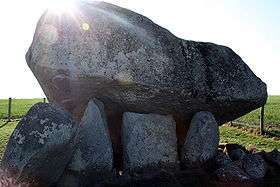 | Carlow |
Carlow !Carlow | 52°50′14″N 6°52′52″W / 52.837337°N 6.881004°W / 52.837337; -6.881004 |
| 393 | Killoughternane Church | Church | 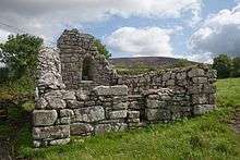 | Killoughternane |
Carlow !Carlow | 52°38′02″N 6°51′13″W / 52.6339°N 6.8536°W / 52.6339; -6.8536 |
| 603 | Rathvilly Moat | Burial Mound | | Knockroe |
Carlow !Carlow | 52°52′50″N 6°40′42″W / 52.880559°N 6.678207°W / 52.880559; -6.678207 |
| 438 | Leighlinbridge Castle | Castle | 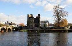 | Leighlinbridge |
Carlow !Carlow | 52°44′09″N 6°58′41″W / 52.7357°N 6.9781°W / 52.7357; -6.9781 |
| 350 | Lorum High Cross | Cross Fragment | | Lorum |
Carlow !Carlow | 52°39′48″N 6°55′40″W / 52.663362°N 6.927915°W / 52.663362; -6.927915 |
| 352 | Nurney Cross | Cross | 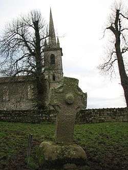 | Nurney |
Carlow !Carlow | 52°45′06″N 6°54′44″W / 52.7518°N 6.9123°W / 52.7518; -6.9123 |
| 3 | St. Mullin's | Early Medieval Ecclesiastical Site |  | St Mullin's |
Carlow !Carlow | 52°29′20″N 6°55′42″W / 52.488908°N 6.928461°W / 52.488908; -6.928461 |
| 452 | Straboe Grave Slab | Medieval Grave Slab | | Straboe |
Carlow !Carlow | 52°51′41″N 6°46′19″W / 52.861279°N 6.771970°W / 52.861279; -6.771970 |
| 310 | Baldongan Church | Church & Tower |  | Baldongan |
Dublin !Dublin | 53°33′11″N 6°07′44″W / 53.55316°N 6.128776°W / 53.55316; -6.128776 (Baldongan Church and Tower) |
| 437 | Ballyedmonduff Wedge Tomb | Wedge Tomb |  | Ballyedmonduff |
Dublin !Dublin | 53°13′45″N 6°13′34″W / 53.229167°N 6.2262°W / 53.229167; -6.2262 |
| 590 | Balrothery Tower | Church Tower |  | Balrothery |
Dublin !Dublin | 53°35′12″N 6°11′24″W / 53.586546°N 6.190072°W / 53.586546; -6.190072 (Balrothery Tower) |
| 291 | Brenanstown Portal Tomb | Portal Tomb | | Brenanstown |
Dublin !Dublin | 53°15′15″N 6°09′27″W / 53.254129°N 6.157612°W / 53.254129; -6.157612 |
| 32 | Clondalkin Round Tower | Round Tower & Cross | 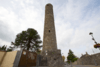 | Clondalkin |
Dublin !Dublin | 53°19′19″N 6°23′43″W / 53.322065°N 6.395374°W / 53.322065; -6.395374 (Clondalkin Tower) |
| 285 | Tully's Castle | Castle | 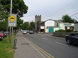 | Clondalkin |
Dublin !Dublin | 53°19′15″N 6°23′24″W / 53.320812°N 6.389957°W / 53.320812; -6.389957 (Tully's Castle) |
| 444 | Archbold's Castle | Castle | 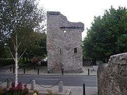 | Dalkey |
Dublin !Dublin | 53°16′40″N 6°06′23″W / 53.27789°N 6.106422°W / 53.27789; -6.106422 (Archbold's Castle) |
| 33 | Dalkey Island Church | Church | 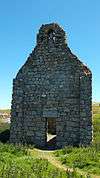 | Dalkey Island |
Dublin !Dublin | 53°16′22″N 6°05′08″W / 53.272685°N 6.085509°W / 53.272685; -6.085509 (Dalkey Island Church) |
| 401 | St. Mary's Abbey | Abbey (Cistercian) (Chapter house) |  | Northside Dublin |
Dublin !Dublin | 53°20′51″N 6°16′09″W / 53.3475°N 6.269167°W / 53.3475; -6.269167 (St. Mary's Abbey) |
| 34 | St. Audoen's Church | Church |  | Southside Dublin |
Dublin !Dublin | 53°20′38″N 6°16′31″W / 53.343889°N 6.275278°W / 53.343889; -6.275278 (St. Audoen's Church) |
| | St. Stephen's Green | Park | 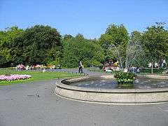 | Southside Dublin |
Dublin !Dublin | 53°20′17″N 6°15′33″W / 53.338056°N 6.259167°W / 53.338056; -6.259167 (St. Stephen's Green) |
| 230 | Dunsoghly Castle | Castle | .jpg) | Dunsoghly |
Dublin !Dublin | 53°25′37″N 6°19′06″W / 53.426936°N 6.318277°W / 53.426936; -6.318277 (Dunsoghly Castle) |
| 276 | Glencullen Standing Stone | Standing Stone | | Glencullen |
Dublin !Dublin | 53°13′11″N 6°13′03″W / 53.219771°N 6.217385°W / 53.219771; -6.217385 (Glencullen Standing Stone) |
| 605 | Grange Abbey | Church |  | Donaghmede |
Dublin !Dublin | 53°23′57″N 6°09′38″W / 53.399075°N 6.160429°W / 53.399075; -6.160429 (Grange Abbey) |
| 36 | Howth Church | Church | 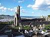 | Howth |
Dublin !Dublin | 53°23′15″N 6°03′57″W / 53.387515°N 6.065961°W / 53.387515; -6.065961 (Howth Church) |
| 226 | Kilgobbin Cross | Cross | 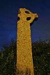 | Kilgobbin |
Dublin !Dublin | 53°15′23″N 6°13′04″W / 53.256478°N 6.217806°W / 53.256478; -6.217806 (Kilgobbin High Cross) |
| 207, 587 | Kill of the Grange | Church, Well & Bullaun Stone | 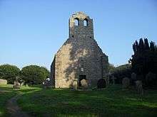 | Kill of the Grange |
Dublin !Dublin | 53°16′53″N 6°09′40″W / 53.281378°N 6.160987°W / 53.281378; -6.160987 (Kill of the Grange Church, Well and Bullaun Stone) |
| 35 | Cill Iníon Léinín | Church | 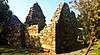 | Killiney |
Dublin !Dublin | 53°15′17″N 6°06′59″W / 53.254727°N 6.116315°W / 53.254727; -6.116315 (Killiney Church) |
| 675 | Kilmainham Gaol | Prison | 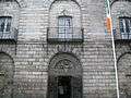 | Kilmainham |
Dublin !Dublin | 53°20′31″N 6°18′35″W / 53.341944°N 6.309722°W / 53.341944; -6.309722 (Kilmainham Gaol) |
| 493 | Kilmashogue | Wedge Tomb | 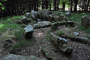 | Rathfarnham |
Dublin !Dublin | 53°15′02″N 6°16′02″W / 53.250558°N 6.267231°W / 53.250558; -6.267231 (Kilmashogue) |
| 343 | Kiltiernan Tomb | Portal Tomb | | Kiltiernan |
Dublin !Dublin | 53°14′20″N 6°12′26″W / 53.238829°N 6.207119°W / 53.238829; -6.207119 (Kiltiernan Portal Tomb) |
| 216 | Laughanstown | Crosses and wedge tomb | 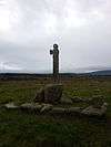 | Laughanstown |
Dublin !Dublin | 53°14′32″N 6°09′06″W / 53.242275°N 6.151569°W / 53.242275; -6.151569 (Laughanstown crosses and wedge tomb) |
| 225 | Tully Church | Church | 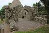 | Laughanstown |
Dublin !Dublin | 53°14′49″N 6°09′08″W / 53.246818°N 6.152242°W / 53.246818; -6.152242 |
| 157 | Lusk | Round Tower & Church Tower | 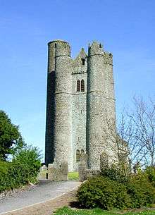 | Lusk |
Dublin !Dublin | 53°31′34″N 6°10′02″W / 53.526116°N 6.167295°W / 53.526116; -6.167295 (Lusk Round Tower and Church Tower) |
| 302 | Casino at Marino | Demesne Building |  | Marino |
Dublin !Dublin | 53°22′16″N 6°13′37″W / 53.37124°N 6.22703°W / 53.37124; -6.22703 (Casino at Marino) |
| 494 | Monkstown Castle | Castle | 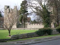 | Monkstown |
Dublin !Dublin | 53°17′20″N 6°09′02″W / 53.288911°N 6.15065°W / 53.288911; -6.15065 (Monkstown Castle) |
| 628 | Rathfarnham Castle | Castle or Fortified House | 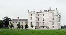 | Rathfarnham |
Dublin !Dublin | 53°17′53″N 6°17′01″W / 53.298099°N 6.283609°W / 53.298099; -6.283609 (Rathfarnham Castle) |
| 162 | Rathmichael | Early Medieval Ecclesiastical Site | 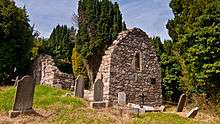 | Rathmichael |
Dublin !Dublin | 53°14′09″N 6°09′20″W / 53.235833°N 6.155556°W / 53.235833; -6.155556 (Rathmichael) |
| 340 | Swords Castle | Castle |  | Swords |
Dublin !Dublin | 53°27′37″N 6°13′12″W / 53.460259°N 6.219985°W / 53.460259; -6.219985 (Swords Castle) |
| 464 | Tibradden | Cairn |  | Rathfarnham |
Dublin !Dublin | 53°14′19″N 6°16′49″W / 53.238744°N 6.280158°W / 53.238744; -6.280158 (Tibradden) |
| | St. Helen's, Booterstown | Period House | 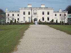 | Booterstown |
Dublin !Dublin | 53°18′17″N 6°12′20″W / 53.304829°N 6.205613°W / 53.304829; -6.205613 (St. Helen's, Booterstown) |
| 681 | Conolly's Folly | Folly/Obelisk |  | Barrogstown West |
Kildare !Kildare | 53°22′09″N 6°33′38″W / 53.369076°N 6.560519°W / 53.369076; -6.560519 (Conolly's Folly) |
| 471 | Castledermot Round Tower | Round Tower & Crosses | 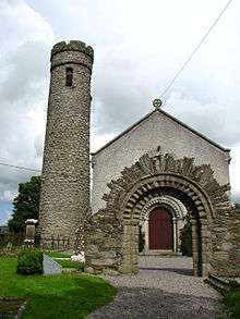 | Castledermot |
Kildare !Kildare | 52°54′38″N 6°50′06″W / 52.910458°N 6.834934°W / 52.910458; -6.834934 |
| 200 | Castledermot Abbey | Friary (Franciscan) | 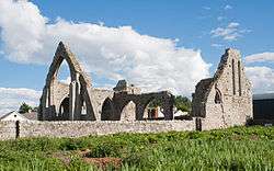 | Castledermot |
Kildare !Kildare | 52°54′31″N 6°50′14″W / 52.908556°N 6.837141°W / 52.908556; -6.837141 |
| 394 | Furness Church | Church | | Forenaghts Great |
Kildare !Kildare | 53°13′24″N 6°36′05″W / 53.22336275°N 6.60147609°W / 53.22336275; -6.60147609 |
| 629 | Grange Castle | Castle | 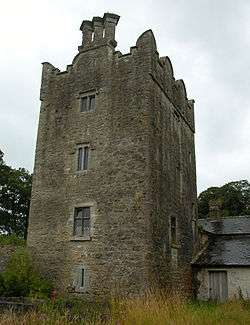 | Grange West |
Kildare !Kildare | 53°22′30″N 7°04′05″W / 53.375118°N 7.068169°W / 53.375118; -7.068169 |
| 528 | Jigginstown House | House - 16th/17th Century | | Jigginstown |
Kildare !Kildare | 53°12′50″N 6°40′57″W / 53.213788°N 6.682488°W / 53.213788; -6.682488 |
| 275 | Kilteel Castle | Castle & Cross | 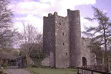 | Kilteel Upper |
Kildare !Kildare | 53°14′03″N 6°31′32″W / 53.234136°N 6.525565°W / 53.234136; -6.525565 |
| 485 | Maynooth Castle | Castle | 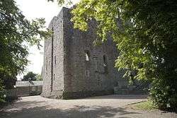 | Maynooth |
Kildare !Kildare | 53°22′51″N 6°35′40″W / 53.38079°N 6.5944°W / 53.38079; -6.5944 (Maynooth Castle) |
| 674 | Moone High Cross | High Cross | 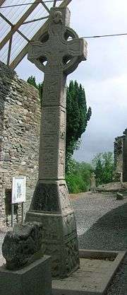 | Moone |
Kildare !Kildare | 53°46′31″N 7°30′01″W / 53.775218°N 7.500249°W / 53.775218; -7.500249 |
| 589 | Mullaghreelan Rath | Ringfort | | Mullaghreelan |
Kildare !Kildare | 52°56′09″N 6°52′24″W / 52.935953°N 6.873419°W / 52.935953; -6.873419 |
| 71 | Old Kilcullen | Church, Round Tower & Crosses |  | Old Kilcullen |
Kildare !Kildare | 53°06′25″N 6°45′45″W / 53.106967°N 6.762521°W / 53.106967; -6.762521 (Old Kilcullen) |
| 190 | Oughter Ard Tower | Round Tower & Church | 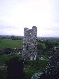 | Oughter Ard |
Kildare !Kildare | 53°16′40″N 6°33′57″W / 53.277716°N 6.565894°W / 53.277716; -6.565894 |
| 305 | Punchestown Longstone | Standing Stone | 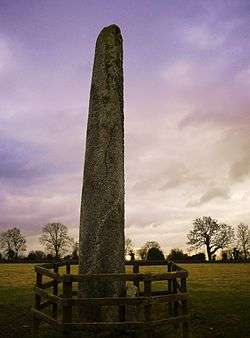 | Punchestown Great |
Kildare !Kildare | 53°11′31″N 6°37′43″W / 53.191838°N 6.628536°W / 53.191838; -6.628536 |
| 404 | Rathcoffey Castle | Castle gatehouse | 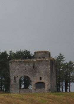 | Rathcoffey Demesne |
Kildare !Kildare | 53°19′53″N 6°39′53″W / 53.331396°N 6.664763°W / 53.331396; -6.664763 |
| 503 | St John's Tower | Tower, formerly part of hospital | | Skenagun |
Kildare !Kildare | 52°54′41″N 6°50′23″W / 52.911404°N 6.839839°W / 52.911404; -6.839839 |
| 70, 578 | Taghadoe | Round Tower and Church |  | Taghadoe |
Kildare !Kildare | 53°21′12″N 6°36′48″W / 53.353199°N 6.613237°W / 53.353199; -6.613237 |
| 334 | Aghaviller | Church & Round Tower |  | Aghaviller |
Kilkenny !Kilkenny | 52°27′55″N 7°16′05″W / 52.465167°N 7.2679167°W / 52.465167; -7.2679167 |
| 599 | Ballyboodan Ogham Stone | Ogham Stone (AD 700-900) |  | Ballyboodan |
Kilkenny !Kilkenny | 52°28′12″N 7°13′22″W / 52.4701036°N 7.2226583°W / 52.4701036; -7.2226583 |
| 282 | Ballylarkin Church | Church | | Ballylarkin Upper |
Kilkenny !Kilkenny | 52°43′22″N 7°25′39″W / 52.722866°N 7.427629°W / 52.722866; -7.427629 |
| 475 | Callan Augustinian Friary | Friary (Augustinian) |  | Callan |
Kilkenny !Kilkenny | 52°32′45″N 7°23′14″W / 52.545787°N 7.387348°W / 52.545787; -7.387348 |
| 455 | Callan Church (St. Mary's) | Church |  | Callan South |
Kilkenny !Kilkenny | 52°32′39″N 7°23′25″W / 52.544064°N 7.39015°W / 52.544064; -7.39015 |
| 79 | Kilkieran High Crosses | High Crosses | 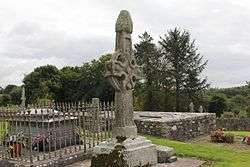 | Castletown (Iverk barony) |
Kilkenny !Kilkenny | 52°23′52″N 7°22′51″W / 52.397809°N 7.380761°W / 52.397809; -7.380761 |
| 274 | Clara Castle | Castle | 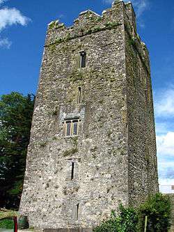 | Clara Upper |
Kilkenny !Kilkenny | 52°40′10″N 7°09′08″W / 52.669444°N 7.152168°W / 52.669444; -7.152168 |
| 77 | Clonamery Church | Church | | Clonamery |
Kilkenny !Kilkenny | 52°28′01″N 7°01′54″W / 52.466927°N 7.031789°W / 52.466927; -7.031789 |
| 646 | Coolhill Castle | Donjon | 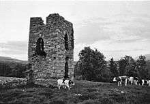 | Coolhill |
Kilkenny !Kilkenny | 52°27′54″N 6°55′56″W / 52.464942°N 6.932191°W / 52.464942; -6.932191 |
| 321 | Burnchurch Castle | Castle & Tower | 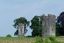 | Farmley |
Kilkenny !Kilkenny | 52°34′34″N 7°17′51″W / 52.576039°N 7.297509°W / 52.576039; -7.297509 |
| 522 | Magdalan Castle | Castle | 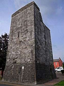 | Gardens |
Kilkenny !Kilkenny | 52°39′10″N 7°14′41″W / 52.652673°N 7.244756°W / 52.652673; -7.244756 |
| 331, 344 | St John's Abbey (Kilkenny) | Priory (Augustinian) (part of & chancel) | 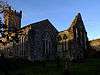 | Gardens |
Kilkenny !Kilkenny | 52°39′13″N 7°14′54″W / 52.653549°N 7.248406°W / 52.653549; -7.248406 |
| 626 | Kells Castle | Motte & Bailey | 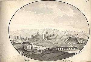 | Kells |
Kilkenny !Kilkenny | 52°32′18″N 7°16′01″W / 52.538333°N 7.266944°W / 52.538333; -7.266944 |
| 214 | St. Mary's Collegiate Church Gowran | Collegiate Church | 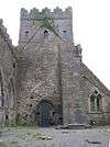 | Gowran |
Kilkenny !Kilkenny | 52°37′45″N 7°03′48″W / 52.6292°N 7.0633°W / 52.6292; -7.0633 |
| 620 | Graiguenamanagh Abbey | Abbey (Cistercian) |  | Graiguenamanagh |
Kilkenny !Kilkenny | 52°32′27″N 6°57′16″W / 52.54076°N 6.954525°W / 52.54076; -6.954525 |
| 74 | Grangefertagh | Round Tower & Church |  | Grangefertagh |
Kilkenny !Kilkenny | 52°46′42″N 7°32′41″W / 52.77841°N 7.544691°W / 52.77841; -7.544691 |
| 80 | Jerpoint Abbey | Abbey (Cistercian) |  | Thomastown |
Kilkenny !Kilkenny | 52°30′39″N 7°09′28″W / 52.510713°N 7.157804°W / 52.510713; -7.157804 |
| 300 | Kilfane Church | Church |  | Kilfane Demesne |
Kilkenny !Kilkenny | 52°33′15″N 7°07′06″W / 52.554055°N 7.118406°W / 52.554055; -7.118406 |
| 75 | Killamery High Cross | High Cross | 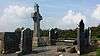 | Killamery |
Kilkenny !Kilkenny | 52°28′31″N 7°26′45″W / 52.475389°N 7.445971°W / 52.475389; -7.445971 |
| 324 | Kilmogue Portal Tomb | Portal Tomb | 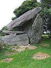 | Kilmogue, Harristown |
Kilkenny !Kilkenny | 52°24′11″N 7°15′45″W / 52.403077°N 7.2625°W / 52.403077; -7.2625 |
| 76 | Kilree | Church, Round Tower & Cross | 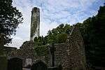 | Kilree |
Kilkenny !Kilkenny | 52°31′05″N 7°16′07″W / 52.518108°N 7.268573°W / 52.518108; -7.268573 |
| 655 | Knockroe | Passage Tomb | 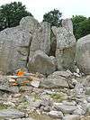 | Knockroe |
Kilkenny !Kilkenny | 52°25′54″N 7°23′59″W / 52.43175°N 7.39981°W / 52.43175; -7.39981 |
| 399 | Dunmore Cave | Cave |  | Ballyfoyle |
Kilkenny !Kilkenny | 52°44′02″N 7°14′48″W / 52.733946°N 7.246579°W / 52.733946; -7.246579 |
| 180 | Kells Priory | Priory (Augustinian) |  | Kells |
Kilkenny !Kilkenny | 52°32′19″N 7°16′01″W / 52.538632°N 7.266906°W / 52.538632; -7.266906 |
| 376 | Rathealy Ringfort | Ringfort | | Rathealy |
Kilkenny !Kilkenny | 52°41′41″N 7°25′57″W / 52.694722°N 7.432625°W / 52.694722; -7.432625 |
| 73 | Sheepstown Church | Church |  | Sheepstown |
Kilkenny !Kilkenny | 52°29′06″N 7°14′36″W / 52.485080°N 7.243442°W / 52.485080; -7.243442 |
| 72 | St. Francis Abbey (Kilkenny) | Friary (Franciscan) |  | St. Mary's Parish |
Kilkenny !Kilkenny | 52°39′21″N 7°15′12″W / 52.655926°N 7.253431°W / 52.655926; -7.253431 |
| 191 | Thomastown Church | Church |  | Thomastown |
Kilkenny !Kilkenny | 52°31′33″N 7°08′22″W / 52.525937°N 7.139316°W / 52.525937; -7.139316 |
| 161 | Tullaherin | Round Tower |  | Tullaherin |
Kilkenny !Kilkenny | 52°34′45″N 7°07′50″W / 52.579284°N 7.130428°W / 52.579284; -7.130428 |
| 670 | Tullaroan Church | Church | | Tullaroan |
Kilkenny !Kilkenny | 52°39′29″N 7°26′01″W / 52.658076°N 7.43363°W / 52.658076; -7.43363 |
| 78 | Ullard Church | Church |  | Ullard |
Kilkenny !Kilkenny | 52°34′49″N 6°55′59″W / 52.580162°N 6.932934°W / 52.580162; -6.932934 |
| 372 | Callan Motte | Motte |  | Westcourt Demesne |
Kilkenny !Kilkenny | 52°32′48″N 7°23′29″W / 52.546749°N 7.391368°W / 52.546749; -7.391368 |
| 540 | Aghnahily Ringfort | Ringfort | | Aghnahily |
Laois !Laois | 53°01′33″N 7°12′21″W / 53.025845°N 7.205918°W / 53.025845; -7.205918 |
| 567 | Coorlaghan Ringfort | Ringfort | | Coorlaghan |
Laois !Laois | 52°50′14″N 7°00′39″W / 52.837357°N 7.01086°W / 52.837357; -7.01086 |
| 615 | Dunamase Castle | Castle |  | Portlaoise and Stradbally |
Laois !Laois | 53°01′55″N 7°12′39″W / 53.031982°N 7.210748°W / 53.031982; -7.210748 |
| 113 | St. Kieran's Church | Church & Cross | | Errill |
Laois !Laois | 52°51′11″N 7°40′19″W / 52.852981°N 7.671985°W / 52.852981; -7.671985 |
| 114 | Fossy Church | Church | | Fossy Lower |
Laois !Laois | 52°57′27″N 7°11′25″W / 52.957551°N 7.190379°W / 52.957551; -7.190379 |
| 115 | Killeshin Church | Church |  | Killeshin |
Laois !Laois | 52°50′51″N 7°00′05″W / 52.84738°N 7.00151°W / 52.84738; -7.00151 |
| 116 | Sleaty Church | Church & Crosses |  | Sleaty |
Laois !Laois | 52°51′29″N 6°56′31″W / 52.858046°N 6.941971°W / 52.858046; -6.941971 |
| 114 | Timahoe Church | Church & Round Tower |  | Timahoe |
Laois !Laois | 52°57′38″N 7°12′13″W / 52.960498°N 7.203569°W / 52.960498; -7.203569 |
| 630 | Aghaward fort | Ringfort | | Aghaward |
Longford !Longford | 53°47′32″N 7°38′41″W / 53.792357°N 7.644732°W / 53.792357; -7.644732 |
| 677 | Corlea Trackway | Timber Trackway | 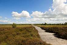 | Longford |
Longford !Longford | 53°37′25″N 7°52′22″W / 53.623543°N 7.87267°W / 53.623543; -7.87267 |
| 91 | Inchcleraun | Early Medieval Ecclesiastical Site | | Inchcleraun |
Longford !Longford | 53°35′06″N 8°00′40″W / 53.584863°N 8.011179°W / 53.584863; -8.011179 |
| 640 | Larkfield fort | Ringfort | | Larkfield |
Longford !Longford | 53°50′30″N 7°32′46″W / 53.841538°N 7.546034°W / 53.841538; -7.546034 |
| 263 | Granard Motte | Motte & Bailey |  | Granard |
Longford !Longford | 53°46′35″N 7°30′07″W / 53.776312°N 7.501945°W / 53.776312; -7.501945 |
| 598 | Sonnagh fort | Ringfort | | Sonnagh |
Longford !Longford | 53°49′51″N 7°36′02″W / 53.830744°N 7.600570°W / 53.830744; -7.600570 |
| 326 | Aghnaskeagh Cairns | Two Cairns | | Aghnaskeagh |
Louth !Louth | 54°03′39″N 6°21′28″W / 54.060871°N 6.357804°W / 54.060871; -6.357804 |
| LH018-040 | Athclare Castle | Castle | .jpg) | Athclare |
Louth !Louth | 53°29′08″N 6°14′07″W / 53.4855°N 6.2353°W / 53.4855; -6.2353 |
| 480 | Mansfieldstown Church | Church |  | Bawn |
Louth !Louth | 53°53′49″N 6°26′45″W / 53.896898°N 6.445724°W / 53.896898; -6.445724 |
| 249 | Carlingford Castle | Castle |  | Carlingford |
Louth !Louth | 54°02′36″N 6°11′13″W / 54.043207°N 6.186884°W / 54.043207; -6.186884 |
| 242 | The Mint | Urban Tower House |  | Carlingford |
Louth !Louth | 54°02′24″N 6°11′11″W / 54.040052°N 6.186259°W / 54.040052; -6.186259 |
| 388 | Dun Dealgan | Motte |  | Castletown |
Louth !Louth | 54°00′50″N 6°25′49″W / 54.013836°N 6.430278°W / 54.013836; -6.430278 |
| 526 | Donaghmore Souterrain | Souterrain |  | Donaghmore |
Louth !Louth | 54°00′11″N 6°27′36″W / 54.003072°N 6.460048°W / 54.003072; -6.460048 |
| 511 | St. Laurence's Gate | Town Gate |  | Drogheda |
Louth !Louth | 53°46′31″N 7°30′01″W / 53.775218°N 7.500249°W / 53.775218; -7.500249 |
| 92 | Dromiskin | Church & Round Tower |  | Dromiskin |
Louth !Louth | 53°55′20″N 6°23′54″W / 53.922124°N 6.398255°W / 53.922124; -6.398255 |
| 144 | Greenmount motte | Motte | 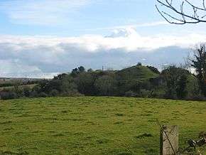 | Greenmount |
Louth !Louth | 53°52′41″N 6°23′08″W / 53.8781°N 6.3856°W / 53.8781; -6.3856 |
| 623 | Carlingford Abbey | Friary (Dominican) | 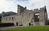 | Carlingford |
Louth !Louth | 54°02′17″N 6°11′04″W / 54.038139°N 6.18451°W / 54.038139; -6.18451 |
| 579 | Lisnaran Fort | Ringfort | | Linns |
Louth !Louth | 53°52′58″N 6°20′49″W / 53.882811°N 6.347015°W / 53.882811; -6.347015 |
| 93 | Mellifont Abbey | Abbey (Cistercian) | 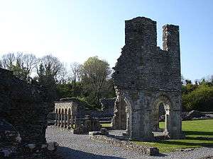 | Drogheda |
Louth !Louth | 53°44′33″N 6°27′59″W / 53.74241°N 6.466337°W / 53.74241; -6.466337 |
| 94 | Monasterboice | High crosses, churches & round tower | 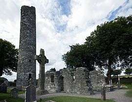 | Monasterboice |
Louth !Louth | 53°46′39″N 6°25′05″W / 53.777518°N 6.41809°W / 53.777518; -6.41809 |
| 312 | St. Mochta's House | Church | 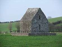 | Priorstate |
Louth !Louth | 53°57′12″N 6°32′44″W / 53.953335°N 6.545541°W / 53.953335; -6.545541 |
| 476 | Proleek Dolmen | Portal Tomb & wedge Tomb | 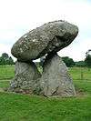 | Proleek |
Louth !Louth | 54°02′14″N 6°20′54″W / 54.037177°N 6.348344°W / 54.037177; -6.348344 |
| 474 | Clochafarmore | Standing Stone | .jpg) | Rathiddy |
Louth !Louth | 53°58′28″N 6°27′57″W / 53.974507°N 6.465904°W / 53.974507; -6.465904 |
| 597 | Ravensdale Park | Cairn | 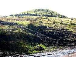 | Ravensdale Park |
Louth !Louth | 54°04′45″N 6°19′18″W / 54.079257°N 6.321654°W / 54.079257; -6.321654 |
| 460 | Castleroche Castle | Castle | 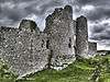 | Dundalk |
Louth !Louth | 54°02′47″N 6°29′18″W / 54.046478°N 6.488439°W / 54.046478; -6.488439 |
| 562 | Rockmarshall Court Tomb | Court Tomb | | Annaloughan |
Louth !Louth | 54°00′33″N 6°17′05″W / 54.009167°N 6.284722°W / 54.009167; -6.284722 |
| 298 | Roodstown Castle | Castle |  | Roodstown |
Louth !Louth | 53°52′21″N 6°29′12″W / 53.872416°N 6.486669°W / 53.872416; -6.486669 |
| 178 | Termonfeckin Castle | Castle | 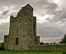 | Termonfeckin |
Louth !Louth | 53°45′43″N 6°16′01″W / 53.76190°N 6.26697°W / 53.76190; -6.26697 |
| 529 | Townleyhall passage grave | Passage Tomb |  | Townleyhall |
Louth !Louth | 53°43′16″N 6°27′05″W / 53.721150°N 6.451253°W / 53.721150; -6.451253 |
| | Alexander Reid mound | Barrow mound | | Alexander Reid |
Meath !Meath | 53°39′04″N 6°37′48″W / 53.651231°N 6.629919°W / 53.651231; -6.629919 |
| 546 | Ardmulchan Passage Tomb | Passage Tomb | | Ardmulchan |
Meath !Meath | 53°40′58″N 6°36′35″W / 53.682740°N 6.609606°W / 53.682740; -6.609606 |
| 496 | Ardmulchan Fort | Ringfort | | Ardmulchan |
Meath !Meath | 53°40′28″N 6°37′36″W / 53.674472°N 6.626735°W / 53.674472; -6.626735 |
| 239 | Cannistown Church | Church |  | Ardsallagh |
Meath !Meath | 53°37′07″N 6°40′05″W / 53.618507°N 6.667935°W / 53.618507; -6.667935 |
| 539 | Athcarne Castle | Castle | 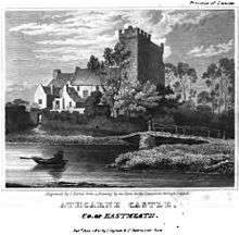 | Athcarne |
Meath !Meath | 53°37′19″N 6°26′29″W / 53.621945°N 6.441283°W / 53.621945; -6.441283 |
| 287 | Athlumney Castle | Castle | 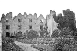 | Athlumney |
Meath !Meath | 53°39′01″N 6°40′30″W / 53.650258°N 6.675125°W / 53.650258; -6.675125 |
| 186, 468 | The Yellow Steeple & Nangle Castle | Priory (Augustinian) & Castle | 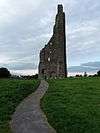 | Trim |
Meath !Meath | 53°33′23″N 6°47′19″W / 53.556454°N 6.788628°W / 53.556454; -6.788628 |
| 356 | Balrath Cross | Cross | 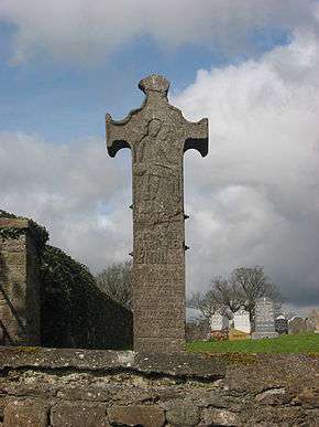 | Balrath |
Meath !Meath | 53°37′25″N 6°29′18″W / 53.623686°N 6.488256°W / 53.623686; -6.488256 |
| 187 | Bective Abbey | Abbey (Cistercian) | 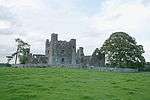 | Bective |
Meath !Meath | 53°34′58″N 6°42′10″W / 53.582653°N 6.702748°W / 53.582653; -6.702748 |
| 469 | Sheep Gate | Town Defences |  | Trim |
Meath !Meath | 53°33′19″N 6°47′16″W / 53.555280°N 6.787879°W / 53.555280; -6.787879 |
| 637 | Calliaghstown Well (St. Columcille's Well) | Holy Well | | Calliaghstown |
Meath !Meath | 53°40′17″N 6°19′46″W / 53.671492°N 6.329380°W / 53.671492; -6.329380 |
| 544 | Carrickdexter Cross (Baronstown Cross) | Stone cross (early 17th century) |  | Carrickdexter |
Meath !Meath | 53°42′11″N 6°34′57″W / 53.702968°N 6.582497°W / 53.702968; -6.582497 |
| 676,148 | Hill of Tara | Ritual & burial site, church & graveyard |  | Castletown Tara and Castleboy |
Meath !Meath | 53°35′03″N 6°36′53″W / 53.584038°N 6.614793°W / 53.584038; -6.614793 |
| 107 | Castlekeeran Crosses | Crosses |  | Castlekeeran |
Meath !Meath | 53°44′28″N 6°57′16″W / 53.741042°N 6.954343°W / 53.741042; -6.954343 |
| 199 | St. Patrick's Church | Church | | Duleek |
Meath !Meath | 53°39′19″N 6°25′12″W / 53.655341°N 6.419963°W / 53.655341; -6.419963 |
| 179 | Duleek Church | Church & Crosses |  | Commons |
Meath !Meath | 53°39′18″N 6°25′08″W / 53.655128°N 6.418852°W / 53.655128; -6.418852 |
| 440 | Dowdall Cross (Duleek) | Cross | | Commons |
Meath !Meath | 53°39′15″N 6°25′09″W / 53.654063°N 6.419194°W / 53.654063; -6.419194 |
| 290,151 | Loughcrew | Passage Tomb Cemetery & Other Monuments, Cairn & Standing Stone |  | Oldcastle |
Meath !Meath | 53°44′34″N 7°08′08″W / 53.742881°N 7.135447°W / 53.742881; -7.135447 |
| 264 | Cruicetown Church | Church & Cross | | Cruicetown |
Meath !Meath | 53°48′16″N 6°47′37″W / 53.804411°N 6.793726°W / 53.804411; -6.793726 |
| 309 | Danestown Fort | Ringfort/Ringwork |  | Danestown |
Meath !Meath | 53°37′27″N 6°31′24″W / 53.624071°N 6.523253°W / 53.624071; -6.523253 |
| 106 | Donaghmore Church | Church & Round Tower |  | Donaghmore |
Meath !Meath | 53°40′13″N 6°39′44″W / 53.670415°N 6.66224°W / 53.670415; -6.66224 |
| 232 | Donore Castle | Castle |  | Donore (Lune barony) |
Meath !Meath | 53°29′37″N 6°56′31″W / 53.493631°N 6.941964°W / 53.493631; -6.941964 |
| 410 | Dowth Mound | Mound, Standing Stone |  | Dowth |
Meath !Meath | 53°42′13″N 6°27′01″W / 53.703650°N 6.450267°W / 53.703650; -6.450267 |
| 652 | Dowth Passage Tomb | Passage Tomb |  | Dowth |
Meath !Meath | 53°42′14″N 6°27′02″W / 53.703841°N 6.450629°W / 53.703841; -6.450629 |
| 482 | Dunmoe Castle | Castle | 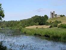 | Dunmoe |
Meath !Meath | 53°40′27″N 6°38′13″W / 53.674094°N 6.636899°W / 53.674094; -6.636899 |
| 489 | Church of St. Nicholas | Church | 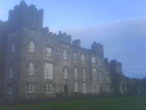 | Dunsany |
Meath !Meath | 53°32′11″N 6°37′03″W / 53.536281°N 6.617540°W / 53.536281; -6.617540 |
| 400 | St. Seachnail's Church | Church |  | Dunshaughlin |
Meath !Meath | 53°30′52″N 6°32′22″W / 53.514344°N 6.539433°W / 53.514344; -6.539433 |
| 472 | Fourknocks Passage Tomb | Passage Tomb | 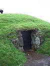 | Fourknocks |
Meath !Meath | 53°35′48″N 6°19′35″W / 53.596739°N 6.326369°W / 53.596739; -6.326369 |
| 541 | Gaulstown Barrow | Round barrow | | Gaulstown |
Meath !Meath | 53°37′43″N 6°27′25″W / 53.628660°N 6.456907°W / 53.628660; -6.456907 |
| 257 | Killeen Church | Church | | Killeen |
Meath !Meath | 53°32′10″N 6°35′41″W / 53.536074°N 6.594700°W / 53.536074; -6.594700 |
| 409 | Knowth Passage Tomb | Cemetery | 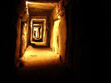 | Knowth |
Meath !Meath | 53°42′04″N 6°29′29″W / 53.701216°N 6.491398°W / 53.701216; -6.491398 |
| 549 | Knowth Mound | Enclosure & Mound | 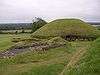 | Knowth |
Meath !Meath | 53°42′04″N 6°29′29″W / 53.701216°N 6.491398°W / 53.701216; -6.491398 |
| 543 | Loughbracken Fort | Mound and bailey | | Loughbrackan |
Meath !Meath | 53°50′09″N 6°40′38″W / 53.835872°N 6.677293°W / 53.835872; -6.677293 |
| 514 | Trim Castle | Castle | 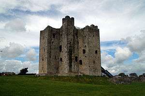 | Trim |
Meath !Meath | 53°33′15″N 6°47′23″W / 53.554299°N 6.789731°W / 53.554299; -6.789731 |
| 651 | Mountfortescue Hillfort | Ringditch, Tumulus & Hillfort | | Mountfortescue |
Meath !Meath | 53°45′43″N 6°34′34″W / 53.762048°N 6.576048°W / 53.762048; -6.576048 |
| 147 | Newgrange | Passage Tomb |  | Newgrange |
Meath !Meath | 53°41′41″N 6°28′26″W / 53.694608°N 6.474026°W / 53.694608; -6.474026 |
| 110 | Newtown Abbey | Cathedral |  | Newtown (Trim) |
Meath !Meath | 53°33′20″N 6°46′21″W / 53.555616°N 6.772612°W / 53.555616; -6.772612 |
| 551 | Ninch | Barrow | | Ninch |
Meath !Meath | 53°40′37″N 6°14′38″W / 53.676840°N 6.243921°W / 53.676840; -6.243921 |
| 261 | Rath Meave | Ritual Enclosure (Henge) | | Odder, Belpere |
Meath !Meath | 53°34′00″N 6°36′33″W / 53.566703°N 6.609245°W / 53.566703; -6.609245 |
| 289 | Rathmore Church | Church, Cross & Base | 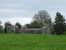 | Rathmore |
Meath !Meath | 53°38′35″N 6°52′21″W / 53.643171°N 6.872439°W / 53.643171; -6.872439 |
| 495 | Realtogue Fort | Ringfort | | Realtogue (Realtoge) |
Meath !Meath | 53°38′33″N 6°35′00″W / 53.642534°N 6.583406°W / 53.642534; -6.583406 |
| 322 | Athcarne Cross | Wayside cross (c. 1700) | 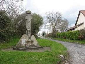 | Gaulstown |
Meath !Meath | 53°37′39″N 6°26′58″W / 53.627487°N 6.449429°W / 53.627487; -6.449429 |
| 25 | Robertstown Castle | Castle (17th century) | | Robertstown |
Meath !Meath | 53°48′06″N 6°48′33″W / 53.801668°N 6.809086°W / 53.801668; -6.809086 |
| 542 | Robertstown Fort | Bivallate ingfort | | Robertstown |
Meath !Meath | 53°47′39″N 6°49′13″W / 53.794130°N 6.820141°W / 53.794130; -6.820141 |
| 553 | Newtown Trim | St. John's Priory | 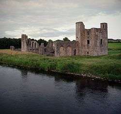 | Saint Johns |
Meath !Meath | 53°33′18″N 6°46′05″W / 53.555101°N 6.767919°W / 53.555101; -6.767919 |
| 547 | Sarsfieldstown Cross | Wayside cross (c. 1500) | 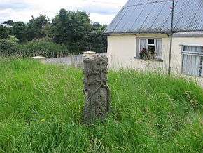 | Sarsfieldstown |
Meath !Meath | 53°39′14″N 6°15′27″W / 53.653951°N 6.257573°W / 53.653951; -6.257573 |
| 109 | Skryne Church | Church & Crosses |  | Skryne |
Meath !Meath | 53°35′10″N 6°33′47″W / 53.586035°N 6.563158°W / 53.586035; -6.563158 |
| 666,188 | Hill of Slane | Church & College | 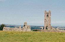 | Slane |
Meath !Meath | 53°43′02″N 6°32′35″W / 53.71715°N 6.543149°W / 53.71715; -6.543149 |
| 108 | St. Columb's House | Church |  | Kells |
Meath !Meath | 53°43′42″N 6°52′51″W / 53.728253°N 6.880766°W / 53.728253; -6.880766 |
| 158 | Kells Round Tower | Round Tower & High Crosses | 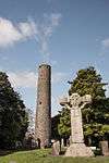 | Kells |
Meath !Meath | 53°43′39″N 6°52′46″W / 53.727401°N 6.879579°W / 53.727401; -6.879579 |
| 679 | Porch Fields | Town gate & medieval roadway | | Trim |
Meath !Meath | 53°33′19″N 6°47′16″W / 53.555281°N 6.787865°W / 53.555281; -6.787865 |
| 150 | Hill of Ward | Earthworks | 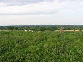 | Wardstown |
Meath !Meath | 53°37′26″N 6°53′10″W / 53.624°N 6.886°W / 53.624; -6.886 |
| 672 | Cadamstown Bridge | Bridge | .jpg) | Cadamstown |
Offaly !Offaly | 53°07′53″N 7°39′25″W / 53.131401°N 7.6569°W / 53.131401; -7.6569 |
| 617 | Cannakill | Deserted Medieval Village | | Cannakill |
Offaly !Offaly | 53°20′45″N 7°17′31″W / 53.345852°N 7.291950°W / 53.345852; -7.291950 |
| 510 | Kinnitty Cross | High cross & medieval wall | 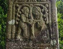 | Kinnitty |
Offaly !Offaly | 53°06′11″N 7°41′51″W / 53.10292°N 7.697468°W / 53.10292; -7.697468 |
| 497 | Saighir (Seir Kieran) | Early Medieval Ecclesiastical Site |  | Churchland and Clonmore |
Offaly !Offaly | 53°04′15″N 7°47′34″W / 53.070723°N 7.79277°W / 53.070723; -7.79277 |
| 336 | Clonfinlough Stone | Rock Art | 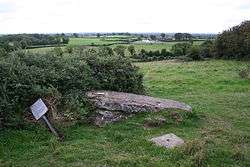 | Clonfinlough |
Offaly !Offaly | 53°19′03″N 7°56′09″W / 53.3176036°N 7.9359239°W / 53.3176036; -7.9359239 |
| 532 | Clonin Earthworks | Earthworks | | Clonin and Bawnmore |
Offaly !Offaly | 53°14′16″N 7°18′46″W / 53.237841°N 7.312725°W / 53.237841; -7.312725 |
| 81 | Clonmacnoise | Early Medieval Ecclesiastical Site |  | Clonmacnoise |
Offaly !Offaly | 53°19′37″N 7°59′10″W / 53.326838°N 7.986137°W / 53.326838; -7.986137 |
| 678,313 | Durrow Abbey | Cross, Church, graveslabs & motte |  | Durrow |
Offaly !Offaly | 53°19′34″N 7°31′22″W / 53.326134°N 7.5227°W / 53.326134; -7.5227 |
| 504 | Gallen Abbey | Church & Slabs | | Gallen |
Offaly !Offaly | 53°15′45″N 7°49′24″W / 53.262536°N 7.823283°W / 53.262536; -7.823283 |
| 82 | Rahan Churches | Churches |  | Rahan |
Offaly !Offaly | 53°16′45″N 7°36′45″W / 53.279054°N 7.612498°W / 53.279054; -7.612498 |
| 520 | Athlone Castle | Castle |  | Athlone |
Westmeath !Westmeath | 53°25′23″N 7°56′34″W / 53.423161°N 7.942875°W / 53.423161; -7.942875 |
| 481 | Delvin Castle | Castle | 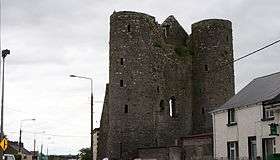 | Delvin |
Westmeath !Westmeath | 53°36′40″N 7°05′37″W / 53.611222°N 7.093569°W / 53.611222; -7.093569 |
| 560 | Dunnamona | Motte | 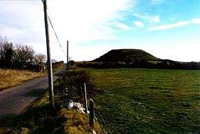 | Dunnamona |
Westmeath !Westmeath | 53°29′58″N 7°47′01″W / 53.499541°N 7.783672°W / 53.499541; -7.783672 |
| 610 | Mortimer's Castle | Castle | 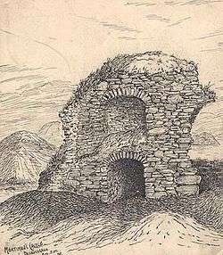 | Faughalstown |
Westmeath !Westmeath | 53°38′55″N 7°20′26″W / 53.648720°N 7.340677°W / 53.648720; -7.340677 |
| 220 | Fore town gates | Town gates | | Fore |
Westmeath !Westmeath | 53°40′45″N 7°13′32″W / 53.679206°N 7.225675°W / 53.679206; -7.225675 |
| 215 | Fore Abbey | Abbey (Benedictine) & hermitage | 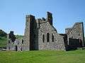 | Fore |
Westmeath !Westmeath | 53°41′02″N 7°13′38″W / 53.683939°N 7.227133°W / 53.683939; -7.227133 |
| 265 | Taghmon Church | Church |  | Glebe |
Westmeath !Westmeath | 53°36′03″N 7°15′59″W / 53.600889°N 7.266459°W / 53.600889; -7.266459 |
| 213 | Inchbofin | Early Medieval Ecclesiastical Site |  | Inchbofin |
Westmeath !Westmeath | 53°32′32″N 7°54′59″W / 53.542231°N 7.916358°W / 53.542231; -7.916358 |
| 155 | Ushnagh Hill, Catstone | Ringfort, Barrow & Stone | 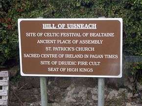 | Ushnagh Hill |
Westmeath !Westmeath | 53°29′18″N 7°33′44″W / 53.488356°N 7.562087°W / 53.488356; -7.562087 |
| 624 | Portlick Motte | Motte | | Portlick |
Westmeath !Westmeath | 53°29′28″N 7°54′38″E / 53.491193°N 7.910627°E / 53.491193; 7.910627 |
| 572 | Raharney Ringfort | Ringfort | | Raharney |
Westmeath !Westmeath | 53°31′03″N 7°05′33″W / 53.517607°N 7.092519°W / 53.517607; -7.092519 |
| 223 | Bealin High Cross | High Cross | | Twyford |
Westmeath !Westmeath | 53°26′07″N 7°50′42″W / 53.435149°N 7.844919°W / 53.435149; -7.844919 |
| 606 | Wattstown Barrows | Two Barrows (tumuli) | | Wattstown |
Westmeath !Westmeath | 53°34′32″N 7°25′53″W / 53.575554°N 7.431458°W / 53.575554; -7.431458 |
| 516 | Ballyhack Castle | Castle |  | Ballyhack |
Wexford !Wexford | 52°14′46″N 6°58′03″W / 52.246065°N 6.967478°W / 52.246065; -6.967478 |
| 375 | Ballymoty Motte | Motte | | Ballymoty More |
Wexford !Wexford | 52°30′20″N 6°27′41″W / 52.505617°N 6.461506°W / 52.505617; -6.461506 |
| 521 | Ferns Castle | Castle | 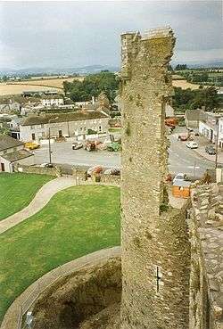 | Ferns |
Wexford !Wexford | 52°35′27″N 6°29′58″W / 52.590721°N 6.499309°W / 52.590721; -6.499309 |
| 665 | Clone Church | Church | | Clone |
Wexford !Wexford | 52°34′06″N 6°30′18″W / 52.568347°N 6.504963°W / 52.568347; -6.504963 |
| 644 | Coolhull Castle | Fortified House | 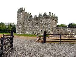 | Coolhull |
Wexford !Wexford | 52°14′03″N 6°42′18″W / 52.234239°N 6.705093°W / 52.234239; -6.705093 |
| 192 | Dunbrody Abbey | Abbey (Cistercian) | 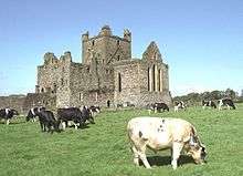 | Dunbrody |
Wexford !Wexford | 52°17′01″N 6°57′33″W / 52.283518°N 6.959281°W / 52.283518; -6.959281 |
| 668 | Duncannon Artillery Fort | Artillery fort | 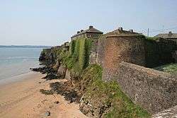 | Duncannon |
Wexford !Wexford | 52°13′15″N 6°56′12″W / 52.220754°N 6.936643°W / 52.220754; -6.936643 |
| 457 | Tacumshane Windmill | Windmill | 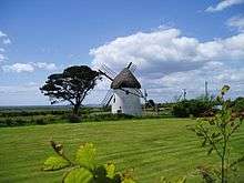 | Tacumshane |
Wexford !Wexford | 52°12′32″N 6°25′26″W / 52.208751°N 6.423955°W / 52.208751; -6.423955 |
| 133 | Ferns Church | Church | | Ferns |
Wexford !Wexford | 52°35′31″N 6°29′26″W / 52.591919°N 6.490515°W / 52.591919; -6.490515 |
| 133 | Ferns Cathedral & Crosses | Church | 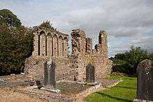 | Ferns |
Wexford !Wexford | 52°35′24″N 6°29′31″W / 52.590016°N 6.492041°W / 52.590016; -6.492041 |
| 133 | Ferns Abbey | Priory (Augustinian) | 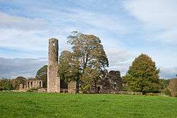 | Ferns |
Wexford !Wexford | 52°35′22″N 6°29′30″W / 52.589577°N 6.491654°W / 52.589577; -6.491654 |
| 443 | St. Mary's Church | Church | 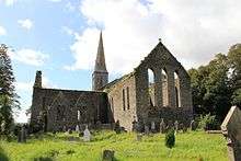 | New Ross |
Wexford !Wexford | 52°23′47″N 6°56′27″W / 52.396252°N 6.94072°W / 52.396252; -6.94072 |
| 434 | Rathmacknee Castle | Castle | 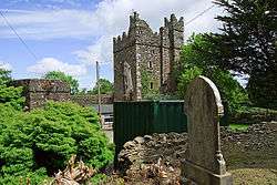 | Rathmacknee Great |
Wexford !Wexford | 52°16′09″N 6°29′26″W / 52.269301°N 6.490495°W / 52.269301; -6.490495 |
| 229 | Rathumney Castle | Castle | 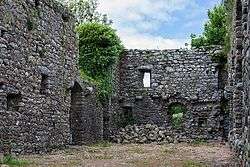 | Rathumney |
Wexford !Wexford | 52°17′43″N 6°52′28″W / 52.295312°N 6.874471°W / 52.295312; -6.874471 |
| 429 | Slade Castle | Castle |  | Slade |
Wexford !Wexford | 52°08′02″N 6°54′38″W / 52.133842°N 6.910632°W / 52.133842; -6.910632 |
| 392 | Vinegar Hill Windmill | Windmill | 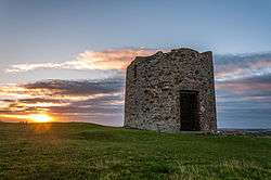 | Templeshannon |
Wexford !Wexford | 52°30′06″N 6°33′13″W / 52.501632°N 6.553488°W / 52.501632; -6.553488 |
| 506, 614 | Tintern Abbey | Abbey (Cistercian), Church & bridge | .jpg) | Tintern |
Wexford !Wexford | 52°14′13″N 6°50′18″W / 52.236867°N 6.838217°W / 52.236867; -6.838217 |
| 445 | St. Selskar's Priory | Church (Augustinian) | 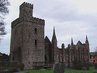 | Wexford |
Wexford !Wexford | 52°20′29″N 6°27′57″W / 52.341375°N 6.465887°W / 52.341375; -6.465887 |
| 137 | Aghowle Church | Church & Cross |  | Aghowle Lower (Shillelagh |
Wicklow !Wicklow | 52°46′04″N 6°37′13″W / 52.767899°N 6.620402°W / 52.767899; -6.620402 |
| 416 | Piper's Stones | Stone Circle | 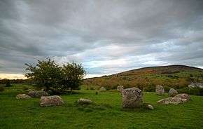 | Athgreany |
Wicklow !Wicklow | 53°04′19″N 6°36′46″W / 53.071899°N 6.612791°W / 53.071899; -6.612791 |
| 203 | Baltinglass Abbey | Abbey (Cistercian) | 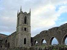 | Baltinglass |
Wicklow !Wicklow | 52°56′38″N 6°42′35″W / 52.943886°N 6.709747°W / 52.943886; -6.709747 |
| 418 | Crossoona Rath | Ringfort & Ogham Stone | | Boleycarrigeen |
Wicklow !Wicklow | 52°56′39″N 6°36′51″W / 52.944262°N 6.614062°W / 52.944262; -6.614062 |
| 134 | Glendalough | Cathedral, Round Tower, Churches, Priory (Augustinian), Crosses, ringfort, hut site & cave |  | Glendalough |
Wicklow !Wicklow | 53°00′37″N 6°19′39″W / 53.010278°N 6.3275°W / 53.010278; -6.3275 (Glendalough) |
| 280 | St. Mark's Cross | High Cross | 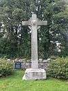 | Burgage More |
Wicklow !Wicklow | 53°09′41″N 6°32′29″W / 53.161499°N 6.54141°W / 53.161499; -6.54141 |
| 442 | Castleruddery Motte | Motte | | Castleruddery Lower |
Wicklow !Wicklow | 52°59′34″N 6°38′40″W / 52.992817°N 6.644379°W / 52.992817; -6.644379 |
| 441 | Castleruddery Stone Circle | Stone Circle | 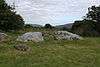 | Castleruddery Lower |
Wicklow !Wicklow | 52°59′28″N 6°38′12″W / 52.991092°N 6.636715°W / 52.991092; -6.636715 |
| 304 | Castletimon Ogham Stone | Ogham Stone | | Castletimon |
Wicklow !Wicklow | 52°54′16″N 6°04′13″W / 52.904307°N 6.070199°W / 52.904307; -6.070199 |
| 662 | Rath Turtle Moat | Ringfort | | Deerpark |
Wicklow !Wicklow | 53°10′46″N 6°33′28″W / 53.179395°N 6.557808°W / 53.179395; -6.557808 |
| 449 | Dwyer–McAllister Cottage | House with historical associations | | Derrynamuck (Donard) |
Wicklow !Wicklow | 52°57′44″N 6°33′53″W / 52.962126°N 6.564607°W / 52.962126; -6.564607 |
| 337 | Fassaroe Cross | Cross | 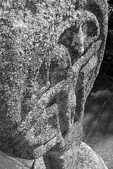 | Fassaroe, Bray |
Wicklow !Wicklow | 53°11′45″N 6°08′25″W / 53.195928°N 6.140404°W / 53.195928; -6.140404 |
| 267 | Kilcoole Church | Church | | Kilcoole |
Wicklow !Wicklow | 53°06′26″N 6°03′46″W / 53.107089°N 6.062804°W / 53.107089; -6.062804 |
| 417 | Kilcroney Church | Church | | Kilcroney |
Wicklow !Wicklow | 53°11′10″N 6°08′20″W / 53.186146°N 6.138794°W / 53.186146; -6.138794 |
| 323 | Kindlestown Castle | Castle | 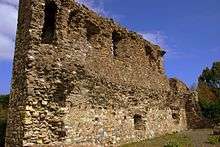 | Kindlestown Upper |
Wicklow !Wicklow | 53°08′28″N 6°05′20″W / 53.141190°N 6.089022°W / 53.141190; -6.089022 |
| 419 | Lemonstown Motte | Motte | | Lemonstown |
Wicklow !Wicklow | 53°05′07″N 6°39′27″W / 53.085262°N 6.657435°W / 53.085262; -6.657435 |
| 368 | Moylisha Wedge Tomb | Wedge Tomb | | Moylisha |
Wicklow !Wicklow | 52°45′05″N 6°37′20″W / 52.751400°N 6.622294°W / 52.751400; -6.622294 |
| 262 | Raheenachluig Church | Church | 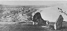 | Newcourt |
Wicklow !Wicklow | 53°11′38″N 6°05′26″W / 53.19379°N 6.090503°W / 53.19379; -6.090503 |
| 328 | Rathcoran | Passage Tomb & Hillfort | | Coolinarrig Upper, Pinnacle, Tuckmill Hill |
Wicklow !Wicklow | 52°56′49″N 6°41′00″W / 52.946997°N 6.683220°W / 52.946997; -6.683220 |
| 422 | Rathgall | Hill Fort | 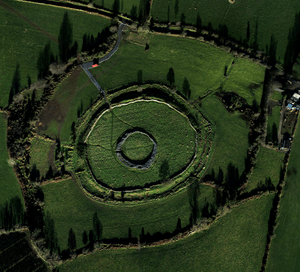 | Rath |
Wicklow !Wicklow | 52°48′08″N 6°39′47″W / 52.80224°N 6.663131°W / 52.80224; -6.663131 |
| 317 | Seefin Passage Tomb | Passage Tomb | 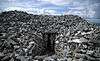 | Scurlocksleap |
Wicklow !Wicklow | 53°11′10″N 6°23′42″W / 53.186168°N 6.394889°W / 53.186168; -6.394889 |
| 491 | Threecastles Castle | Castle | 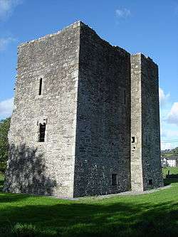 | Threecastles |
Wicklow !Wicklow | 53°10′54″N 6°29′14″W / 53.181654°N 6.487324°W / 53.181654; -6.487324 |
| 531 | Tornant Moat | Ringfort & Barrows | | Tornant Lower |
Wicklow !Wicklow | 53°02′43″N 6°42′04″W / 53.045350°N 6.701020°W / 53.045350; -6.701020 |
| 135 | St. Mary's Church, Downsmill | Church (11th century) |  | Woodlands |
Wicklow !Wicklow | 53°07′47″N 6°06′38″W / 53.129729°N 6.110652°W / 53.129729; -6.110652 |