| NM# |
Monument name |
Description |
Image |
Townland | County |
Location
|
|---|
| 11 | Corcomroe Abbey | Abbey (Cistercian) |  | Abbey West |
Clare !Clare | 53°07′37″N 9°03′14″W / 53.126911°N 9.054013°W / 53.126911; -9.054013 (Corcomroe Abbey) |
| 648 | Ballyallaban | Ringforts | _-_geograph.org.uk_-_3074975.jpg) | Ballyallaban |
Clare !Clare | 53°05′24″N 9°09′31″W / 53.09005°N 9.158578°W / 53.09005; -9.158578 (Ballyallaban) |
| 574 | Tau Cross (Cross Inneenboy) | Cross |  | Ballycashen, Roughan |
Clare !Clare | 52°58′40″N 9°06′53″W / 52.977822°N 9.114703°W / 52.977822; -9.114703 (Tau Cross / Cross Inneenboy) |
| 484 | Ballyhickey | Wedge Tomb | | Ballyhickey |
Clare !Clare | 52°50′04″N 8°51′19″W / 52.834406°N 8.855389°W / 52.834406; -8.855389 |
| 591 | Brian Boru's Fort | Ringfort | | Ballyvally |
Clare !Clare | 52°49′08″N 8°27′06″W / 52.818908°N 8.451578°W / 52.818908; -8.451578 |
| 478 | Bunratty Castle | Castle |  | Bunratty East |
Clare !Clare | 52°41′48″N 8°48′42″W / 52.696667°N 8.811667°W / 52.696667; -8.811667 (Bunratty Castle) |
| 466 | Caheraphuca | Wedge Tomb | | Caheraphuca |
Clare !Clare | 52°56′04″N 8°54′07″W / 52.934486°N 8.901825°W / 52.934486; -8.901825 (Caheraphuca) |
| 354 | Cahermacnaghten | Cashel | .jpg) | Cahermacnaghten |
Clare !Clare | 53°02′45″N 9°11′54″W / 53.045964°N 9.198353°W / 53.045964; -9.198353 (Cahermacnaghten) |
| 195 | Canon Island Abbey | Abbey (Augustinian) |  | Canon Island |
Clare !Clare | 52°40′44″N 9°02′13″W / 52.678981°N 9.036906°W / 52.678981; -9.036906 (Canon Island Abbey) |
| 197 | Clare Abbey | Abbey (Augustinian) | 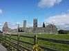 | Clarecastle |
Clare !Clare | 52°49′44″N 8°58′08″W / 52.828964°N 8.968881°W / 52.828964; -8.968881 (Clare Abbey) |
| 583 | Dromore Castle | Castle | 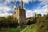 | Dromore |
Clare !Clare | 52°55′31″N 8°57′46″W / 52.925269°N 8.962639°W / 52.925269; -8.962639 (Dromore Castle) |
| 204 | Drumcliff | Church & Round Tower | 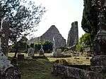 | Drumcliff |
Clare !Clare | 52°52′04″N 8°59′51″W / 52.8679°N 8.997506°W / 52.8679; -8.997506 (Drumcliff) |
| 170 | Ennis Friary | Friary (Franciscan) | 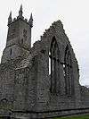 | Ennis |
Clare !Clare | 52°50′45″N 8°58′53″W / 52.845972°N 8.981381°W / 52.845972; -8.981381 (Ennis Friary) |
| 509 | Gleninagh Castle | Castle | 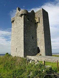 | Gleninagh North |
Clare !Clare | 53°08′16″N 9°12′21″W / 53.137656°N 9.205919°W / 53.137656; -9.205919 (Gleninagh Castle) |
| 14 | Inchicronan Abbey | Abbey (Augustinian) | 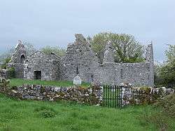 | Inchicronan |
Clare !Clare | 52°55′05″N 8°54′24″W / 52.917964°N 8.906675°W / 52.917964; -8.906675 (Inchicronan Abbey) |
| 5 | Inishcaltra (Inis Cealtra) | Early Medieval Ecclesiastical Site | 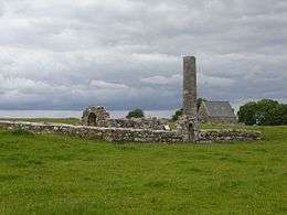 | Mountshannon |
Clare !Clare | 52°54′53″N 8°27′01″W / 52.914764°N 8.450144°W / 52.914764; -8.450144 (Inish Cealtra) |
| 7 | Kilfenora | Church | | Kilcarragh |
Clare !Clare | 52°59′23″N 9°13′23″W / 52.9896°N 9.2231°W / 52.9896; -9.2231 (Kilfenora Church) |
| 9 | Kilfenora Abbey | Friary (Franciscan) | 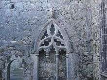 | Kilfenora |
Clare !Clare | 52°59′27″N 9°13′05″W / 52.990959°N 9.218177°W / 52.990959; -9.218177 (Kilfenora Abbey) |
| 8 | Kilfenora | Cathedral & Crosses | 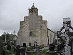 | Kilfenora |
Clare !Clare | 52°59′26″N 9°13′01″W / 52.9906°N 9.217003°W / 52.9906; -9.217003 (Kilfenora Cathedral) |
| 279 | St. Molua's Church | Church | %2C_St._Molua's_Church_(1).jpg) | Killaloe |
Clare !Clare | 52°48′25″N 8°26′40″W / 52.806993°N 8.444308°W / 52.806993; -8.444308 |
| 448 | Leamaneh Castle | Castle | 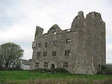 | Leamaneah North |
Clare !Clare | 52°59′15″N 9°08′23″W / 52.987636°N 9.139847°W / 52.987636; -9.139847 (Leamaneh Castle) |
| 16 | Dysert O'Dea | Church, Round Tower & Cross | 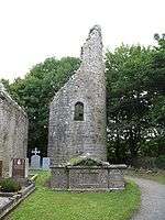 | Mollaneen |
Clare !Clare | 52°54′33″N 9°04′06″W / 52.909169°N 9.068394°W / 52.909169; -9.068394 (Dysert O'Dea) |
| 649 | Mooghaun | Hillfort | 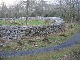 | Mooghaun |
Clare !Clare | 52°47′42″N 8°52′27″W / 52.794972°N 8.874069°W / 52.794972; -8.874069 (Mooghaun) |
| 176 | Killone Abbey | Abbey (Augustinian) | 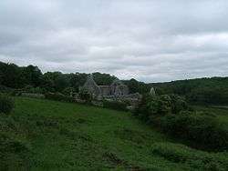 | Ennis |
Clare !Clare | 52°48′22″N 9°00′15″W / 52.806228°N 9.004189°W / 52.806228; -9.004189 (Killone Abbey) |
| 12 | Oughtmama | Three Churches | 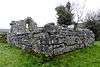 | Oughtmama |
Clare !Clare | 53°07′01″N 9°02′19″W / 53.116857°N 9.038548°W / 53.116857; -9.038548 (Oughtmama) |
| 17 | Ruan Church | Church | | Portlecka |
Clare !Clare | 52°55′41″N 8°59′24″W / 52.928125°N 8.989933°W / 52.928125; -8.989933 (Ruan Church) |
| 632 | Poulnabrone | Portal Tomb |  | Poulnabrone |
Clare !Clare | 53°02′55″N 9°08′24″W / 53.048696°N 9.140025°W / 53.048696; -9.140025 (Poulnabrone Dolmen) |
| 15 | Quin Abbey | Friary (Franciscan) |  | Quin |
Clare !Clare | 52°49′09″N 8°51′47″W / 52.8192°N 8.862956°W / 52.8192; -8.862956 (Quin Abbey) |
| 427 | Carrigaholt Castle | Castle | 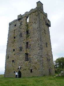 | Carrigaholt |
Clare !Clare | 52°36′00″N 9°41′58″W / 52.599947°N 9.699425°W / 52.599947; -9.699425 (Carrigaholt Castle) |
| 10 | Scattery Island (Inis Cathaigh) | Early Medieval Ecclesiastical Site | 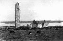 | Kilrush |
Clare !Clare | 52°36′42″N 9°31′10″W / 52.611583°N 9.519336°W / 52.611583; -9.519336 (Scattery Island) |
| 6 | St. Flannan's Church | Church | 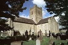 | Killaloe |
Clare !Clare | 52°48′23″N 8°26′21″W / 52.8065°N 8.43925°W / 52.8065; -8.43925 (St. Flannan's Church) |
| 270 | Slievenaglasha | Wedge Tomb | | Slievenaglasha |
Clare !Clare | 53°01′07″N 9°03′42″W / 53.018681°N 9.061803°W / 53.018681; -9.061803 (Slievenaglasha) |
| 13 | Temple Cronan | Church | 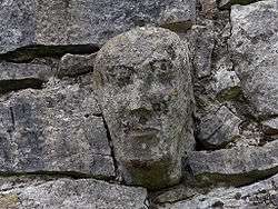 | Termon |
Clare !Clare | 53°02′46″N 9°03′40″W / 53.046164°N 9.061109°W / 53.046164; -9.061109 (Temple Cronan) |
| 224 | Magh Adhair | Inauguration Site | | Toonagh |
Clare !Clare | 52°50′28″N 8°49′44″W / 52.841228°N 8.828881°W / 52.841228; -8.828881 (Magh Adhair) |
| 270 | Tullycommon | Wedge Tomb | | Tullycommon |
Clare !Clare | 53°01′32″N 9°03′31″W / 53.025496°N 9.058521°W / 53.025496; -9.058521 |
| 270 | Cashlaungarr | Cashel | _(14593898110).jpg) | Tullycommon |
Clare !Clare | 53°00′48″N 9°04′47″W / 53.013266°N 9.079670°W / 53.013266; -9.079670 |
| 270 | Cahercommaun | Cashel |  | Carran |
Clare !Clare | 53°00′52″N 9°04′14″W / 53.014575°N 9.070519°W / 53.014575; -9.070519 (Cahercommaun) |
| 645 | Altar (tomb) | Wedge Tomb | | Altar |
Cork !Cork | 51°30′49″N 9°38′38″W / 51.51373°N 9.64398°W / 51.51373; -9.64398 |
| 314 | Ardskeagh | Church | | Ardskeagh |
Cork !Cork | 52°12′32″N 8°44′30″W / 52.20897°N 8.74164°W / 52.20897; -8.74164 |
| 301 | Ballybeg | Dovecote | 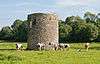 | Ballybeg East |
Cork !Cork | 52°13′13″N 8°40′11″W / 52.22023°N 8.66984°W / 52.22023; -8.66984 |
| 301 | Ballybeg | Tower |  | Ballybeg West |
Cork !Cork | 52°13′12″N 8°40′07″W / 52.21989°N 8.66851°W / 52.21989; -8.66851 |
| 301 | Ballybeg Abbey | Friary (Augustinian) |  | Buttevant |
Cork !Cork | 52°13′10″N 8°40′11″W / 52.21941°N 8.66976°W / 52.21941; -8.66976 |
| 22 | Templekieran, Clear Island | Church & Cross inscribed pillar | | Ballyieragh North |
Cork !Cork | 51°26′00″N 9°30′00″W / 51.43333°N 9.5°W / 51.43333; -9.5 |
| 425 | Ballinacarriga Castle | Castle |  | Dunmanway |
Cork !Cork | 51°42′20″N 9°01′54″W / 51.70561°N 9.03175°W / 51.70561; -9.03175 |
| 641 | Barryscourt Castle | Castle |  | Carrigtwohill |
Cork !Cork | 51°54′17″N 8°15′34″W / 51.90462°N 8.25937°W / 51.90462; -8.25937 |
| 594 | Blossomfort | Ringfort | | Blossomfort |
Cork !Cork | 52°10′07″N 8°44′24″W / 52.16869°N 8.73988°W / 52.16869; -8.73988 |
| 558 | Glanworth | Medieval tower |  | Boherash |
Cork !Cork | 52°11′21″N 8°21′20″W / 52.189069°N 8.355511°W / 52.189069; -8.355511 |
| 558 | Glanworth Castle | Castle |  | Glanworth |
Cork !Cork | 52°11′17″N 8°21′17″W / 52.18817°N 8.3547°W / 52.18817; -8.3547 |
| 558 | Rock Abbey, Glanworth | Friary (Franciscan) | 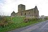 | Boherash |
Cork !Cork | 52°11′21″N 8°21′22″W / 52.18911°N 8.35625°W / 52.18911; -8.35625 |
| 450 | Breeny More | Stone Circle & boulder burials | | Breeny More |
Cork !Cork | 51°44′28″N 9°22′32″W / 51.7412°N 9.3755°W / 51.7412; -9.3755 |
| 202 | Buttevant Abbey | Friary (Franciscan) | 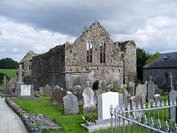 | Buttevant |
Cork !Cork | 52°13′52″N 8°40′09″W / 52.23124°N 8.66909°W / 52.23124; -8.66909 |
| 233 | Cahervagliar | Ringfort | | Cappeen West |
Cork !Cork | 51°47′35″N 8°59′49″W / 51.79310°N 8.99694°W / 51.79310; -8.99694 |
| 660 | Carrigagulla | Stone Circle | 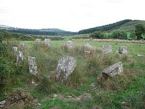 | Ballinagree |
Cork !Cork | 52°00′01″N 8°54′59″W / 52.000410°N 8.916359°W / 52.000410; -8.916359 |
| 255 | Carrigaphooca Castle | Castle |  | Macroom |
Cork !Cork | 51°54′19″N 8°57′45″W / 51.90531°N 8.96248°W / 51.90531; -8.96248 |
| 255 | Carrigaphooca stone circle | Stone Circle | | Carrigaphooca |
Cork !Cork | 51°54′35″N 9°01′30″W / 51.909610°N 9.024975°W / 51.909610; -9.024975 |
| 656 | Castledonovan Castle | Castle | 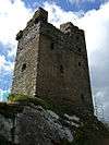 | Castledonovan |
Cork !Cork | 51°41′32″N 9°16′57″W / 51.69211°N 9.28259°W / 51.69211; -9.28259 |
| 281 | Mallow Castle | Castle | 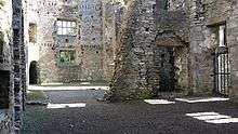 | Castlelands |
Cork !Cork | 52°08′05″N 8°38′18″W / 52.13459°N 8.63824°W / 52.13459; -8.63824 |
| 536 | Clodagh | Standing Stones - Pair | | Clodagh, County Cork |
Cork !Cork | 51°41′53″N 9°13′27″W / 51.69804°N 9.22428°W / 51.69804; -9.22428 |
| 240 | Conna Castle | Castle | 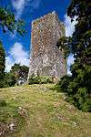 | Conna |
Cork !Cork | 52°05′40″N 8°06′06″W / 52.09454°N 8.10170°W / 52.09454; -8.10170 |
| 592 | Carn Tierna | Hillfort & Cairn | | Coolcarron, Corrin |
Cork !Cork | 52°06′54″N 8°16′58″W / 52.114982°N 8.282754°W / 52.114982; -8.282754 |
| 565 | Coolcoulaghta | Standing Stones - Pair | | Coolcoulaghta |
Cork !Cork | 51°35′48″N 9°32′36″W / 51.59669°N 9.54334°W / 51.59669; -9.54334 |
| 395 | Coole Upper | Two Churches | 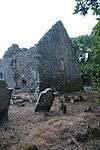 | Coole Upper |
Cork !Cork | 52°06′31″N 8°12′12″W / 52.10873°N 8.20338°W / 52.10873; -8.20338 |
| 600 | Derryarkane | Stone Circle & Standing Stone | | Derryarkane |
Cork !Cork | 51°43′43″N 9°22′19″W / 51.72859°N 9.37206°W / 51.72859; -9.37206 |
| 296 | Drishane Castle | Castle | 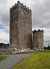 | Drishane More |
Cork !Cork | 52°04′31″N 9°02′55″W / 52.07515°N 9.04849°W / 52.07515; -9.04849 |
| 339 | Dromaneen Castle | Castle |  | Dromaneen |
Cork !Cork | 52°07′35″N 8°43′50″W / 52.12636°N 8.73066°W / 52.12636; -8.73066 |
| 381 | Drombeg Stone | Circle, Hut Site & Fulacht Fiadh | 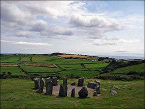 | Glandore |
Cork !Cork | 51°33′52″N 9°05′13″W / 51.56455°N 9.08702°W / 51.56455; -9.08702 |
| 169 | Sherkin Abbey | Friary (Franciscan) | 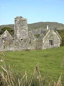 | Sherkin Island |
Cork !Cork | 51°28′28″N 9°23′58″W / 51.474487°N 9.399394°W / 51.474487; -9.399394 |
| 374 | Farranahineeny | Stone Row | | Farranahineeny |
Cork !Cork | 51°47′42″N 9°08′20″W / 51.79494°N 9.13888°W / 51.79494; -9.13888 |
| 284 | Knockdrum Stone Fort | Cashel |  | Farrandau |
Cork !Cork | 51°31′36″N 9°11′39″W / 51.52669°N 9.19413°W / 51.52669; -9.19413 |
| 426 | Ballycrovane | Ogham Stone |  | Faunkill and the Woods |
Cork !Cork | 51°42′47″N 9°56′41″W / 51.71315°N 9.94460°W / 51.71315; -9.94460 |
| 535 | Charles Fort | Star-Shaped-Fort | 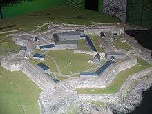 | Summer Cove |
Cork !Cork | 51°41′47″N 8°29′56″W / 51.6965°N 8.499°W / 51.6965; -8.499 |
| 552 | Greenhill | Ogham Stones | | Greenhill |
Cork !Cork | 52°04′42″N 8°36′28″W / 52.07826°N 8.60785°W / 52.07826; -8.60785 |
| 502 | Island | Wedge Tomb | | Island |
Cork !Cork | 52°04′03″N 8°34′43″W / 52.06762°N 8.57854°W / 52.06762; -8.57854 |
| 490 | Kilbolane Castle | Castle | 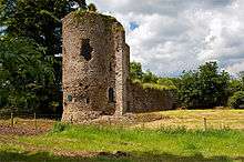 | Milford |
Cork !Cork | 52°20′20″N 8°51′04″W / 52.339°N 8.851°W / 52.339; -8.851 |
| 182 | Kilcrea Abbey | Friary (Franciscan) | 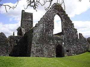 | Ovens |
Cork !Cork | 51°51′54″N 8°42′41″W / 51.86498°N 8.71128°W / 51.86498; -8.71128 |
| 316 | Kileenemer | Church | 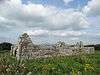 | Killeenemer |
Cork !Cork | 52°12′56″N 8°19′43″W / 52.21546°N 8.32850°W / 52.21546; -8.32850 |
| 436 | Kilnaruane/Bantry Pillar Stone | Shaft of High Cross | 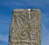 | Kilnaruane |
Cork !Cork | 51°40′17″N 9°28′05″W / 51.67132°N 9.46799°W / 51.67132; -9.46799 |
| 420 | Knocknakilla | Stone Circle | 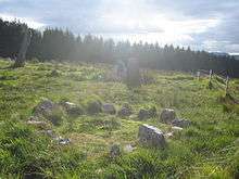 | Macroom and Millstreet |
Cork !Cork | 52°00′22″N 9°01′25″W / 52.00618°N 9.02355°W / 52.00618; -9.02355 |
| 318 | Labbacallee wedge tomb | Wedge Tomb | 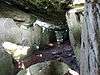 | Glanworth |
Cork !Cork | 52°10′11″N 8°20′13″W / 52.16984°N 8.33689°W / 52.16984; -8.33689 |
| 18 | Labbamolaga | Church & Grave slabs | 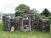 | Labbamolaga |
Cork !Cork | 52°18′39″N 8°20′51″W / 52.31080°N 8.34761°W / 52.31080; -8.34761 |
| 333 | Liscarroll Castle | Castle | 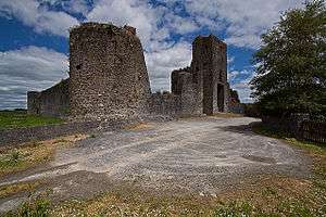 | Liscarroll |
Cork !Cork | 52°15′40″N 8°48′12″W / 52.26108°N 8.80338°W / 52.26108; -8.80338 |
| 571 | Lissacresig | Stone Circle | | Lissacresig |
Cork !Cork | 51°55′33″N 9°03′49″W / 51.92590°N 9.06369°W / 51.92590; -9.06369 |
| 571 | Lissacresig | Ringfort | | Lissacresig |
Cork !Cork | 51°55′43″N 9°03′59″W / 51.92863°N 9.06642°W / 51.92863; -9.06642 |
| | Maughanasilly | Stone Row | | Maughanasilly |
Cork !Cork | 51°46′14″N 9°23′11″W / 51.7706°N 9.3865°W / 51.7706; -9.3865 |
| 411 | Castlelyons Friary | Friary (Carmelite)[1] | 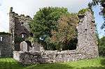 | Mohera |
Cork !Cork | 52°05′21″N 8°14′01″W / 52.08918°N 8.23366°W / 52.08918; -8.23366 |
| 525 | James Fort | Star-Shaped-Fort & Blockhouse |  | Castlepark |
Cork !Cork | 51°41′59″N 8°30′37″W / 51.69964°N 8.51028°W / 51.69964; -8.51028 |
| 517 | Kanturk Castle | Castle | 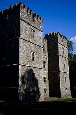 | Kanturk |
Cork !Cork | 52°09′55″N 8°54′10″W / 52.16530°N 8.90279°W / 52.16530; -8.90279 |
| 580 | Skeagh Cairn | Ring barrow & Cairn | | Skeagh |
Cork !Cork | 51°34′29″N 9°20′18″W / 51.574745°N 9.338471°W / 51.574745; -9.338471 |
| | Mount Gabriel | Prehistoric copper mines | | Schull |
Cork !Cork | 51°33′07″N 9°31′51″W / 51.551977°N 9.530854°W / 51.551977; -9.530854 |
| 618 | Kinneigh Round Tower | Round Tower |  | Castletown-Kinneigh |
Cork !Cork | 51°45′50″N 8°58′31″W / 51.76394°N 8.97539°W / 51.76394; -8.97539 |
| 21 | Timoleague Abbey | Friary (Franciscan) |  | Timoleague |
Cork !Cork | 51°38′35″N 8°45′49″W / 51.64302°N 8.76351°W / 51.64302; -8.76351 |
| 360 | Desmond Castle or The French Prison, Kinsale | Tower House |  | Kinsale |
Cork !Cork | 51°42′26″N 8°31′29″W / 51.70736°N 8.52484°W / 51.70736; -8.52484 |
| 299 | Tullylease | Church & Grave Slabs | 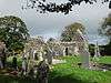 | Tullylease |
Cork !Cork | 52°19′00″N 8°56′23″W / 52.31669°N 8.93965°W / 52.31669; -8.93965 |
| 634 | Michael Collins birth place | Site with historic associations |  | Woodfield |
Cork !Cork | 51°36′40″N 8°58′42″W / 51.61102°N 8.97834°W / 51.61102; -8.97834 |
| 286 | North Abbey, Youghal | Friary (Dominican) |  | Youghal |
Cork !Cork | 51°57′27″N 7°51′16″W / 51.95744°N 7.85454°W / 51.95744; -7.85454 |
| 56 | Annagh | Church | _looking_Northeast.JPG) | Annagh |
Kerry !Kerry | 52°14′55″N 9°45′17″W / 52.248522°N 9.754818°W / 52.248522; -9.754818 |
| 430 | Ardcanaght Stones | Ogham Stones | | Ardcanaght |
Kerry !Kerry | 52°10′10″N 9°43′35″W / 52.169473°N 9.726435°W / 52.169473; -9.726435 |
| 54 | Ardfert Cathedral | Cathedral & 2 Churches |  | Ardfert |
Kerry !Kerry | 52°19′44″N 9°46′54″W / 52.328801°N 9.781773°W / 52.328801; -9.781773 |
| 358 | Ardfert Abbey | Friary (Franciscan) |  | Ardfert |
Kerry !Kerry | 52°19′49″N 9°46′26″W / 52.330294°N 9.773911°W / 52.330294; -9.773911 |
| 221 | Arraglen | Ogham Stone | | Arraglen (Corkaguiney Barony) |
Kerry !Kerry | 52°11′12″N 10°20′28″W / 52.186673°N 10.341102°W / 52.186673; -10.341102 |
| 355 | Gallaunmore | Standing stone | | Ballineetig |
Kerry !Kerry | 52°08′21″N 10°13′22″W / 52.139254°N 10.222848°W / 52.139254; -10.222848 |
| 221 | Ballinknockane | Burial ground & possible church | | Ballinknockane (Kilgobban civil parish) |
Kerry !Kerry | 52°14′02″N 10°17′49″W / 52.233905°N 10.297032°W / 52.233905; -10.297032 |
| 221 | Ballinknockane | Hut sites | | Ballinknockane (Kilquane civil parish) |
Kerry !Kerry | |
| 221 | Ballinknockane | Hut site & souterrain | | Ballinknockane (Kilquane civil parish) |
Kerry !Kerry | |
| 168 | Ballinskelligs Abbey | Priory (Augustinian) |  | Ballinskelligs |
Kerry !Kerry | 51°48′55″N 10°16′18″W / 51.815318°N 10.271774°W / 51.815318; -10.271774 |
| 64 | Ballintaggart | Ogham Stones | .png) | Ballintaggart |
Kerry !Kerry | 52°07′40″N 10°14′35″W / 52.127783°N 10.243178°W / 52.127783; -10.243178 |
| 221 | Ballybowler North | Ogham Stone | | Ballybowler North |
Kerry !Kerry | |
| 364 | Ballymalis Castle | Castle | _-_geograph.org.uk_-_1392760.jpg) | Ballymalis |
Kerry !Kerry | 52°05′05″N 9°41′33″W / 52.084602°N 9.692596°W / 52.084602; -9.692596 |
| 62 | Teampall Geal (St. Manchan's Oratory) | Early Medieval Ecclesiastical Site & ogham stone | | Ballymorereagh |
Kerry !Kerry | 52°09′16″N 10°19′53″W / 52.154517°N 10.331273°W / 52.154517; -10.331273 |
| 221 | Cathair na BhFionnúrach | Stone fort, huts & souterrain | | Ballynavenooragh |
Kerry !Kerry | 52°13′34″N 10°17′53″W / 52.226192°N 10.297974°W / 52.226192; -10.297974 |
| 221 | Ballynavenooragh | Stone fort & hut | | Ballynavenooragh |
Kerry !Kerry | 52°13′38″N 10°17′48″W / 52.227350°N 10.296693°W / 52.227350; -10.296693 |
| 221 | Cathair na gCat | Cashel & Ogham Stone | | Ballywiheen |
Kerry !Kerry | 52°09′22″N 10°24′27″W / 52.156188°N 10.407492°W / 52.156188; -10.407492 |
| 221 | Ballywiheen | Early Medieval Ecclesiastical Site |  | Ballywiheen |
Kerry !Kerry | 52°09′32″N 10°24′25″W / 52.158809°N 10.406990°W / 52.158809; -10.406990 |
| 380, 492 | Beenbane | Calluragh, hut sites, cross slab, enclosure, souterrain, cross, standing stones | | Beenbane |
Kerry !Kerry | 51°49′55″N 10°09′25″W / 51.831927°N 10.156948°W / 51.831927; -10.156948 |
| 500 | Beginish house | Stone-built house |  | Beginish |
Kerry !Kerry | 51°56′20″N 10°17′24″W / 51.938991°N 10.289963°W / 51.938991; -10.289963 |
| 184 | Caherconree Fort | Promontory Fort (Inland) | 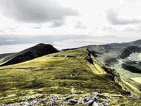 | Caherconree |
Kerry !Kerry | 52°11′51″N 9°51′47″W / 52.197367°N 9.863012°W / 52.197367; -9.863012 |
| 221 | Caherdorgan North | Cashel | | Caherdorgan North |
Kerry !Kerry | 52°10′45″N 10°20′22″W / 52.179233°N 10.339492°W / 52.179233; -10.339492 |
| 221 | The Chancellor's House | Building - medieval | %2C_The_Chancellor's_House_-_geograph.org.uk_-_275343.jpg) | Caherdorgan North |
Kerry !Kerry | 52°10′54″N 10°20′18″W / 52.181803°N 10.338227°W / 52.181803; -10.338227 |
| 238 | Callanafersy (Lisgortnageragh) | Ringfort | | Callanafersy West |
Kerry !Kerry | 52°08′13″N 9°46′28″W / 52.136969°N 9.774545°W / 52.136969; -9.774545 |
| 249 | Carrigafoyle Castle | Castle |  | Ballylongford |
Kerry !Kerry | 52°34′12″N 9°29′39″W / 52.570048°N 9.494181°W / 52.570048; -9.494181 |
| 59 | Church Island (Valentia Harbour) | Early Medieval Ecclesiastical Site | | Valentia Harbour |
Kerry !Kerry | 51°56′16″N 10°16′58″W / 51.937757°N 10.282833°W / 51.937757; -10.282833 |
| 60 | Church Island (Lough Currane) | Early Medieval Ecclesiastical Site | 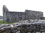 | Lough Currane |
Kerry !Kerry | 51°50′07″N 10°07′49″W / 51.83516°N 10.1304°W / 51.83516; -10.1304 |
| 228 | Cloghanecarhan | Ringfort & Ogham Stone | | Cloghanecarhan |
Kerry !Kerry | 51°53′18″N 10°11′02″W / 51.888380°N 10.183974°W / 51.888380; -10.183974 |
| 385 | Dunloe | Ogham Stones | .jpg) | Coolmagort |
Kerry !Kerry | 52°03′36″N 9°38′05″W / 52.059967°N 9.634751°W / 52.059967; -9.634751 |
| 346 | Darrynane Beg | Ogham Stone | | Derrynane |
Kerry !Kerry | 51°45′51″N 10°07′19″W / 51.764121°N 10.121920°W / 51.764121; -10.121920 |
| 221 | Doonmore | Promontory Fort |  | Doonsheane |
Kerry !Kerry | 52°07′07″N 10°13′19″W / 52.118696°N 10.221967°W / 52.118696; -10.221967 |
| 221 | Emlagh East | Ogham Stone | | Emlagh East (Dingle civil parish) |
Kerry !Kerry | 52°07′54″N 10°13′00″W / 52.131659°N 10.216570°W / 52.131659; -10.216570 |
| 391 | Emlagh East | Cashel | | Emlagh East (Dingle civil parish) |
Kerry !Kerry | 52°08′04″N 10°13′32″W / 52.134521°N 10.225647°W / 52.134521; -10.225647 |
| 177 | Dunbeg Fort | Promontory Fort |  | Fahan |
Kerry !Kerry | 52°06′12″N 10°24′31″W / 52.103408°N 10.408541°W / 52.103408; -10.408541 |
| 65 | Gallarus Castle | Castle | 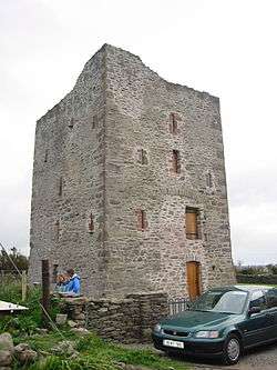 | Baile na nGall |
Kerry !Kerry | 52°10′33″N 10°21′21″W / 52.175824°N 10.355942°W / 52.175824; -10.355942 |
| 66 | Gallarus Oratory | Early Medieval Ecclesiastical Site |  | Baile na nGall |
Kerry !Kerry | 52°10′22″N 10°21′00″W / 52.172695°N 10.349936°W / 52.172695; -10.349936 |
| 64 | Garfinny | Cemetery | | Garfinny |
Kerry !Kerry | 52°08′53″N 10°14′03″W / 52.147965°N 10.234200°W / 52.147965; -10.234200 |
| 612 | Garfinny | Bridge |  | Garfinny & Flemingstown |
Kerry !Kerry | 52°09′00″N 10°13′38″W / 52.149939°N 10.227143°W / 52.149939; -10.227143 |
| 156 | Cathair Sayer | Clochaun | | Glanfahan |
Kerry !Kerry | |
| 156 | Cathair Martín | Clochaun | | Glanfahan |
Kerry !Kerry | 52°06′07″N 10°25′29″W / 52.101993°N 10.424610°W / 52.101993; -10.424610 |
| 156 | Cathair Murphy | Clochaun | | Glanfahan |
Kerry !Kerry | |
| 156 | Cathair Síleoid | Clochán | | Glanfahan |
Kerry !Kerry | |
| 156 | Caher Conor | Cashel | | Glanfahan |
Kerry !Kerry | 52°06′06″N 10°25′17″W / 52.101705°N 10.421369°W / 52.101705; -10.421369 |
| 221 | Glin North | Clochán & stone fort | | Glin North |
Kerry !Kerry | 52°10′52″N 10°16′53″W / 52.181148°N 10.281366°W / 52.181148; -10.281366 |
| 221 | Glin North | Cashel | | Glin North |
Kerry !Kerry | 52°10′49″N 10°17′09″W / 52.180344°N 10.285700°W / 52.180344; -10.285700 |
| 63 | Rínn an Chaisleáin | Church site | | Great Blasket Island |
Kerry !Kerry | 52°05′40″N 10°32′26″W / 52.094469°N 10.540438°W / 52.094469; -10.540438 |
| 61 | Skellig Michael | Early Medieval Ecclesiastical Site | 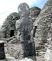 | Great Skellig |
Kerry !Kerry | 51°46′20″N 10°32′19″W / 51.772187°N 10.538701°W / 51.772187; -10.538701 |
| 67 | Illauntannig | Early Medieval Ecclesiastical Site | | Illauntannig |
Kerry !Kerry | 52°19′34″N 10°01′12″W / 52.326209°N 10.019893°W / 52.326209; -10.019893 |
| 63 | Inishtooskert | Early Medieval Ecclesiastical Site |  | Inishtooskert |
Kerry !Kerry | 52°04′55″N 10°34′05″W / 52.082043°N 10.568069°W / 52.082043; -10.568069 |
| 63 | Inishvickillane | Early Medieval Ecclesiastical Site | | Inishvickillane |
Kerry !Kerry | 52°02′39″N 10°36′31″W / 52.044036°N 10.608539°W / 52.044036; -10.608539 |
| 183 | Innisfallen Abbey | Church, Oratory & Abbey (Benedictine) |  | Innisfallen Island |
Kerry !Kerry | 52°02′48″N 9°33′15″W / 52.046577°N 9.554222°W / 52.046577; -9.554222 |
| 329 | Kilcoolaght East ogham stones | Ogham Stones | | Kilcoolaght East |
Kerry !Kerry | 52°04′26″N 9°44′46″W / 52.073977°N 9.745985°W / 52.073977; -9.745985 |
| 593 | Killelton | Church |  | Killelton |
Kerry !Kerry | 52°13′41″N 9°52′26″W / 52.228188°N 9.873757°W / 52.228188; -9.873757 |
| 65 | Kilmalkedar | Early Medieval Ecclesiastical Site |  | Kilmalkedar |
Kerry !Kerry | 52°11′06″N 10°20′11″W / 52.184913°N 10.336476°W / 52.184913; -10.336476 |
| 221 | Keelers' Stone | Bullaun Stone | | Kilmalkedar |
Kerry !Kerry | 52°11′08″N 10°20′18″W / 52.185523°N 10.338254°W / 52.185523; -10.338254 |
| 221 | St. Brendan's Oratory | Church | | Kilmalkedar |
Kerry !Kerry | 52°11′05″N 10°20′11″W / 52.184798°N 10.336304°W / 52.184798; -10.336304 |
| 227 | Cahergall | Cashel |  | Kimego West |
Kerry !Kerry | 51°57′21″N 10°15′28″W / 51.955903°N 10.257801°W / 51.955903; -10.257801 |
| 414 | Leacanabuaile | Cashel | | Kimego West |
Kerry !Kerry | 51°57′30″N 10°15′43″W / 51.958234°N 10.261858°W / 51.958234; -10.261858 |
| 258 | Lislaughtin Abbey | Friary (Franciscan) |  | Lislaughtin |
Kerry !Kerry | 52°33′27″N 9°28′12″W / 52.557472°N 9.470057°W / 52.557472; -9.470057 |
| 260 | Listowel Castle | Castle | 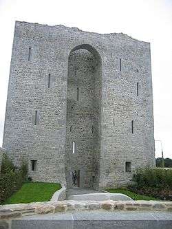 | Listowel |
Kerry !Kerry | 52°26′33″N 9°39′00″W / 52.442473°N 9.64999°W / 52.442473; -9.64999 |
| 611 | Loher | Cashel |  | Loher |
Kerry !Kerry | 51°47′10″N 10°09′56″W / 51.78604°N 10.16558°W / 51.78604; -10.16558 |
| 221 | Maumanorig | Early Medieval Ecclesiastical Site | | Maumanorig |
Kerry !Kerry | 52°08′38″N 10°21′31″W / 52.143812°N 10.358662°W / 52.143812; -10.358662 |
| 311 | Muckross Abbey | Friary (Franciscan) | 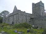 | Killarney National Park |
Kerry !Kerry | 52°01′34″N 9°29′42″W / 52.026206°N 9.494901°W / 52.026206; -9.494901 |
| 53 | Aghadoe | Early Medieval Ecclesiastical Site | 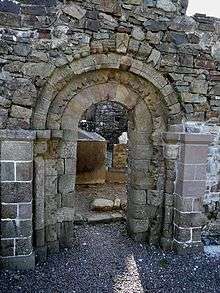 | Parkavonear |
Kerry !Kerry | 52°04′36″N 9°33′16″W / 52.076745°N 9.554511°W / 52.076745; -9.554511 |
| 236 | Parkavonear Castle | Castle | 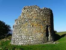 | Parkavonear |
Kerry !Kerry | 52°04′33″N 9°33′18″W / 52.075938°N 9.555020°W / 52.075938; -9.555020 |
| 10001 | Illaunloughan | Early Medieval Ecclesiastical Site | | Portmagee |
Kerry !Kerry | 51°53′11″N 10°22′25″W / 51.886476°N 10.373579°W / 51.886476; -10.373579 |
| 221 | Rahinnane Castle | Castle, Ringfort and Souterrain |  | Ventry |
Kerry !Kerry | 52°08′35″N 10°22′59″W / 52.143153°N 10.383186°W / 52.143153; -10.383186 |
| 57 | Ratass | Church & Ogham Stone |  | Ratass |
Kerry !Kerry | 52°16′01″N 9°40′55″W / 52.267011°N 9.681834°W / 52.267011; -9.681834 |
| 55 | Rattoo | Early Medieval Ecclesiastical Site | 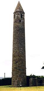 | Rattoo |
Kerry !Kerry | 52°26′33″N 9°39′00″W / 52.442473°N 9.64999°W / 52.442473; -9.64999 |
| 519 | Reask | Early Medieval Ecclesiastical Site | 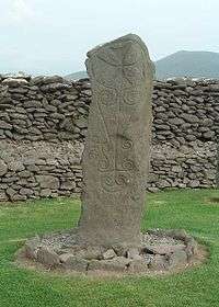 | Reask |
Kerry !Kerry | 52°10′03″N 10°23′16″W / 52.167374°N 10.387698°W / 52.167374; -10.387698 |
| 221 | Reenconnell | Early Medieval Ecclesiastical Site | | Reenconnell |
Kerry !Kerry | 52°11′07″N 10°18′10″W / 52.185371°N 10.302805°W / 52.185371; -10.302805 |
| 534 | Ross Castle | Castle | 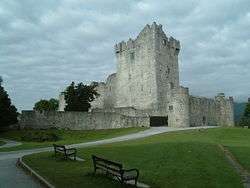 | Ross Island |
Kerry !Kerry | 52°02′29″N 9°31′54″W / 52.041345°N 9.531683°W / 52.041345; -9.531683 |
| 221 | Dún an Óir (Fort del Oro) | Promontory Fort |  | Smerwick |
Kerry !Kerry | 52°11′27″N 10°24′52″W / 52.190926°N 10.414348°W / 52.190926; -10.414348 |
| 143 | Staigue | Cashel | 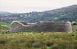 | Sneem |
Kerry !Kerry | 51°48′18″N 10°00′56″W / 51.805033°N 10.015565°W / 51.805033; -10.015565 |
| 303 | Tonaknock Cross | Cross | | Tonaknock |
Kerry !Kerry | 52°22′59″N 9°41′54″W / 52.383012°N 9.698287°W / 52.383012; -9.698287 |
| 295 | Tullygarran ogham stones | Two Ogham Stones | | Tullygarran |
Kerry !Kerry | 52°16′33″N 9°38′33″W / 52.275833°N 9.642500°W / 52.275833; -9.642500 |
| 212 | Kilmallock Abbey | Friary (Dominican) | 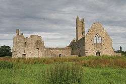 | Abbeyfarm |
Limerick !Limerick | 52°24′09″N 8°34′30″W / 52.402439°N 8.574891°W / 52.402439; -8.574891 |
| 622 | Desmond Castle | Castle | .jpg) | Adare |
Limerick !Limerick | 52°34′10″N 8°46′56″W / 52.569503°N 8.782221°W / 52.569503; -8.782221 |
| 201 | Askeaton Castle | Castle | 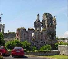 | Askeaton |
Limerick !Limerick | 52°36′00″N 8°58′26″W / 52.600064°N 8.974024°W / 52.600064; -8.974024 |
| 625 | Ballylanders fort | Ringfort | | Ballylanders |
Limerick !Limerick | 52°22′51″N 8°21′09″W / 52.380727°N 8.352398°W / 52.380727; -8.352398 |
| 247 | Lough Gur | Enclosure |  | Bruff |
Limerick !Limerick | 52°30′51″N 8°32′31″W / 52.514301°N 8.541850°W / 52.514301; -8.541850 |
| 247 | Lough Gur Tomb | Megalithic Tomb unclassified |  | Lough Gur |
Limerick !Limerick | 52°30′31″N 8°31′55″W / 52.508474°N 8.532034°W / 52.508474; -8.532034 |
| 85 | Mungret Churches | Three Churches | 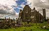 | Ballynash |
Limerick !Limerick | 52°38′06″N 8°40′29″W / 52.635055°N 8.67462°W / 52.635055; -8.67462 |
| 194 | Hospital Church | Church (Knights Hospitallers) | | Barrysfarm |
Limerick !Limerick | 52°28′34″N 8°25′57″W / 52.476226°N 8.432532°W / 52.476226; -8.432532 |
| 83 | Dísert Óengusa | Early Medieval Hermitage | 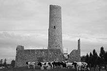 | Carrigeen (Croom) |
Limerick !Limerick | 52°31′15″N 8°44′41″W / 52.520925°N 8.744785°W / 52.520925; -8.744785 |
| 636, 582 | Desmond Hall and Castle | Medieval Castle Complex | %2C_Newcastle_West%2C_Limerick_-_geograph.org.uk_-_1392672.jpg) | Newcastlewest |
Limerick !Limerick | 52°27′00″N 9°03′42″W / 52.450045°N 9.061538°W / 52.450045; -9.061538 |
| 84 | Clonkeen Church | Church | | Clonkeen (Barrington) |
Limerick !Limerick | 52°38′38″N 8°27′36″W / 52.643905°N 8.459916°W / 52.643905; -8.459916 |
| 345 | Killeen Cowpark | Church | 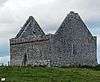 | Cowpark |
Limerick !Limerick | 52°36′29″N 8°53′38″W / 52.607967°N 8.893779°W / 52.607967; -8.893779 |
| 663 | Cush Earthworks | Earthworks | | Cush |
Limerick !Limerick | 52°22′52″N 8°26′34″W / 52.381111°N 8.442778°W / 52.381111; -8.442778 |
| 315 | Duntryleague passage tomb | Passage Tomb | .jpg) | Deerpark (Duntryleague) |
Limerick !Limerick | 52°24′23″N 8°19′21″W / 52.406472°N 8.322376°W / 52.406472; -8.322376 |
| 555 | Rathard | Ringfort | | Garryheakin |
Limerick !Limerick | 52°31′03″N 8°18′24″W / 52.517617°N 8.306650°W / 52.517617; -8.306650 |
| 341 | Killulta Church | Church | 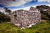 | Glennameade |
Limerick !Limerick | 52°37′45″N 8°50′10″W / 52.629075°N 8.836006°W / 52.629075; -8.836006 |
| 268 | Glenquin Castle | Castle | 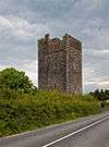 | Killeedy |
Limerick !Limerick | 52°23′02″N 9°06′25″W / 52.383904°N 9.106815°W / 52.383904; -9.106815 |
| 247 | Lough Gur Stone Circle | Stone Circle (potential) | 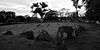 | Lough Gur |
Limerick !Limerick | 52°30′55″N 8°32′29″W / 52.515322°N 8.541526°W / 52.515322; -8.541526 |
| 247 | Lough Gur Standing Stone | Standing Stone | | Lough Gur |
Limerick !Limerick | |
| 247 | Grange stone circle | Embanked Stone Circle | 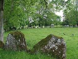 | Grange |
Limerick !Limerick | 52°30′51″N 8°32′30″W / 52.514295°N 8.541803°W / 52.514295; -8.541803 |
| 247 | The Spectacles | House sites & field system | | Grange |
Limerick !Limerick | 52°31′18″N 8°31′11″W / 52.521805°N 8.519669°W / 52.521805; -8.519669 |
| 247 | Crock Island | Crannóg | | Grange |
Limerick !Limerick | 52°31′12″N 8°32′16″W / 52.520055°N 8.537676°W / 52.520055; -8.537676 |
| 247 | Lough Gur Megalithic Structure | Megalithic Structure | | Lough Gur |
Limerick !Limerick | |
| 680 | Kilmallock House (Tigh An Fhile) | Medieval House | | Killmallock |
Limerick !Limerick | 52°24′02″N 8°34′23″W / 52.400583°N 8.573171°W / 52.400583; -8.573171 |
| 408 | Collegiate Church of SS Peter & Paul | Church | 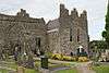 | Killmallock |
Limerick !Limerick | 52°24′04″N 8°34′29″W / 52.40102°N 8.574652°W / 52.40102; -8.574652 |
| 173 | King John's Castle | Castle | _-_geograph.org.uk_-_1392873.jpg) | Kilmallock |
Limerick !Limerick | 52°24′05″N 8°34′36″W / 52.401443°N 8.576541°W / 52.401443; -8.576541 |
| 538 | Kilmihill | Ringfort | | Kilmihill |
Limerick !Limerick | 52°22′04″N 8°33′22″W / 52.367666°N 8.556031°W / 52.367666; -8.556031 |
| 247 | Lough Gur Cemetery | Cairn | | Lough Gur |
Limerick !Limerick | 52°30′39″N 8°31′39″W / 52.510857°N 8.527633°W / 52.510857; -8.527633 |
| 247 | Lough Gur Ringfort | Ringfort | | Lough Gur |
Limerick !Limerick | |
| 576 | De Valera's Cottage | House with historic associations | | Knockmore |
Limerick !Limerick | 52°26′01″N 8°39′25″W / 52.433680°N 8.656964°W / 52.433680; -8.656964 |
| 86 | Killaliathan Church (Killagholehane church, Our Lady of the Snows) | Church | | Lacka Lower |
Limerick !Limerick | 52°19′54″N 8°58′38″W / 52.331801°N 8.977225°W / 52.331801; -8.977225 |
| 366 | Kilrush Church | Church | %2C_Kilrush_Church_(1).jpg) | Limerick |
Limerick !Limerick | 52°39′39″N 8°39′19″W / 52.660882°N 8.655214°W / 52.660882; -8.655214 |
| 288 | King John's Castle | Castle |  | Limerick |
Limerick !Limerick | 52°40′11″N 8°37′32″W / 52.669786°N 8.625458°W / 52.669786; -8.625458 |
| 383 | Fanning's Castle | Castle | | Limerick (Creagh Lane) |
Limerick !Limerick | 52°40′02″N 8°37′19″W / 52.667352°N 8.621961°W / 52.667352; -8.621961 |
| 247 | Lough Gur House | Prehistoric House Site | | Lough Gur |
Limerick !Limerick | |
| 247 | Lough Gur Wedge Tomb | Wedge Tomb | | Lough Gur |
Limerick !Limerick | |
| 247 | Knockadoon | Prehistoric Habitation | | Lough Gur |
Limerick !Limerick | |
| 247 | Carraig Aille | Enclosure | | Lough Gur |
Limerick !Limerick | |
| 247 | Lough Gur Cemetery Mound | Cemetery Mound | | Lough Gur |
Limerick !Limerick | |
| 247 | Leagun | Standing Stone | | Lough Gur |
Limerick !Limerick | |
| 185 | Askeaton Abbey | Friary (Franciscan) | 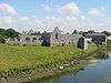 | Askeaton |
Limerick !Limerick | 52°36′14″N 8°58′31″W / 52.60398°N 8.975381°W / 52.60398; -8.975381 |
| 171 | Monasteranenagh Abbey | Abbey (Cistercian) |  | Monaster South |
Limerick !Limerick | 52°31′01″N 8°39′46″W / 52.516914°N 8.662689°W / 52.516914; -8.662689 |
| 459 | Ardagh Fort | Ringfort | | Reerasta South |
Limerick !Limerick | 52°29′37″N 9°04′05″W / 52.493636°N 9.068108°W / 52.493636; -9.068108 |
| 378 | Lackeen Castle | Castle |  | Abbeville |
Tipperary !Tipperary | 53°05′18″N 8°04′26″W / 53.0884°N 8.0738°W / 53.0884; -8.0738 |
| 124 | Ahenny High Crosses | High Crosses |  | Ahenny |
Tipperary !Tipperary | 52°24′45″N 7°23′41″W / 52.412577°N 7.394614°W / 52.412577; -7.394614 |
| 396 | St. Berrihert's Kyle | Crosses & Inscribed Slabs |  | Ardane |
Tipperary !Tipperary | 52°24′39″N 8°05′34″W / 52.410727°N 8.092677°W / 52.410727; -8.092677 |
| 604 | Ardcroney Burial Mound | Burial Mound (Cist) | | Ardcroney |
Tipperary !Tipperary | 52°56′28″N 8°11′09″W / 52.941172°N 8.18571°W / 52.941172; -8.18571 |
| 573 | Ashleypark Burial Mound | Burial Moundy (Cist) | | Ashleypark |
Tipperary !Tipperary | 52°56′02″N 8°11′20″W / 52.933858°N 8.188848°W / 52.933858; -8.188848 |
| 120 | Athassel Abbey | Priory (Augustinian) |  | Cashel |
Tipperary !Tipperary | 52°28′46″N 7°59′01″W / 52.479444°N 7.983611°W / 52.479444; -7.983611 |
| 581 | Ballycomisk | Three Ringforts | | Ballycomisk |
Tipperary !Tipperary | 52°29′22″N 7°50′27″W / 52.489523°N 7.840805°W / 52.489523; -7.840805 |
| 659 | Ballingarry Warhouse | House with historical associations |  | Farranrory Upper |
Tipperary !Tipperary | 52°37′09″N 7°31′22″W / 52.619273°N 7.522898°W / 52.619273; -7.522898 |
| 234 | Ballynahow Castle | Castle |  | Ballynahow |
Tipperary !Tipperary | 52°41′35″N 7°52′41″W / 52.693070°N 7.878118°W / 52.693070; -7.878118 |
| 123 | Ballynoran Church | Church | | Ballynoran |
Tipperary !Tipperary | 52°19′36″N 8°05′16″W / 52.326606°N 8.087783°W / 52.326606; -8.087783 |
| 370 | Burncourt Castle | Castle or fortified house | _-_geograph.org.uk_-_1393348.jpg) | Burncourt |
Tipperary !Tipperary | 52°18′53″N 8°04′12″W / 52.314828°N 8.069973°W / 52.314828; -8.069973 |
| 595 | Cahir Abbey (Priory of St. Mary in Cahir) | Priory (Augustinian) |  | Cahir |
Tipperary !Tipperary | 52°22′45″N 7°55′43″W / 52.379263°N 7.928563°W / 52.379263; -7.928563 |
| 507 | Cahir Castle | Castle | 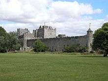 | Cahir |
Tipperary !Tipperary | 52°22′28″N 7°55′38″W / 52.374571°N 7.927254°W / 52.374571; -7.927254 |
| 577 | Cahir Castle Cottage | Cahir Castle Cottage | | Cahir |
Tipperary !Tipperary | 52°22′26″N 7°55′38″W / 52.374018°N 7.927183°W / 52.374018; -7.927183 |
| 647 | Swiss Cottage | Cottage | 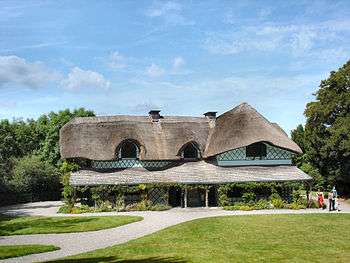 | Cahir |
Tipperary !Tipperary | 52°21′27″N 7°55′25″W / 52.357395°N 7.923524°W / 52.357395; -7.923524 |
| 447 | Carrick-on-Suir Castle | Castle | 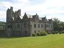 | Carrick-on-Suir |
Tipperary !Tipperary | 52°20′42″N 7°24′25″W / 52.345084°N 7.406971°W / 52.345084; -7.406971 |
| 537 | Rathanadav | Ringfort | | Carron (St. Johnbaptist) |
Tipperary !Tipperary | 52°28′32″N 7°53′16″W / 52.475425°N 7.887863°W / 52.475425; -7.887863 |
| 550 | Carron fort | Ringfort | | Carron (Tipperary town) |
Tipperary !Tipperary | 52°29′37″N 8°10′48″W / 52.493514°N 8.179885°W / 52.493514; -8.179885 |
| 127 | Hore Abbey | Abbey (Cistercian) |  | Cashel |
Tipperary !Tipperary | 52°31′07″N 7°53′52″W / 52.5186°N 7.897893°W / 52.5186; -7.897893 |
| 128 | Rock of Cashel | Ecclesiastical site | 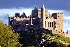 | Cashel |
Tipperary !Tipperary | 52°31′12″N 7°53′25″W / 52.51995°N 7.890288°W / 52.51995; -7.890288 |
| 667 | Clonmel Main Guard | Courthouse | %2C_The_Main_Guard_-_geograph.org.uk_-_260570.jpg) | Clonmel |
Tipperary !Tipperary | 52°21′10″N 7°41′54″W / 52.352879°N 7.698455°W / 52.352879; -7.698455 |
| 353 | Timoney Hills | Standing Stones | | Cullaun, Timenyhills, Timoney |
Tipperary !Tipperary | 52°54′01″N 7°43′12″W / 52.900309°N 7.720127°W / 52.900309; -7.720127 |
| 533 | Derryvella | Early Medieval Ecclesiastical Site | | Derryvella |
Tipperary !Tipperary | 52°37′05″N 7°40′09″W / 52.617944°N 7.669056°W / 52.617944; -7.669056 |
| 193 | St. Dominic's Abbey | Abbey (Dominican) |  | Cashel |
Tipperary !Tipperary | 52°31′10″N 7°53′13″W / 52.519449°N 7.886933°W / 52.519449; -7.886933 |
| 122 | Donaghmore Church | Church |  | Donaghmore |
Tipperary !Tipperary | 52°24′47″N 7°43′29″W / 52.412987°N 7.724840°W / 52.412987; -7.724840 |
| 407 | Grallagh Castle | Castle & Bawn |  | Grallagh |
Tipperary !Tipperary | 52°35′41″N 7°46′16″W / 52.594772°N 7.771243°W / 52.594772; -7.771243 |
| 121 | Holy Cross Abbey | Abbey (Cistercian) (part of) | 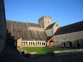 | Holycross |
Tipperary !Tipperary | 52°38′25″N 7°52′11″W / 52.640342°N 7.869773°W / 52.640342; -7.869773 |
| 654 | Kilcash Church | Church & graveyard |  | Kilcash |
Tipperary !Tipperary | 52°23′50″N 7°31′24″W / 52.397176°N 7.523361°W / 52.397176; -7.523361 |
| 654 | Kilcash Castle | Castle | 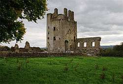 | Kilcash |
Tipperary !Tipperary | 52°23′50″N 7°31′16″W / 52.397326°N 7.521244°W / 52.397326; -7.521244 |
| 218 | Kilcooly Abbey | Abbey (Cistercian) | 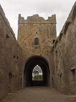 | Kilcoolyabbey |
Tipperary !Tipperary | 52°40′15″N 7°34′16″W / 52.670731°N 7.571237°W / 52.670731; -7.571237 |
| 584 | Knockgraffon | Motte & Bailey | 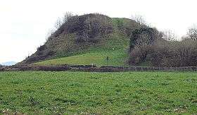 | New Inn |
Tipperary !Tipperary | 52°24′44″N 7°55′59″W / 52.412111°N 7.933144°W / 52.412111; -7.933144 |
| 266 | Liathmore | Two Churches |  | Leigh |
Tipperary !Tipperary | 52°40′14″N 7°40′07″W / 52.670486°N 7.66858°W / 52.670486; -7.66858 |
| 348 | Lismacrory Mounds | Mounds |  | Lismacrory |
Tipperary !Tipperary | 53°02′16″N 8°01′54″W / 53.037717°N 8.031574°W / 53.037717; -8.031574 |
| 524 | Longstone Rath | Standing Stone & prehistoric earthworks | 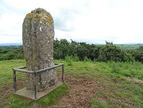 | Longstone |
Tipperary !Tipperary | 52°30′22″N 8°17′52″W / 52.506051°N 8.297753°W / 52.506051; -8.297753 |
| 673 | Lorrha Church | Church & two crosses |  | Lorrha |
Tipperary !Tipperary | 53°05′30″N 8°07′13″W / 53.091572°N 8.120249°W / 53.091572; -8.120249 |
| 357 | Lorrha Priory | Priory (Augustinian) |  | Lorrha |
Tipperary !Tipperary | 53°05′31″N 8°07′17″W / 53.092012°N 8.121414°W / 53.092012; -8.121414 |
| 361 | Lorrha Friary | Friary (Dominican) | 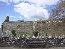 | Lorrha |
Tipperary !Tipperary | 53°05′28″N 8°07′34″W / 53.091081°N 8.126113°W / 53.091081; -8.126113 |
| 335 | Derrynaflan Church | Church & Early Medieval Ecclesiastical site | | Lurgoe |
Tipperary !Tipperary | 52°35′50″N 7°44′02″W / 52.597315°N 7.733829°W / 52.597315; -7.733829 |
| 125 | Monaincha Church | Church & Cross | 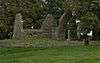 | Monaincha |
Tipperary !Tipperary | 52°56′47″N 7°44′53″W / 52.946321°N 7.74795°W / 52.946321; -7.74795 |
| 292 | Moor Abbey | Friary (Franciscan) | 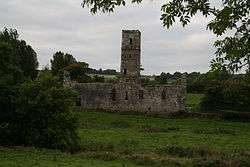 | Moorabbey |
Tipperary !Tipperary | 52°24′09″N 8°16′42″W / 52.402466°N 8.278207°W / 52.402466; -8.278207 |
| 513 | Nenagh Castle | Castle |  | Nenagh |
Tipperary !Tipperary | 52°51′54″N 8°11′53″W / 52.865014°N 8.198154°W / 52.865014; -8.198154 |
| | Roscrea Friary | Friary (Franciscan) | 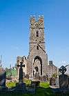 | Roscrea |
Tipperary !Tipperary | 52°57′09″N 7°47′59″W / 52.952579°N 7.799620°W / 52.952579; -7.799620 |
| 451 | Portland Church | Church | | Portland |
Tipperary !Tipperary | 53°05′24″N 8°10′32″W / 53.090070°N 8.175483°W / 53.090070; -8.175483 |
| 126 | Roscrea Church | Church, Round Tower, High Cross & Mill | 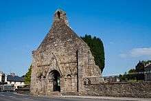 | Roscrea |
Tipperary !Tipperary | 52°57′20″N 7°47′45″W / 52.955606°N 7.795717°W / 52.955606; -7.795717 |
| 211 | Roscrea Castle | Castle | 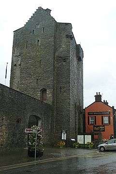 | Roscrea |
Tipperary !Tipperary | 52°57′19″N 7°47′53″W / 52.9553°N 7.7980°W / 52.9553; -7.7980 |
| 548 | Shrough Passage Tomb | Passage Tomb | | Shrough |
Tipperary !Tipperary | 52°25′37″N 8°13′58″W / 52.426943°N 8.232823°W / 52.426943; -8.232823 |
| 363 | Terryglass Castle | Castle | 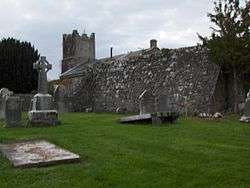 | Terryglass |
Tipperary !Tipperary | 53°03′34″N 8°12′43″W / 53.059364°N 8.211910°W / 53.059364; -8.211910 |
| 332 | Toureen Peakaun | Church, Crosses & Slabs | | Toureen |
Tipperary !Tipperary | 52°24′32″N 7°59′36″W / 52.408754°N 7.993235°W / 52.408754; -7.993235 |
| 131 | Ardmore Cathedral | Cathedral, Round Tower & Oratory |  | Ardmore |
Waterford !Waterford | 51°56′56″N 7°43′34″W / 51.948782°N 7.72606°W / 51.948782; -7.72606 |
| 384 | Ballynageeragh Portal Tomb | Portal Tomb | | Ballynageeragh |
Waterford !Waterford | 52°10′40″N 7°16′37″W / 52.177695°N 7.276887°W / 52.177695; -7.276887 |
| 330 | Kiltera | Ogham Stones | | Dromore |
Waterford !Waterford | 52°04′28″N 7°50′56″W / 52.074442°N 7.848787°W / 52.074442; -7.848787 |
| 154 | Drumlohan | Souterrain & Ogham Stones | | Drumlohan |
Waterford !Waterford | 52°09′43″N 7°27′51″W / 52.16206°N 7.464094°W / 52.16206; -7.464094 |
| 569 | Dungarvan Castle | Castle | 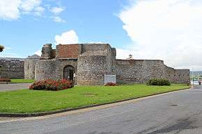 | Dungarvan |
Waterford !Waterford | 52°05′21″N 7°36′58″W / 52.089277°N 7.616229°W / 52.089277; -7.616229 |
| 398 | Gaulstown Portal Tomb | Portal Tomb | 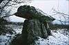 | Gaulstown |
Waterford !Waterford | 52°12′20″N 7°12′40″W / 52.2056°N 7.2112°W / 52.2056; -7.2112 |
| 421 | Knockeen Portal Tomb | Portal Tomb |  | Knockeen |
Waterford !Waterford | 52°12′26″N 7°09′34″W / 52.2072°N 7.1595°W / 52.2072; -7.1595 |
| 237 | Matthewstown Passage Tomb | Passage Tomb |  | Matthewstown |
Waterford !Waterford | 52°10′33″N 7°13′38″W / 52.175879°N 7.227260°W / 52.175879; -7.227260 |
| 132 | Mothel Abbey | Priory (Augustinian) | | Mothel |
Waterford !Waterford | 52°17′54″N 7°25′07″W / 52.298456°N 7.418558°W / 52.298456; -7.418558 |
| 671 | Double Tower | Town Defences | 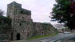 | Waterford |
Waterford !Waterford | 52°15′23″N 7°06′43″W / 52.256421°N 7.111968°W / 52.256421; -7.111968 |
| 661 | Reginald's Tower | Town Defences | 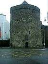 | Waterford |
Waterford !Waterford | 52°15′38″N 7°06′19″W / 52.260462°N 7.10539°W / 52.260462; -7.10539 |
| 205 | French Church, Waterford | Friary Church (Franciscan) |  | Waterford |
Waterford !Waterford | 52°15′38″N 7°06′24″W / 52.260471°N 7.10662°W / 52.260471; -7.10662 |