| [3] |
Name on the Register |
Image |
Date listed[4] |
Location |
City or town |
Description |
|---|
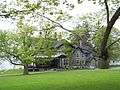
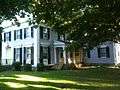
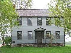
| 1 |
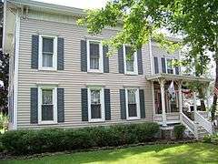
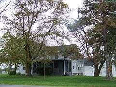
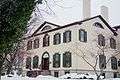
Henry Allen House |
|
000000001995-02-24-0000February 24, 1995
(#95000060) |
12 E. Cayuga St.
42°42′47″N 76°25′16″W / 42.713056°N 76.421111°W / 42.713056; -76.421111 (Henry Allen House) |
Moravia |
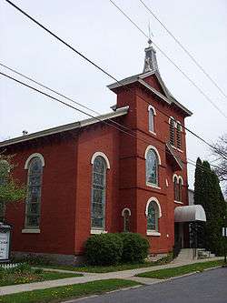
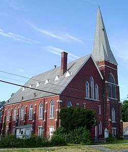
|
| 2 |
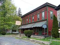
Auburn Button Works and Logan Silk Mills |
Upload image |
000000002007-09-28-0000September 28, 2007
(#07001014) |
9-11 Logan St.
42°55′47″N 76°33′53″W / 42.929722°N 76.564722°W / 42.929722; -76.564722 (Auburn Button Works and Logan Silk Mills) |
Auburn |
|
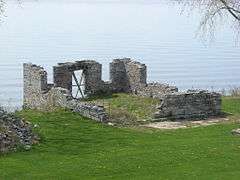
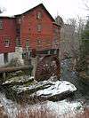
| 3 |
Aurora Steam Grist Mill |
|
000000001976-07-30-0000July 30, 1976
(#76001207) |
Main St.
42°45′15″N 76°42′15″W / 42.754167°N 76.704167°W / 42.754167; -76.704167 (Aurora Steam Grist Mill) |
Aurora |
|
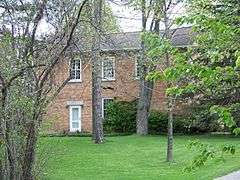
| 4 |
Aurora Village-Wells College Historic District |
|
000000001980-11-19-0000November 19, 1980
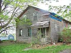
(#80002595) |
NY 90
42°45′01″N 76°42′00″W / 42.750278°N 76.7°W / 42.750278; -76.7 (Aurora Village-Wells College Historic District) |
Aurora |
Includes Glen Park, designed by A. J. Davis, with grounds designed by A. J. Downing; and E. B. Morgan House
|
| 5 |
Belt-Gaskin House |
Upload image |
000000002005-10-05-0000October 5, 2005
(#05001135) |
77 Chapman Ave.
42°55′20″N 76°34′33″W / 42.922222°N 76.575833°W / 42.922222; -76.575833 (Belt-Gaskin House) |
Auburn |
|
| 6 |
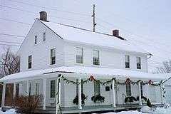
Orrin W. Burritt House |
Upload image |
000000002007-08-30-0000August 30, 2007
(#07000864) |
2696 Van Buren St.
43°02′45″N 76°33′47″W / 43.045833°N 76.563056°W / 43.045833; -76.563056 (Orrin W. Burritt House) |
Weedsport |
|
| 7 |
Case Memorial-Seymour Library |
|
000000001980-05-06-0000May 6, 1980
(#80002594) |
176 Genesee St.
42°55′44″N 76°34′18″W / 42.928889°N 76.571667°W / 42.928889; -76.571667 (Case Memorial-Seymour Library) |
Auburn |
|
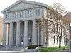
| 8 |
Cayuga County Courthouse and Clerk's Office |
|
000000001991-06-21-0000June 21, 1991
(#91000721) |
152-154 Genesee St.
42°55′47″N 76°34′09″W / 42.929722°N 76.569167°W / 42.929722; -76.569167 (Cayuga County Courthouse and Clerk's Office) |
Auburn |
|
| 9 |
Centreport Aqueduct |
|
000000002000-02-04-0000February 4, 2000
(#00000051) |
2462 NY 31
43°02′34″N 76°34′39″W / 43.042778°N 76.5775°W / 43.042778; -76.5775 (Centreport Aqueduct) |
Weedsport |
|
| 10 |
Church Street-Congress Street Historic District |
Upload image |
000000001994-02-03-0000February 3, 1994
(#92001364) |
Roughly bounded by S. Main, Church, Park and Congress Sts.
42°42′36″N 76°25′07″W / 42.71°N 76.418611°W / 42.71; -76.418611 (Church Street-Congress Street Historic District) |
Moravia |
|
| 11 |
Cottage Farm |
Upload image |
000000002012-11-21-0000November 21, 2012
(#12000952) |
14475 Richmond Ave
43°19′03″N 76°42′16″W / 43.31738°N 76.704388°W / 43.31738; -76.704388 (Cottage Farm) |
Fair Haven |
|
| 12 |
Almeron Durkee House |
Upload image |
000000002005-01-05-0000January 5, 2005
(#04001455) |
13 Cayuga St.
42°50′03″N 76°41′45″W / 42.834167°N 76.695833°W / 42.834167; -76.695833 (Almeron Durkee House) |
Union Springs |
|
| 13 |
Charles Chauncey Dwight House |
Upload image |
000000002015-11-17-0000November 17, 2015
(#15000818) |
149 North St.
42°56′30″N 76°34′12″W / 42.941535°N 76.5700787°W / 42.941535; -76.5700787 (Charles Chauncey Dwight House) |
Auburn |
1835 house renovated in 1871 by Dwight, a Union Army officer and judge
|
| 14 |
East Genoa Methodist Episcopal Church |
Upload image |
000000002002-01-24-0000January 24, 2002
(#01001500) |
558 E. Genoa Rd.
42°38′44″N 76°30′19″W / 42.645556°N 76.505278°W / 42.645556; -76.505278 (East Genoa Methodist Episcopal Church) |
Genoa |
|
| 15 |
Erie Canal Lock 52 Complex |
Upload image |
000000001998-09-03-0000September 3, 1998
(#98001146) |
Maiden Ln.
43°02′13″N 76°38′06″W / 43.036944°N 76.635°W / 43.036944; -76.635 (Erie Canal Lock 52 Complex) |
Port Byron |
|
| 16 |
First Baptist Church of Weedsport |
|
000000002002-12-31-0000December 31, 2002
(#02001640) |
Liberty St.
43°02′47″N 76°33′42″W / 43.046389°N 76.561667°W / 43.046389; -76.561667 (First Baptist Church of Weedsport) |
Weedsport |
|
| 17 |
Former US Post Office and Federal Courthouse |
|
000000001991-06-11-0000June 11, 1991
(#91000722) |
151-157 Genesee St.
42°55′49″N 76°34′12″W / 42.930278°N 76.57°W / 42.930278; -76.57 (Former US Post Office and Federal Courthouse) |
Auburn |
|
| 18 |
William and Mary Hosmer House |
Upload image |
000000002006-04-12-0000April 12, 2006
(#06000262) |
29 Washington St.
42°55′56″N 76°34′35″W / 42.932222°N 76.576389°W / 42.932222; -76.576389 (William and Mary Hosmer House) |
Auburn |
|
| 19 |
House at 15 East Cayuga Street |
Upload image |
000000001995-04-20-0000April 20, 1995
(#95000472) |
15 E. Cayuga St.
42°42′49″N 76°25′15″W / 42.713611°N 76.420833°W / 42.713611; -76.420833 (House at 15 East Cayuga Street) |
Moravia |
|
| 20 |
House at 17 Aurora Street |
Upload image |
000000001995-02-24-0000February 24, 1995
(#95000057) |
17 Aurora St.
42°42′37″N 76°25′24″W / 42.710278°N 76.423333°W / 42.710278; -76.423333 (House at 17 Aurora Street) |
Moravia |
|
| 21 |
House at 18 Aurora Street |
|
000000001995-02-24-0000February 24, 1995
(#95000058) |
18 Aurora St.
42°42′39″N 76°25′24″W / 42.710833°N 76.423333°W / 42.710833; -76.423333 (House at 18 Aurora Street) |
Moravia |
Two-story, frame Greek Revival style dwelling constructed about 1850. The structure is dominated by its three-bay, side entrance temple front.
|
| 22 |
House at 20 Aurora Street |
Upload image |
000000001995-02-24-0000February 24, 1995
(#95000059) |
20 Aurora St.
42°42′39″N 76°25′25″W / 42.710833°N 76.423611°W / 42.710833; -76.423611 (House at 20 Aurora Street) |
Moravia |
|
| 23 |
House at 21 West Cayuga Street |
Upload image |
000000001995-02-24-0000February 24, 1995
(#95000103) |
21 W. Cayuga St.
42°42′49″N 76°25′27″W / 42.713611°N 76.424167°W / 42.713611; -76.424167 (House at 21 West Cayuga Street) |
Moravia |
|
| 24 |
House at 31 West Cayuga Street |
Upload image |
000000001995-02-24-0000February 24, 1995
(#95000062) |
31 W. Cayuga
42°42′49″N 76°25′32″W / 42.713611°N 76.425556°W / 42.713611; -76.425556 (House at 31 West Cayuga Street) |
Moravia |
|
| 25 |
House at 36 South Main Street |
Upload image |
000000001995-02-24-0000February 24, 1995
(#95000064) |
36 S. Main St.
42°42′28″N 76°25′18″W / 42.707778°N 76.421667°W / 42.707778; -76.421667 (House at 36 South Main Street) |
Moravia |
|
| 26 |
House at 37 West Cayuga Street |
Upload image |
000000001995-02-24-0000February 24, 1995
(#95000063) |
37 W. Cayuga St.
42°42′50″N 76°25′36″W / 42.713889°N 76.426667°W / 42.713889; -76.426667 (House at 37 West Cayuga Street) |
Moravia |
|
| 27 |
House at 46 South Main Street |
Upload image |
000000001995-02-24-0000February 24, 1995
(#95000065) |
46 S. Main St.
42°42′25″N 76°25′18″W / 42.706944°N 76.421667°W / 42.706944; -76.421667 (House at 46 South Main Street) |
Moravia |
|
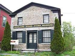
| 28 |
Howland Cobblestone Store |
|
000000001994-03-17-0000March 17, 1994
(#94000171) |
N side Sherwood Rd., just E of jct. with Co. Rd. 34B
42°45′40″N 76°37′17″W / 42.761111°N 76.621389°W / 42.761111; -76.621389 (Howland Cobblestone Store) |
Scipio |
|
| 29 |
Augustus Howland House |
Upload image |
000000002008-05-20-0000May 20, 2008
(#08000448) |
1395 Sherwood Rd.
42°45′37″N 76°38′51″W / 42.7603°N 76.647497°W / 42.7603; -76.647497 (Augustus Howland House) |
Sherwood |
|
| 30 |
Charles Howland-William H. Chase House |
Upload image |
000000002005-01-05-0000January 5, 2005
(#04001456) |
188 Cayuga St.
42°50′46″N 76°41′25″W / 42.846111°N 76.690278°W / 42.846111; -76.690278 (Charles Howland-William H. Chase House) |
Union Springs |
|
| 31 |
Slocum and Hannah Howland House |
|
000000002006-04-12-0000April 12, 2006
(#06000263) |
1781 Sherwood Rd.
42°45′47″N 76°37′21″W / 42.763056°N 76.6225°W / 42.763056; -76.6225 (Slocum and Hannah Howland House) |
Sherwood |
|
| 32 |
Hutchinson Homestead |
Upload image |
000000002009-09-09-0000September 9, 2009
(#09000478) |
6080 Lake St.
42°54′41″N 76°43′36″W / 42.911261°N 76.726675°W / 42.911261; -76.726675 (Hutchinson Homestead) |
Cayuga |
|
| 33 |
William Smith Ingham House |
Upload image |
000000002005-04-06-0000April 6, 2005
(#05000263) |
3069 W Main St.
43°10′05″N 76°32′15″W / 43.168056°N 76.5375°W / 43.168056; -76.5375 (William Smith Ingham House) |
Meridian |
|
| 34 |
Lakeside Park |
Upload image |
000000001989-10-30-0000October 30, 1989
(#89001790) |
NY 38A at Owasco Lake
42°54′09″N 76°32′14″W / 42.9025°N 76.537222°W / 42.9025; -76.537222 (Lakeside Park) |
Owasco |
|
| 35 |
John McGeer House |
Upload image |
000000001995-02-24-0000February 24, 1995
(#95000056) |
7 Aurora St.
42°42′37″N 76°25′23″W / 42.710278°N 76.423056°W / 42.710278; -76.423056 (John McGeer House) |
Moravia |
|
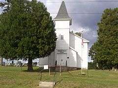
| 36 |
Mentz Church |
|
000000002004-09-24-0000September 24, 2004
(#04001064) |
Mentz Church Rd. at McDonald Rd.
42°59′53″N 76°40′39″W / 42.998056°N 76.6775°W / 42.998056; -76.6775 (Mentz Church) |
Montezuma |
|
| 37 |
Moravia Union Cemetery |
Upload image |
000000001995-11-07-0000November 7, 1995
(#95001278) |
NY 38
42°42′07″N 76°25′04″W / 42.701944°N 76.417778°W / 42.701944; -76.417778 (Moravia Union Cemetery) |
Moravia |
|
| 38 |
Morse Farm |
Upload image |
000000001995-02-24-0000February 24, 1995
(#95000067) |
53 S. Main St.
42°42′22″N 76°25′10″W / 42.706111°N 76.419444°W / 42.706111; -76.419444 (Morse Farm) |
Moravia |
|
| 39 |
Mosher Farmstead |
|
000000002003-12-12-0000December 12, 2003
(#03001280) |
1016 Sherwood Rd.
42°45′36″N 76°40′21″W / 42.76°N 76.6725°W / 42.76; -76.6725 (Mosher Farmstead) |
Aurora |
|
| 40 |
New Hope Mills Complex |
|
000000002005-03-15-0000March 15, 2005
(#05000158) |
Glen Haven Rd. and NY 41A
42°47′55″N 76°20′49″W / 42.798611°N 76.346944°W / 42.798611; -76.346944 (New Hope Mills Complex) |
New Hope |
|
| 41 |
New York State Barge Canal |
Upload image |
000000002014-10-15-0000October 15, 2014
(#14000860) |
Linear across county
Coordinates missing |
Aurelius, Brutus, Cato, Conquest, Mentz, Montezuma |
Successor to Erie Canal approved by state voters in early 20th century to compete with railroads.
|
| 42 |
North Main Street Historic District |
Upload image |
000000001993-02-03-0000February 3, 1993
(#92001365) |
N. Main St. and part of Keeler Ave.
42°42′54″N 76°25′19″W / 42.715°N 76.421944°W / 42.715; -76.421944 (North Main Street Historic District) |
Moravia |
|
| 43 |
North Street Friends Meetinghouse |
|
000000002005-12-09-0000December 9, 2005
(#05001386) |
2960 Brick Church Rd.
42°45′48″N 76°39′04″W / 42.763333°N 76.651111°W / 42.763333; -76.651111 (North Street Friends Meetinghouse) |
Ledyard |
|
| 44 |
Job and Deborah Otis House |
Upload image |
000000002008-05-29-0000May 29, 2008
(#08000468) |
1882-1886 Sherwood Rd.
42°45′48″N 76°39′04″W / 42.763333°N 76.651111°W / 42.763333; -76.651111 (Job and Deborah Otis House) |
Sherwood |
|
| 45 |
Owasco Reformed Church |
|
000000002010-04-27-0000April 27, 2010
(#10000223) |
5105 Rte 38A (E. Lake Rd.)
42°51′17″N 76°27′55″W / 42.854714°N 76.465239°W / 42.854714; -76.465239 (Owasco Reformed Church) |
Owasco |
|
| 46 |
William Richardson House |
Upload image |
000000002005-03-15-0000March 15, 2005
(#05000160) |
5494 Cross Rd.
42°53′08″N 76°40′48″W / 42.885556°N 76.68°W / 42.885556; -76.68 (William Richardson House) |
Union Springs |
|
| 47 |
Sager House |
Upload image |
000000001995-02-24-0000February 24, 1995
(#95000061) |
12 W. Cayuga St.
42°42′50″N 76°25′24″W / 42.713889°N 76.423333°W / 42.713889; -76.423333 (Sager House) |
Moravia |
|
| 48 |
St. Peter's Episcopal Church Complex |
|
000000002002-01-24-0000January 24, 2002
(#01001508) |
169 Genesee St.
42°55′47″N 76°34′18″W / 42.929722°N 76.571667°W / 42.929722; -76.571667 (St. Peter's Episcopal Church Complex) |
Auburn |
|
| 49 |
Sand Beach Church |
Upload image |
000000001975-06-10-0000June 10, 1975
(#75001176) |
S of Auburn on NY 38
42°54′10″N 76°32′52″W / 42.902778°N 76.547778°W / 42.902778; -76.547778 (Sand Beach Church) |
Auburn |
|
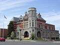
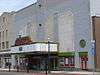
| 50 |
Schines Auburn Theatre |
|
000000002000-03-15-0000March 15, 2000
(#94001333) |
12-14 South St.
42°55′52″N 76°33′56″W / 42.931111°N 76.565556°W / 42.931111; -76.565556 (Schines Auburn Theatre) |
Auburn |
|
| 51 |
Seneca River Crossing Canals Historic District |
Upload image |
000000002005-12-09-0000December 9, 2005
(#05001397) |
Off NY 90
43°00′32″N 76°42′45″W / 43.008889°N 76.7125°W / 43.008889; -76.7125 (Seneca River Crossing Canals Historic District) |
Montezuma and Tyre |
|
| 52 |
Sennett Federated Church and Parsonage |
Upload image |
000000002005-10-05-0000October 5, 2005
(#05001130) |
777 Weedsport-Sennett Rd.
42°59′45″N 76°32′01″W / 42.995833°N 76.533611°W / 42.995833; -76.533611 (Sennett Federated Church and Parsonage) |
Sennett |
|
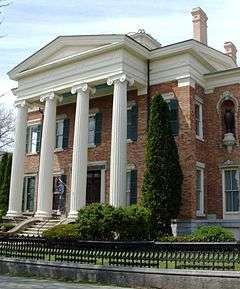
| 53 |
William H. Seward House |
|
000000001966-10-15-0000October 15, 1966
(#66000504) |
33 South St.
42°55′33″N 76°33′59″W / 42.925833°N 76.566389°W / 42.925833; -76.566389 (William H. Seward House) |
Auburn |
|
| 54 |
Sherwood Equal Rights Historic District |
|
000000002008-02-29-0000February 29, 2008
(#08000096) |
Sherwood Rd. & NY 34B
42°45′40″N 76°37′17″W / 42.761025°N 76.621375°W / 42.761025; -76.621375 (Sherwood Equal Rights Historic District) |
Sherwood |
|
| 55 |
South Street Area Historic District |
|
000000001991-03-09-0000March 9, 1991
(#91000109) |
Roughly, South St. and adjacent properties from Metcalf Dr. to Lincoln St.
42°55′47″N 76°33′45″W / 42.929722°N 76.5625°W / 42.929722; -76.5625 (South Street Area Historic District) |
Auburn |
|
| 56 |
Sterling District No. 5 Schoolhouse |
Upload image |
000000002002-10-10-0000October 10, 2002
(#02001119) |
NY104A
43°19′25″N 76°38′51″W / 43.323611°N 76.6475°W / 43.323611; -76.6475 (Sterling District No. 5 Schoolhouse) |
Sterling |
|
| 57 |
Sterling Grist Mill Complex |
Upload image |
000000002002-01-24-0000January 24, 2002
(#01001498) |
1332 NY 104A
43°19′31″N 76°38′49″W / 43.325278°N 76.646944°W / 43.325278; -76.646944 (Sterling Grist Mill Complex) |
Sterling |
|
| 58 |
Thompson AME Zion Church |
|
000000001999-04-02-0000April 2, 1999
(#99000349) |
33 Parker St.
42°55′24″N 76°34′34″W / 42.923333°N 76.576111°W / 42.923333; -76.576111 (Thompson AME Zion Church) |
Auburn |
Part of a National Historic Landmark
|
| 59 |
Frank and Eliza Tryon House |
Upload image |
000000002014-05-19-0000May 19, 2014
(#14000223) |
8976 N. Seneca St.
43°03′07″N 76°33′45″W / 43.0518659°N 76.5626007°W / 43.0518659; -76.5626007 (Frank and Eliza Tryon House) |
Weedsport |
|
| 60 |
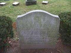
Harriet Tubman Grave |
|
000000001999-04-02-0000April 2, 1999
(#99000348) |
Fort Hill Cemetery
42°55′29″N 76°34′29″W / 42.924722°N 76.574722°W / 42.924722; -76.574722 (Harriet Tubman Grave) |
Auburn |
|
| 61 |
Harriet Tubman Home for the Aged |
|
000000001974-05-30-0000May 30, 1974
(#74001222) |
180-182 South St.
42°54′40″N 76°34′04″W / 42.911111°N 76.567778°W / 42.911111; -76.567778 (Harriet Tubman Home for the Aged) |
Auburn |
|
| 62 |
Harriet Tubman House |
|
000000001999-04-02-0000April 2, 1999
(#99000347) |
182 South St.
42°54′40″N 76°33′42″W / 42.911111°N 76.561667°W / 42.911111; -76.561667 (Harriet Tubman House) |
Auburn |
Part of a National Historic Landmark
|
| 63 |
Tuthill-Green House |
Upload image |
000000001995-02-24-0000February 24, 1995
(#95000066) |
52 S. Main St.
42°42′23″N 76°25′18″W / 42.706389°N 76.421667°W / 42.706389; -76.421667 (Tuthill-Green House) |
Moravia |
|
| 64 |
Wall Street Methodist Episcopal Church |
|
000000001999-04-29-0000April 29, 1999
(#99000507) |
69 Wall St.
42°56′07″N 76°34′43″W / 42.935278°N 76.578611°W / 42.935278; -76.578611 (Wall Street Methodist Episcopal Church) |
Auburn |
|
| 65 |
Willard Memorial Chapel-Welch Memorial Hall |
|
000000001989-06-08-0000June 8, 1989
(#89000461) |
17-19 Nelson St.
42°56′14″N 76°33′48″W / 42.937222°N 76.563333°W / 42.937222; -76.563333 (Willard Memorial Chapel-Welch Memorial Hall) |
Auburn |
|
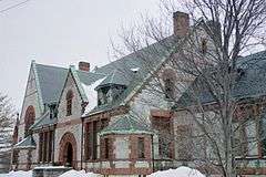
| 66 |
Dr. Sylvester Willard Mansion |
|
000000001989-11-13-0000November 13, 1989
(#89001948) |
203 W. Genesee St.
42°55′39″N 76°34′30″W / 42.9275°N 76.575°W / 42.9275; -76.575 (Dr. Sylvester Willard Mansion) |
Auburn |
|
| 67 |
Jethro Wood House |
|
000000001966-10-15-0000October 15, 1966
(#66000505) |
NY 34B
42°44′15″N 76°37′57″W / 42.7375°N 76.6325°W / 42.7375; -76.6325 (Jethro Wood House) |
Poplar Ridge |
Home of inventor of iron plow
|
| 68 |
Peter Yawger House |
Upload image |
000000002004-04-15-0000April 15, 2004
(#04000283) |
NY 90
42°53′24″N 76°42′29″W / 42.89°N 76.708056°W / 42.89; -76.708056 (Peter Yawger House) |
Union Springs |
|


 Media related to National Register of Historic Places in Cayuga County, New York at Wikimedia Commons