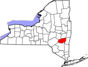
| [3] |
Name on the Register |
Image |
Date listed[4] |
Location |
City or town |
Description |
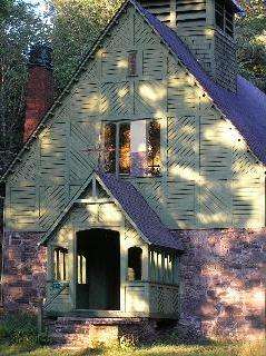
|---|
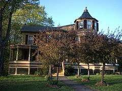
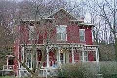
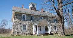
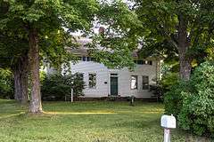
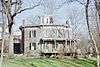
| 1 |
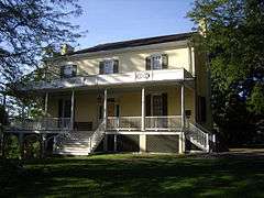
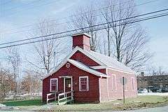
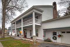
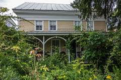
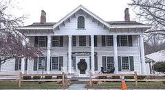
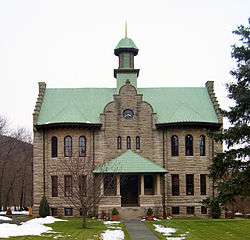
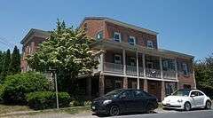
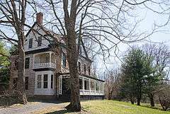
A. T. House |
|
000000002006-01-18-0000January 18, 2006
(#05001538) |
435 Main St.
42°24′40″N 74°09′14″W / 42.411111°N 74.153889°W / 42.411111; -74.153889 (A. T. House) |
Oak Hill |
|
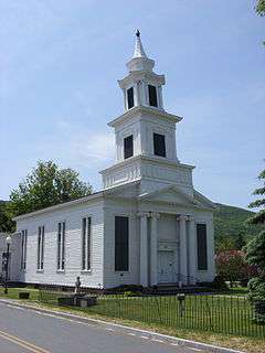
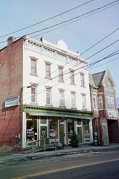
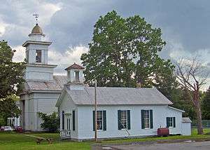
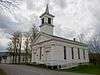
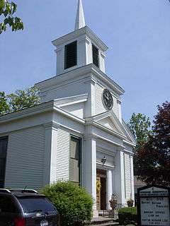
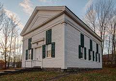
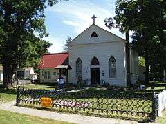
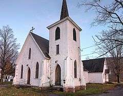
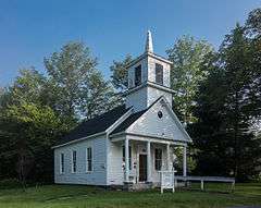
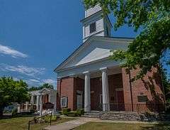
| 2 |
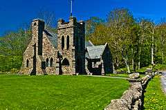
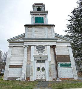
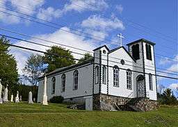
All Souls Church |
|
000000001993-11-24-0000November 24, 1993
(#93001223) |
Rt. 23-C north of Tannersville
42°13′29″N 74°08′05″W / 42.224722°N 74.134722°W / 42.224722; -74.134722 (All Souls Church) |
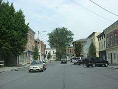
Tannersville |
|
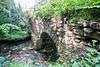
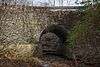
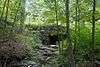
| 3 |
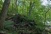
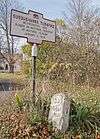
Allan Teator Road Stone Arch Bridge |
|
000000002008-01-09-0000January 9, 2008
(#07001365) |
Allan Teator Rd.
42°24′27″N 74°13′12″W / 42.4075°N 74.22°W / 42.4075; -74.22 (Allan Teator Road Stone Arch Bridge) |
West Durham |
|
| 4 |
Athens Lower Village Historic District |
|
000000001980-11-28-0000November 28, 1980
(#80002616) |
Roughly bounded by Hudson River, NY 385, Vernon and Market Sts.
42°15′34″N 73°48′46″W / 42.259444°N 73.812778°W / 42.259444; -73.812778 (Athens Lower Village Historic District) |
Athens |
|
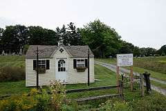
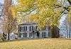
| 5 |
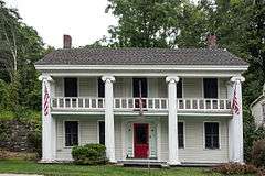
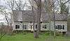
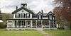
Henry T. Botsford House |
|
000000001993-11-12-0000November 12, 1993
(#93001224) |
NY 81 west of the junction with NY 32
42°24′24″N 74°01′28″W / 42.406667°N 74.024444°W / 42.406667; -74.024444 (Henry T. Botsford House) |
Greenville |
|
| 6 |
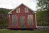
Brand Hollow Road Stone Arch Bridge |
Upload image |
000000002008-04-10-0000April 10, 2008
(#08000271) |
Brand Hollow Road
42°24′12″N 74°14′22″W / 42.403333°N 74.239444°W / 42.403333; -74.239444 (Brand Hollow Road Stone Arch Bridge) |
West Durham |
|
| 7 |
William Brandow House |
|
000000002009-11-10-0000November 10, 2009
(#09000908) |
480 Rt. 385
42°15′04″N 73°50′06″W / 42.251108°N 73.83495°W / 42.251108; -73.83495 (William Brandow House) |
Athens |
|
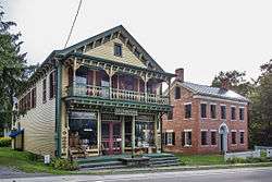
| 8 |
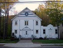
Brick Row Historic District |
|
000000001980-11-28-0000November 28, 1980
(#80002617) |
Off NY 385
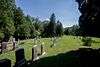
42°16′39″N 73°47′55″W / 42.2775°N 73.798611°W / 42.2775; -73.798611 (Brick Row Historic District) |
Athens |
|
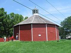
| 9 |
Bronck Farm 13-Sided Barn |
|
000000001984-09-29-0000September 29, 1984
(#84002395) |
Old Kings Rd.
42°20′46″N 73°50′42″W / 42.346111°N 73.845°W / 42.346111; -73.845 (Bronck Farm 13-Sided Barn) |
Coxsackie |
|
| 10 |
Pieter Bronck House |
|
000000001967-12-24-0000December 24, 1967
(#67000012) |
2 miles (3.2 km) west of Coxsackie on west side of U.S. 9W
42°20′44″N 73°50′49″W / 42.345556°N 73.846944°W / 42.345556; -73.846944 (Pieter Bronck House) |
Coxsackie |
|
| 11 |
Bronk-Silvester House |
|
000000002002-03-12-0000March 12, 2002
(#02000140) |
188 Mansion St.
42°21′33″N 73°48′51″W / 42.359167°N 73.814167°W / 42.359167; -73.814167 (Bronk-Silvester House) |
Coxsackie |
|
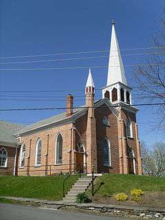
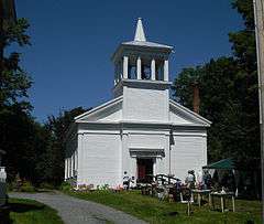
| 12 |
Centre Presbyterian Church |
|
000000001979-09-07-0000September 7, 1979
(#79001586) |
Main and Church Sts
42°18′24″N 74°15′09″W / 42.306667°N 74.2525°W / 42.306667; -74.2525 (Centre Presbyterian Church) |
Windham |
|
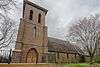
| 13 |
Christ Church |
|
000000002015-11-16-0000November 16, 2015
(#15000800) |
11228 NY 32
42°25′01″N 74°01′20″W / 42.4170°N 74.0221°W / 42.4170; -74.0221 (Christ Church) |
Greenville |
Also called Christ Episcopal Church; well-preserved 1857 Gothic Revival church made of locally quarried red sandstone
|
| 14 |
Church of St. John the Evangelist |
|
000000002004-04-21-0000April 21, 2004
(#04000352) |
Philadelphia Hill Rd.
42°10′56″N 74°08′53″W / 42.182222°N 74.148056°W / 42.182222; -74.148056 (Church of St. John the Evangelist) |
Hunter |
|
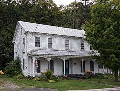
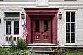
| 15 |
L.E. Cleveland House |
|
000000002001-12-28-0000December 28, 2001
(#01001385) |
7818 NY 81
42°24′38″N 74°09′10″W / 42.410556°N 74.152778°W / 42.410556; -74.152778 (L.E. Cleveland House) |
Durham |
|
| 16 |
Thomas Cole House |
|
000000001966-10-15-0000October 15, 1966
(#66000522) |
218 Spring St.
42°13′33″N 73°51′43″W / 42.225833°N 73.861944°W / 42.225833; -73.861944 (Thomas Cole House) |
Catskill |
|
| 17 |
Commercial Building at 32 West Bridge Street |
|
000000001995-08-10-0000August 10, 1995
(#95000961) |
32 W. Bridge St.
42°13′01″N 73°52′12″W / 42.216944°N 73.87°W / 42.216944; -73.87 (Commercial Building at 32 West Bridge Street) |
Catskill |
|
| 18 |
Croswell-Parsons Paper Mill Ruin |
|
000000002008-11-09-0000November 9, 2008
(#07001366) |
NY 144
42°27′30″N 73°48′01″W / 42.458278°N 73.800371°W / 42.458278; -73.800371 (Croswell-Parsons Paper Mill Ruin) |
New Baltimore |
|
| 19 |
W. F. DeWitt Hotel |
|
000000002001-12-28-0000December 28, 2001
(#01001389) |
7803 NY 81
42°24′35″N 74°09′11″W / 42.409722°N 74.153056°W / 42.409722; -74.153056 (W. F. DeWitt Hotel) |
Durham |
|
| 20 |
District School No. 11 |
|
000000001995-08-10-0000August 10, 1995
(#95000964) |
S. Jefferson Ave.
42°13′51″N 73°52′51″W / 42.230833°N 73.880833°W / 42.230833; -73.880833 (District School No. 11) |
Catskill |
|
| 21 |
DuBois Stone House |
|
000000001995-11-22-0000November 22, 1995
(#95001336) |
347 W. Main St.
42°13′09″N 73°52′11″W / 42.219167°N 73.869722°W / 42.219167; -73.869722 (DuBois Stone House) |
Catskill |
|
| 22 |
Benjamin DuBois Stone House-Captain Martin Stone House |
|
000000001995-11-22-0000November 22, 1995
(#95001333) |
347 W. Main St.
42°13′14″N 73°52′12″W / 42.220556°N 73.87°W / 42.220556; -73.87 (Benjamin DuBois Stone House-Captain Martin Stone House) |
Catskill |
(distinct from DuBois Stone House though listed at same address)
|
| 23 |
East Side Historic District |
|
000000001982-08-09-0000August 9, 1982
(#82004779) |
Roughly bounded by Catskill Creek, the Hudson River, and River, Harrison, Day, and Gardner Sts.
42°13′07″N 73°51′44″W / 42.218611°N 73.862222°W / 42.218611; -73.862222 (East Side Historic District) |
Catskill |
|
| 24 |
ELEANOR (Sailing Sloop) |
Upload image |
000000001982-12-27-0000December 27, 1982
(#82001174) |
Off Lower Main St. in Catskill Creek
42°12′44″N 73°51′41″W / 42.212222°N 73.861389°W / 42.212222; -73.861389 (ELEANOR (Sailing Sloop)) |
Catskill |
|
| 25 |
Elka Park Historic District |
Upload image |
000000001993-05-22-0000May 22, 1993
(#93000399) |
Southeast of the Hunter town center
42°09′19″N 74°10′05″W / 42.155278°N 74.168056°W / 42.155278; -74.168056 (Elka Park Historic District) |
Hunter |
|
| 26 |
Harry Fischel House |
|
000000002000-04-21-0000April 21, 2000
(#00000348) |
6302 Main St.
42°12′40″N 74°12′56″W / 42.211111°N 74.215556°W / 42.211111; -74.215556 (Harry Fischel House) |
Hunter |
|
| 27 |
Flint Mine Hill Archeological District |
Upload image |
000000001978-11-29-0000November 29, 1978
(#78001852) |
Address Restricted
|
Coxsackie |
|
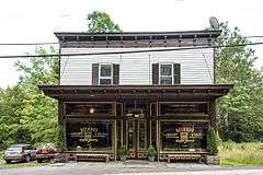
| 28 |
Ford's Store |
|
000000002001-12-28-0000December 28, 2001
(#01001395) |
7811 NY 81
42°24′35″N 74°09′11″W / 42.409722°N 74.153056°W / 42.409722; -74.153056 (Ford's Store) |
Durham |
|
| 29 |
Forestville Commonwealth |
Upload image |
000000001974-11-20-0000November 20, 1974
(#74001242) |
Address Restricted
|
Earlton |
|
| 30 |
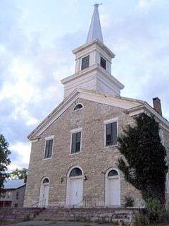
Greenville Presbyterian Church Complex |
|
000000001985-03-28-0000March 28, 1985
(#85000657) |
North St., NY 32
42°24′58″N 74°01′23″W / 42.416111°N 74.023056°W / 42.416111; -74.023056 (Greenville Presbyterian Church Complex) |
Greenville |
1860 Greek Revival church is home to first non-Dutch congregation established in Catskill region
|
| 31 |
Halcott Grange No. 881 |
|
000000002000-04-06-0000April 6, 2000
(#00000351) |
County Route 3
42°11′27″N 74°29′10″W / 42.190833°N 74.486111°W / 42.190833; -74.486111 (Halcott Grange No. 881) |
Halcott |
|
| 32 |
Joseph Hallock House |
|
000000001995-08-10-0000August 10, 1995
(#95000958) |
241 W. Main St.
42°12′59″N 73°52′08″W / 42.216389°N 73.868889°W / 42.216389; -73.868889 (Joseph Hallock House) |
Catskill |
|
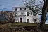
| 33 |
Hathaway |
|
000000002008-02-12-0000February 12, 2008
(#08000023) |
781 County Road 25
42°13′27″N 74°07′40″W / 42.224275°N 74.127816°W / 42.224275; -74.127816 (Hathaway) |
Tannersville |
|
| 34 |
Haxton–Griffin Farm |
|
000000002012-01-04-0000January 4, 2012
(#11000999) |
84 Howard Hall Rd.
42°15′23″N 73°50′10″W / 42.256492°N 73.836014°W / 42.256492; -73.836014 (Haxton–Griffin Farm) |
Athens |
|
| 35 |
Hervey Street Road Stone Arch Bridge |
|
000000002008-01-09-0000January 9, 2008
(#07001367) |
Hervey Street Rd., & Hervey Street-Sunside Rd.
42°20′42″N 74°07′37″W / 42.345°N 74.126944°W / 42.345; -74.126944 (Hervey Street Road Stone Arch Bridge) |
Hervey Street |
|
| 36 |
Hop-o'-Nose Knitting Mill |
|
000000001995-08-10-0000August 10, 1995
(#95000959) |
130 W. Main St.
42°12′46″N 73°52′01″W / 42.212778°N 73.866944°W / 42.212778; -73.866944 (Hop-o'-Nose Knitting Mill) |
Catskill |
|
| 37 |
Peter Houghtaling Farm and Lime Kiln |
|
000000001986-03-20-0000March 20, 1986
(#86000491) |
Lime Kiln Rd.
42°23′36″N 73°51′18″W / 42.393333°N 73.855°W / 42.393333; -73.855 (Peter Houghtaling Farm and Lime Kiln) |
West Coxsackie |
|
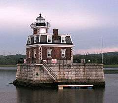
| 38 |
Hudson/Athens Lighthouse |
|
000000001979-05-29-0000May 29, 1979
(#79003796) |
South of Middle Ground Flats in Hudson River
42°15′06″N 73°48′32″W / 42.251667°N 73.808889°W / 42.251667; -73.808889 (Hudson/Athens Lighthouse) |
Athens |
|
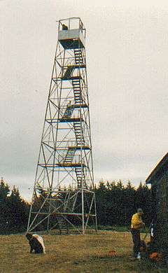
| 39 |
Hunter Mountain Fire Tower |
|
000000001997-06-30-0000June 30, 1997
(#97000569) |
Roughly following Hunter Brook from Spruceton Rd. to Hunter Mountain
42°11′03″N 74°15′06″W / 42.184167°N 74.251667°W / 42.184167; -74.251667 (Hunter Mountain Fire Tower) |
Hunter |
First site in the Catskills manned by the state as fire lookout tower in 1909
|
| 40 |
Hunter Synagogue |
|
000000001999-12-09-0000December 9, 1999
(#99001484) |
Main St.
42°12′38″N 74°12′57″W / 42.210556°N 74.215833°W / 42.210556; -74.215833 (Hunter Synagogue) |
Hunter |
|
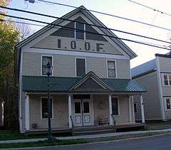
| 41 |
IOOF Hall |
|
000000002002-12-31-0000December 31, 2002
(#02001642) |
6325 Main St.
42°12′43″N 74°13′03″W / 42.211944°N 74.2175°W / 42.211944; -74.2175 (IOOF Hall) |
Hunter |
|
| 42 |
Jewett Presbyterian Church Complex |
|
000000002001-12-28-0000December 28, 2001
(#01001382) |
Church St.
42°16′12″N 74°18′15″W / 42.27°N 74.304167°W / 42.27; -74.304167 (Jewett Presbyterian Church Complex) |
Jewett |
|
| 43 |
William Lampman House |
|
000000001995-08-10-0000August 10, 1995
(#95000960) |
147 Grandview Ave.
42°12′42″N 73°52′22″W / 42.211667°N 73.872778°W / 42.211667; -73.872778 (William Lampman House) |
Catskill |
|
| 44 |
John and Martinus Laraway Inn |
|
000000002012-07-17-0000July 17, 2012
(#12000419) |
Main St.
42°19′07″N 74°26′08″W / 42.318614°N 74.435422°W / 42.318614; -74.435422 (John and Martinus Laraway Inn) |
Prattsville |
|
| 45 |
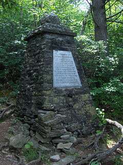
Frank D. Layman Memorial |
|
000000002003-06-06-0000June 6, 2003
(#03000022) |
Near Kaaterskill Falls
42°11′24″N 74°03′55″W / 42.19°N 74.065278°W / 42.19; -74.065278 (Frank D. Layman Memorial) |
Hunter |
Monument on Catskill Escarpment Trail to firefighter who perished fighting forest fire there in 1901
|
| 46 |
Leeds Dutch Reformed Church |
|
000000001996-02-22-0000February 22, 1996
(#96000141) |
Co. Rt. 23B (Susquehanna Tpk.)
42°15′17″N 73°54′04″W / 42.254722°N 73.901111°W / 42.254722; -73.901111 (Leeds Dutch Reformed Church) |
Leeds |
|
| 47 |
Leeds Flat Site |
Upload image |
000000001998-10-01-0000October 1, 1998
(#98001223) |
Address Restricted
|
Catskill |
|
| 48 |
Lexington House |
|
000000001986-09-04-0000September 4, 1986
(#86002175) |
NY 42
42°14′23″N 74°22′00″W / 42.239722°N 74.366667°W / 42.239722; -74.366667 (Lexington House) |
Lexington |
|
| 49 |
Methodist Episcopal Church of Windham Centre |
|
000000002009-04-27-0000April 27, 2009
(#09000255) |
1843 NY 23
42°18′29″N 74°14′57″W / 42.308056°N 74.249167°W / 42.308056; -74.249167 (Methodist Episcopal Church of Windham Centre) |
Windham |
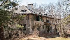
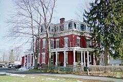
|
| 50 |
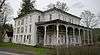
Moore-Howland Estate |
Upload image |
000000002010-08-30-0000August 30, 2010
(#10000609) |
4 New York State Route 385
42°13′46″N 73°51′27″W / 42.229444°N 73.8575°W / 42.229444; -73.8575 (Moore-Howland Estate) |
Catskill |
|
| 51 |
Moore Road Stone Arch Bridge |
|
000000002008-04-10-0000April 10, 2008
(#08000272) |
Moore Rd.
42°21′11″N 74°10′19″W / 42.3530°N 74.1720°W / 42.3530; -74.1720 (Moore Road Stone Arch Bridge) |
Cornwallville |
|
| 52 |
Morss Homestead/Federal City Homestead |
|
000000001983-09-30-0000September 30, 1983
(#83001680) |
NY 23
42°18′35″N 74°23′45″W / 42.309722°N 74.395833°W / 42.309722; -74.395833 (Morss Homestead/Federal City Homestead) |
Red Falls |
|
| 53 |
New Baltimore Hamlet Historic District |
|
000000001996-02-23-0000February 23, 1996
(#96000139) |
Roughly, Main St. from NY 144 to south junction with Mill St. and along NY 144, Church and New Sts. and Washington and Madison
42°26′46″N 73°47′18″W / 42.446111°N 73.788333°W / 42.446111; -73.788333 (New Baltimore Hamlet Historic District) |
New Baltimore |
|
| 54 |
Newkirk Homestead |
|
000000001979-07-22-0000July 22, 1979
(#79001584) |
Northwest of Leeds on Sandy Plains Rd.
42°15′59″N 73°54′26″W / 42.266389°N 73.907222°W / 42.266389; -73.907222 (Newkirk Homestead) |
Leeds |
|
| 55 |
North Settlement Methodist Church |
|
000000001996-05-16-0000May 16, 1996
(#96000561) |
Co. Rt. 10, east of the junction with Co. Rt. 32C
42°20′16″N 74°17′46″W / 42.337778°N 74.296111°W / 42.337778; -74.296111 (North Settlement Methodist Church) |
Ashland |
|
| 56 |
Oak Hill Cemetery |
|
000000002011-05-11-0000May 11, 2011
(#11000274) |
NY 81
42°24′43″N 74°09′38″W / 42.411944°N 74.160556°W / 42.411944; -74.160556 (Oak Hill Cemetery) |
Oak Hill |
|
| 57 |
Oak Hill Methodist Episcopal Church |
|
000000002006-11-01-0000November 1, 2006
(#06000972) |
427 Main St.
42°24′45″N 74°09′18″W / 42.4125°N 74.155°W / 42.4125; -74.155 (Oak Hill Methodist Episcopal Church) |
Oak Hill |
|
| 58 |
Old Episcopal Manse |
|
000000002000-11-22-0000November 22, 2000
(#00001415) |
NY 23, Main St.
42°18′51″N 74°25′59″W / 42.314167°N 74.433056°W / 42.314167; -74.433056 (Old Episcopal Manse) |
Prattsville |
|
| 59 |
Onteora Park Historic District |
Upload image |
000000002003-02-12-0000February 12, 2003
(#03000023) |
Onteora Club Property
42°12′36″N 74°09′06″W / 42.21°N 74.151667°W / 42.21; -74.151667 (Onteora Park Historic District) |
Hunter |
|
| 60 |
Mrs. Osburn House |
|
000000002001-12-28-0000December 28, 2001
(#01001390) |
7872 NY 81
42°24′43″N 74°09′16″W / 42.411944°N 74.154444°W / 42.411944; -74.154444 (Mrs. Osburn House) |
Durham |
|
| 61 |
The Parsonage |
|
000000002005-04-06-0000April 6, 2005
(#05000262) |
424 Main St.
42°24′45″N 74°09′21″W / 42.4125°N 74.155833°W / 42.4125; -74.155833 (The Parsonage) |
Oak Hill |
|
| 62 |
Charles Pierce House |
|
000000002001-12-28-0000December 28, 2001
(#01001386) |
7846 NY 81
42°24′41″N 74°09′12″W / 42.411389°N 74.153333°W / 42.411389; -74.153333 (Charles Pierce House) |
Durham |
|
| 63 |
Old Platte Clove Post Office |
|
000000002005-06-30-0000June 30, 2005
(#05000637) |
2340 Platte Clove Rd.
42°08′02″N 74°05′18″W / 42.133889°N 74.088333°W / 42.133889; -74.088333 (Old Platte Clove Post Office) |
Elka Park |
|
| 64 |
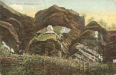
Pratt Rock Park |
|
000000001992-12-10-0000December 10, 1992
(#92001645) |
NY 23 northwest of the junction with NY 23A
42°18′43″N 74°24′39″W / 42.311944°N 74.410833°W / 42.311944; -74.410833 (Pratt Rock Park) |
Prattsville |
Rock etchings by tanner and later U.S. Congressman Zadock Pratt
|
| 65 |
Zadock Pratt House |
|
000000001986-08-14-0000August 14, 1986
(#86001654) |
Main St.
42°18′52″N 74°25′56″W / 42.314444°N 74.432222°W / 42.314444; -74.432222 (Zadock Pratt House) |
Prattsville |
|
| 66 |
Prattsville Commercial Building |
|
000000001996-03-01-0000March 1, 1996
(#96000203) |
NY 23
42°19′01″N 74°26′06″W / 42.316944°N 74.435°W / 42.316944; -74.435 (Prattsville Commercial Building) |
Prattsville |
|
| 67 |
Prattsville Reformed Dutch Church |
|
000000001996-12-06-0000December 6, 1996
(#96001430) |
Main St., northwest of the junction with Co. Rd. 10
42°19′00″N 74°26′09″W / 42.316667°N 74.435833°W / 42.316667; -74.435833 (Prattsville Reformed Dutch Church) |
Prattsville |
|
| 68 |
Prevost Manor House |
|
000000001972-11-15-0000November 15, 1972
(#72000842) |
West of Greenville off NY 81
42°24′50″N 74°03′03″W / 42.413889°N 74.050833°W / 42.413889; -74.050833 (Prevost Manor House) |
Greenville |
|
| 69 |
Reed Street Historic District |
|
000000001980-05-06-0000May 6, 1980
(#80002621) |
Reed, Ely, Mansion, and River Sts.
42°21′06″N 73°47′50″W / 42.351667°N 73.797222°W / 42.351667; -73.797222 (Reed Street Historic District) |
Coxsackie |
|
| 70 |
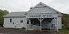
Rowena Memorial School |
|
000000002002-08-22-0000August 22, 2002
(#02000879) |
NY 23A
42°10′30″N 74°01′12″W / 42.175°N 74.02°W / 42.175; -74.02 (Rowena Memorial School) |
Palenville |
Built early 20th century by local vacationer as gift to local community in memory of his wife; used through early 1970s.
|
| 71 |
Rushmore Farm |
|
000000002010-06-18-0000June 18, 2010
(#10000364) |
8748 US 9W
42°20′05″N 73°50′58″W / 42.334736°N 73.849356°W / 42.334736; -73.849356 (Rushmore Farm) |
Athens |
|
| 72 |
St. Francis DeSales Church |
|
000000001999-12-09-0000December 9, 1999
(#99001485) |
Church St.
42°14′20″N 74°21′41″W / 42.238889°N 74.361389°W / 42.238889; -74.361389 (St. Francis DeSales Church) |
Lexington |
|
| 73 |
St. Mary's of the Mountain Church |
|
000000001999-01-27-0000January 27, 1999
(#99000057) |
NY 23A
42°12′14″N 74°12′01″W / 42.203889°N 74.200278°W / 42.203889; -74.200278 (St. Mary's of the Mountain Church) |
Hunter |
|
| 74 |
St. Paul's Lutheran Church |
|
000000002005-07-06-0000July 6, 2005
(#05000682) |
464 Main St.
42°24′29″N 74°09′06″W / 42.408056°N 74.151667°W / 42.408056; -74.151667 (St. Paul's Lutheran Church) |
Oak Hill |
|
| 75 |
Salisbury Manor |
|
000000001979-06-19-0000June 19, 1979
(#79001585) |
Northwest of Leeds on NY 145
42°15′47″N 73°55′10″W / 42.263056°N 73.919444°W / 42.263056; -73.919444 (Salisbury Manor) |
Leeds |
|
| 76 |
Shady Glen Road Stone Arch Bridge |
|
000000002008-01-09-0000January 9, 2008
(#07001368) |
Shady Glen Rd. at Stone Bridge Rd.
42°22′47″N 74°08′44″W / 42.379722°N 74.145556°W / 42.379722; -74.145556 (Shady Glen Road Stone Arch Bridge) |
Cornwallville |
|
| 77 |
Stanton Hill Cemetery |
|
000000002016-04-26-0000April 26, 2016
(#16000201) |
County Route 50
Coordinates missing |
Hannacroix |
Cemetery established by local Quakers in 1820s, later opened to all, has collection of gravestones and funerary art from different periods
|
| 78 |
Stranahan-DelVecchio House |
|
000000001980-11-28-0000November 28, 1980
(#80002618) |
N. Washington St.
42°16′07″N 73°48′18″W / 42.268611°N 73.805°W / 42.268611; -73.805 (Stranahan-DelVecchio House) |
Athens |
|
| 79 |
Elijah Strong House |
|
000000002003-01-15-0000January 15, 2003
(#02001711) |
12278 NY 23
42°18′14″N 74°20′30″W / 42.303889°N 74.341667°W / 42.303889; -74.341667 (Elijah Strong House) |
Ashland |
|
| 80 |
Susquehannah Turnpike |
|
000000001974-01-02-0000January 2, 1974
(#74001241) |
Beginning at Catskill, follows the Mohican Trail (NY 145) and CR 20 and 22 NW to the Schoharie County line
42°18′35″N 74°00′58″W / 42.309722°N 74.016111°W / 42.309722; -74.016111 (Susquehannah Turnpike) |
Catskill |
|
| 81 |
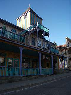
Tannersville Main Street Historic District |
|
000000002008-11-14-0000November 14, 2008
(#08001047) |
5898-6144 Main St., 10 Spring St.
42°11′45″N 74°07′40″W / 42.195739°N 74.127692°W / 42.195739; -74.127692 (Tannersville Main Street Historic District) |
Tannersville |
|
| 82 |
Torry-Chittendon Farmhouse |
|
000000002010-08-30-0000August 30, 2010
(#10000612) |
4268 County Road 20
42°23′54″N 74°10′52″W / 42.398333°N 74.181111°W / 42.398333; -74.181111 (Torry-Chittendon Farmhouse) |
Durham |
|
| 83 |
Trinity Episcopal Church |
|
000000001996-12-06-0000December 6, 1996
(#96001438) |
NY 23, southwest of the junction with Co. Rd. 19
42°17′53″N 74°17′54″W / 42.298056°N 74.298333°W / 42.298056; -74.298333 (Trinity Episcopal Church) |
Ashland |
|
| 84 |
Tripp House and Store Complex |
|
000000002001-03-12-0000March 12, 2001
(#01000240) |
NY 81
42°24′44″N 74°09′20″W / 42.412222°N 74.155556°W / 42.412222; -74.155556 (Tripp House and Store Complex) |
Durham |
|
| 85 |
Twilight Park Historic District |
Upload image |
000000002007-06-27-0000June 27, 2007
(#07000626) |
Ledge End Rd., Spray Falls Rd., Upper Level Rd., and vicinity
42°11′21″N 74°05′15″W / 42.189169°N 74.0875°W / 42.189169; -74.0875 (Twilight Park Historic District) |
Haines Falls |
|
| 86 |
Ulster and Delaware Railroad Station |
|
000000001996-08-08-0000August 8, 1996
(#96000861) |
NY 23A, Hamlet of Haines Falls
42°11′45″N 74°05′29″W / 42.195833°N 74.091389°W / 42.195833; -74.091389 (Ulster and Delaware Railroad Station) |
Hunter |
|
| 87 |
Union Chapel |
|
000000002001-12-28-0000December 28, 2001
(#01001394) |
Mill Rd.
42°21′11″N 74°14′43″W / 42.353056°N 74.245278°W / 42.353056; -74.245278 (Union Chapel) |
Windham |
|
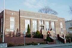
| 88 |
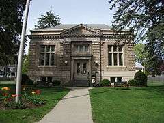
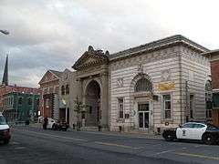
US Post Office-Catskill |
|
000000001988-11-17-0000November 17, 1988
(#88002471) |
270 Main St.
42°12′56″N 73°51′51″W / 42.215556°N 73.864167°W / 42.215556; -73.864167 (US Post Office-Catskill) |
Catskill |
|
| 89 |
Van Bergen House |
|
000000001991-04-25-0000April 25, 1991
(#91000444) |
Junction of U.S. 9W and Schiller Park Rd.
42°23′04″N 73°50′04″W / 42.384444°N 73.834444°W / 42.384444; -73.834444 (Van Bergen House) |
New Baltimore |
|
| 90 |
David Van Gelder Octagon House |
|
000000001998-01-16-0000January 16, 1998
(#97001620) |
47 Division St.
42°13′04″N 73°52′26″W / 42.217778°N 73.873889°W / 42.217778; -73.873889 (David Van Gelder Octagon House) |
Catskill |
|
| 91 |
Albertus Van Loon House |
|
000000001980-11-28-0000November 28, 1980
(#80002619) |
N. Washington St.
42°16′03″N 73°48′20″W / 42.2675°N 73.805556°W / 42.2675; -73.805556 (Albertus Van Loon House) |
Athens |
|
| 92 |
John Van Vechten House |
|
000000001995-03-10-0000March 10, 1995
(#95000212) |
Susquehanna Tpk. (Co. Rd. 23B)
42°15′19″N 73°54′14″W / 42.255278°N 73.903889°W / 42.255278; -73.903889 (John Van Vechten House) |
Leeds |
|
| 93 |
Weldon House |
|
000000002000-01-07-0000January 7, 2000
(#99001658) |
NY 145
42°21′55″N 74°04′53″W / 42.365278°N 74.081389°W / 42.365278; -74.081389 (Weldon House) |
East Durham |
|
| 94 |
West Athens Hill Site |
Upload image |
000000001973-03-20-0000March 20, 1973
(#73001194) |
Address Restricted
|
Athens |
|
| 95 |
West Settlement Methodist Church |
|
000000001996-12-06-0000December 6, 1996
(#96001435) |
West Settlement Rd. at its junction with Cleveland Rd.
42°19′57″N 74°22′13″W / 42.3325°N 74.370278°W / 42.3325; -74.370278 (West Settlement Methodist Church) |
Ashland |
|
| 96 |
Wiley Hose Company Building |
|
000000001995-08-10-0000August 10, 1995
(#95000962) |
30 W. Bridge St.
42°13′01″N 73°52′09″W / 42.216944°N 73.869167°W / 42.216944; -73.869167 (Wiley Hose Company Building) |
Catskill |
|
| 97 |
Woodward Road Stone Arch Bridge |
|
000000002009-03-09-0000March 9, 2009
(#09000134) |
Woodward Road
42°22′17″N 74°05′46″W / 42.371389°N 74.096111°W / 42.371389; -74.096111 (Woodward Road Stone Arch Bridge) |
East Durham |
|
| 98 |
Zion Lutheran Church |
|
000000001980-11-28-0000November 28, 1980
(#80002620) |
N. Washington St.
42°16′05″N 73°48′21″W / 42.268056°N 73.805833°W / 42.268056; -73.805833 (Zion Lutheran Church) |
Athens |
|