| [3] |
Name on the Register |
Image |
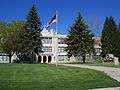
Date listed[4] |
Location |
City or town |
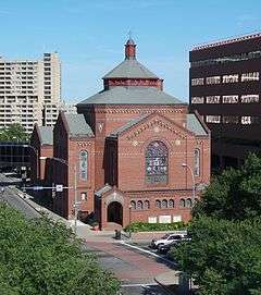
Description |
|---|
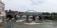
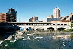
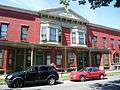
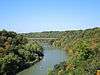
| 1 |
Andrews Street Bridge |
|
000000001984-10-11-0000October 11, 1984
(#84000182) |
Andrews St. at Genesee River
43°09′32″N 77°36′45″W / 43.158889°N 77.6125°W / 43.158889; -77.6125 (Andrews Street Bridge) |
Rochester |
|
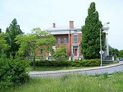
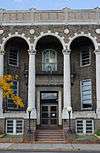
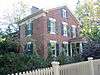
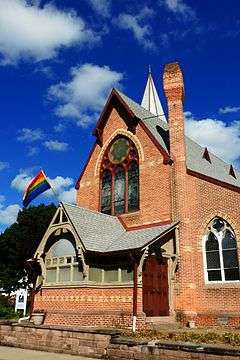
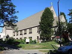
| 2 |
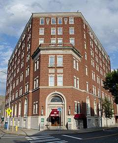
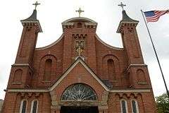
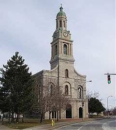
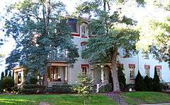
Susan B. Anthony House |
|
000000001966-10-15-0000October 15, 1966
(#66000528) |
17 Madison St.
43°09′12″N 77°37′41″W / 43.153333°N 77.628056°W / 43.153333; -77.628056 (Susan B. Anthony House) |
Rochester |
This NHL is where Susan B. Anthony was arrested after attempting to vote in the 1872 Presidential Election
|
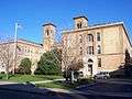
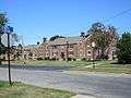
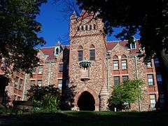
| 3 |
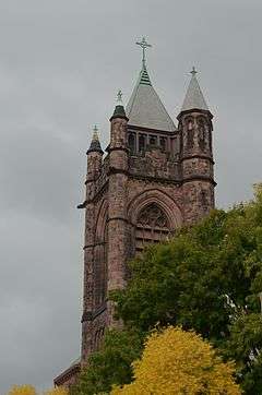
Aquinas Institute |
|
000000001989-06-08-0000June 8, 1989
(#89000464) |
1127 Dewey Ave.
43°11′15″N 77°38′26″W / 43.1875°N 77.640556°W / 43.1875; -77.640556 (Aquinas Institute) |
Rochester |
|
| 4 |
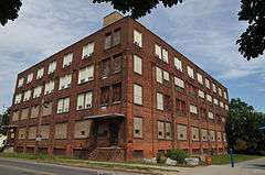
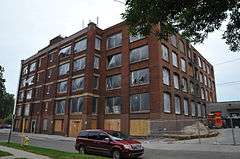
Arvine Heights Historic District |
Upload image |
000000002015-06-01-0000June 1, 2015
(#15000310) |
15–120 Arvine Heights
43°07′35″N 77°38′21″W / 43.126314°N 77.6390827°W / 43.126314; -77.6390827 (Arvine Heights Historic District) |
Rochester |
Early 20th-century middle-class residential development
|
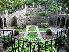
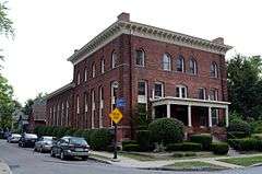
| 5 |
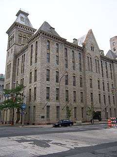
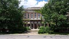
Bevier Memorial Building |
|
000000001973-10-25-0000October 25, 1973
(#73001201) |
Washington St.
43°09′12″N 77°36′59″W / 43.153333°N 77.616389°W / 43.153333; -77.616389 (Bevier Memorial Building) |
Rochester |
Built in 1910 for the Rochester Athaneaum and Mechanics Institute, a three and a half brick story with ceramic trim designed by architect Claude Fayette Bragdon.[5]
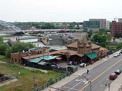
|
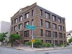
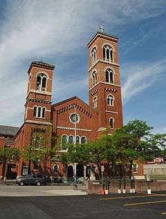
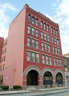
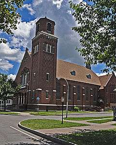
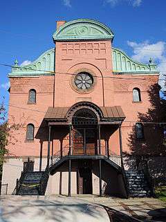
| 6 |
Brick Presbyterian Church Complex |
|
000000001992-03-12-0000March 12, 1992
(#92000152) |
121 N. Fitzhugh St.
43°09′27″N 77°37′01″W / 43.1575°N 77.616944°W / 43.1575; -77.616944 (Brick Presbyterian Church Complex) |
Rochester |
Now known as Downtown United Presbyterian Church, a Presbyterian church complex including the Brick Church and Church School (1860, rebuilt 1903), attached Brick Church Institute building (1909–1910), and Taylor Chapel (1941). The Brick Church and Church School was designed in 1860 as an Early Romanesque Revival–style edifice by Rochester architect Andrew Jackson Warner (1833–1910). His son, J. Foster Warner (1859–1937), modified the church structure to the Lombard Romanesque form in 1903.[6] Part of the Inner Loop Multiple Resource Area (MRA).
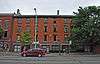
|
| 7 |
Bridge Square Historic District |
|
000000001984-10-11-0000October 11, 1984
(#84000273) |
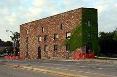
Roughly bounded by Inner Loop, Centre Park, Washington and W. Main Sts.
43°09′17″N 77°37′08″W / 43.154722°N 77.618889°W / 43.154722; -77.618889 (Bridge Square Historic District) |
Rochester |
part of the Inner Loop MRA
|
| 8 |
Brown's Race Historic District |
|
000000001989-03-02-0000March 2, 1989
(#89000067) |
Brown's Race St. from Platt St. to Conrail railroad tracks
43°09′38″N 77°36′59″W / 43.160556°N 77.616389°W / 43.160556; -77.616389 (Brown's Race Historic District) |
Rochester |
District of 15 commercial buildings, 2 other structures and 14 sites, along or near the curving south rim of the Genesee River gorge at the rim of the High Falls. Included are the mill race and the 19th century iron Pont De Rennes bridge, which is in use as a pedestrian bridge and viewing platform of the High Falls and surrounding gorge.[7]
|
| 9 |
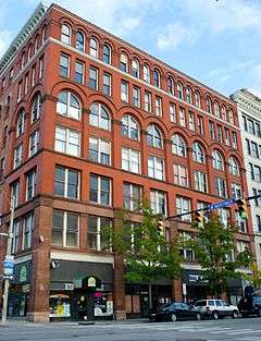
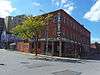
Adam Brown Block |
|
000000001985-10-04-0000October 4, 1985
(#85002857) |
480 E. Main St.
43°09′31″N 77°35′59″W / 43.158611°N 77.599722°W / 43.158611; -77.599722 (Adam Brown Block) |
Rochester |
part of the Inner Loop MRA
|
| 10 |
Browncroft Historic District |
|
000000002004-04-20-0000April 20, 2004
(#04000346) |
Roughly bounded by Browncroft Blvd., Newcastle, Blossom, and Winton Rds.
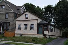
43°09′16″N 77°32′44″W / 43.154444°N 77.545556°W / 43.154444; -77.545556 (Browncroft Historic District) |
Rochester |
|
| 11 |
Building at 551-555 North Goodman Street |
|
000000001986-03-20-0000March 20, 1986
(#86000448) |
551-555 N. Goodman St.
43°09′50″N 77°35′00″W / 43.163889°N 77.583333°W / 43.163889; -77.583333 (Building at 551-555 North Goodman Street) |
Rochester |
|
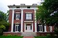
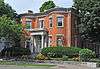
| 12 |
Campbell-Whittlesey House |
|
000000001971-02-18-0000February 18, 1971
(#71000542) |
123 S. Fitzhugh St.
43°09′04″N 77°36′45″W / 43.151111°N 77.6125°W / 43.151111; -77.6125 (Campbell-Whittlesey House) |
Rochester |
|
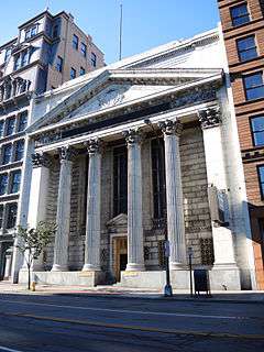
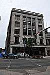
| 13 |
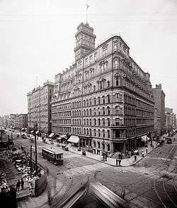
Central Trust Bank Building |
|
000000002012-02-14-0000February 14, 2012
(#12000014) |
44 Exchange Rd.
43°09′18″N 77°36′42″W / 43.154925°N 77.611672°W / 43.154925; -77.611672 (Central Trust Bank Building) |
Rochester |
|
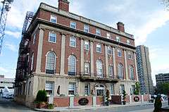
| 14 |
Chamber of Commerce |
|
000000001985-10-04-0000October 4, 1985
(#85002859) |
55 Saint Paul St.
43°09′28″N 77°36′36″W / 43.157778°N 77.61°W / 43.157778; -77.61 (Chamber of Commerce) |
Rochester |
part of the Inner Loop MRA
|
| 15 |
Jonathan Child House & Brewster-Burke House Historic District |
|
000000001971-02-18-0000February 18, 1971
(#71000543) |
37 S. Washington St. and 130 Spring St.
43°09′10″N 77°37′01″W / 43.152778°N 77.616944°W / 43.152778; -77.616944 (Jonathan Child House & Brewster-Burke House Historic District) |
Rochester |
|
| 16 |
Chili–West Historic District |
Upload image |
000000002015-09-01-0000September 1, 2015
(#15000556) |
15-17 Ardmore, 5-75 Appleton, 14-48 Darien, 22-56 Hancock, 41-146 Lozier & 20-99 Somerset Sts., 50-432 Chili Ave.
43°08′54″N 77°38′42″W / 43.148368°N 77.6451317°W / 43.148368; -77.6451317 (Chili–West Historic District) |
Rochester |
Early suburban neighborhood completed by mid-1930s
|
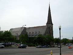
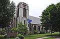
| 17 |
Christ Church |
|
000000002008-02-12-0000February 12, 2008
(#08000024) |
141 East Ave.
43°09′12″N 77°35′26″W / 43.153333°N 77.590556°W / 43.153333; -77.590556 (Christ Church) |
Rochester |
|
| 18 |
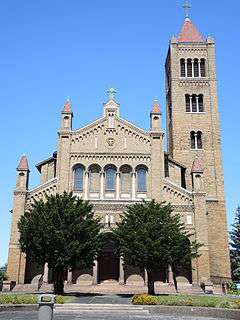
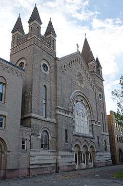
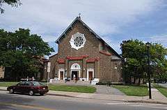
Church of Saints Peter and Paul Complex |
|
000000002012-06-20-0000June 20, 2012
(#12000342) |
720 & 736 W. Main, & 681 Brown Sts.
43°09′06″N 77°37′57″W / 43.151575°N 77.632551°W / 43.151575; -77.632551 (Church of Saints Peter and Paul Complex) |
Rochester |
|
| 19 |
City Hall Historic District |
|
000000001974-09-17-0000September 17, 1974
(#74001258) |
S. Fitzhugh St. between Broad and W. Main Sts.
43°09′16″N 77°36′50″W / 43.154444°N 77.613889°W / 43.154444; -77.613889 (City Hall Historic District) |
Rochester |
|
| 20 |
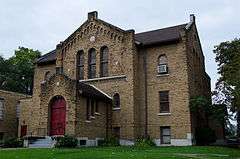
Congregation Ahavas Achim Anshi Austria |
Upload image |
000000002015-11-09-0000November 9, 2015
(#15000775) |
692 Joseph Ave.
43°10′38″N 77°36′34″W / 43.177163°N 77.6093667°W / 43.177163; -77.6093667 (Congregation Ahavas Achim Anshi Austria) |
Rochester |
1928 Georgian Revival synagogue was early focal point for Jewish immigrant community in city's northeast
|
| 21 |
Fernwood Park Historic District |
|
000000002010-06-21-0000June 21, 2010
(#10000360) |
Bounded by Fernwood Ave., Woodman Park, Culver Rd., and Waring Rd.
43°10′48″N 77°33′45″W / 43.18°N 77.5625°W / 43.18; -77.5625 (Fernwood Park Historic District) |
Rochester |
|
| 22 |
H. C. Cohen Company Building-Andrews Building |
|
000000001985-10-04-0000October 4, 1985
(#85002853) |
216 Andrews St.
43°09′35″N 77°36′34″W / 43.159722°N 77.609444°W / 43.159722; -77.609444 (H. C. Cohen Company Building-Andrews Building) |
Rochester |
part of the Inner Loop MRA
|
| 23 |
Court Exchange Building-National Casket Company |
|
000000001985-10-04-0000October 4, 1985
(#85002850) |
142 Exchange St.
43°09′09″N 77°36′40″W / 43.1525°N 77.611111°W / 43.1525; -77.611111 (Court Exchange Building-National Casket Company) |
Rochester |
part of the Inner Loop MRA
|
| 24 |
Court Street Bridge |
|
000000001984-10-11-0000October 11, 1984
(#84000276) |
Court St. at Genesee River
43°09′12″N 77°36′34″W / 43.153333°N 77.609444°W / 43.153333; -77.609444 (Court Street Bridge) |
Rochester |
|
| 25 |
Cox Building |
|
000000001984-10-11-0000October 11, 1984
(#84000279) |
36-48 St. Paul St.
43°09′27″N 77°36′34″W / 43.1575°N 77.609444°W / 43.1575; -77.609444 (Cox Building) |
Rochester |
|
| 26 |
Chester Dewey School No. 14 |
|
000000001985-10-04-0000October 4, 1985
(#85002847) |
200 University Ave.
43°09′35″N 77°35′51″W / 43.159722°N 77.5975°W / 43.159722; -77.5975 (Chester Dewey School No. 14) |
Rochester |
part of the Inner Loop MRA
|
| 27 |
East Avenue Historic District |
|
000000001979-04-17-0000April 17, 1979
(#79001589) |
Irregular pattern along East Ave. from Probert St. to Alexander St.
43°09′09″N 77°34′51″W / 43.1525°N 77.580833°W / 43.1525; -77.580833 (East Avenue Historic District) |
Rochester |
|
| 28 |
East High School |
|
000000001983-06-30-0000June 30, 1983
(#83001707) |
410 Alexander St.
43°09′35″N 77°35′31″W / 43.159722°N 77.591944°W / 43.159722; -77.591944 (East High School) |
Rochester |
|
| 29 |
East Side Presbyterian Church |
|
000000002010-11-10-0000November 10, 2010
(#10000898) |
345 Parsells St.
43°09′56″N 77°34′10″W / 43.165556°N 77.569444°W / 43.165556; -77.569444 (East Side Presbyterian Church) |
Rochester |
|
| 30 |
Eastman Dental Dispensary |
|
000000001983-04-28-0000April 28, 1983
(#83001708) |
800 E. Main St.
43°09′38″N 77°35′30″W / 43.160556°N 77.591667°W / 43.160556; -77.591667 (Eastman Dental Dispensary) |
Rochester |
|
| 31 |
George Eastman House |
|
000000001966-11-13-0000November 13, 1966
(#66000529) |
900 East Ave.
43°09′12″N 77°34′54″W / 43.153333°N 77.581667°W / 43.153333; -77.581667 (George Eastman House) |
Rochester |
|
| 32 |
Edwards Building |
|
000000001984-10-11-0000October 11, 1984
(#84000287) |
26-34 St. Paul St.
43°09′26″N 77°36′33″W / 43.157222°N 77.609167°W / 43.157222; -77.609167 (Edwards Building) |
Rochester |
|
| 33 |
Hervey Ely House |
|
000000001971-08-12-0000August 12, 1971
(#71000544) |
138 Troup St.
43°09′05″N 77°37′06″W / 43.151389°N 77.618333°W / 43.151389; -77.618333 (Hervey Ely House) |
Rochester |
|
| 34 |
Emmanuel Presbyterian Church |
|
000000002001-03-29-0000March 29, 2001
(#01000295) |
Jefferson Ave. at 9 Shelter St.
43°08′19″N 77°37′47″W / 43.138611°N 77.629722°W / 43.138611; -77.629722 (Emmanuel Presbyterian Church) |
Rochester |
|
| 35 |
English Evangelical Church of the Reformation and Parish House |
|
000000001992-03-12-0000March 12, 1992
(#92000150) |
111 N. Chestnut St.
43°09′32″N 77°36′12″W / 43.158889°N 77.603333°W / 43.158889; -77.603333 (English Evangelical Church of the Reformation and Parish House) |
Rochester |
part of the Inner Loop MRA
|
| 36 |
Erie Canal: Second Genesee Aqueduct |
|
000000001976-09-29-0000September 29, 1976
(#76001228) |
Broad St.
43°09′17″N 77°36′35″W / 43.154722°N 77.609722°W / 43.154722; -77.609722 (Erie Canal: Second Genesee Aqueduct) |
Rochester |
|
| 37 |
Federal Building |
|
000000001972-04-13-0000April 13, 1972
(#72000856) |
N. Fitzhugh and Church Sts.
43°09′25″N 77°36′54″W / 43.156944°N 77.615°W / 43.156944; -77.615 (Federal Building) |
Rochester |
|
| 38 |
First National Bank of Rochester-Old Monroe County Savings Bank Building |
|
000000001985-10-04-0000October 4, 1985
(#85002861) |
35 State St.
43°09′22″N 77°36′49″W / 43.156111°N 77.613611°W / 43.156111; -77.613611 (First National Bank of Rochester-Old Monroe County Savings Bank Building) |
Rochester |
part of the Inner Loop MRA
|
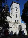
| 39 |
First Presbyterian Church |
|
000000001973-10-25-0000October 25, 1973
(#73001202) |
101 S. Plymouth Ave.
43°09′10″N 77°36′56″W / 43.152778°N 77.615556°W / 43.152778; -77.615556 (First Presbyterian Church) |
Rochester |
|
| 40 |
First Unitarian Church |
|
000000002014-09-02-0000September 2, 2014
(#14000537) |
220 Winton Rd., S.
43°08′28″N 77°33′33″W / 43.1409809°N 77.5591261°W / 43.1409809; -77.5591261 (First Unitarian Church) |
Rochester |
1969 brick Modernist structure by Louis Kahn
|
| 41 |
First Universalist Church |
|
000000001971-05-27-0000May 27, 1971
(#71000545) |
SE corner of S. Clinton Ave. and Court St.
43°09′14″N 77°36′17″W / 43.153889°N 77.604722°W / 43.153889; -77.604722 (First Universalist Church) |
Rochester |
|
| 42 |
Gannett Building |
|
000000001985-10-04-0000October 4, 1985
(#85002862) |
55 Exchange St.
43°09′14″N 77°36′45″W / 43.153889°N 77.6125°W / 43.153889; -77.6125 (Gannett Building) |
Rochester |
part of the Inner Loop MRA
|
| 43 |
Genesee Lighthouse |
|
000000001974-08-13-0000August 13, 1974
(#74001259) |
70 Lighthouse St.
43°15′10″N 77°36′40″W / 43.252778°N 77.611111°W / 43.252778; -77.611111 (Genesee Lighthouse) |
Rochester |
|
| 44 |
German United Evangelical Church Complex |
|
000000001992-03-12-0000March 12, 1992
(#92000151) |
60-90 Bittner St.
43°09′38″N 77°36′34″W / 43.160556°N 77.609444°W / 43.160556; -77.609444 (German United Evangelical Church Complex) |
Rochester |
part of the Inner Loop MRA
|
| 45 |
Granite Building |
|
000000001984-10-11-0000October 11, 1984
(#84000290) |
130 E. Main St.
43°09′25″N 77°36′33″W / 43.156944°N 77.609167°W / 43.156944; -77.609167 (Granite Building) |
Rochester |
Built in 1894 to house the Sibley, Lindsay and Curr department store.
|
| 46 |
Grove Place Historic District |
|
000000001984-10-11-0000October 11, 1984
(#84000299) |
Gibbs, Selden, Grove and Windsor Sts.
43°09′35″N 77°36′03″W / 43.159722°N 77.600833°W / 43.159722; -77.600833 (Grove Place Historic District) |
Rochester |
part of the Inner Loop MRA
|
| 47 |
David Hagaman House |
|
000000001994-12-23-0000December 23, 1994
(#94001477) |
661 Highland Ave.
43°07′50″N 77°35′45″W / 43.130556°N 77.595833°W / 43.130556; -77.595833 (David Hagaman House) |
Rochester |
|
| 48 |
Holy Rosary Church Complex |
|
000000002012-09-04-0000September 4, 2012
(#12000597) |
414 Lexington Ave.
43°10′47″N 77°38′29″W / 43.179645°N 77.641307°W / 43.179645; -77.641307 (Holy Rosary Church Complex) |
Rochester |
|
| 49 |
House at 235-237 Reynolds Street |
|
000000001985-09-12-0000September 12, 1985
(#85002272) |
235-237 Reynolds St.
43°08′35″N 77°37′36″W / 43.143056°N 77.626667°W / 43.143056; -77.626667 (House at 235-237 Reynolds Street) |
Rochester |
|
| 50 |
Immaculate Conception Roman Catholic Church Complex |
|
000000001992-03-31-0000March 31, 1992
(#92000381) |
445 Frederick Douglass St. and 187 and 205 Edinburgh St.
43°08′47″N 77°37′04″W / 43.146389°N 77.617778°W / 43.146389; -77.617778 (Immaculate Conception Roman Catholic Church Complex) |
Rochester |
|
| 51 |
Immanuel Baptist Church |
|
000000002002-02-05-0000February 5, 2002
(#01001566) |
815 Park Ave.
43°08′48″N 77°34′28″W / 43.146667°N 77.574444°W / 43.146667; -77.574444 (Immanuel Baptist Church) |
Rochester |
|
| 52 |
Inglewood and Thurston Historic District |
Upload image |
000000002015-06-30-0000June 30, 2015
(#15000368) |
15-218 Inglewood Dr., 169-291 Thurston Rd. & 5 Marlborough
43°08′26″N 77°39′15″W / 43.1406°N 77.6543°W / 43.1406; -77.6543 (Inglewood and Thurston Historic District) |
Rochester |
|
| 53 |
Jewish Young Men's and Women's Association |
|
000000001985-10-04-0000October 4, 1985
(#85002848) |
400 Andrews St.
43°09′37″N 77°36′16″W / 43.160278°N 77.604444°W / 43.160278; -77.604444 (Jewish Young Men's and Women's Association) |
Rochester |
part of the Inner Loop MRA
|
| 54 |
Kirstein Building |
|
000000001985-10-04-0000October 4, 1985
(#85002844) |
242 Andrews St.
43°09′36″N 77°36′28″W / 43.16°N 77.607778°W / 43.16; -77.607778 (Kirstein Building) |
Rochester |
part of the Inner Loop MRA
|
| 55 |
Lehigh Valley Railroad Station |
|
000000001985-10-04-0000October 4, 1985
(#85002858) |
99 Court St.
43°09′11″N 77°36′29″W / 43.153056°N 77.608056°W / 43.153056; -77.608056 (Lehigh Valley Railroad Station) |
Rochester |
Currently Dinosaur Bar-B-Que; part of the Inner Loop MRA
|
| 56 |
Leopold Street Shule |
|
000000001974-06-07-0000June 7, 1974
(#74001260) |
30 Leopold St.
43°09′53″N 77°36′16″W / 43.164722°N 77.604444°W / 43.164722; -77.604444 (Leopold Street Shule) |
Rochester |
|
| 57 |
Linden-South Historic District |
|
000000002009-08-26-0000August 26, 2009
(#09000655) |
25-272 Linden St., both sides; 809-835 South Ave., odd numbers only
43°08′20″N 77°36′21″W / 43.138858°N 77.605964°W / 43.138858; -77.605964 (Linden-South Historic District) |
Rochester |
|
| 58 |
Little Theatre |
|
000000001985-10-04-0000October 4, 1985
(#85002860) |
240 East Ave.
43°09′21″N 77°35′52″W / 43.155833°N 77.597778°W / 43.155833; -77.597778 (Little Theatre) |
Rochester |
part of the Inner Loop MRA
|
| 59 |
Madison Square-West Main Street Historic District |
|
000000001988-11-03-0000November 3, 1988
(#88002382) |
Roughly bounded by Silver, Canal, W. Main and Madison Sts.
43°09′14″N 77°37′37″W / 43.153889°N 77.626944°W / 43.153889; -77.626944 (Madison Square-West Main Street Historic District) |
Rochester |
|
| 60 |
Main Street Bridge |
|
000000001984-10-11-0000October 11, 1984
(#84000303) |
Main St. at Genesee River
43°09′22″N 77°36′39″W / 43.156111°N 77.610833°W / 43.156111; -77.610833 (Main Street Bridge) |
Rochester |
|
| 61 |
Maplewood Historic District |
|
000000001997-12-08-0000December 8, 1997
(#97001454) |
Roughly along Lakeview Park, Lake Ave., Seneca Pkwy., and Maplewood Ave.
43°07′26″N 77°37′44″W / 43.123889°N 77.628889°W / 43.123889; -77.628889 (Maplewood Historic District) |
Rochester |
|
| 62 |
Michaels-Stern Building |
|
000000001985-10-04-0000October 4, 1985
(#85002854) |
87 N. Clinton Ave.
43°09′31″N 77°36′28″W / 43.158611°N 77.607778°W / 43.158611; -77.607778 (Michaels-Stern Building) |
Rochester |
part of the Inner Loop MRA
|
| 63 |
George J. Michelsen Furniture Factory |
|
000000002012-06-06-0000June 6, 2012
(#12000328) |
182 Avenue D
43°10′49″N 77°37′11″W / 43.180286°N 77.619655°W / 43.180286; -77.619655 (George J. Michelsen Furniture Factory) |
Rochester |
|
| 64 |
Mt. Hope-Highland Historic District |
|
000000001974-01-21-0000January 21, 1974
(#74001261) |
Bounded roughly by the Clarissa St. Bridge, Genesee River, Grove and Mt. Hope Aves., plus
43°08′09″N 77°36′40″W / 43.135833°N 77.611111°W / 43.135833; -77.611111 (Mt. Hope-Highland Historic District) |
Rochester |
|
| 65 |
National Company Building |
|
000000001984-10-11-0000October 11, 1984
(#84000291) |
159 E. Main St.
43°09′23″N 77°36′29″W / 43.156389°N 77.608056°W / 43.156389; -77.608056 (National Company Building) |
Rochester |
|
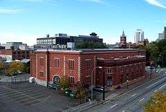
| 66 |
Naval Armory-Convention Hall |
|
000000001985-10-04-0000October 4, 1985
(#85002852) |
75 Woodbury Blvd.
43°09′08″N 77°36′19″W / 43.152222°N 77.605278°W / 43.152222; -77.605278 (Naval Armory-Convention Hall) |
Rochester |
Currently houses the Geva Theatre Center; part of the Inner Loop MRA
|
| 67 |
Nazareth House |
|
000000001984-04-12-0000April 12, 1984
(#84002734) |
94 Averill Ave.
43°08′39″N 77°36′35″W / 43.144167°N 77.609722°W / 43.144167; -77.609722 (Nazareth House) |
Rochester |
|
| 68 |
New York State Barge Canal |
Upload image |
000000002014-10-15-0000October 15, 2014
(#14000860) |
Linear across city
Coordinates missing |
Rochester |
Successor to Erie Canal approved by state voters in early 20th century to compete with railroads.
|
| 69 |
Norton Village Historic District |
|
000000002010-06-21-0000June 21, 2010
(#10000362) |
Norton St., Norton Village Ln., Village Way, and Veteran St.
43°11′14″N 77°33′58″W / 43.187222°N 77.566111°W / 43.187222; -77.566111 (Norton Village Historic District) |
Rochester |
|
| 70 |
O'Kane Market and O'Kane Building |
|
000000001985-09-12-0000September 12, 1985
(#85002288) |
104-106 Bartlett St. & 239-255 Reynolds St.
43°08′34″N 77°37′36″W / 43.142778°N 77.626667°W / 43.142778; -77.626667 (O'Kane Market and O'Kane Building) |
Rochester |
|
| 71 |
Old Stone Warehouse |
|
000000001973-10-15-0000October 15, 1973
(#73001203) |
1 Mt. Hope Ave.
43°08′54″N 77°36′24″W / 43.148333°N 77.606667°W / 43.148333; -77.606667 (Old Stone Warehouse) |
Rochester |
|
| 72 |
Our Lady of Victory Roman Catholic Church |
|
000000001992-03-12-0000March 12, 1992
(#92000153) |
210 Pleasant St.
43°09′32″N 77°36′33″W / 43.158889°N 77.609167°W / 43.158889; -77.609167 (Our Lady of Victory Roman Catholic Church) |
Rochester |
part of the Inner Loop MRA
|
| 73 |
Powers Building |
|
000000001973-04-03-0000April 3, 1973
(#73001204) |
W. Main and State Sts.
43°09′21″N 77°36′48″W / 43.155833°N 77.613333°W / 43.155833; -77.613333 (Powers Building) |
Rochester |
|
| 74 |
Pulaski Library |
|
000000002002-02-05-0000February 5, 2002
(#01001562) |
1151 Hudson Ave.
43°11′11″N 77°36′00″W / 43.186389°N 77.6°W / 43.186389; -77.6 (Pulaski Library) |
Rochester |
|
| 75 |
Ramona Park Historic District |
|
000000002010-06-21-0000June 21, 2010
(#10000363) |
Ramona Park
43°11′50″N 77°39′06″W / 43.197222°N 77.651667°W / 43.197222; -77.651667 (Ramona Park Historic District) |
Rochester |
|
| 76 |
Reynolds Arcade |
|
000000001985-10-04-0000October 4, 1985
(#85002855) |
16 E. Main St.
43°09′21″N 77°36′44″W / 43.155833°N 77.612222°W / 43.155833; -77.612222 (Reynolds Arcade) |
Rochester |
part of the Inner Loop MRA
|
| 77 |
Rochester City School No. 24 |
|
000000001983-09-15-0000September 15, 1983
(#83001709) |
Meigs St.
43°08′10″N 77°36′05″W / 43.136111°N 77.601389°W / 43.136111; -77.601389 (Rochester City School No. 24) |
Rochester |
|
| 78 |
Rochester Fire Department Headquarters and Shops |
|
000000001985-10-21-0000October 21, 1985
(#85003361) |
185 North St.
43°09′39″N 77°36′16″W / 43.160833°N 77.604444°W / 43.160833; -77.604444 (Rochester Fire Department Headquarters and Shops) |
Rochester |
part of the Inner Loop MRA
|
| 79 |
Rochester Savings Bank |
|
000000001972-03-16-0000March 16, 1972
(#72000857) |
40 Franklin St.
43°09′31″N 77°36′18″W / 43.158611°N 77.605°W / 43.158611; -77.605 (Rochester Savings Bank) |
Rochester |
|
| 80 |
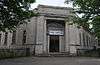
Rundel Memorial Library |
|
000000001985-10-04-0000October 4, 1985
(#85002845) |
115 South Ave.
43°09′13″N 77°37′06″W / 43.153611°N 77.618333°W / 43.153611; -77.618333 (Rundel Memorial Library) |
Rochester |
part of the Inner Loop MRA
|
| 81 |
Saint Andrew's Episcopal Church |
|
000000002006-09-28-0000September 28, 2006
(#06000886) |
95 Averill Ave.
43°08′44″N 77°36′30″W / 43.145556°N 77.608333°W / 43.145556; -77.608333 (Saint Andrew's Episcopal Church) |
Rochester |
|
| 82 |
Saint Bernard's Seminary |
|
000000001996-04-18-0000April 18, 1996
(#96000435) |
2260 Lake Ave.
43°12′34″N 77°37′44″W / 43.209444°N 77.628889°W / 43.209444; -77.628889 (Saint Bernard's Seminary) |
Rochester |
|
| 83 |
Saint Mark's and Saint John's Episcopal Church |
|
000000002004-12-16-0000December 16, 2004
(#04001438) |
1245 Culver Rd.
43°10′05″N 77°33′45″W / 43.168056°N 77.5625°W / 43.168056; -77.5625 (Saint Mark's and Saint John's Episcopal Church) |
Rochester |
|
| 84 |
Seneca Park East and West |
|
000000002003-09-26-0000September 26, 2003
(#03000969) |
Saint Paul Blvd., Maplewood Dr, Lake Ave.
43°11′46″N 77°37′31″W / 43.196111°N 77.625278°W / 43.196111; -77.625278 (Seneca Park East and West) |
Rochester |
West part is known as Maplewood Park.
|
| 85 |
Shantz Button Factory |
|
000000002013-08-13-0000August 13, 2013
(#13000600) |
340 & 330 Rutgers St., 795 Monroe Ave.
43°08′34″N 77°35′25″W / 43.142732°N 77.5902327°W / 43.142732; -77.5902327 (Shantz Button Factory) |
Rochester |
|
| 86 |
Shingleside |
|
000000001984-09-13-0000September 13, 1984
(#84002737) |
476 Beach Ave.
43°15′46″N 77°36′56″W / 43.262778°N 77.615556°W / 43.262778; -77.615556 (Shingleside) |
Rochester |
|
| 87 |
Sibley Triangle Building |
|
000000001985-10-04-0000October 4, 1985
(#85002849) |
20-30 East Ave.
43°09′26″N 77°36′15″W / 43.157222°N 77.604167°W / 43.157222; -77.604167 (Sibley Triangle Building) |
Rochester |
part of the Inner Loop MRA
|
| 88 |
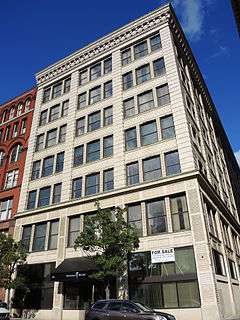
Sibley's, Lindsay and Curr Building |
|
000000002014-01-08-0000January 8, 2014
(#84003945) |
228 E. Main St.
43°09′29″N 77°36′21″W / 43.15796°N 77.605812°W / 43.15796; -77.605812 (Sibley's, Lindsay and Curr Building) |
Rochester |
Part of the Inner Loop MRA
|
| 89 |
Sibley–Elmdorf Historic District |
Upload image |
000000002015-09-01-0000September 1, 2015
(#15000557) |
23-405 Aberdeen, 20-324 Aldine, 447-551 Genesee, 157-320 Melrose, 187-325 Roslyn & 2-242 Trafalgar Sts.
43°08′23″N 77°38′40″W / 43.139621°N 77.6444377°W / 43.139621; -77.6444377 (Sibley–Elmdorf Historic District) |
Rochester |
Many extant well-preserved houses in various 19th-century styles
|
| 90 |
St. Joseph's Church and Rectory |
|
000000001975-05-29-0000May 29, 1975
(#75001197) |
108 Franklin St.
43°09′34″N 77°36′24″W / 43.159444°N 77.606667°W / 43.159444; -77.606667 (St. Joseph's Church and Rectory) |
Rochester |
|
| 91 |
St. Mary's Roman Catholic Church and Rectory |
|
000000001992-03-12-0000March 12, 1992
(#92000154) |
15 St. Mary's Pl.
43°09′12″N 77°36′23″W / 43.153333°N 77.606389°W / 43.153333; -77.606389 (St. Mary's Roman Catholic Church and Rectory) |
Rochester |
part of the Inner Loop MRA
|
| 92 |
St. Paul-North Water Streets Historic District |
|
000000001984-10-11-0000October 11, 1984
(#84000398) |
St. Paul, N. Water, and Andrews Sts.
43°09′37″N 77°36′41″W / 43.160278°N 77.611389°W / 43.160278; -77.611389 (St. Paul-North Water Streets Historic District) |
Rochester |
part of the Inner Loop MRA
|
| 93 |
State Street Historic District |
|
000000001984-10-11-0000October 11, 1984
(#84000402) |
109-173 State St.
43°09′27″N 77°36′55″W / 43.1575°N 77.615278°W / 43.1575; -77.615278 (State Street Historic District) |
Rochester |
part of the Inner Loop MRA
|
| 94 |
South Wedge Historic District |
|
000000002013-05-22-0000May 22, 2013
(#13000307) |
20-98 Alexander, 20-123 Ashland, 39-336 Averill, 14-89 Bond, 38-149 Comfort, 1-396 Gregory, 59-279 Hamilton Sts.
43°08′36″N 77°36′14″W / 43.143402°N 77.6039577°W / 43.143402; -77.6039577 (South Wedge Historic District) |
Rochester |
|
| 95 |
Teoronto Block Historic District |
|
000000002010-09-24-0000September 24, 2010
(#10000798) |
Bounded by State, Brown, Factory and Mill Streets
43°09′43″N 77°37′09″W / 43.161944°N 77.619167°W / 43.161944; -77.619167 (Teoronto Block Historic District) |
Rochester |
|
| 96 |
Third Ward Historic District |
|
000000001974-07-12-0000July 12, 1974
(#74001262) |
Roughly bounded by Adams and Peach Sts., I-490, and both sides of Troup and Fitzhugh Sts.
43°09′01″N 77°36′56″W / 43.150278°N 77.615556°W / 43.150278; -77.615556 (Third Ward Historic District) |
Rochester |
|
| 97 |
University Club |
|
000000001985-10-04-0000October 4, 1985
(#85002851) |
26 Broadway
43°09′20″N 77°36′00″W / 43.155556°N 77.6°W / 43.155556; -77.6 (University Club) |
Rochester |
part of the Inner Loop MRA
|
| 98 |
Vanderbeck House |
|
000000001984-04-09-0000April 9, 1984
(#84002739) |
1295 Lake Ave.
43°11′24″N 77°37′50″W / 43.19°N 77.630556°W / 43.19; -77.630556 (Vanderbeck House) |
Rochester |
|
| 99 |
Timothy Wallace House |
|
000000001994-02-04-0000February 4, 1994
(#94000004) |
2169 S. Clinton Ave.
43°06′59″N 77°35′50″W / 43.116389°N 77.597222°W / 43.116389; -77.597222 (Timothy Wallace House) |
Rochester |
|
| 100 |
H. H. Warner Building |
|
000000001985-10-04-0000October 4, 1985
(#85002846) |
72-82 St. Paul St.
43°09′30″N 77°36′34″W / 43.158333°N 77.609444°W / 43.158333; -77.609444 (H. H. Warner Building) |
Rochester |
part of the Inner Loop MRA
|
| 101 |
Washington Street Rowhouses |
|
000000001985-10-04-0000October 4, 1985
(#85002856) |
30-32 N. Washington St.
43°09′21″N 77°37′04″W / 43.155833°N 77.617778°W / 43.155833; -77.617778 (Washington Street Rowhouses) |
Rochester |
part of the Inner Loop MRA
|
| 102 |
Ebenezer Watts House |
|
000000001996-10-18-0000October 18, 1996
(#85003632) |
47 S. Fitzhugh St.
43°09′13″N 77°36′50″W / 43.153611°N 77.613889°W / 43.153611; -77.613889 (Ebenezer Watts House) |
Rochester |
Oldest surviving residence in Rochester, an Italianate house built during 1825-1827 and remodelled in the 1850s. Has a Federal style entrance and interior.[8] Part of the Inner Loop MRA.
|
| 103 |
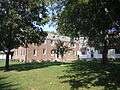
Wilder Building |
|
000000001985-10-04-0000October 4, 1985
(#85002863) |
1 E. Main St.
43°09′19″N 77°36′44″W / 43.155278°N 77.612222°W / 43.155278; -77.612222 (Wilder Building) |
Rochester |
part of the Inner Loop MRA |
_Highways_map.png)


.jpg)


.jpg)

.jpg)